
Italia
Descripción

Italy is a country of enormous diversity and contrast. Most famous are the Alps. Coming from the efficient neatness of Switzerland or Austria, the Italian Alps are wilder and at the same time more tranquil, like stepping back in time. The most beautiful and popular areas are Gran Paradiso, Val Grande, Stelvio and the Dolomites.
In addition there are countless national parks, all very much worth hiking through. A series of mountain ranges runs from north to south like a backbone, starting from the hills of Tuscany, to the Apennines and Abruzzo to Italy's toe, Calabria. Southern Italy, too far for many tourists, has several attractive hiking regions, like Pollino and Aspromonte.
In the Alps you can walk from hut to hut, elsewhere you can do day hikes, such is the rule in general. However some genuine long distance hiking trails are under construction. European long distance trail E10 in the Alps, which coincides with the 1000km long Grande Alpine Trail and the international Via Alpina. The second large project is the E1, which coincides with the Grand Apennine Mountains Trail and the Ligurian Mountains High Trail. If this trail is ever completed, you can start from Como passing Genova and continue all the way to Reggio di Calabria and Palermo or Siracuse on Sicily. The third large project means to join all these trails into one 6000km long Sentiero Italia. Last but not least, there is the Alta Via in the Dolomites: splendid walking.
Mountain huts abound in the Alps. Hiking can be done all summer, from June until well into October. Further south spring is the best hiking season. In April you will still get stuck in the snow up in the mountains. Autumn is supposed to be fine as well, but alas, as one hiker put it: "you wake up to the sounds of church bells and gunfire". As hunters, Italians are best avoided.
Mapa


Senderos
- Alta Via dei GigantiGPX
- Alta Via dei Monti LiguriGPX
- Alta Via Della Valle d'Aosta No 1
- Alta Via Della Valle d'Aosta No 2
- Alta Via Dolomiti 1GPX
- Alta Via Dolomiti 10
- Alta Via Dolomiti 2GPX
- Alta Via Dolomiti 3GPX
- Alta Via Dolomiti 4GPX
- Alta Via Dolomiti 5
- Alta Via Dolomiti 6GPX
- Alta Via Dolomiti 7
- Alta Via Dolomiti 8
- Alta Via Dolomiti 9
- Bassa Via del GardaGPX
- Cinque Terre
- E1GPX
- E10GPX
- E12GPX
- E5GPX
- E7GPX
- Florence - Siena
- GoethewegGPX
- GR58 - Tour du QueyrasGPX
- Grande Escursione AppenninicaGPX
- Grande Traversata del Gran Paradiso
- Grande Traversata delle AlpiGPX
- Meraner HöhenwegGPX
- Pfunderer HöhenwegGPX
- Santiago de Compostela Pilgrims WayGPX
- Südalpenweg - 3GPX
- SeealpentourGPX
- Sentiero della PaceGPX
- Sentiero ItaliaGPX
- Sentiero Roma
- Tiroler Höhenweg
- TMB - Tour du Mont BlancGPX
- Tour des CombinsGPX
- Tour des Grands Barrages
- Tour du MatterhornGPX
- Tour Monte RosaGPX
- Traumpfad München-VenedigGPX
- Via AlpinaGPX
- Via FrancigenaGPX
- Via SacraGPX
- Via SbrinzGPX
- Via SplugaGPX
- Via ValtellinaGPX
Regiones
- Abruzzi
- Adamello
- Aeolian Islands
- Alpi Biellesi e Cusiane
- Alpi di Livigno
- Alpi Liguri
- Alpi Marittime
- Alpi Oróbie e Bergamasche
- Alpi Sarentini
- Alpi Vicentine
- Alps
- Amalfi Coast
- Appennini
- Apulia
- Ötztal
- Bernina
- Brenta
- Calabria
- Cilento
- Defereggengebirge
- Dolomiti
- Dolomiti di Fiemme
- Elba
- Friuli
- Garda
- Gran Paradiso
- Grand Combin
- Julische Alpen
- Karawanken
- Karnischer Alpen
- Lago di Como
- Lago Maggiore
- Liguria
- Lombardia
- Matterhorn
- Moncenisio
- Monginevro
- Mont Blanc
- Monte Leone
- Monte Rosa
- Monti Sibillini
- Monviso
- Nonstaler Alpen
- Ortler
- Paganella
- Platta Gruppe
- Presanella
- Rieserfernergruppe
- Sardinia
- Südtirol
- Sesvenna Gruppe
- Sicilia
- Sobretta
- Stelvio
- Stubai
- Texelgruppe
- Tirol
- Toscana
- Trentino
- Umbria
- Val d'Aosta
- Val Grande
- Val Venosta
- Valle d'Aosta
- Veneto
- Vinschgau
- Zillertal
Montañas


Enlaces
Datos
Informes
Guías y mapas
Hospedaje
Organizaciones
Operadores turísticos
GPS
Otro
Libros

United Kingdom
2015
- Italian Lakes Walking: Garda, Maggiore, Como and Iseo
- This guidebook describes 50 walks around Lakes Como, Iseo, Garda and Maggiore in Northern Italy. The picturesque routes are accessible by public transport from popular centres including Bellagio, Riva, Stresa and Cannero, and range from 2 to 14km in length. There are gentle lakeside strolls, and numerous ridge routes and traverses as well as... Leer más

United Kingdom
- Touring the Italian Front 1917-1919
- The guide describes the ground and operations covered by the British, French and US Expeditionary Forces deployed from France to the area north of Venice between November 1917 and Spring 1919. These forces supported the Italians after their disastrous defeat at Caporetto and helped stem the Austrian and German onslaught. This is the first guide... Leer más

United Kingdom
- Grove
- An unnamed narrator, recently bereaved, travels to Olevano, a small village southeast of Rome. It is winter, and from her temporary residence on a hill between village and cemetery, she embarks on walks and outings, exploring the banal and the sublime with equal dedication and intensity. She recalls her travels in 1970s Italy, which she often... Leer más

United Kingdom
- Walking in Italy
- Walking in Italy is a unique guide written for those who want to experience the delights of Italy’s finest towns cities and landscapes. The best way to appreciate Italy is undoubtedly on foot, whether you are visiting a city for the first time or venturing out into the Italian countryside. You don’t need to be an athlete to enjoy a... Leer más

United Kingdom
- Pale di San Martino - Primiero San Martino di Castrozza - Paneveggio - Valle del Vanoi Kompass 622
- Pale di S.Martino - Fiera di Primiero - Panaveggio - Valle del Vanoi area at 1:25,000 on a durable, waterproof and tear-resistant map from Kompass in their series of detailed maps of the Dolomites.CARTOGRAPHY: Kompass maps of the Dolomites at 1:25,000 have contours at 25-m intervals. An overprint shows local and long-distance footpaths,... Leer más

United Kingdom
- Bolzano and Environs Kompass 54
- Map No. 54, Bolzano and Environs, from Kompass, printed on waterproof and tear-resistant synthetic paper in a series of walking maps of selected areas of Italy at 1:50,000, with hiking routes on a topographic base, various types of accommodation, recreational facilities, places of interest, etc. Kompass are Europe’s largest publishers of... Leer más

United Kingdom
- Cortina d`Ampezzo Kompass 55
- Map No. 55, Cortina d`Ampezzo - with a panorama map on the reverse, from Kompass, printed on sturdy, waterproof and tear-resistant synthetic paper in their series of walking maps of selected areas of Italy at 1:50,000, with hiking routes on a topographic base, various types of accommodation, recreational facilities, places of interest, etc.... Leer más


United Kingdom
2021
- Lonely Planet Best Day Walks Italy
- Lonely Planet`s Best Day Walks Italy is your passport to 60 easy escapes into nature. Stretch your legs outside the city by picking a hike that works for you, from just a couple of hours to a full day, from easy to hard. Hike the Dolomites, explore the Italian Lakes, and stroll Sardinia`s coast. Get to the heart of Italy and begin your journey... Leer más
- Also available from:
- The Book Depository, United Kingdom
- De Zwerver, Netherlands


United Kingdom
2015
- The Way of St Francis
- Via di Francesco: From Florence to Assisi and Rome Leer más
- Also available from:
- De Zwerver, Netherlands

Netherlands
2019
- Wandelgids - Pelgrimsroute The Way of St Francis - Via Francigena | Cicerone
- Guidebook to walking the Way of St Francis, Via di Francesco. 550km pilgrimage from Florence, through Assisi to Rome through Central Italy visiting key sites from the saint's life. Described in 28 stages, the guide to the month-long route includes detailed maps, profiles and information about all the shrines, churches and towns along the way. Leer más

United Kingdom
2018
- Florence Walks
- Explore Florence on foot with these wonderful and insightful routes. Plan your time with the unique bird`s-eye view illustrations that capture the spirit of this amazing city. Following these walks is like being shown around the city by an exceptionally knowledgeable friend. They`re fun and they`ll help you fit it all together. And you`ll... Leer más
- Also available from:
- The Book Depository, United Kingdom
- De Zwerver, Netherlands


Netherlands
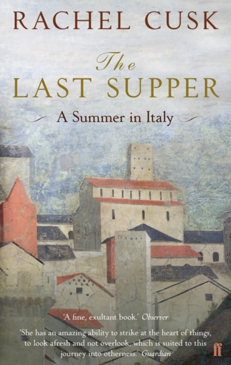
- The Last Supper
- When prize-winning author Rachel Cusk decides to travel to Italy for a summer with her husband and two young children she has no idea of the trials and wonders that lie in store. Their journey leads them to both the expected - the Piero della Francesca trail and queues at the Vatican - and the surprising - an amorous Scottish ex-pat and a... Leer más
- Also available from:
- Bol.com, Belgium
Belgium
- The Last Supper
- When prize-winning author Rachel Cusk decides to travel to Italy for a summer with her husband and two young children she has no idea of the trials and wonders that lie in store. Their journey leads them to both the expected - the Piero della Francesca trail and queues at the Vatican - and the surprising - an amorous Scottish ex-pat and a... Leer más
Netherlands
2014
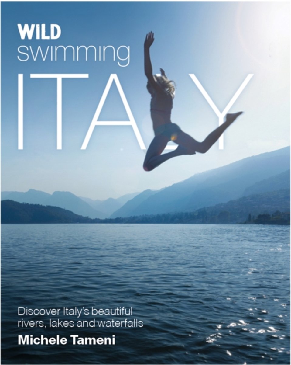
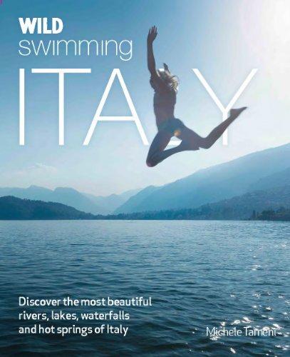
- Wild Swimming Italy
- The Wild Swimming series travels to Italy to explore freshwater lakes, mountain and lagoons. Dip in to the emerald-green plunge pools of Sicily and swim at river beaches in Campania. Discover the secret hot springs of Tuscany and amazing waterfalls of the Dolomiti. Explore the hidden shores of Lake Como and Garda. Perfect for family explorers... Leer más
- Also available from:
- Bol.com, Belgium
- De Zwerver, Netherlands
Belgium
2014
- Wild Swimming Italy
- The Wild Swimming series travels to Italy to explore freshwater lakes, mountain and lagoons. Dip in to the emerald-green plunge pools of Sicily and swim at river beaches in Campania. Discover the secret hot springs of Tuscany and amazing waterfalls of the Dolomiti. Explore the hidden shores of Lake Como and Garda. Perfect for family explorers... Leer más
Netherlands
2014
- Reisgids Wild Swimming Italy | Wild Things Publishing
- The 'Wild Swimming' series travels to Italy to explore freshwater lakes, mountains and lagoons. Dip into the emerald-green plunge pools of Sicily and swim at river beaches in Campania. Discover the secret hot springs of Tuscany and amazing waterfalls of the Dolomiti, and explore the hidden shores Lake Como and Garda. The Wild Swimming series... Leer más
Netherlands
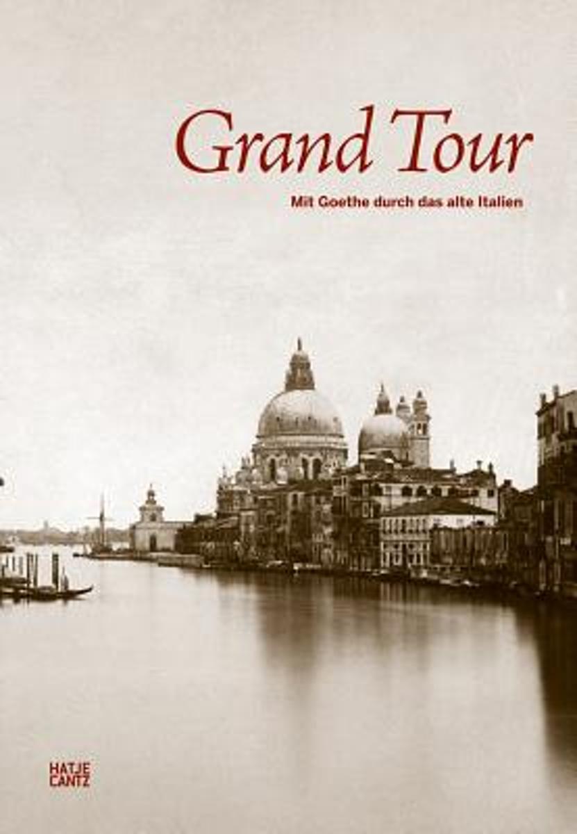
- Grand Tour
- Large, magnificent volume with spectacular early Italian photographs from the nineteenth century.Excerpts from Goethe's Italian Journey accompany the gelatin silver prints, some of which are hand-colored."Know'st thou the land where lemon trees do bloom, and oranges like gold in leafy gloom . . . ." In the seventeenth and eighteenth centuries,... Leer más
- Also available from:
- Bol.com, Belgium
Belgium
- Grand Tour
- Large, magnificent volume with spectacular early Italian photographs from the nineteenth century.Excerpts from Goethe's Italian Journey accompany the gelatin silver prints, some of which are hand-colored."Know'st thou the land where lemon trees do bloom, and oranges like gold in leafy gloom . . . ." In the seventeenth and eighteenth centuries,... Leer más
Netherlands
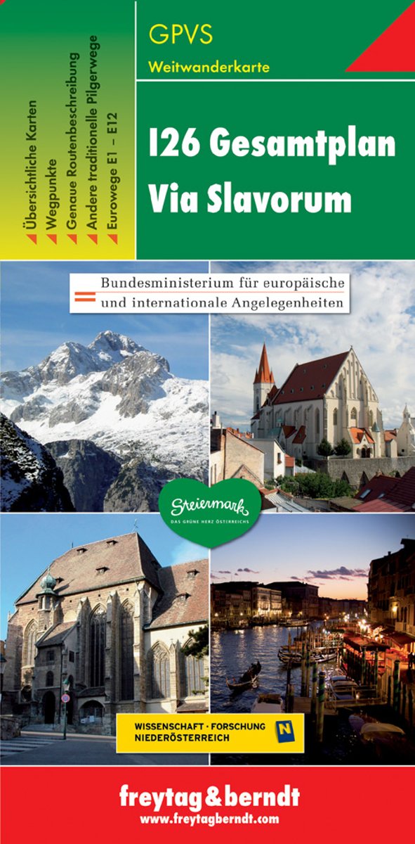
- FB GPVS Via Slavorum
- Dubbelzijdige wandel- en vrijetijdskaart toeristische tips stadsplattegronden overzichtskaart van de pelgrimsroute Via Slavorum, de internationale pelgrimsweg I26 die dwars door Midden- en Zuid-Europa voert GPS-punten Leer más
- Also available from:
- Bol.com, Belgium
- De Zwerver, Netherlands
Belgium
- FB GPVS Via Slavorum
- Dubbelzijdige wandel- en vrijetijdskaart toeristische tips stadsplattegronden overzichtskaart van de pelgrimsroute Via Slavorum, de internationale pelgrimsweg I26 die dwars door Midden- en Zuid-Europa voert GPS-punten Leer más
Netherlands
- Wandelkaart - Pelgrimsroute (kaart) - Wegenkaart - landkaart Via Slavorum I26 Gesamtplan Steiermark | Freytag & Berndt
- Dit is een overzichtskaart van de wandelkaart en/of pelgrimskaart voor de Via Slavorum, de internationale pelgrimsweg I26 die dwars door Midden-en Zuid-Europa voert: Van Krakau in Polen - Brno / Brünn in Tsjechië - Wenen, Mariazell, Graz, Klagefurt in Oostenrijk (Neder-Oostenrijk, Steiermark en Karinthie) - door het Save en Isonzodal in... Leer más
Mapas

United Kingdom
- Italy IGN ITA01
- Topographic survey of France at 1:25,000 in IGN`s excellent TOP25 / Série Bleue series. All the maps are GPS compatible, with a 1km UTM grid plus latitude and longitude lines at 5’ intervals. Contours are at 5m intervals except for mountainous areas where the maps have contours at 10m intervals, vividly enhanced by hill shading and graphics for... Leer más

United Kingdom
- Val d`Arbia, Ombrone and Orcia
- The valleys of Arbia, Ombrone and Orcia in Tuscany directly south of Siena on a detailed contoured map at 1:50,000 from Litografia Artistica Cartografica highlighting the course of La Via Francigena and other waymarked local trails.The map covers an area from Siena southwards to Castel del Piano including several nature reserves. Topography is... Leer más

United Kingdom
- Carso Triestino e Isontino Tabacco 047
- Carso Triestino e Isontino area in a series of Tabacco maps at 1:25,000 covering the Dolomites and the mountains of north-eastern Italy - Stanfords’ most popular coverage for this region, with excellent cartography and extensive overprint for hiking routes and other recreational activities, local bus stops, etc. An inset at 1:12,500 shows the... Leer más

United Kingdom
- Porto Rotondo to Capo Comino
- Porto Rotondo - Capo Comino area in a series of contoured, GPS compatible maps at 1:60,000 from Ed. Abies, with extensive tourist information including special recreational routes plus additional coverage at more detailed scales of selected popular areas. *Main series at 1:60,000 (Nos. 1 to 12)*The maps have contours at 100m intervals and... Leer más

United Kingdom
- Val Divedro - Alpe Veglia - Bugliaga - Monte Cistella SUPERCEDED
- 1:25,000 hiking map to Val Divedro, centred on Iselle and including Crodo.Published in association with the CAI, the Italian Alpine Club, who are responsible for the trails. Trails are marked on the map. The key information and more detailed information on the rear of the sheet are in Italian, German and English. Printed on waterproof,... Leer más

United Kingdom
- Slovenia Kartografija Road Atlas
- Slovenia at 1:75,000 presented in an A4, paperback road atlas from the Ljubljana-based Kartografija with very detailed GPS-compatible mapping at 1:75,000, including vivid presentation of the topography, extensive tourist overprint, plus 11 indexed street plans, a distance table, etc. Coverage includes the border areas of Italy around Trieste... Leer más

United Kingdom
- Urzulei
- Urzulei area at 1:25,000 in a series of contoured maps from Ed. Abies. Overprint highlights 19 hiking paths from three hours long to a two-day route. Symbols show viewpoints, caves, archaeological sites, exceptional trees and other landscape features of particular interest. This title has no UTM grid.*Main series at 1:60,000 (Nos. 1 to 12)*The... Leer más

United Kingdom
- Valle di Bognanco - NP Alpe Veglia Geo4Map 8
- 1:25,000 hiking map to the Valle di Bognanco including Iselle, Crevoladossola, Domodossola, Villadossola and Antronapiana. Published in association with the CAI, the Italian Alpine Club, who are responsible for the trails. Trails are marked on the map. The key information and more detailed information on the rear of the sheet are in Italian,... Leer más

United Kingdom
- Colli Euganei - Abano e Montegrotto Terme Tabacco 060
- Colli Euganei - Abano & Montegrotto Terme area in a series of Tabacco maps at 1:25,000 covering the Dolomites and the mountains of north-eastern Italy - Stanfords’ most popular coverage for this region, with excellent cartography and extensive overprint for hiking routes and other recreational activities, local bus stops, etc. Additional... Leer más


United Kingdom
- Lago d`Iseo - Valle Trompia - Franciacorta Kompass 106
- Lago d`Iseo - Valle Trompia - Franciacorta area on a GPS compatible hiking and recreational map at 1:50,000 from Kompass on durable, waterproof and tear-resistant synthetic paper. Coverage extends south to include Brescia.KOMPASS HIKING MAPS OF ITALY:This title is part of an extensive series of walking maps from Kompass covering selected areas... Leer más

United Kingdom
- Valsesia - Riva Valdobbia - Campertogno - Mollia - Rassa - Scopelllo
- 1:25,000 hiking map to the south west of Valsesia including Riva Valdobbia, Campertogno, Mollia, Rassa, Scopelllo.Published in association with the CAI, the Italian Alpine Club, who are responsible for the trails. Trails are marked on the map. The key information and more detailed information on the rear of the sheet are in Italian, German and... Leer más

United Kingdom
- Valle Anzasca - Vanzone - Piedimulera SUPERCEDED
- 1:25,000 hiking map covering the east end of the Valle Anzasca, centred on Pieve Vergonte, including Villadossola and Anzola d`Ossola. Published in association with the CAI, the Italian Alpine Club, who are responsible for the hiking trails. Trails are marked on the map. The key information and more detailed information on the rear of the sheet... Leer más

United Kingdom
- Alta Badia - Arabba - Marmolada Tabacco 07
- Alta Badia - Arabba - Marmolada area in a series of Tabacco maps at 1:25,000 covering the Dolomites and the mountains of north-eastern Italy - Stanfords’ most popular coverage for this region, with excellent cartography and extensive overprint for hiking routes and other recreational activities, local bus stops, etc. Additional overprint in... Leer más

United Kingdom
- Cinque Terre - Golfo del Tigullio: La Spezia - Sestri Levante - Rapallo - Genoa 50K IGC Map No. 23
- Cinque Terre - Golfo del Tigullio area of the Italian Riviera from genoa to la Spezia including Sestri Levante and Rapallo in a series contoured hiking maps at 1:50,000 with local trails, long-distance footpaths, mountain accommodation, etc. from the Turin based Istituto Geografico Centrale.Maps in this series have contours at 50m intervals,... Leer más