
Tirol
Descripción
Tirol comprises the Western part of Austria (Nordtirol) and the bordering region in Italy (Osttirol, Südtirol and Trentino).
Senderos en región
Enlaces
Datos
Informes
Guías y mapas
Hospedaje
Organizaciones
Operadores turísticos
GPS
Otro
Libros

Stanfords
United Kingdom
United Kingdom
- Tannheimer Tal F&B WK5352
- Tannheimer Tal - Füssen - Forchach area of the Austrian and Bavarian Alps presented at 1:35,000 in a series of contoured and GPS compatible outdoor leisure map from Freytag & Berndt with hiking and cycling routes, mountain huts, campsites and youth hostels, local bus stops, plus other tourist information. Cartography is an enlargement of the... Leer más
Stanfords
United Kingdom
United Kingdom
- Saalfelden - Saalbach-Hinterglemm - Zell am See Kompass 30
- Saalfelden - Saalbach - Zell am See (No. 30), a detailed, GPS compatible map at 1:50,000 from Kompass with local and long-distance footpaths, cycling routes, accommodation, etc, printed on durable, waterproof and tear-resistant synthetic paper. This title has on the reverse an additional panorama map of the region.KOMPASS HIKING & RECREATIONAL... Leer más

Stanfords
United Kingdom
United Kingdom
- Radstadt - Schladming - Flachau Kompass 31
- Radstadt - Schladming - Flachau area of the Austrian Alps on a detailed, GPS compatible map at 1:50,000 from Kompass with local and long-distance footpaths, cycling routes, accommodation, etc, printed on durable, waterproof and tear-resistant synthetic paper. KOMPASS HIKING & RECREATIONAL MAPS: this title is part of an extensive series covering... Leer más

Stanfords
United Kingdom
United Kingdom
- Tyrol Mountain Bike Trail (1000km) Bikeline Atlas
- A 1000-km long mountain bike trail in the very heart of the Austrian Alps in a 172-page German language guide from Verlag Esterbauer. The route, which can be divided into shorter circuits, takes in many of the region’s top tourist destinations including Innsbruck, Kitzbühel, Mayrhofen, Kufstein, Landeck, Ischgl, St. Anton, etc. IMPORTANT -... Leer más

Stanfords
United Kingdom
United Kingdom
- Landeck - Nauders - Samnaungruppe Kompass 42
- Landeck - Nauders - Samnaungruppe (No. 42), a detailed, GPS compatible map at 1:50,000 from Kompass with local and long-distance footpaths, cycling routes, accommodation, etc, printed on durable, waterproof and tear-resistant synthetic paper. KOMPASS HIKING & RECREATIONAL MAPS:This title is part of an extensive series covering Austria, much of... Leer más

Stanfords
United Kingdom
2018
United Kingdom
2018
- Innsbruck Mountain Adventures: Summer routes for a multi-activity holiday around the capital of Austria`s Tirol
- This guidebook presents 60 routes covering some of the best day walks, scrambles, hut-to-hut walks, alpine mountaineering, sport climbing, via ferratas, mountain-biking routes, road rides, city and trail runs and family activities the Innsbruck area has to offer. Ideal for a multi-activity holiday or for the keen amateur seeking a summary of... Leer más
- Also available from:
- The Book Depository, United Kingdom
- De Zwerver, Netherlands

The Book Depository
United Kingdom
2018
United Kingdom
2018
- Innsbruck Mountain Adventures
- Summer routes for a multi-activity holiday around the capital of Austria's Tirol Leer más

De Zwerver
Netherlands
2018
Netherlands
2018
- Klimgids - Klettersteiggids Innsbruck Mountain Adventures | Cicerone
- Summer routes for a multi-activity holiday around the capital of Austria's Tirol Leer más
Bol.com
Netherlands
2017
Netherlands
2017
- WF5654 Achsensee • Karwendel • Brandenberger Alpen • Rofan Kompass
- Destination:. Still schimmert das bläulich-grüne Wasser und plätschert, bewegt durch eine leichte Brise, an schroffe Uferfelsen. Steil steigt das steinige Ufer an, schwingt sich in ungeahnte Höhen auf, über denen der blaue Himmel strahlt. Die Idylle liegt an keinem norwegischen Fjord, selbst wenn es auf den ersten Blick so aussieht, sondern... Leer más
- Also available from:
- Bol.com, Belgium
Bol.com
Belgium
2017
Belgium
2017
- WF5654 Achsensee • Karwendel • Brandenberger Alpen • Rofan Kompass
- Destination:. Still schimmert das bläulich-grüne Wasser und plätschert, bewegt durch eine leichte Brise, an schroffe Uferfelsen. Steil steigt das steinige Ufer an, schwingt sich in ungeahnte Höhen auf, über denen der blaue Himmel strahlt. Die Idylle liegt an keinem norwegischen Fjord, selbst wenn es auf den ersten Blick so aussieht, sondern... Leer más
De Zwerver
Netherlands
2010
Netherlands
2010
- Wandelgids Hikeline Paznaun | Esterbauer
- Handzame gids met een goede beschrijving van een groot aantal dagtochten in dit gebied. De gids is in spiraalbinding en elke pagina is op scheur- en watervast papier gedrukt. Daar is echt over nagedacht! Streckencharakteristik Länge, Höhenmeter und Anforderungen Die 40 Touren dieses Buches decken eine große Bandbreite von kurzen Spaziergängen... Leer más
- Also available from:
- Bol.com, Belgium
- Also available from:
- Bol.com, Belgium

De Zwerver
Netherlands
2011
Netherlands
2011
- Wandelgids Tirol Oberinntal | Rother Bergverlag
- 50 Touren zwischen Innsbruck und Arlberg Rother Wanderbuch. 1. Auflage. Leer más
De Zwerver
Netherlands
2011
Netherlands
2011
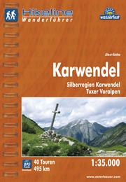
- Wandelgids Hikeline Karwendel | Esterbauer
- Handzame gids met een goede beschrijving van een groot aantal dagtochten in dit gebied. De gids is in spiraalbinding en elke pagina is op scheur- en watervast papier gedrukt. Daar is echt over nagedacht! Streckencharakteristik Länge, Höhenmeter und Anforderungen Die vierzig Touren dieses Buches decken eine große Bandbreite von kurzen... Leer más
Más libros…
Mapas

Stanfords
United Kingdom
United Kingdom
- Achensee - Rofan - Unterinntal F&B WK321
- Achensee - Rofan - Unterinntal area of the Austrian Alps north-east of Innsbruck presented at 1:50,000 in a series of contoured and GPS compatible outdoor leisure map from Freytag & Berndt with hiking and cycling routes, mountain huts, campsites and youth hostels, local bus stops, plus other tourist information. To see the list of currently... Leer más

Stanfords
United Kingdom
United Kingdom
- Grossglockner - Sonnblick - Kaprun - Zell am See F&B WK120
- Grossglockner - Sonnblick - Kaprun - Zell am See area of the Austrian Alps presented at 1:50,000 in a series of contoured and GPS compatible outdoor leisure map from Freytag & Berndt with hiking and cycling routes, mountain huts, campsites and youth hostels, local bus stops, plus other tourist information.To see the list of currently available... Leer más

Stanfords
United Kingdom
United Kingdom
- Zell am See - Kaprun - Saalbach F&B WK382
- Zell-am-See - Kaprun - Saalbach area of the Austrian Alps presented at 1:50,000 in a series of contoured and GPS compatible outdoor leisure map from Freytag & Berndt with hiking and cycling routes, mountain huts, campsites and youth hostels, local bus stops, plus other tourist information. To see the list of currently available titles in this... Leer más

Stanfords
United Kingdom
United Kingdom
- Mölltal - Kreuzeckgruppe - Drautal F&B WK225
- Mölltal - Kreuzeckgruppe - Drautal area of Carinthia presented at 1:50,000 in a series of contoured and GPS compatible outdoor leisure map from Freytag & Berndt with hiking and cycling routes, mountain huts, campsites and youth hostels, local bus stops, plus other tourist information.To see the list of currently available titles in this series... Leer más

Stanfords
United Kingdom
United Kingdom
- Mayrhofen - Zillertal Alps - Gerlos - Krimml - Tuxertal - Zell im Zillertal F&B WK152
- Mayrhofen - Zillertal Alps - Gerlos - Krimml - Tuxertal - Zell im Zillertal area of the Austrian Alps presented at 1:50,000 in a series of contoured and GPS compatible outdoor leisure map from Freytag & Berndt with hiking and cycling routes, mountain huts, campsites and youth hostels, local bus stops, plus other tourist information.To see the... Leer más

Stanfords
United Kingdom
United Kingdom
- Defereggental - Villgratental Kompass 45
- Defereggental - Lasörlinggruppe (No. 45), a detailed, GPS compatible map at 1:50,000 from Kompass with local and long-distance footpaths, cycling routes, accommodation, etc, printed on durable, waterproof and tear-resistant synthetic paper. This title has on the reverse an additional panorama map of the region.KOMPASS HIKING & RECREATIONAL... Leer más

Stanfords
United Kingdom
United Kingdom
- Kitzbühel F&B
- Street plan of Kitzbühel with on the reverse a detailed map at 1:50,000 of the resort’s environs highlighting numerous hiking trails and cycling or mountain bike routes. The plan shows one way streets and car parks, railway stations and various places of interest for which brief multilingual descriptions are provided. On the reverse is a... Leer más
Stanfords
United Kingdom
United Kingdom
- Kufstein - Walchsee - St. Johann in Tirol Kompass 09
- Kufstein - Walchsee - St.Johann in Tirol area in a detailed, GPS compatible map at 1:25,000 from Kompass with local and long-distance footpaths, cycling routes, accommodation, etc, printed on durable, waterproof and tear-resistant synthetic paper. KOMPASS HIKING & RECREATIONAL MAPS:This title is part of an extensive series covering Austria,... Leer más
Stanfords
United Kingdom
United Kingdom
- Stubai Alps Kompass 83
- Stubai Alps (No. 83), a detailed, GPS compatible map at 1:50,000 from Kompass with local and long-distance footpaths, cycling routes, accommodation, etc, printed on durable, waterproof and tear-resistant synthetic paper. This title has on the reverse an additional panorama map of the region.KOMPASS HIKING & RECREATIONAL MAPS:This title is part... Leer más

Stanfords
United Kingdom
United Kingdom
- Zillertal Alps West Alpenverein Map 35/1
- Zillertal Alps West area of the Alps in a hiking edition at 1:25,000 from a series of detailed, GPS compatible maps published by the DAV - Deutscher Alpenverein and produced by the German and Austrian Alpine Clubs using cartography from their respective survey organizations. Maps in this series have topography vividly presented by contours at... Leer más
Stanfords
United Kingdom
United Kingdom
- Venedigergruppe - Oberpinzgau Kompass 38
- Venedigergruppe - Oberpinzgau (No. 38), a detailed, GPS compatible map at 1:50,000 from Kompass with local and long-distance footpaths, cycling routes, accommodation, etc, printed on durable, waterproof and tear-resistant synthetic paper. This title has on the reverse an additional panorama map of the region.KOMPASS HIKING & RECREATIONAL... Leer más

Stanfords
United Kingdom
United Kingdom
- East Tyrol Cycling Atlas
- Cycling routes in the East Tyrol region of Austria presented at 1:75,000 by Verlag Esterbauer with essential information on accommodation, repair facilities, etc. All the text is in GERMAN only but extensive map legend includes English, as shown on our sample image.Esterbauer’s Bikeline guides in this series can be used without any knowledge of... Leer más

Stanfords
United Kingdom
2013
United Kingdom
2013
- Grossvenediger - Hohe Tauern NP - Matrei - Felber - Tauern - Oberpinzgau K+F Outdoor Map 12
- Grossvenediger - Hohe Tauern NP - Matrei - Felber - Tauern - Oberpinzgau area of the Tyrol at 1:35,000 on a GPS compatible, double-sided map from Kümmerly+Frey printed on sturdy, waterproof and tear-resistant synthetic paper; contoured, with hiking, cycling and ski routes, accommodation facilities, locations for other recreational activities,... Leer más

Stanfords
United Kingdom
United Kingdom
- Vorderes Zillertal - Achensee - Alpbachtal - Wildschonau Kompass 28
- Vorderes Zillertal - Alpbach - Rofan - Wildschönau (No. 28), a detailed, GPS compatible map at 1:50,000 from Kompass with local and long-distance footpaths, cycling routes, accommodation, etc, printed on durable, waterproof and tear-resistant synthetic paper. This title has on the reverse an additional panorama map of the region. KOMPASS HIKING... Leer más
Stanfords
United Kingdom
United Kingdom
- Zillertal Alps - Tux Alps Kompass 37
- Zillertal Alps - Mayrhofen - Zell am Ziller - Tuxer Voralpen (No. 37), a detailed, GPS compatible map at 1:50,000 from Kompass with local and long-distance footpaths, cycling routes, accommodation, etc, printed on durable, waterproof and tear-resistant synthetic paper. KOMPASS HIKING & RECREATIONAL MAPS:This title is part of an extensive series... Leer más