
Italia
Descripción

Italy is a country of enormous diversity and contrast. Most famous are the Alps. Coming from the efficient neatness of Switzerland or Austria, the Italian Alps are wilder and at the same time more tranquil, like stepping back in time. The most beautiful and popular areas are Gran Paradiso, Val Grande, Stelvio and the Dolomites.
In addition there are countless national parks, all very much worth hiking through. A series of mountain ranges runs from north to south like a backbone, starting from the hills of Tuscany, to the Apennines and Abruzzo to Italy's toe, Calabria. Southern Italy, too far for many tourists, has several attractive hiking regions, like Pollino and Aspromonte.
In the Alps you can walk from hut to hut, elsewhere you can do day hikes, such is the rule in general. However some genuine long distance hiking trails are under construction. European long distance trail E10 in the Alps, which coincides with the 1000km long Grande Alpine Trail and the international Via Alpina. The second large project is the E1, which coincides with the Grand Apennine Mountains Trail and the Ligurian Mountains High Trail. If this trail is ever completed, you can start from Como passing Genova and continue all the way to Reggio di Calabria and Palermo or Siracuse on Sicily. The third large project means to join all these trails into one 6000km long Sentiero Italia. Last but not least, there is the Alta Via in the Dolomites: splendid walking.
Mountain huts abound in the Alps. Hiking can be done all summer, from June until well into October. Further south spring is the best hiking season. In April you will still get stuck in the snow up in the mountains. Autumn is supposed to be fine as well, but alas, as one hiker put it: "you wake up to the sounds of church bells and gunfire". As hunters, Italians are best avoided.
Mapa


Senderos
- Alta Via dei GigantiGPX
- Alta Via dei Monti LiguriGPX
- Alta Via Della Valle d'Aosta No 1
- Alta Via Della Valle d'Aosta No 2
- Alta Via Dolomiti 1GPX
- Alta Via Dolomiti 10
- Alta Via Dolomiti 2GPX
- Alta Via Dolomiti 3GPX
- Alta Via Dolomiti 4GPX
- Alta Via Dolomiti 5
- Alta Via Dolomiti 6GPX
- Alta Via Dolomiti 7
- Alta Via Dolomiti 8
- Alta Via Dolomiti 9
- Bassa Via del GardaGPX
- Cinque Terre
- E1GPX
- E10GPX
- E12GPX
- E5GPX
- E7GPX
- Florence - Siena
- GoethewegGPX
- GR58 - Tour du QueyrasGPX
- Grande Escursione AppenninicaGPX
- Grande Traversata del Gran Paradiso
- Grande Traversata delle AlpiGPX
- Meraner HöhenwegGPX
- Pfunderer HöhenwegGPX
- Santiago de Compostela Pilgrims WayGPX
- Südalpenweg - 3GPX
- SeealpentourGPX
- Sentiero della PaceGPX
- Sentiero ItaliaGPX
- Sentiero Roma
- Tiroler Höhenweg
- TMB - Tour du Mont BlancGPX
- Tour des CombinsGPX
- Tour des Grands Barrages
- Tour du MatterhornGPX
- Tour Monte RosaGPX
- Traumpfad München-VenedigGPX
- Via AlpinaGPX
- Via FrancigenaGPX
- Via SacraGPX
- Via SbrinzGPX
- Via SplugaGPX
- Via ValtellinaGPX
Regiones
- Abruzzi
- Adamello
- Aeolian Islands
- Alpi Biellesi e Cusiane
- Alpi di Livigno
- Alpi Liguri
- Alpi Marittime
- Alpi Oróbie e Bergamasche
- Alpi Sarentini
- Alpi Vicentine
- Alps
- Amalfi Coast
- Appennini
- Apulia
- Ötztal
- Bernina
- Brenta
- Calabria
- Cilento
- Defereggengebirge
- Dolomiti
- Dolomiti di Fiemme
- Elba
- Friuli
- Garda
- Gran Paradiso
- Grand Combin
- Julische Alpen
- Karawanken
- Karnischer Alpen
- Lago di Como
- Lago Maggiore
- Liguria
- Lombardia
- Matterhorn
- Moncenisio
- Monginevro
- Mont Blanc
- Monte Leone
- Monte Rosa
- Monti Sibillini
- Monviso
- Nonstaler Alpen
- Ortler
- Paganella
- Platta Gruppe
- Presanella
- Rieserfernergruppe
- Sardinia
- Südtirol
- Sesvenna Gruppe
- Sicilia
- Sobretta
- Stelvio
- Stubai
- Texelgruppe
- Tirol
- Toscana
- Trentino
- Umbria
- Val d'Aosta
- Val Grande
- Val Venosta
- Valle d'Aosta
- Veneto
- Vinschgau
- Zillertal
Montañas


Enlaces
Datos
Informes
Guías y mapas
Hospedaje
Organizaciones
Operadores turísticos
GPS
Otro
Libros

United Kingdom
- Bolzano and Environs Kompass 54
- Map No. 54, Bolzano and Environs, from Kompass, printed on waterproof and tear-resistant synthetic paper in a series of walking maps of selected areas of Italy at 1:50,000, with hiking routes on a topographic base, various types of accommodation, recreational facilities, places of interest, etc. Kompass are Europe’s largest publishers of... Leer más

United Kingdom
- Cortina d`Ampezzo Kompass 55
- Map No. 55, Cortina d`Ampezzo - with a panorama map on the reverse, from Kompass, printed on sturdy, waterproof and tear-resistant synthetic paper in their series of walking maps of selected areas of Italy at 1:50,000, with hiking routes on a topographic base, various types of accommodation, recreational facilities, places of interest, etc.... Leer más

United Kingdom
2018
- Italian Sunflower Landscape Guide
- This new 3rd edition of Italian Lakes has been carefully revised just a few months prior to publication. The topo maps now show waypoints, and free downloadable GPS tracks are available for all the walks. Colour coding on the Contents page enables you to see at a glance the grading of various walks. These great expanses of water, bound to the... Leer más

United Kingdom
- Pale di San Martino - Primiero San Martino di Castrozza - Paneveggio - Valle del Vanoi Kompass 622
- Pale di S.Martino - Fiera di Primiero - Panaveggio - Valle del Vanoi area at 1:25,000 on a durable, waterproof and tear-resistant map from Kompass in their series of detailed maps of the Dolomites.CARTOGRAPHY: Kompass maps of the Dolomites at 1:25,000 have contours at 25-m intervals. An overprint shows local and long-distance footpaths,... Leer más


- Also available from:
- De Zwerver, Netherlands


United Kingdom
2015
- The Way of St Francis
- Via di Francesco: From Florence to Assisi and Rome Leer más
- Also available from:
- De Zwerver, Netherlands

Netherlands
2019
- Wandelgids - Pelgrimsroute The Way of St Francis - Via Francigena | Cicerone
- Guidebook to walking the Way of St Francis, Via di Francesco. 550km pilgrimage from Florence, through Assisi to Rome through Central Italy visiting key sites from the saint's life. Described in 28 stages, the guide to the month-long route includes detailed maps, profiles and information about all the shrines, churches and towns along the way. Leer más

- Also available from:
- De Zwerver, Netherlands


United Kingdom
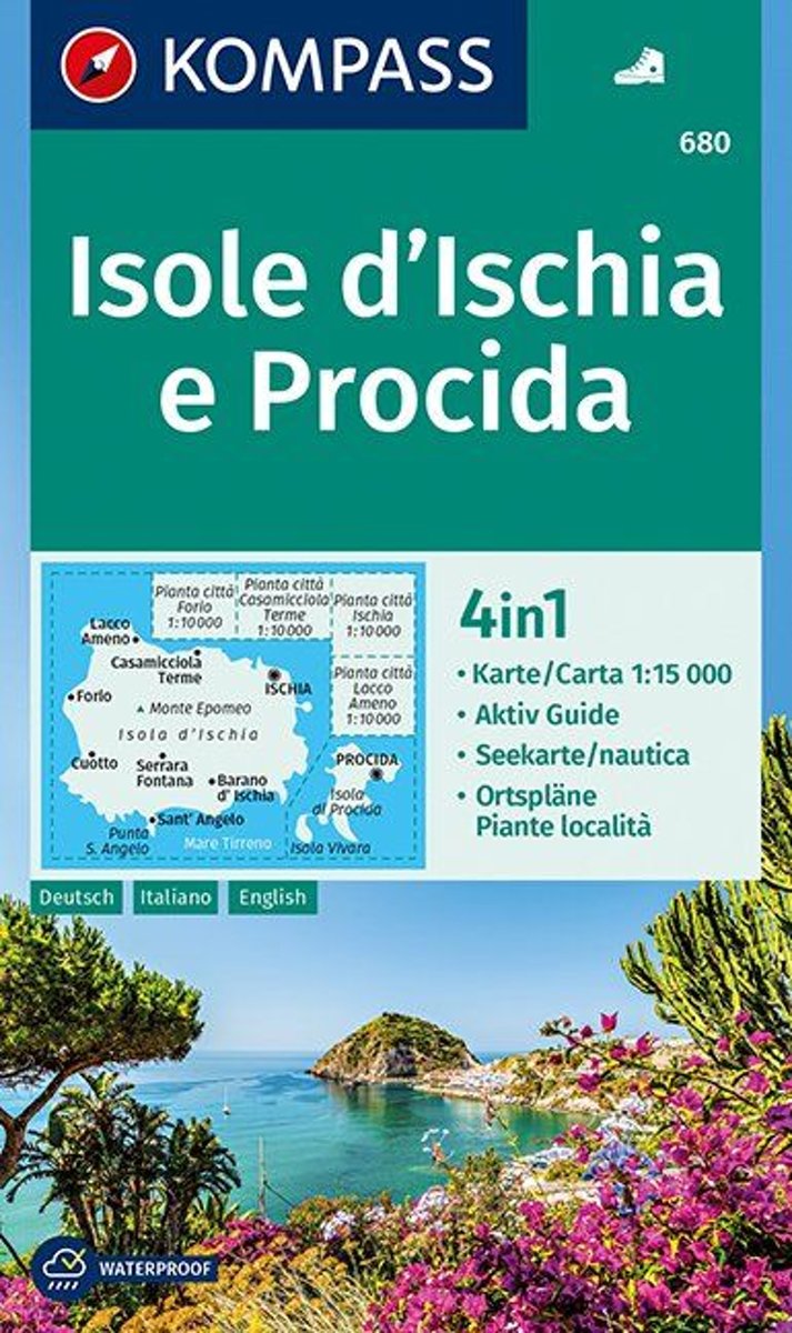
- Ischia and Procida Islands Kompass 680
- Map No. 680, Ischia and Procida, with street plan of Ischia town, Forio, Cassamicciola Terme and Lacco Ameno, plus a booklet which includes English. Printed on sturdy, waterproof and tear-resistant synthetic paper, this title is part of a series of walking maps from Kompass covering selected areas of Italy at 1:50,000, with hiking routes on a... Leer más
- Also available from:
- Bol.com, Netherlands
- Bol.com, Belgium
Netherlands
- Isole d' Ischia e Procida 1:15 000
- Deze zeer gedetailleerde Kompass wandelkaart, schaal 1:15 000, is ideaal om uw route uit te stippelen en om onderweg te gebruiken; naast de bekende bestemmingen, worden ook de minder bekende vermeld; openbaar vervoer bij begin- of eindpunt van een route aangegeven; eenvoudige wandelingen tot pittige (berg)tochten, voor getrainde en ongetrainde... Leer más
Belgium
- Isole d' Ischia e Procida 1:15 000
- Deze zeer gedetailleerde Kompass wandelkaart, schaal 1:15 000, is ideaal om uw route uit te stippelen en om onderweg te gebruiken; naast de bekende bestemmingen, worden ook de minder bekende vermeld; openbaar vervoer bij begin- of eindpunt van een route aangegeven; eenvoudige wandelingen tot pittige (berg)tochten, voor getrainde en ongetrainde... Leer más
Netherlands
2013
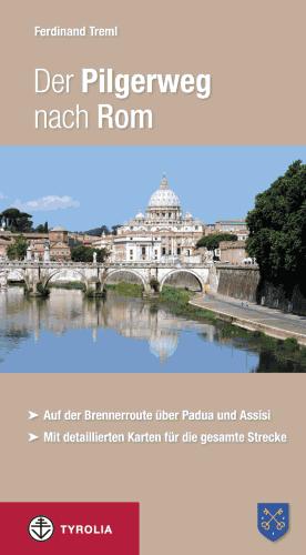
- Wandelgids - Pelgrimsroute Der Pilgerweg nach Rom | Tyrolia
- Auf der Brennerroute über Padua und Assisi. Abt-Albert-von Stade-Weg, Antoniusweg Cammino di Sant´Antonio, Franziskusweg Cammino di Assisi, Romweg Via di Roma. Mit detaillierten Karten für die gesamte Strecke. Leer más
Netherlands
2018
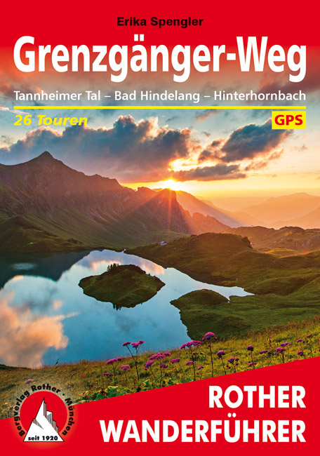
- Wandelgids Grenzgänger-Weg | Rother Bergverlag
- Uitstekende wandelgids met een groot aantal dagtochten in dal en hooggebergte. Met praktische informatie en beperkt kaartmateriaal! Wandelingen in verschillende zwaarte weergegeven in rood/blauw/zwart. Deels zijn het dagtochten, deels tochten die deel uitmaken van de langere Grenzgänger-weg. In den Allgäuer Hochalpen lädt der »Grenzgänger-Weg«... Leer más

Netherlands
- Ciao, Napoli
- When Antoinette Carone and her husband hatched a plan to relocate to Naples, Italy, they had no inkling that every trip to the market would be a sojourn dating back as far as 2500 years. Now, she shares their remarkable experience roaming the streets of Naples and beyond on trail of history as colorful as it is far-reaching. From the famous... Leer más
- Also available from:
- Bol.com, Belgium
Belgium
- Ciao, Napoli
- When Antoinette Carone and her husband hatched a plan to relocate to Naples, Italy, they had no inkling that every trip to the market would be a sojourn dating back as far as 2500 years. Now, she shares their remarkable experience roaming the streets of Naples and beyond on trail of history as colorful as it is far-reaching. From the famous... Leer más

Netherlands
2016
- Friaul - Julisch Venetien
- Die kleine grüne Region im Nordosten Italiens erstreckt sich von den Alpen bis zur nördlichen Adria. Wer hier Ferien macht, kann am Vormittag bergwandern und sich am Nachmittag an prächtigen langen Sandstränden vergnügen.Tags drauf locken ausgedehnte Weinlandschaften, römische Ausgrabungen oder... Leer más
- Also available from:
- Bol.com, Belgium
Belgium
2016
- Friaul - Julisch Venetien
- Die kleine grüne Region im Nordosten Italiens erstreckt sich von den Alpen bis zur nördlichen Adria. Wer hier Ferien macht, kann am Vormittag bergwandern und sich am Nachmittag an prächtigen langen Sandstränden vergnügen.Tags drauf locken ausgedehnte Weinlandschaften, römische Ausgrabungen oder... Leer más

Netherlands
- Riomaggiore Italy
- Via dellAmore connects the Cinque de Terre, City of Lights, five cities connected with the love trail on the Italian beautiful seaside... Riomaggiore is on the Riviera di Levante on the Mediterraneans Gulf of Genoa The city is the Most southern city of the City of Lights*** Galleria and more joy to your heart and soul, Soli Deo Gloria Leer más
- Also available from:
- Bol.com, Belgium
Belgium
- Riomaggiore Italy
- Via dellAmore connects the Cinque de Terre, City of Lights, five cities connected with the love trail on the Italian beautiful seaside... Riomaggiore is on the Riviera di Levante on the Mediterraneans Gulf of Genoa The city is the Most southern city of the City of Lights*** Galleria and more joy to your heart and soul, Soli Deo Gloria Leer más

Netherlands
- Reisgids The Marche and San Marino | Blue Guides
- Een zeer gedegen reisgids over dit gebied, speciaal gericht op kunst en cultuur. Diepgaande informatie over dit specifieke onderwerp. Een van de beste reisgidsen die er bestaan! New edition of this comprehensive, readable, reliable and affectionate guide. The only full-length English-language guide to focus on this area of eastern Italy. Most... Leer más
Mapas

United Kingdom
- Ponte di Legno - Alta Val Camonica - Passo del Tonale Kompass 107
- Ponte di Legno - Alta Val Camonica area of northern Italy on a GPS compatible hiking and recreational map at 1:50,000 from Kompass, printed on durable, waterproof and tear-resistant synthetic paper.KOMPASS HIKING MAPS OF ITALY:This title is part of an extensive series of walking maps from Kompass covering selected areas of Italy at mainly... Leer más

United Kingdom
- Sorrento Peninsula - Amalfi Coast - Vesuvius - Pompeii - Salerno - Sorrento Kompass 682
- Sorrento Peninsula on a hiking and recreational map at 1:50,000 from Kompass on durable, waterproof and tear-resistant synthetic paper. Coverage includes Vesuvius and Pompeii and separate panels provide street plans of Sorrento, Positano, Amalfi, Ravello, Salerno and Castellammarte di Stabia. Accompanying booklet includes 16 pages in English... Leer más

United Kingdom
- Po Valley Cycle Route: Milan to the Adriatic (595km) Bikeline Map-Guide
- The Po Valley Cycle Route, a 595-km long cycle trail linking Milan to the Adriatic, presented by the Verlag Esterbauer in guide with maps at 1:75,000 showing the route and its variants. Extensive information is conveyed by symbols, indicating road surface, campsites and other accommodation, repair workshops, recreational facilities, places of... Leer más

United Kingdom
- Slovenia Kartografija Road Atlas
- Slovenia at 1:75,000 presented in an A4, paperback road atlas from the Ljubljana-based Kartografija with very detailed GPS-compatible mapping at 1:75,000, including vivid presentation of the topography, extensive tourist overprint, plus 11 indexed street plans, a distance table, etc. Coverage includes the border areas of Italy around Trieste... Leer más

United Kingdom
- Urzulei
- Urzulei area at 1:25,000 in a series of contoured maps from Ed. Abies. Overprint highlights 19 hiking paths from three hours long to a two-day route. Symbols show viewpoints, caves, archaeological sites, exceptional trees and other landscape features of particular interest. This title has no UTM grid.*Main series at 1:60,000 (Nos. 1 to 12)*The... Leer más

United Kingdom
- Laces / Latsch - Val Martello / Martell - Silandro / Schlanders Tabacco 045
- Laces/Latsch - Val Martello/Martell - Silandro/Schlanders area in a series of Tabacco maps at 1:25,000 covering the Dolomites and the mountains of north-eastern Italy - Stanfords’ most popular coverage for this region, with excellent cartography and extensive overprint for hiking routes and other recreational activities, local bus stops, etc.... Leer más

United Kingdom
- San Gimignano - Volterra
- Contoured, GPS compatible map of one of Tuscany’s most visited areas, with hiking and mountain bike routes, plus on the reverse street plans of San Gimignano and Volterra, recommendations for rural accommodation, etc.The main map covers the area at 1:25,000 and has contours at 25m intervals. An overprint highlights numerous waymarked hiking... Leer más

United Kingdom
- Valsugana - Trento - Piné - Levico - Lavarone Kompass 75
- Valsugana - Trento - Piné - Levico – Lavarone area of southern Dolomites on a GPS compatible hiking and recreational map at 1:50,000 from Kompass, printed on durable, waterproof and tear-resistant synthetic paper. On the reverse is a panorama of the Trentino region, extending from Monte Baldo and the northern part of Lake Garda northwards to... Leer más

United Kingdom
- Valmalenco
- Valmalenco on a double-sided, contoured and GPS compatible map at 1:25,000 from Litografia Artistica Cartografica in their Global Map imprint. Coverage extends from Sondrio and the Adda River northwards to beyond the Swiss border and includes Monte Disgrazia, Pizzo Scalino and the peak of Bernina with the surrounding glaciers.The map has... Leer más

United Kingdom
- Monte Grappa - Basano - Feltre Tabacco 051
- Monte Grappa - Basano - Feltre in a series of Tabacco maps at 1:25,000 covering the Dolomites and the mountains of north-eastern Italy - Stanfords’ most popular coverage for this region, with excellent cartography and extensive overprint for hiking routes and other recreational activities, local bus stops, etc. Additional overprint in this... Leer más

United Kingdom
- Colli Euganei - Abano e Montegrotto Terme Tabacco 060
- Colli Euganei - Abano & Montegrotto Terme area in a series of Tabacco maps at 1:25,000 covering the Dolomites and the mountains of north-eastern Italy - Stanfords’ most popular coverage for this region, with excellent cartography and extensive overprint for hiking routes and other recreational activities, local bus stops, etc. Additional... Leer más

United Kingdom
- Val Formazza - Val Bavona - Val Maggia Geo4Map 11 SUPERCEDED
- 1:25,000 hiking map to the north east of Val Formazza centred on Formazza, including Blinnenhorn and Passo di San Giacomo.Published in association with the CAI, the Italian Alpine Club, who are responsible for the trails. Trails are marked on the map. The key information and more detailed information on the rear of the sheet are in Italian,... Leer más

United Kingdom
- Lanzo - Viù - Chialamberto - Locana 25K IGC Map No. 110
- Lanzo - Viù - Chialamberto - Locana – Cirié – Basse Valli di Lanzo area at 1:25,000 in a series of contoured, GPS compatible walking maps from the Turin based Istituto Geografico Centrale, highlighting hiking trails including long-distance routes, ski routes and alpine accommodation. Maps in this series have contours at 25m intervals, enhanced... Leer más

United Kingdom
- Livigno and Environs
- Livigno and its environs on a detailed, contoured and GPS compatible map at 1:25,000 from Litografia Artistica Cartographical in their Global Map imprint, highlighting hiking trails, huts, ski lifts, etc. The map is double-sided, with a very generous overlap, and extends from the Swiss approaches to the Lago di Livigno Dam to Rifigio Dosde, and... Leer más

United Kingdom
- Val de Peio - Val di Rabbi - Val di Sole Tabacco 048
- Val de Peio - Val di Rabbi - Val di Sole area in a series of Tabacco maps at 1:25,000 covering the Dolomites and the mountains of north-eastern Italy - Stanfords’ most popular coverage for this region, with excellent cartography and extensive overprint for hiking routes and other recreational activities, local bus stops, etc. Additional... Leer más