
Umbria
Descripción
Region in the center of Italy.
Enlaces
Datos
Informes
Guías y mapas
Hospedaje
Organizaciones
Operadores turísticos
GPS
Otro
Libros

Stanfords
United Kingdom
United Kingdom
- DK Eyewitness Road Trips Northern & Central Italy
- With its snow-capped mountain ranges and beautiful hill towns, Italy is an ideal destination for a leisurely road trip. It`s yours to explore with Road Trips Northern and Central Italy, our redesigned and newly updated guide containing 25 drives across the region, from the dramatic coastline of the Cinque Terre to the lakes of Lombardy and the... Leer más

Stanfords
United Kingdom
2005
United Kingdom
2005
- Walking and Eating in Tuscany & Umbria
- In Walking and Eating in Tuscany and Umbria, James Lasdun and Pia Davis offer forty walks through the spectacular countryside of both regions. Arranged for the utmost flexibility the guide includes half-day outings easily accessible from a city base to day walks that can be linked together in a series. These itineraries are designed to combine... Leer más

Stanfords
United Kingdom
United Kingdom
- Parco Nazionale del Stelvio / NP Stilfser Joch Kompass 072
- Parco Nazionale del Stelvio (NP Stilfser Joch) on a GPS compatible hiking and recreational map at 1:50,000 from Kompass printed on durable, waterproof and tear-resistant synthetic paper.KOMPASS HIKING MAPS OF ITALY:This title is part of an extensive series of walking maps from Kompass covering selected areas of Italy at mainly 1:50,000, with a... Leer más

Stanfords
United Kingdom
United Kingdom
- Sardinia North 4-Map Set Kompass 2497
- The northern part of Sardinia on a set of four double-sided, contoured and GPS compatible recreational maps at 1:50,000 from Kompass. Extensive overprint highlights hiking trails, cycle and selected mountain bike routes, and horse riding paths. Symbols indicate various types of accommodation including campsites, youth hostels, “Friends of... Leer más

Stanfords
United Kingdom
United Kingdom
- Cortina d`Ampezzo Kompass 55
- Map No. 55, Cortina d`Ampezzo - with a panorama map on the reverse, from Kompass, printed on sturdy, waterproof and tear-resistant synthetic paper in their series of walking maps of selected areas of Italy at 1:50,000, with hiking routes on a topographic base, various types of accommodation, recreational facilities, places of interest, etc.... Leer más

Stanfords
United Kingdom
2019
United Kingdom
2019
- Walking in Umbria: 40 walks in the `Green Heart` of Italy
- This guidebook by Italian walking expert Gillian Price describes 40 varied day walks in the region of Umbria, taking in the towns of Assisi, Perugia, Orvieto and Norcia. The walks range from 2.5km to 19km in length, the majority of the routes are circular, and several wonderful traverses have been included, with the return to the start point... Leer más
- Also available from:
- The Book Depository, United Kingdom
- De Zwerver, Netherlands

The Book Depository
United Kingdom
2019
United Kingdom
2019
- Walking in Umbria
- 40 walks in the 'Green Heart' of Italy Leer más

De Zwerver
Netherlands
2019
Netherlands
2019
- Wandelgids Walking in Umbria - Umbrië | Cicerone
- This guidebook describes 40 walks in Umbria, among the ancient towns of Assisi, Perugia, Orvieto and Norcia. Known as the 'green heart' of Italy, the region of Umbria is home to hills reaching up to the Apennines and Sibillini mountains, as well as ancient villages, Roman and Etruscan ruins, dense woodland and nature reserves. Leer más

Stanfords
United Kingdom
2021
United Kingdom
2021
- Lonely Planet Best Day Walks Italy
- Lonely Planet`s Best Day Walks Italy is your passport to 60 easy escapes into nature. Stretch your legs outside the city by picking a hike that works for you, from just a couple of hours to a full day, from easy to hard. Hike the Dolomites, explore the Italian Lakes, and stroll Sardinia`s coast. Get to the heart of Italy and begin your journey... Leer más
- Also available from:
- The Book Depository, United Kingdom
- De Zwerver, Netherlands


De Zwerver
Netherlands
2022
Netherlands
2022
De Zwerver
Netherlands
2007
Netherlands
2007
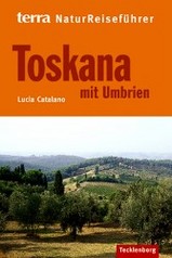
- Natuurgids NaturReiseführer Toskana mit Umbrien | Tecklenborg
- Duitstalige natuurreisgids met leuke informatie welke flora en fauna waar te zien is. Goede beschrijvingen en mooie foto´s. Beschrijft wel een selectie van natuurgebieden, niet uitputtend voor hele land. Neben den weltweit bekannten Hügeln mit Zypressen, Weingärten und Olivenhainen bietet das Gebiet „Toskana und Umbrien´´ dem Naturfreund eine... Leer más
Bol.com
Netherlands
Netherlands
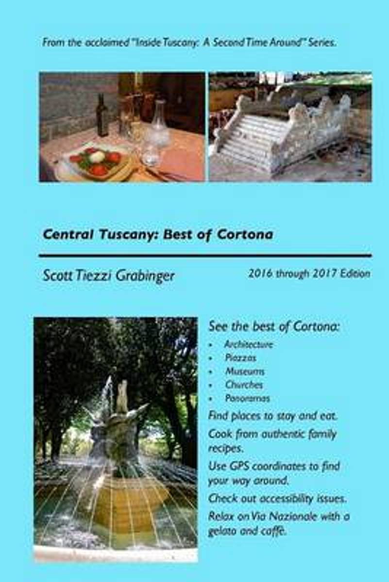
- Central Tuscany
- Central Tuscany: Best of CortonaNew and Expanded 2018 to 2019 EditionThe latest edition of the Cortona guidebook is the most comprehensive in English. It invites you to view its excellent churches and museums and to experience the culture. Founded by Noah after the ark sailed up the Tiber if you believe the legends it sits high on a steep... Leer más
- Also available from:
- Bol.com, Belgium
Bol.com
Belgium
Belgium
- Central Tuscany
- Central Tuscany: Best of CortonaNew and Expanded 2018 to 2019 EditionThe latest edition of the Cortona guidebook is the most comprehensive in English. It invites you to view its excellent churches and museums and to experience the culture. Founded by Noah after the ark sailed up the Tiber if you believe the legends it sits high on a steep... Leer más

Stanfords
United Kingdom
United Kingdom
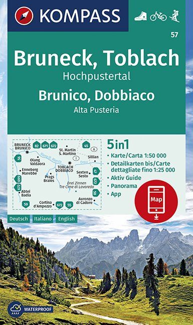
- Brunico - Dobbiaco - Alta Pusteria Kompass 57
- Map No. 57, Brunico - Dobbiaco - Tre Cimma de Lavaredo, from Kompass printed on sturdy waterproof and tear-resistant synthetic paper in a series of walking maps of selected areas of Italy at 1:50,000, with hiking routes on a topographic base, various types of accommodation, recreational facilities, places of interest, etc. Kompass are Europe’s... Leer más
- Also available from:
- De Zwerver, Netherlands
De Zwerver
Netherlands
Netherlands
- Wandelkaart 57 Bruneck, Brunico - Toblach, Dobbiaco | Kompass
- Die 4in1 Wanderkarte ist jetzt noch übersichtlicher und besser lesbar. Die Wanderkarten aus den Top-Wanderregionen sind mit einer zusätzlichen Karte im Detailmaßstab ausgestattet. Der Aktiv Guide informiert Sie rund um das Thema Outdoor und die kostenlose App für unterwegs gibt es auch noch dazu. Das bildet die perfekte Grundlage für die... Leer más
Bol.com
Netherlands
2010
Netherlands
2010
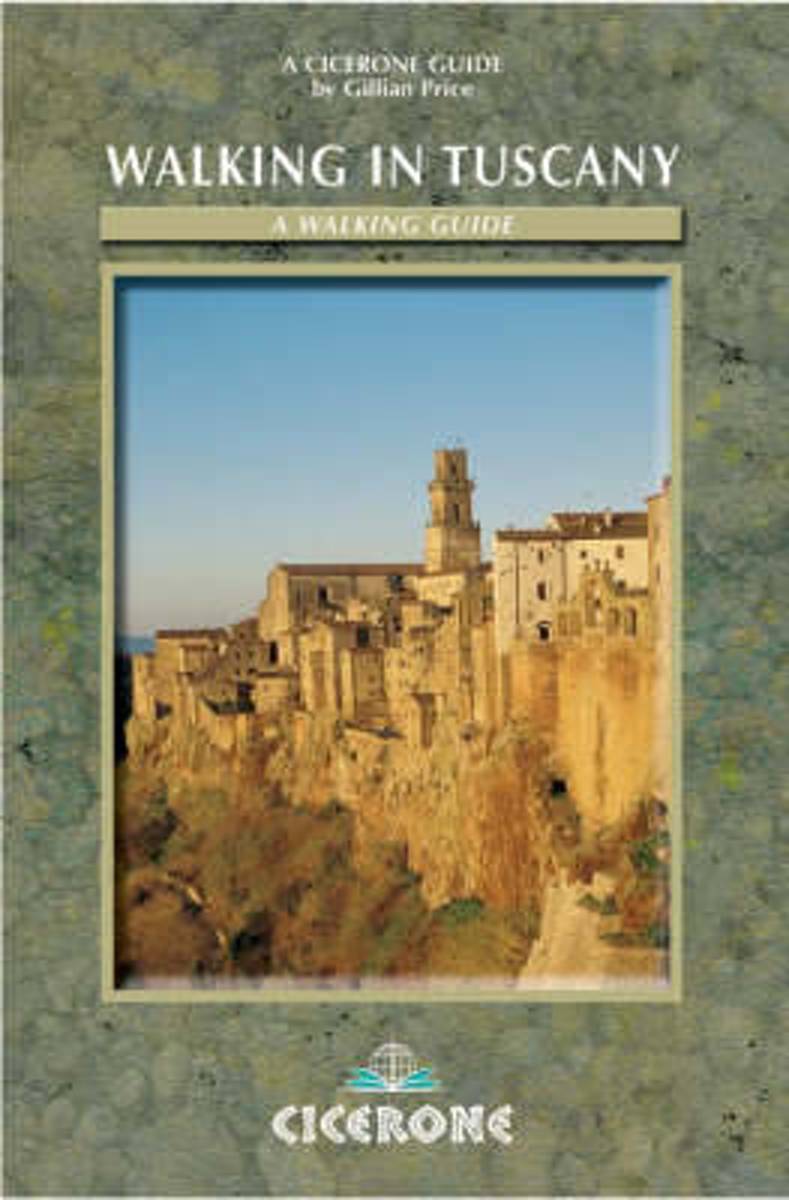
- Walking In Tuscany
- Third edition of a guidebook to 50 walks through Italy's Tuscany, Umbria and Latium, ranging from brief strolls to a 5-day trek (the Chianti Trail). This guide offers suggestions for exploratory walks through the picture postcard landscapes of Tuscany, Umbria and Latium. The 50 itineraries range from brief strolls to a five-day trek, taking in... Leer más
- Also available from:
- Bol.com, Belgium
Bol.com
Belgium
2010
Belgium
2010
- Walking In Tuscany
- Third edition of a guidebook to 50 walks through Italy's Tuscany, Umbria and Latium, ranging from brief strolls to a 5-day trek (the Chianti Trail). This guide offers suggestions for exploratory walks through the picture postcard landscapes of Tuscany, Umbria and Latium. The 50 itineraries range from brief strolls to a five-day trek, taking in... Leer más
De Zwerver
Netherlands
2016
Netherlands
2016
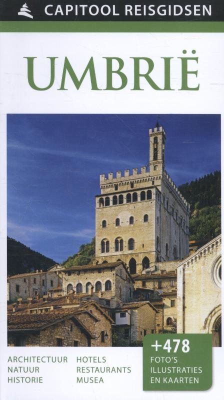
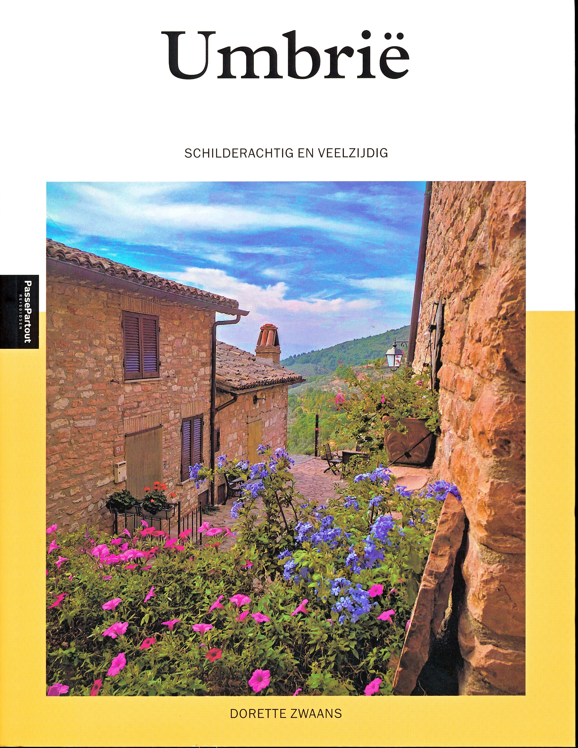
- Reisgids Capitool Reisgidsen Umbrië | Unieboek
- Prachtig geillustreerde reisgids met o.a. 3D tekeningen, fraaie kaarten en geweldige foto’s. Daarnaast uitgebreide achtergrondbeschrijvingen. Echt om in de stemming te komen! Groot formaat gids. Capitool Reisgids Het groene hart Umbrië ligt midden in Italië; de glooiende heuvels en vruchtbare vlakten zijn bezaaid met schilderachtige dorpen,... Leer más
Bol.com
Netherlands
2017
Netherlands
2017
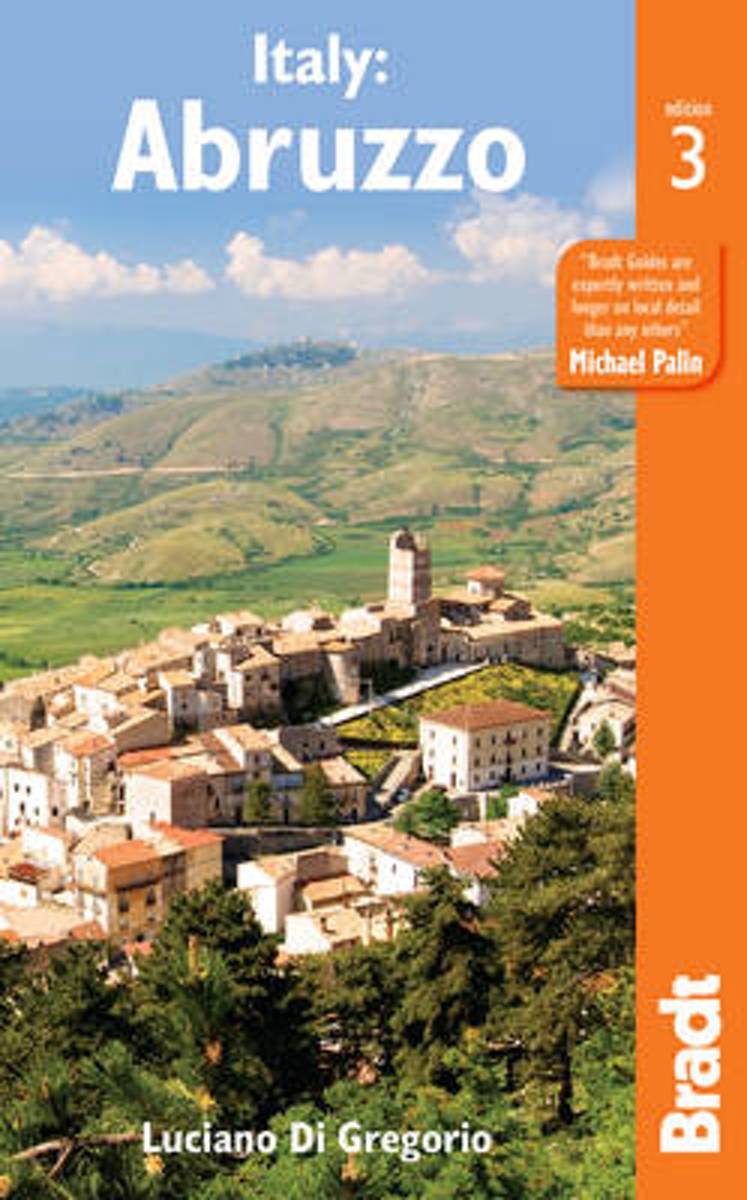
- Italy
- Bradt's Abruzzo remains the only full English-language guide to this beautiful and increasingly favoured part of Italy. This new edition has been thoroughly updated to cover all developments since the last edition, reflecting the region's growing popularity for holiday homes and as a busy conference destination at the heart of Italy, plus its... Leer más
- Also available from:
- Bol.com, Belgium
- De Zwerver, Netherlands
Bol.com
Belgium
2017
Belgium
2017
- Italy
- Bradt's Abruzzo remains the only full English-language guide to this beautiful and increasingly favoured part of Italy. This new edition has been thoroughly updated to cover all developments since the last edition, reflecting the region's growing popularity for holiday homes and as a busy conference destination at the heart of Italy, plus its... Leer más
De Zwerver
Netherlands
2017
Netherlands
2017
- Reisgids Abruzzo (Abruzzen) | Bradt Travel Guides
- Voor vele landen net zo goed, zo niet beter dan de Planet. Beduidend soberder uitgevoerd, maar ook met veel informatie voor backpackers en met veel kaartmateriaal. Een aanrader! Situated in the centre of Italy, Abruzzo lies just an hour's drive from Rome. Often overlooked, it has never been discovered by mass tourism. Abruzzo has something for... Leer más
De Zwerver
Netherlands
2022
Netherlands
2022
Mapas

Stanfords
United Kingdom
United Kingdom
- Lago d`Iseo - Valle Trompia - Franciacorta Kompass 106
- Lago d`Iseo - Valle Trompia - Franciacorta area on a GPS compatible hiking and recreational map at 1:50,000 from Kompass on durable, waterproof and tear-resistant synthetic paper. Coverage extends south to include Brescia.KOMPASS HIKING MAPS OF ITALY:This title is part of an extensive series of walking maps from Kompass covering selected areas... Leer más

Stanfords
United Kingdom
United Kingdom
- Cinque Terre Kompass 2450
- Cinque Terra area of the Ligurian Coast on a double-sided, contoured and GPS compatible recreational map at 1:50,000 from Kompass, printed on durable, waterproof and tear-resistant synthetic paper. Coverage Montemarcello Magra Regional Park. In addition to numerous local hiking trails and long-distance routes such as the Alta Via dei Monti... Leer más

Stanfords
United Kingdom
United Kingdom
- Monte Fumaiolo - Monte Comero 18
- Map No. 18, Monte Fumaiolo - Alto Tevere, in series of contoured, GPS compatible hiking maps at 1:25,000 from the Istituto Geografico Adriatico, covering mainly the spine of the Apennines along the borders of Tuscany, Emilia-Romagna, Umbria and the Marches.Map in this series have contours at 25m intervals with additional shading and numerous... Leer más

Stanfords
United Kingdom
United Kingdom
- Alpe di San Benedetto 21
- Map No. 21, Alpe di San Benedetto: Passo del Muraglione – San Godenzo – Dicomano, in series of contoured, GPS compatible hiking maps at 1:25,000 from the Istituto Geografico Adriatico, covering mainly the spine of the Apennines along the borders of Tuscany, Emilia-Romagna, Umbria and the Marches.Map in this series have contours at 25m intervals... Leer más

Stanfords
United Kingdom
United Kingdom
- Val Venosta / Vinschgau Kompass 52
- Val Venosta/Vinschgau area of the Dolomites on a GPS compatible hiking and recreational map at 1:50,000 from Kompass, printed on durable, waterproof and tear-resistant synthetic paper. KOMPASS HIKING MAPS OF ITALY: this title is part of an extensive series of walking maps from Kompass covering selected areas of Italy at mainly 1:50,000, with a... Leer más

Stanfords
United Kingdom
United Kingdom
- Chianti - Val di Pesa - Val d`Elsa Edizioni Multigraphic 512
- Chianti Classico: Val di Pesa - Val d`Elsa at 1:25,000 in a series of hiking maps from Edizioni Multigraphic covering Tuscany, parts of Umbria, and the adjoining areas. The cartography is rather old fashioned and sometimes not as clear as in the other map series but for many areas, especially for parts of Tuscany, these are the only hiking maps... Leer más

Stanfords
United Kingdom
United Kingdom
- Etruscan Coast: Cecina to San Vincenzo 25K Ed. Multigraphic Map No. 539
- The Etruscan Coast of Tuscany between Cecina and San Vincenzo at 1:25,000 on a contoured map from Edizioni Multigraphic highlighting hiking paths, cycle routes archaeological sites, interesting locations, etc. Contours are at 25m intervals. The map has no geographical coordinates. Map legend includes English.Maps in this Edizioni Multigraphic... Leer más

Stanfords
United Kingdom
United Kingdom
- Sardinia South 4-Map Set Kompass 2499
- The southern part of Sardinia on a set of four double-sided, contoured and GPS compatible recreational maps at 1:50,000 from Kompass. Extensive overprint highlights hiking trails, cycle and selected mountain bike routes, and horse riding paths. Symbols indicate various types of accommodation including campsites, youth hostels, “Friends of... Leer más

Stanfords
United Kingdom
United Kingdom
- Alpe Veglia and Alpe Devero NP - Valle Antigorio - Val Formazza Kompass 89
- Map No. 89, Domodóssola, from Kompass, printed on waterproof and tear-resistant synthetic paper in a series of walking maps of selected areas of Italy at 1:50,000, with hiking routes on a topographic base, various types of accommodation, recreational facilities, places of interest, etc. Kompass are Europe’s largest publishers of walking maps,... Leer más

Stanfords
United Kingdom
United Kingdom
- Lago di Bolsena - Acquapendente - Orvieto - Pitigliano - Sorano Kompass 2471
- Lago di Bolsena – Orvieto area at 1:50,000 from Kompass on a map printed on durable, waterproof and tear-resistant synthetic paper. Coverage includes Acquapendente, Ficulle, Santa Flora, Valentano, Montefiascone, Selva del Lamone, etc. Contours are at 40m intervals, with a 2-km UTM grid. Extensive overprint includes cycling and selected... Leer más

Stanfords
United Kingdom
United Kingdom
- Valchiavenna - Val Bregaglia - Valle San Giacomo - Madesimo Kompass 92
- Map No. 92, Chiavenna - Val Bregaglia, from Kompass printed on sturdy waterproof and tear-resistant synthetic paper in a series of walking maps of selected areas of Italy at 1:50,000, with hiking routes on a topographic base, various types of accommodation, recreational facilities, places of interest, etc. Kompass are Europe’s largest... Leer más

Stanfords
United Kingdom
United Kingdom
- Siena - Volterra - Massa Marittima - Roccastrada Kompass 2462
- Siena - Volterra - Massa Marittima - Rocca Strada map at 1:50,000 from Kompass, printed on durable, waterproof and tear-resistant synthetic paper. Coverage includes Colle di Va d’Elsa, Casole d’Elsa, Metallifere hills, etc. Contours are at 40m intervals, with a 2-km UTM grid. Extensive overprint includes GEA - Grande Escursione Appenninica,... Leer más

Stanfords
United Kingdom
United Kingdom
- Lake Como - Lake Lugano Kompass 91
- Lake Como and Lake Lugano on a contoured and GPS compatible hiking and recreational map at 1:50,000 from Kompass. Coverage extends from Lugano in Switzerland to Lecco on the eastern spur of Lake Como and includes part of the Parco delle Grigne. KOMPASS HIKING MAPS OF ITALY – TO SEE THE OTHER TITLES IN THIS SERIES PLEASE CLICK ON THE SERIES... Leer más
Stanfords
United Kingdom
United Kingdom
- Bagno di Romagna Monti Editore 19
- Map No. 19, Bagno di Romagna, in series of contoured, GPS compatible hiking maps at 1:25,000 from the Istituto Geografico Adriatico, covering mainly the spine of the Apennines along the borders of Tuscany, Emilia-Romagna, Umbria and the Marches.The maps have contours at 25m intervals with additional shading and numerous Map in this series have... Leer más

Stanfords
United Kingdom
United Kingdom
- Umbria Bikeline Cycling Atlas (1020km)
- Umbria Cycling Atlas with around 1020km cycling routes across the region presented by the Verlag Esterbauer in guide with maps at 1:75,000 showing the routes and their variants. Extensive information is conveyed by symbols, indicating road surface, campsites and other accommodation, repair workshops, recreational facilities, places of interest,... Leer más