
Washington
Descripción
Washington, bordering on Canada and the Pacific Ocean, is very scenic. The Cascades run from north to south, and are covered by the long and strenuous Pacific Crest Trail.
This wilderness counts a string of national forests and parks, with many thousands of miles of trails. Best are Wenatchee National Forest, Mount Baker-Snoqualmie National Forest. Okanogan National Forest, Gifford Pinchot National Forest, Mount Rainier National Park with its 93 mile circular Wonderland Trail, North Cascades National Park and Colville National Forest.
A different and very scenic part of Washington is the Olympic Peninsula, with its National Park and National Forest.
Finally, we should mention the American Discovery Trail and Pacific Northwest Trail.
Mapa

Senderos en estado
Enlaces
Datos
Informes
Guías y mapas
Hospedaje
Organizaciones
Operadores turísticos
GPS
Otro
Libros


The Book Depository
United Kingdom
United Kingdom
- Pacific Crest Trail, Washington South
- Topographic Map Guide Leer más

The Book Depository
United Kingdom
United Kingdom
- A Twisting Journey
- Southern Oregon Backroads Guide to the PCT Leer más

The Book Depository
United Kingdom
2021
United Kingdom
2021
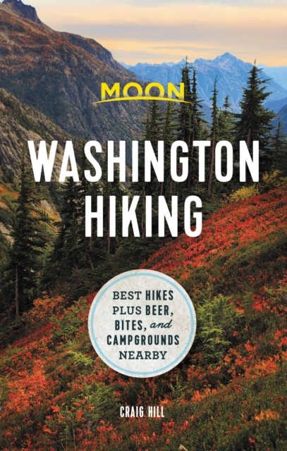
- Moon Washington Hiking (First Edition)
- Best Hikes plus Beer, Bites, and Campgrounds Nearby Leer más
- Also available from:
- De Zwerver, Netherlands
De Zwerver
Netherlands
2021
Netherlands
2021
- Wandelgids Washington Hiking (state) | Moon Travel Guides
- Craggy coastal cliffs, towering active volcanoes, and cascading waterfalls: wherever you turn in Washington, adventure awaits. Pack a lunch, lace up your boots, and hit the trails with Moon Washington Hiking. Inside you`ll find:* Diverse Hiking Options: Whether you plan to take leisurely lakeside walks or challenging journeys around Mount... Leer más


The Book Depository
United Kingdom
United Kingdom
- Hiking Trails of the Pacific Northwest
- Northern California, Oregon, Washington, Southwestern British Columbia Leer más

The Book Depository
United Kingdom
United Kingdom
- A Good Place For Maniacs
- Dispatches From The Pacific Crest Trail Leer más
The Book Depository
United Kingdom
United Kingdom
- Oregon Uncaged
- A Tale of Two-Sips on the Pacific Crest Trail Leer más


The Book Depository
United Kingdom
United Kingdom
- Portland Hikes
- Day Hikes in Oregon and Washington Within 100 Miles of Portland Leer más
The Book Depository
United Kingdom
United Kingdom
- Pacific Crest Trail, Washington North
- Topographic Map Guide Leer más

The Book Depository
United Kingdom
United Kingdom
- Pacific Crest Trail: Oregon & Washington
- From the California Border to Canada Leer más

- Also available from:
- De Zwerver, Netherlands

The Book Depository
United Kingdom
2022
United Kingdom
2022
- Lonely Planet Epic Hikes of the Americas
- Lace up your hiking boots for the next in Lonely Planet`s highly successful Epic Hikes series, this time exploring 50 of the Americas` most rewarding treks and trails. From Canada`s longest hut-to-hut hike, the Sunshine Coast Trail, to a descent through Havasu Canyon in the USA, and the Santa Cruz Trail of northern Peru, we cover a huge variety... Leer más
- Also available from:
- De Zwerver, Netherlands

De Zwerver
Netherlands
2022
Netherlands
2022
- Wandelgids Epic Hikes of the Americas | Lonely Planet
- Lace up your hiking boots for the next in Lonely Planet`s highly successful Epic Hikes series, this time exploring 50 of the Americas` most rewarding treks and trails. From Canada`s longest hut-to-hut hike, the Sunshine Coast Trail, to a descent through Havasu Canyon in the USA, and the Santa Cruz Trail of northern Peru, we cover a huge variety... Leer más
Mapas

Stanfords
United Kingdom
United Kingdom
- Mount Rainier National Park WA
- Mount Rainier National Park in Washington State at 1:50,000 a series of detailed, contoured maps from Earthwalk Press with cartography based on the USGS topographic survey of the country plus additional information for visitors, printed on light, waterproof and tear-resistant synthetic paper. Enlargements show in greater detail enlarged... Leer más

Stanfords
United Kingdom
United Kingdom
- Washington DC Borch
- Clear, indexed, laminated and waterproof street plan of Washington DC, combining a plan of the central part of the city with an enlargement for the Mall area, a map of the capital’s environs, and a list of 30 top sights. The main plan at 1:15,000 covers the city from the Arlington Cemetery to the RFK Stadium, and from Columbia Heights district... Leer más

Stanfords
United Kingdom
United Kingdom
- Newcastle upon Tyne 1862-1867
- Map No. 88, Newcastle upon Tyne 1862-1867, in the Cassini Historical Series of old Ordnance Survey mapping of England and Wales at 1:50,000 in a format designed to offer a convenient comparison with the present day coverage from the OS, and most locations in three different editions. Old historical maps have been combined so that the sheet... Leer más
Stanfords
United Kingdom
United Kingdom
- Newcastle upon Tyne 1925
- Map No. 88, Newcastle upon Tyne 1925, in the Cassini Historical Series of old Ordnance Survey mapping of England and Wales at 1:50,000 in a format designed to offer a convenient comparison with the present day coverage from the OS, and most locations in three different editions. Old historical maps have been combined so that the sheet lines... Leer más
Stanfords
United Kingdom
United Kingdom
- Newcastle upon Tyne 1901-1904
- Map No. 88, Newcastle upon Tyne 1901-1904, in the Cassini Historical Series of old Ordnance Survey mapping of England and Wales at 1:50,000 in a format designed to offer a convenient comparison with the present day coverage from the OS, and most locations in three different editions. Old historical maps have been combined so that the sheet... Leer más
Stanfords
United Kingdom
United Kingdom
- Newcastle upon Tyne 1862-1925 (3-map set)
- Map No. 88, Newcastle upon Tyne 1862-1925 (3-map set), in the Cassini Historical Series of old Ordnance Survey mapping of England and Wales at 1:50,000 in a format designed to offer a convenient comparison with the present day coverage from the OS, and most locations in three different editions. Old historical maps have been combined so that... Leer más

Stanfords
United Kingdom
United Kingdom
- Vancouver to Calgary MapArt Back Road Atlas
- The main Trans-Canada Highway from Vancouver to Calgary, including the adjoining Okanagan and Crowsnest Highways and the Seattle area of north-west Washington State, presented at 1:250,000 in an A4 paperback road atlas with additional street plans, listing of local events and wineries, etc.Mapping at 1:250,000 covers the areas indicated on our... Leer más

Stanfords
United Kingdom
United Kingdom
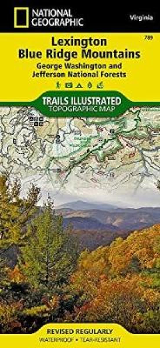
- Lexington - Blue Ridge Mts - George Washington and Jefferson NF VA
- Map No. 789, George Washington and Jefferson National Forest: Lexington - Blue Ridge, VA, in an extensive series of GPS compatible, contoured hiking maps of USA’s national and state parks or forests and other popular recreational areas. Cartography based on the national topographic survey, with additional tourist information.The maps, with most... Leer más
- Also available from:
- Bol.com, Netherlands
- Bol.com, Belgium
Bol.com
Netherlands
Netherlands
- Lexington/blue Ridge, G.w. & Jefferson National Forests
- Waterproof Tear-Resistant Topographic MapCoverage includes George Washington and Jefferson National Forest. Towns: Lexington, Buena Vista, Waynesboro, Bedford, Blue Ridge. Wilderness Areas: The Priest, Three Ridges, Saint Mary's, Thunder Ridge, James River Face. Major Trails: Appalachian National Scenic Trail, Glenwood Horse Trail. Other... Leer más
Bol.com
Belgium
Belgium
- Lexington/blue Ridge, G.w. & Jefferson National Forests
- Waterproof Tear-Resistant Topographic MapCoverage includes George Washington and Jefferson National Forest. Towns: Lexington, Buena Vista, Waynesboro, Bedford, Blue Ridge. Wilderness Areas: The Priest, Three Ridges, Saint Mary's, Thunder Ridge, James River Face. Major Trails: Appalachian National Scenic Trail, Glenwood Horse Trail. Other... Leer más

Stanfords
United Kingdom
United Kingdom
- Mount Whitney CA NGS Trails Illustrated Map 322
- Map No. 322, Mount Whitney in California at 1:40,000, in an extensive series of GPS compatible, contoured hiking maps of USA’s national and state parks or forests and other popular recreational areas. Cartography is based on the national topographic survey, with additional tourist information.The maps, with most titles now printed on light,... Leer más
- Also available from:
- Bol.com, Netherlands
- Bol.com, Belgium

Bol.com
Netherlands
Netherlands
- Mount Whitney
- Waterproof Tear-Resistant Topographic MapMount Whitney is universally famous as the highest mountain in the United State outside of Alaska, as well as the highest point in California. National Geographic's Trails Illustrated map of Mount Whitney is a two-sided, waterproof map designed to meet the needs of Whitney visitors with unmatched... Leer más
Bol.com
Belgium
Belgium
- Mount Whitney
- Waterproof Tear-Resistant Topographic MapMount Whitney is universally famous as the highest mountain in the United State outside of Alaska, as well as the highest point in California. National Geographic's Trails Illustrated map of Mount Whitney is a two-sided, waterproof map designed to meet the needs of Whitney visitors with unmatched... Leer más
De Zwerver
Netherlands
Netherlands
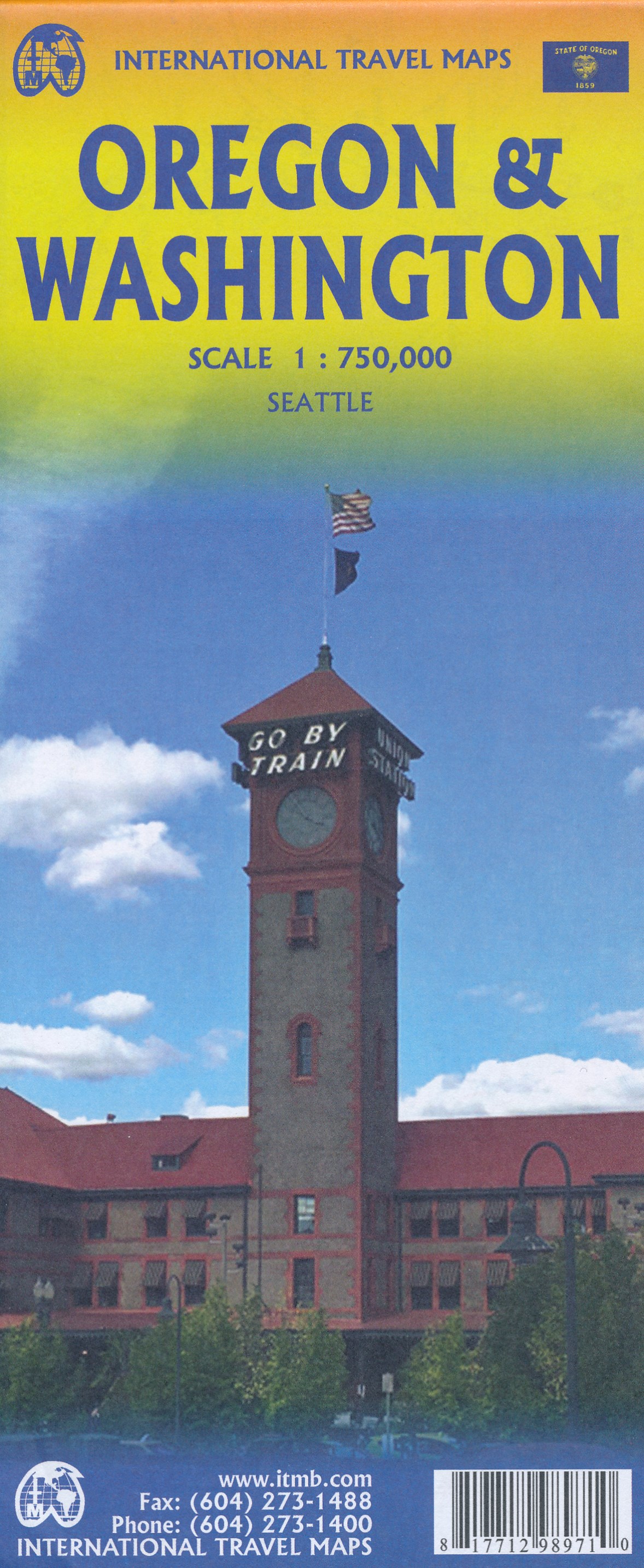
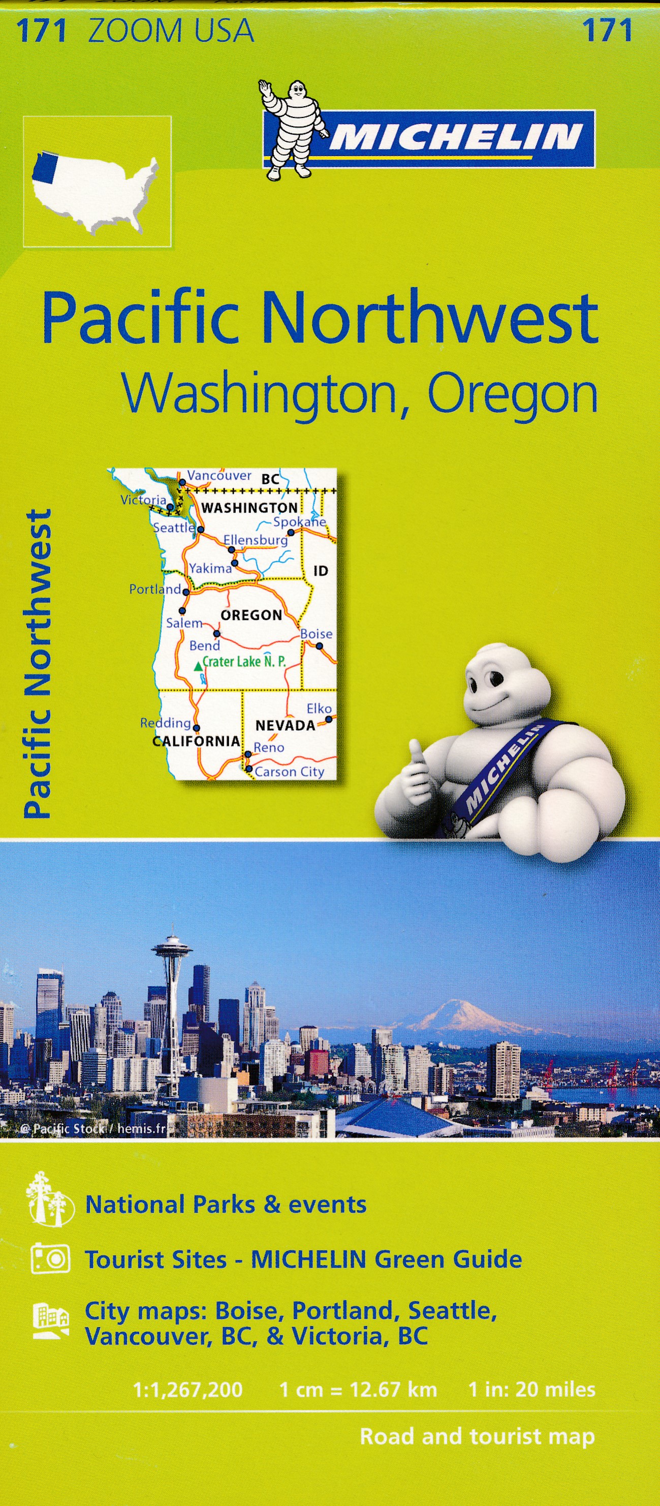
- Wegenkaart - landkaart Washington state - Oregon | ITMB
- Oregon / Washington 1:750 000 ab 10.49 EURO Landkarte, doppelseitig Plan Seattle. 1. Auflage Leer más
De Zwerver
Netherlands
Netherlands

Stanfords
United Kingdom
United Kingdom
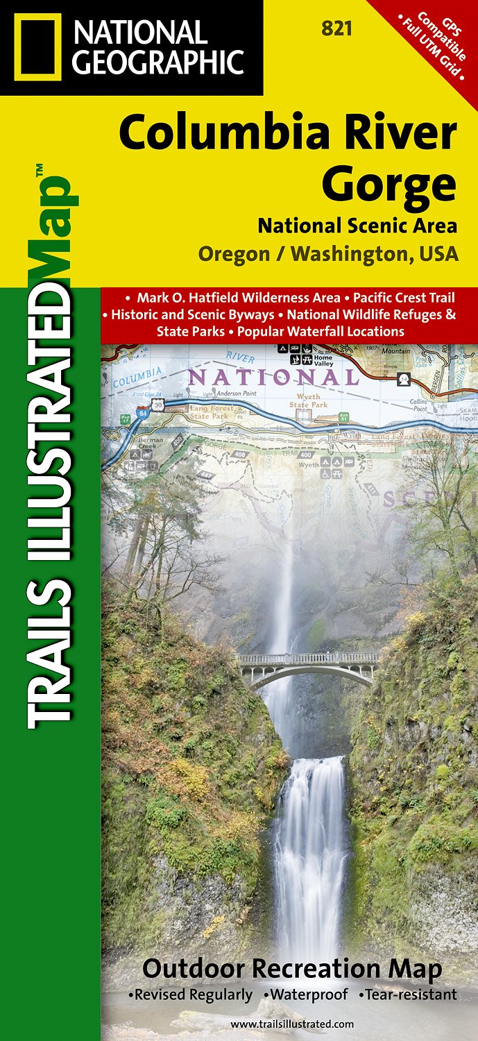
- Columbia River Gorge OR/WA NGS Trails Illustrated Map 821
- Map No. 821, Columbia River Gorge in Oregon and Washington State, in an extensive series of GPS compatible, contoured hiking maps of USA’s national and state parks or forests and other popular recreational areas. Cartography based on the national topographic survey, with additional tourist information.The maps, with most titles now printed on... Leer más
- Also available from:
- De Zwerver, Netherlands
De Zwerver
Netherlands
Netherlands
- Wandelkaart - Topografische kaart 821 Columbia River Gorge National Scenic Area | National Geographic
- Prachtige geplastificeerde kaart van het bekende nationaal park. Met alle recreatieve voorzieningen als campsites, maar ook met topografische details en wandelroutes ed. Door uitgekiend kleurgebruik zeer prettig in gebruik. Scheur en watervast! Considered one of the best year-round outdoor recreation areas in the country, the Columbia River... Leer más

Stanfords
United Kingdom
United Kingdom
- Sequoia - Kings Canyon National Parks CA NGS Trails Illustrated Map 205
- Map No. 205, Sequoia/Kings Canyon National Park, CA, in an extensive series of GPS compatible, contoured hiking maps of USA’s national and state parks or forests and other popular recreational areas. Cartography based on the national topographic survey, with additional tourist information.The maps, with most titles now printed on light,... Leer más
- Also available from:
- The Book Depository, United Kingdom
- Bol.com, Netherlands
- Bol.com, Belgium
- De Zwerver, Netherlands

The Book Depository
United Kingdom
United Kingdom
- Sequoia/kings Canyon National Park
- Trails Illustrated National Parks Leer más

Bol.com
Netherlands
Netherlands
- Sequoia/kings Canyon National Park
- Waterproof Tear-Resistant Topographic MapIn Sequioa and Kings Canyon National Parks you can walk among the world's largest trees, hike the alpine landscape of the Sierra Crest, and marvel at the towering granite cliffs of one of the deepest canyons in the United States. National Geographic's Trails Illustrated map of Sequoia and Kings... Leer más
Bol.com
Belgium
Belgium
- Sequoia/kings Canyon National Park
- Waterproof Tear-Resistant Topographic MapIn Sequioa and Kings Canyon National Parks you can walk among the world's largest trees, hike the alpine landscape of the Sierra Crest, and marvel at the towering granite cliffs of one of the deepest canyons in the United States. National Geographic's Trails Illustrated map of Sequoia and Kings... Leer más

De Zwerver
Netherlands
Netherlands
- Wandelkaart - Topografische kaart 205 Sequoia - Kings Canyon National Parks | National Geographic
- Prachtige geplastificeerde kaart van het nationaal park. Met alle recreatieve voorzieningen als campsites, maar ook met topografische details en wandelroutes ed. Door uitgekiend kleurgebruik zeer prettig in gebruik. Scheur en watervast! Trails Illustrated maps are the most trusted and popular recreation maps available. Continually setting the... Leer más
De Zwerver
Netherlands
Netherlands
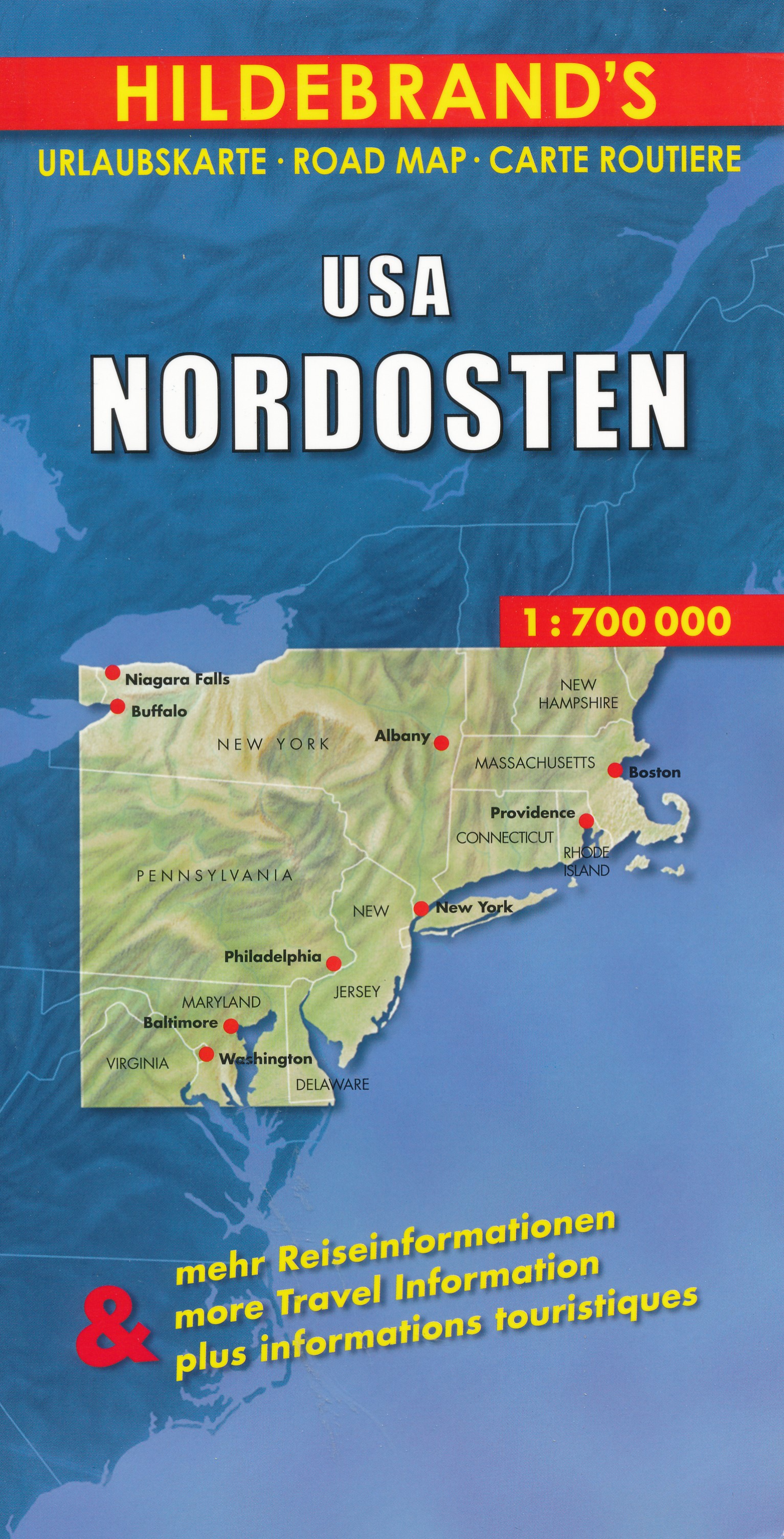
- Wegenkaart - landkaart USA Northeast - USA Noordoost | Hildebrand's
- USA Nordosten 1 : 700 000. Hildebrand´s Urlaubskarte ab 7.95 EURO Umgebungskarten: Boston, New York, Washington - Baltimore. Stadtpläne: Boston, New York/Manhattan, Philadelphia, Baltimore, Washington, Buffalo, Niagara Falls, Pittsburgh. Ortsregister Hildebrand´s Urlaubskarte. Neuauflage, Laufzeit bis 2016 Leer más

Stanfords
United Kingdom
United Kingdom
- Olympic National Park WA
- Map No. 216, Olympic National Park, WA, in an extensive series of GPS compatible, contoured hiking maps of USA’s national and state parks or forests and other popular recreational areas. Cartography based on the national topographic survey, with additional tourist information.The maps, with most titles now printed on light, waterproof and... Leer más
- Also available from:
- Bol.com, Netherlands
- Bol.com, Belgium
- De Zwerver, Netherlands

Bol.com
Netherlands
Netherlands
- Olympic National Park
- Waterproof Tear-Resistant Topographic MapOlympic National Park encompasses four distinctly different ecosystems in its nearly one million acres. National Geographic's Trails Illustrated map of Olympic National Park offers outdoors enthusiasts a valuable tool for exploring the park's old-growth forests, glaciers, untamed rivers, and rugged... Leer más
Bol.com
Belgium
Belgium
- Olympic National Park
- Waterproof Tear-Resistant Topographic MapOlympic National Park encompasses four distinctly different ecosystems in its nearly one million acres. National Geographic's Trails Illustrated map of Olympic National Park offers outdoors enthusiasts a valuable tool for exploring the park's old-growth forests, glaciers, untamed rivers, and rugged... Leer más

De Zwerver
Netherlands
Netherlands
- Wandelkaart 216 Olympic National Park | National Geographic
- Prachtige geplastificeerde kaart van het bekende nationaal park. Met alle recreatieve voorzieningen als campsites, maar ook met topografische details en wandelroutes ed. Door uitgekiend kleurgebruik zeer prettig in gebruik. Scheur en watervast! Within the park, there is detailed coverage of Mount Olympus, Tshletshy Ridge, Hurrican Ridge,... Leer más