
Coronado National Forest
Descripción
Senderos en región
Enlaces
Datos
Informes
Guías y mapas
Hospedaje
Organizaciones
Operadores turísticos
GPS
Otro
Libros


Stanfords
United Kingdom
United Kingdom
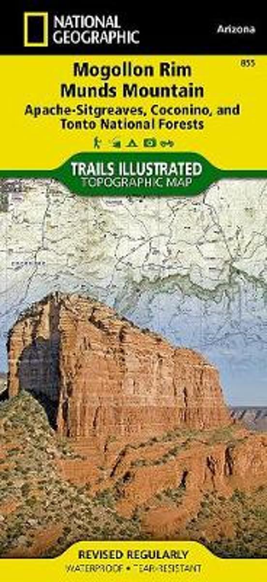
- Mogollon Rim - Munds Mountain - Apache-Sitgreaves, Coconino and Tonto National Forests AZ
- Map No. 855, Coconino National Forest: Mogollon Rim and Munds Mountain Wilderness Areas, AZ, in an extensive series of GPS compatible, contoured hiking maps of USA’s national and state parks or forests and other popular recreational areas. Cartography based on the national topographic survey, with additional tourist information.The maps, with... Leer más
- Also available from:
- The Book Depository, United Kingdom
- Bol.com, Netherlands
- Bol.com, Belgium

The Book Depository
United Kingdom
United Kingdom
- Mogollon Rim & Munds Mountain Wilderness Areas, Apache-sitgreaves, Coconino & Tonto National Forests
- Trails Illustrated Other Rec. Areas Leer más
Bol.com
Netherlands
Netherlands
- Mogollon Rim & Munds Mountain Wilderness Areas, Apache-sitgreaves, Coconino & Tonto National Forests
- Waterproof Tear-Resistant Topographic MapNational Geographic's Mogollon Rim / Munds Mountain Trails Illustrated topographic map is the most comprehensive available for outdoor enthusiasts of all types. Designed to be easy-to-read, yet highly detailed this map includes a comprehensive road and trail network distinguishing between major,... Leer más
Bol.com
Belgium
Belgium
- Mogollon Rim & Munds Mountain Wilderness Areas, Apache-sitgreaves, Coconino & Tonto National Forests
- Waterproof Tear-Resistant Topographic MapNational Geographic's Mogollon Rim / Munds Mountain Trails Illustrated topographic map is the most comprehensive available for outdoor enthusiasts of all types. Designed to be easy-to-read, yet highly detailed this map includes a comprehensive road and trail network distinguishing between major,... Leer más

The Book Depository
United Kingdom
United Kingdom
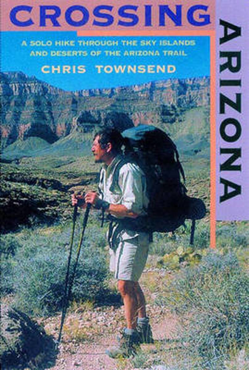
- Crossing Arizona
- A Solo Hike through the Sky Islands and Deserts of the Arizona Trail Leer más
- Also available from:
- Bol.com, Netherlands
- Bol.com, Belgium
Bol.com
Netherlands
Netherlands
- Crossing Arizona
- The author's engaging account of his solo hike along the Arizona Trailfrom the Mexican border to Utah. Crossing Arizona takes us on an extraordinary journey across some of the harshest, most remote, and arguably most beautiful natural terrain in the Lower 48. Long-distance hiker Chris Townsend, inspired by the writings of Edward Abbey and Colin... Leer más
Bol.com
Belgium
Belgium
- Crossing Arizona
- The author's engaging account of his solo hike along the Arizona Trailfrom the Mexican border to Utah. Crossing Arizona takes us on an extraordinary journey across some of the harshest, most remote, and arguably most beautiful natural terrain in the Lower 48. Long-distance hiker Chris Townsend, inspired by the writings of Edward Abbey and Colin... Leer más

Stanfords
United Kingdom
United Kingdom
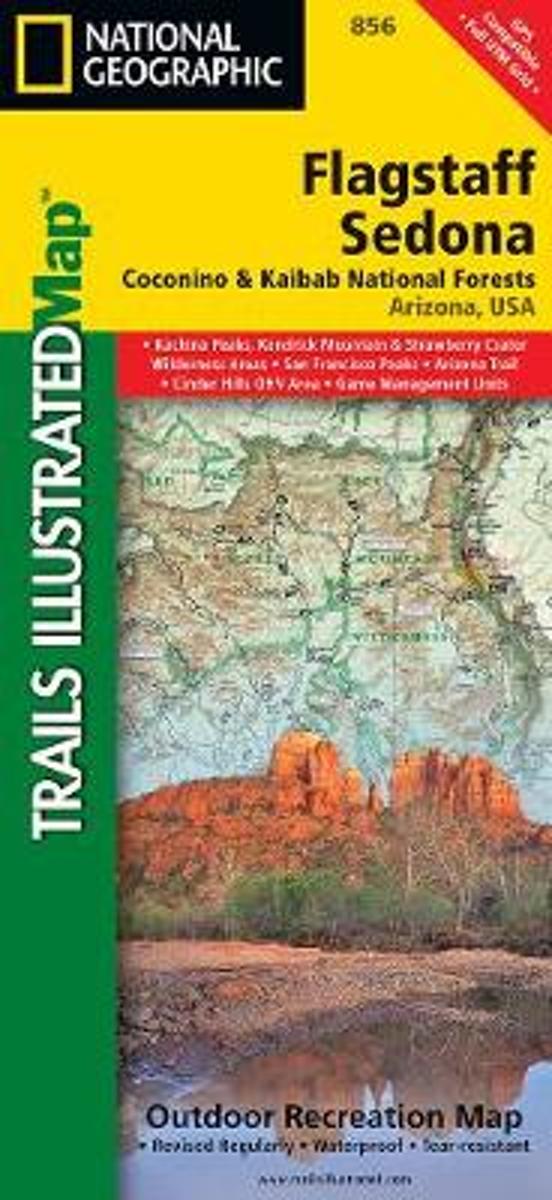
- Flagstaff - Sedona - Coconino and Kaibab National Forests AZ
- Map No. 856, Coconino National Forest: Flagstaff and Sedona, AZ, in an extensive series of GPS compatible, contoured hiking maps of USA’s national and state parks or forests and other popular recreational areas. Cartography based on the national topographic survey, with additional tourist information.The maps, with most titles now printed on... Leer más
- Also available from:
- Bol.com, Netherlands
- Bol.com, Belgium
Bol.com
Netherlands
Netherlands
- Flagstaff/sedona, Coconino & Kaibab National Forests
- Waterproof Tear-Resistant Topographic MapNational Geographic's Flagstaff and Sedona Trails Illustrated topographic map is the most comprehensive available for outdoor enthusiasts of all types. Designed to be easy-to-read, yet highly detailed this map includes a comprehensive road and trail network distinguishing between major,... Leer más
Bol.com
Belgium
Belgium
- Flagstaff/sedona, Coconino & Kaibab National Forests
- Waterproof Tear-Resistant Topographic MapNational Geographic's Flagstaff and Sedona Trails Illustrated topographic map is the most comprehensive available for outdoor enthusiasts of all types. Designed to be easy-to-read, yet highly detailed this map includes a comprehensive road and trail network distinguishing between major,... Leer más

Bol.com
Netherlands
Netherlands
- Gravel Cycling
- Head out for adventure on the unpaved back roads of America with Nick Legans complete guide to gravel grinders and bikepacking!Gravel cycling is a glorious return to the purest roots of two-wheeled adventure. From farm roads and miners paths to the high passes of the Rockies and the Alps, gravel cycling and bikepacking will set you free to... Leer más
- Also available from:
- Bol.com, Belgium
Bol.com
Belgium
Belgium
- Gravel Cycling
- Head out for adventure on the unpaved back roads of America with Nick Legans complete guide to gravel grinders and bikepacking!Gravel cycling is a glorious return to the purest roots of two-wheeled adventure. From farm roads and miners paths to the high passes of the Rockies and the Alps, gravel cycling and bikepacking will set you free to... Leer más
Bol.com
Netherlands
Netherlands
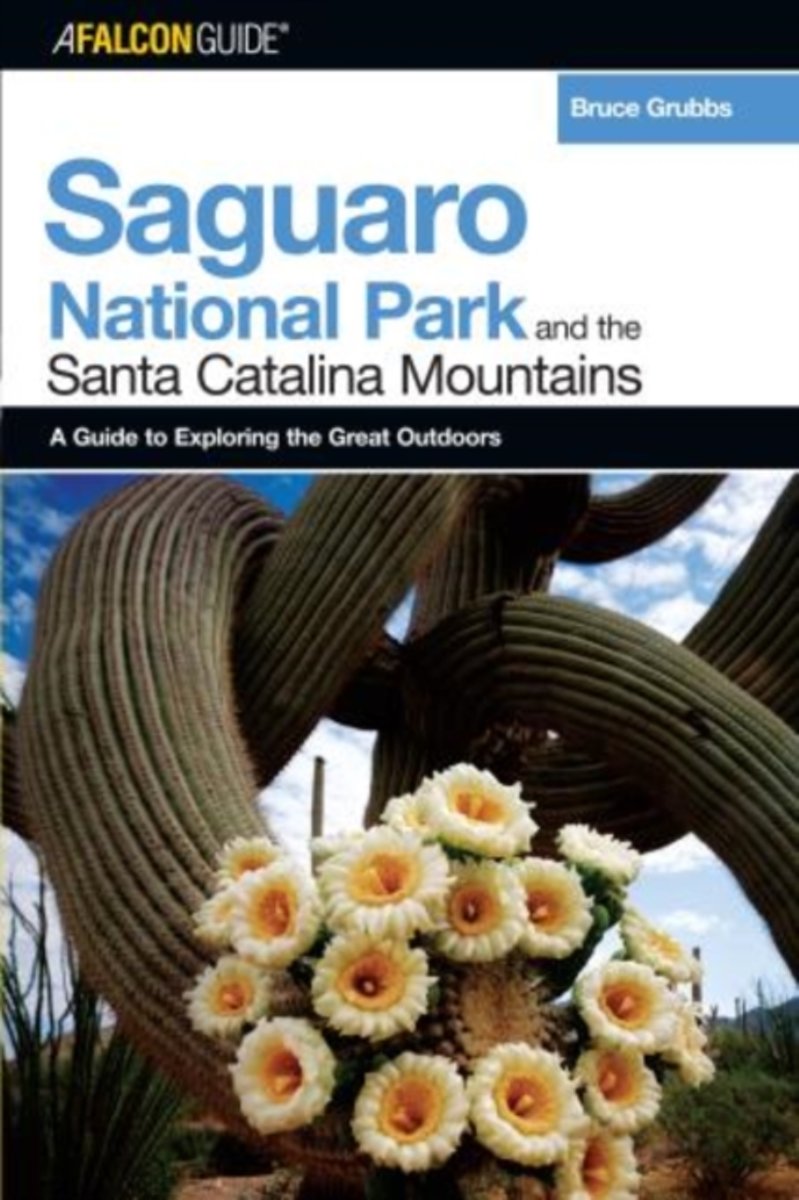
- A Falconguide to Saguaro National Park and the Santa Catalina Mountains
- This guide covers the extensive trail networks within the Tucson Mountain and Rincon Mountain units of Saguaro National Park, along with the Pusch Ridge Wilderness and the Santa Catalina Mountains in the Coronado National Forest. Camping, alpine skiing, cross-country skiing and snowshoeing, rock climbing, and mountain biking are also covered. Leer más
- Also available from:
- Bol.com, Belgium
Bol.com
Belgium
Belgium
- A Falconguide to Saguaro National Park and the Santa Catalina Mountains
- This guide covers the extensive trail networks within the Tucson Mountain and Rincon Mountain units of Saguaro National Park, along with the Pusch Ridge Wilderness and the Santa Catalina Mountains in the Coronado National Forest. Camping, alpine skiing, cross-country skiing and snowshoeing, rock climbing, and mountain biking are also covered. Leer más
Mapas
Bol.com
Netherlands
Netherlands
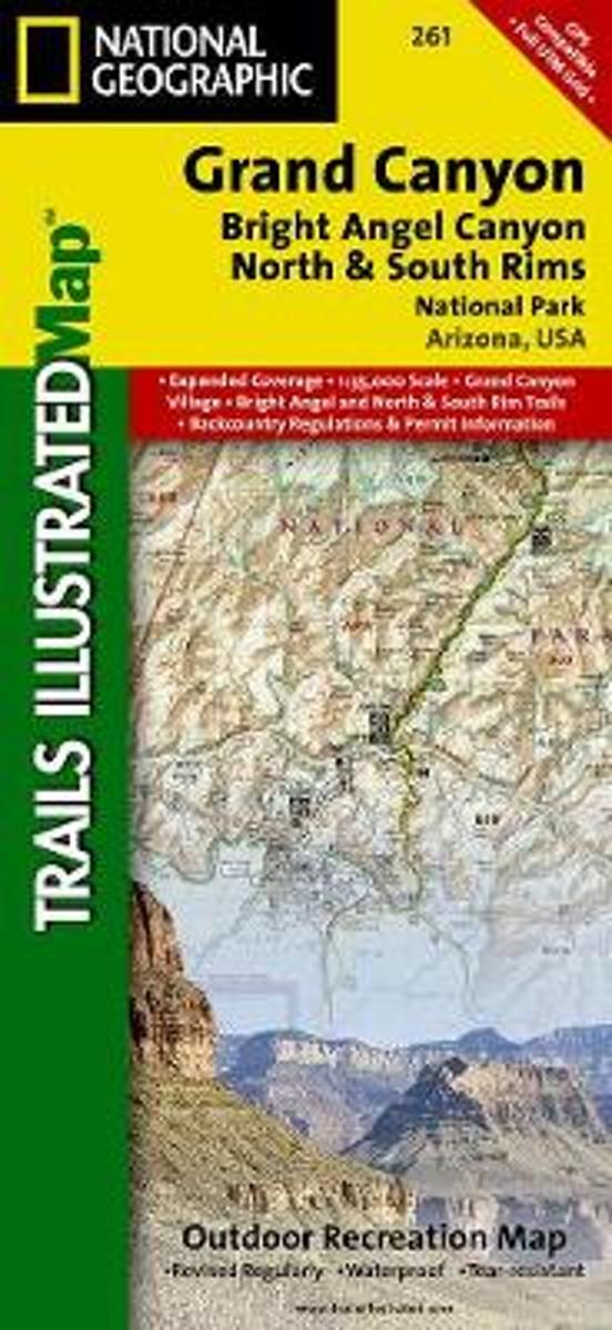
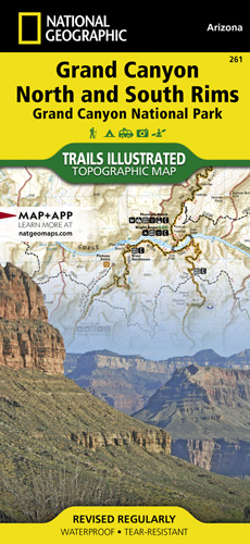
- Grand Canyon, Bright Angel Canyon/north & South Rims
- Waterproof Tear-Resistant Topographic MapExplore the uniquely inspiring and wondrous landscape of the Grand Canyon with National Geographic's Trails Illustrated map of Grand Canyon National Park, North and South Rims. Expertly researched and created in partnership with local land management agencies, this map is designed to meet the needs... Leer más
- Also available from:
- Bol.com, Belgium
- De Zwerver, Netherlands
Bol.com
Belgium
Belgium
- Grand Canyon, Bright Angel Canyon/north & South Rims
- Waterproof Tear-Resistant Topographic MapExplore the uniquely inspiring and wondrous landscape of the Grand Canyon with National Geographic's Trails Illustrated map of Grand Canyon National Park, North and South Rims. Expertly researched and created in partnership with local land management agencies, this map is designed to meet the needs... Leer más
De Zwerver
Netherlands
Netherlands
- Wandelkaart - Topografische kaart 261 Grand Canyon | National Geographic
- Prachtige geplastificeerde kaart van het bekende nationaal park. Met alle recreatieve voorzieningen als campsites, maar ook met topografische details en wandelroutes ed. Door uitgekiend kleurgebruik zeer prettig in gebruik. Scheur en watervast! Grand Canyon, Bright Angel Canyon/North & South Rims (#261) replaces the previous Grand Canyon... Leer más

Bol.com
Netherlands
Netherlands
- Grand Canyon East
- Waterproof Tear-Resistant Topographic MapGrand Canyon East (#262) and Grand Canyon West (#263) combine to cover the entire Grand Canyon National Park and its bordering public lands. Both maps contain detailed and easy-to-read trail and road networks, locations of facilities, points of interest, and highly accurate terrain with thousands... Leer más
- Also available from:
- Bol.com, Belgium
- De Zwerver, Netherlands
Bol.com
Belgium
Belgium
- Grand Canyon East
- Waterproof Tear-Resistant Topographic MapGrand Canyon East (#262) and Grand Canyon West (#263) combine to cover the entire Grand Canyon National Park and its bordering public lands. Both maps contain detailed and easy-to-read trail and road networks, locations of facilities, points of interest, and highly accurate terrain with thousands... Leer más

De Zwerver
Netherlands
Netherlands
- Wandelkaart 262 Grand Canyon East - Oost | National Geographic
- Prachtige geplastificeerde kaart van het nationaal park. Met alle recreatieve voorzieningen als campsites, maar ook met topografische details en wandelroutes ed. Door uitgekiend kleurgebruik zeer prettig in gebruik. Scheur en watervast! Grand Canyon East (#262) and Grand Canyon West (#263) combine to cover the entire Grand Canyon National Park... Leer más