
Santiago de Compostela Pilgrims Way
Descripción
- Name Santiago de Compostela Pilgrims Way
- Fin de sendero Santiago de Compostela
- Clasificación Traildino MW, Caminata moderada, sendero de mochileros
- Clasificación Travesía de refugios T1, Caminata


Ever since the year 813, when the tomb of St.James was claimed to be (re-)discovered there, the city of Santiago de Compostela in northwestern Spain has attracted many thousands of Christian pilgrims from all parts of Europe, particularly in the Middle Ages. As a result, there is no single route or trail. Of course, it all depends on where you start your pilgrimage.
Almost every West European country has an association, society or confraternity dedicated to pilgrimage to Santiago de Compostela, often carrying the name of the apostle involved: St.James, known by numerous translations such as Sint Jacob, Sint Jakobus, Saint-Jacques, Sankt Jakob, Sant Iago, etc. These organisations all provide information on the pilgrimage to their members, and also issue an official internationally recognized ‘pilgrim pass'. Having collected the correct stamps en route, pass-holders are entitled to the official ‘Compostela' certificate to prove that the pilgrimage was accomplished as intended.
Visit Traildino's overview page for the Way of Saint James / Camino de Santiago.
Mapa


Enlaces
Datos
Informes
Guías y mapas
Hospedaje
Organizaciones
Operadores turísticos
GPS
Otro
Libros

United Kingdom
- Les Chemins de St-Jacques au Pays Basque
- Les Chemins de St-Jacques au Pays Basque covers two routes of the Way of St James in the Basque country: le Chemin de Baztán and le Chemin de Saint-Palais á la côte. The former links Bayonne, Saint-Jean de Luz and Urdax, extending south to Pamplona; the latter links Sare to Saint Palais via Esplette. This is one of the titles in a series of... Leer más

United Kingdom
- Le Chemin du Vézelay: de la Bourgogne aux Pyrénéees
- Le Chemin du Vézelay: de la Bourgogne aux Pyrénéees covers the one of most popular routes of the Way of St. James in France, from the cathedral in Vézelay, across the La Charité-sur-Loire, Bourges, La Souterraine, Limoges, Périgueux, Ste-Foy-la-Grande, Bazas, Mont-de-Marsan and Orthez to Saint-Jean-Pied-de-Port.This title is part of a series of... Leer más

United Kingdom
2018
- Sentiers de St-Jacques via le Puy - Le Puy to Figeac GR65
- Chemins de St-Jacques: Le Puy - Figeac, FFRP topoguide Ref. no. 651, covering a 252km section of the Way of St. James across the Massif Central from Le Puy-en-Velay to Figeac along the GR 65. Current edition of this title was published in August 2014.ABOUT THE FFRP (Fédération française de la randonnée pédestre) TOPOGUIDES: published in a handy... Leer más

United Kingdom
- Chemins de St.Jacques: Cluny/Lyon - Le Puy à pied
- Chemins de St.Jacques: Cluny/Lyon-Le Puy à pied from Chamina presents the route overprinted on IGN’s 1:50,000 topographic survey with details of accommodation, local services and other tourist information.Each stage is shown on extracts from IGN`s 1:50,000 topographic survey cross-referenced to the descriptions of the route. Symbols indicate... Leer más

United Kingdom
2015
- GR654 Chemins de St-Jacques: Vézelay - Périgueux FFRP Topo-guide No. 6542
- Chemins de St-Jacques: Vézelay - Périgueux, FFRP topoguide Ref. no. 6542, covering the 744km route along the GR654 the Way of St. Jamezs from Vézelay via Limoges to Périgueux. Current edition of this title was published in March 2015.ABOUT THE FFRP (Fédération française de la randonnée pédestre) TOPOGUIDES: published in a handy A5 paperback... Leer más

United Kingdom
2017
- Sentiers de St- Jacques via le Puy - Moissac to Roncevaux GR65
- Continuation and end of the Puy road, through Quercy, Béarn and Basque Country. More than 15 days of hiking.Chemins de St- Jacques: Moissac - Roncevaux (Roncesvalles), FFRP topoguide Ref. no. 653, covering the last, 345-km long section of the Way of St. James in France along the GR65 between Le Puy-en-Velay to the Spanish border. Current... Leer más

United Kingdom
2019
- Portugal`s Rota Vicentina: Alentejo and Algarve coastal route
- Guidebook to walking Portugal`s Rota Vicentina, a stunning 220km route down the southwestern Atlantic coast, through the Alentejo and Algarve districts. The route, which is suitable for all fit walkers and is not technically difficult, is described across 12 stages, making it perfect for a two-week holiday.Walkers who appreciate sunny days,... Leer más

United Kingdom
2016
- St-Jacques-de-Compostelle - Puy-en-Velay to Moissac GR65-1 IGN 89020
- Chemin de St-Jacques - the Way of St James in France along the GR65 between Le Puy-en-Velay and Moissac presented at 1:100,000 on a double-sided, waterproof and tear-resistant map from IGN with cartography from their highly popular TOP100 series. The route is prominently highlighted on contoured mapping and annotated with hiking distances.... Leer más

United Kingdom
2016
- St-Jacques-de-Compostelle - Moissac to Roncevaux / Roncesvalles GR65-2 IGN 89021
- Chemin de St-Jacques - the Way of St James in France along the GR65 between Moissac and Roncevaux/Roncesvalles in the Spanish Pyrenees presented at 1:100,000 on a double-sided, waterproof and tear-resistant map from IGN with cartography from their highly popular TOP100 series. The route is prominently highlighted on contoured mapping and... Leer más

United Kingdom
2019
- The Camino del Norte and Camino Primitivo
- To Santiago de Compostela and Finisterre from Irun or Oviedo Leer más
- Also available from:
- De Zwerver, Netherlands
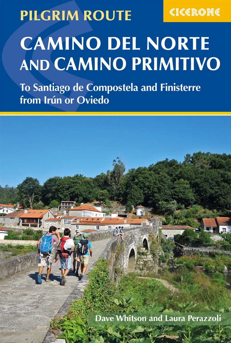
Netherlands
2019
- Wandelgids - Pelgrimsroute The Camino del Norte and Camino Primitivo | Cicerone
- Guidebook to walking the Camino del Norte and Camino Primitivo pilgrim routes to Santiago de Compostela in northwest Spain. The 817km Camino del Norte from Irún via Bilbao and Santander takes around 5 weeks to complete. The 355km Camino Primitivo takes about 2 weeks. Includes the Camino Finisterre from Santiago to the coast. Leer más

United Kingdom
2020
- Camino de Santiago: Camino Frances
- Guide and map book - includes Finisterre finish Leer más
- Also available from:
- De Zwerver, Netherlands
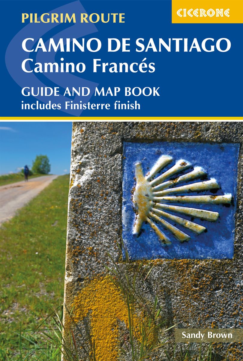
Netherlands
2020
- Wandelgids - Pelgrimsroute Camino de Santiago - Camino Frances | Cicerone
- Guidebook and map book to walking the 784km Camino Frances from St Jean-Pied-de-Port in southern France to Santiago de Compostela in Spain, including an additional route to Finisterre. Split into 6 sections and 36 customisable stages, the guide lists over 500 pilgrim hostels. The map book covers the entire route, which can be walked in 4-5 weeks. Leer más


United Kingdom
2018
- The Camino Portugues
- From Lisbon and Porto to Santiago - Central, Coastal and Spiritual Caminos Leer más

Mapas

United Kingdom
- Rías Baixas CNIG Map
- Rías Baixas region of Galicia in northern Spain on a contoured and GPS compatible map at 1:100,000 from IGN/CNIG using cartography of their civilian topographic survey of Spain. Coverage extends from north of Santiago de Compostela and Cape Finisterre to the Portuguese border.Contours are 100m intervals, enhanced by relief shading plus... Leer más

United Kingdom
- Lugo and Environs CNIG Map
- Lugo and its environs on a double-sided map combining a street plan with topographic mapping at 1:50,000 from the Instituto Geográfico Nacional – Centro Nacional de Información Geograficá, the country’s civilian survey organization.On one side is a street plan of the city showing the course along its streets of the Camino de Santiago – the Way... Leer más

United Kingdom
2010
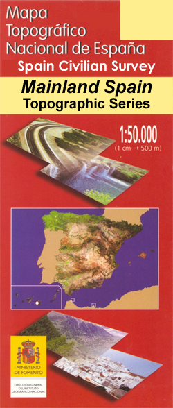
- Camino de Santiago 50K CNIG Topo 11-Map Box Set
- The whole of Way of St James to Santiago de Compostela in a set of 11 maps: 10 double-sided topographic maps at 1:50,000 plus an overview map of northern Spain, published by the Spanish civilian survey organization.Each 1:50,000 map is double-sided and has four 57 x 35cm panels with full topographic mapping of the area through which the route... Leer más

United Kingdom
- Caribbean Islands Western Half ITMB Travel Atlas
- The islands of the western Caribbean presented by ITMB in a handy size, A5, paperback, indexed atlas with city centre street plans of main cities. The mapping is taken from ITMB’s extensive coverage of the region on individual country maps, so scales vary. The atlas covers the Bahamas (1:500,000) with street plans of Nassau, New Providence and... Leer más

United Kingdom
- Santiago del Teide - Tenerife CNIG Topo 1091-3
- Topographic coverage of the Canary Islands at 1:25,000 published by the Instituto Geográfico Nacional – Centro Nacional de Información Geografica, the country’s civilian survey organization. The maps have contours at 10m intervals and colouring and/or graphics to show different types of vegetation or land use. Boundaries of national parks and... Leer más

United Kingdom
- Galicia: Santiago de Compostela - León 500K CNIG Regional Map No.1
- Spain’s north-western province of Galicia with coverage extending eastwards to León at 1:500,000 in a series of regional road maps from the country’s civilian survey organization IGN-CNIG (Instituto Geográfico Nacional - Centro Nacional de Información Geográfica), vividly presenting the topography by altitude colouring, boundaries of... Leer más

United Kingdom
- Santiago Environs
- The Condor Circuit at 1:50,000/1:25,000 in a series of contoured, GPS compatible trekking and exploration maps at various scales form Trekkingchile. The main map at 1:50,000 covers the trekking area from Vilches Alto and Parque Inglés eastwards beyond Volcán Descabezado Grande. Contours are at 50m intervals. The map shows local roads, paths and... Leer más

United Kingdom
- Compostella Cycling Route: St-Jean-Pied-de-Port - Santiago de Compostela (980km) Bikeline Map/Guide
- The 980km long Spanish section of the Way of St. James, from St-Jean-Pied-de-Port in France across the Pyrenees to Pamplona and on to Santiago de Compostela, presented by the Verlag Esterbauer in guide with maps at 1:75,000 showing the route and its variants. Coverage includes the section west from Santiago de Compostela to Cape Finisterre, and... Leer más

United Kingdom
- Santiago de la Espada CNIG Topo 908
- Topographic coverage of mainland Spain at 1:50,000 in the MTN50 (Mapa Topográfico Nacional) series from the Centro Nacional de Información Geografica, the country’s civilian survey organization. The maps have contours at 20m intervals, enhanced by relief shading, plus colouring and/or graphics to show different types of terrain, vegetation or... Leer más

United Kingdom
- Cajón del Maipo - Volcán San José
- Cajón del Maipo - Volcán San José region of central Chile east of Santiago on a waterproof and tear-resistant map in a series of contoured, GPS compatible trekking and exploration maps at various scales form Trekkingchile. On one side the main map at 1:100,000 covers the region eastwards along the River Maipo from Las Vertientes near its... Leer más
United Kingdom
- Horcajo de Santiago CNIG Topo 632
- Topographic coverage of mainland Spain at 1:50,000 in the MTN50 (Mapa Topográfico Nacional) series from the Centro Nacional de Información Geografica, the country’s civilian survey organization. The maps have contours at 20m intervals, enhanced by relief shading, plus colouring and/or graphics to show different types of terrain, vegetation or... Leer más

United Kingdom
- Santiago do Cacem
- Topographic survey of Portugal at 1:50,000 from the Instituto Geográfico Português, the country’s civilian survey organisation. The maps have contours at 25m intervals and in addition to the standard features shown on topographic mapping at this scale also indicate various types of vegetation (vineyards, olive groves, etc). Each sheet covers an... Leer más

United Kingdom
- Santiago de Escoural
- Topographic survey of Portugal at 1:50,000 from the Instituto Geográfico do Exército, the country’s military survey organisation. The maps have contours at 20m intervals and in addition to the standard features shown on topographic mapping at this scale also indicate various types of terrain or vegetation (sand, terraces, rocks, woodlands,... Leer más

United Kingdom
- Admiralty Chart 3184 - Corpus Christi and Brownsville
- NEW EDITION OUT ON 09//09/2021Plans included in this chart:Port Aransas to Corpus Christi 1:40,000Corpus Christi Harbor 1:20,000Brazos Santiago to Port Brownsville 1:40,000Admiralty standard nautical charts comply with Safety of Life at Sea (SOLAS) regulations and are ideal for professional, commercial and recreational use. Charts within the... Leer más

United Kingdom
- Santiago do Cacem
- Topographic survey of Portugal at 1:100,000 from the Instituto Geográfico Português, the country’s civilian survey organisation. The maps have contours at 50m intervals and in addition to the standard features shown on topographic mapping at this scale also indicate various types of vegetation (vineyards, olive groves, etc). Each sheet covers... Leer más
- Also available from:
- Stanfords, United Kingdom
United Kingdom
- Santiago do Cacem
- Topographic survey of Portugal at 1:50,000 from the Instituto Geográfico do Exército, the country’s military survey organisation. The maps have contours at 20m intervals and in addition to the standard features shown on topographic mapping at this scale also indicate various types of terrain or vegetation (sand, terraces, rocks, woodlands,... Leer más