E11

Descripción

    E11
  1. Name E11 (E11)
  2. Distancia de sendero 2,070 km, 1,286 millas
  3. Duración en días 100 días
  4. Inicio de sendero The Hague (Nl)
  5. Fin de sendero Lithuanian border (Lt)
  6. Clasificación Traildino EW, Paseo fácil, sendero en la naturaleza

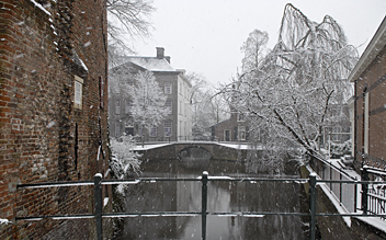
E11, Marskramerpad, Amersfoort, Netherlands

E11: The Hague (Nl) - Augustov (Pl) - Lithuania (Lt), 2070 km

North Sea – Harz – Mark Brandenburg – Masuren

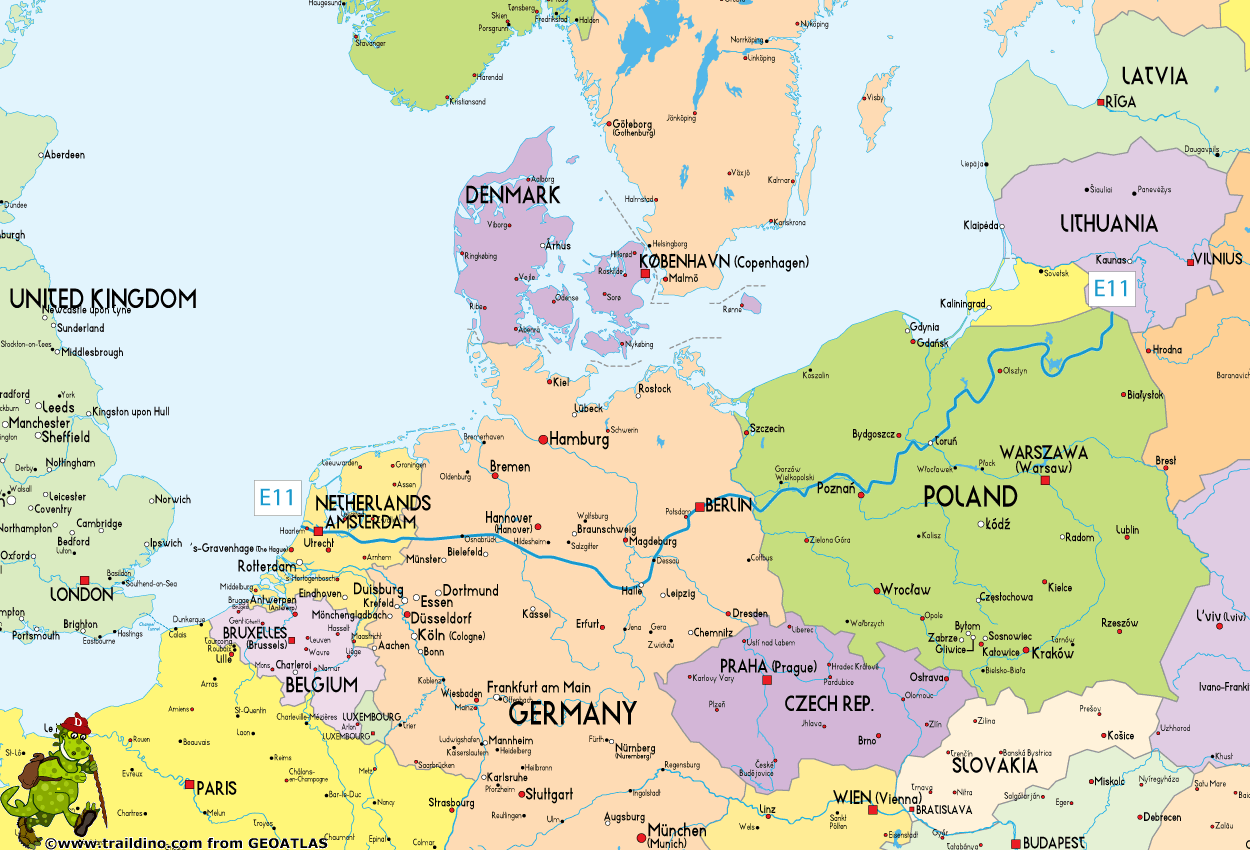
This E11 path currently measures about 2070 km, and it runs west to east, starting on the North Sea coast in The Hague in the Netherlands, and leading across Germany and Poland to the border with Lithuania.

In the Netherlands and the first part of Germany, the E11 follows well established routes, waymarked, named. From the German city of Hameln onwards, local trails are used, still waymarked. A long, long trail takes you all the way to Berlin and beyond. The Harz is a fine destination halfway, and indeed, before "die Wende" the E11 was called "Netherlands - Harz Trail", and halted at the Iron Curtain.

That's history now. We can pass the frontier, somewhere halfway the Harz, without even noticing the recent past. And the trail eventualy brings us into the heart of modern and ancient Germany, Berlin. It continues further east. The finish of the German part of the E11 is on the historic city of Frankfurt an der Oder, which now constitutes the border with Poland. 

In Poland, the E11 is not well waymarked and established as it is in The Netherlands and Germany. Even the precise course has not been defined everywhere. It will run through the heart of Poland and traverse the forests in the east of the country. The end of the trail these days is in the town of Augustów and village of Ogrodniki, in the border area with Lithuania and Belarus. Plans exist to extend the E11 into Lithuania and even Russia.

Let's have a look at the constituent parts of the E11:

Netherlands (350 km)

Germany (920 km)

  • Töddenweg to Osnabrück
  • (the stretch between Deventer and Osnabrück is also called the Handelsweg)
  • Wittekindsweg to Lübbecke
  • Wesergebirgsweg to Hameln
  • Local trails, waymarked, toBerlin and Frankfurt an der Oder
  • Last village in Germany Frankfurt an der Oder

Poland (800 km, partly marked)

  • First village in Poland is Słubice
  • Słubice - Ośno Lubuskie – Międzyrzecz – Międzychód – Toruń – Brodnica – Gołdap - Ogrodniki
  • Last village in Poland is Ogrodniki

Lithuania

  • Possible future extension
Select some tracks
European long distance path E11
European long distance path E11 - Netherlands
.Marskramerpad - 20, 20km
.Marskramerpad - 19, 19km
.Marskramerpad - 18, 21km
.Marskramerpad - 17, 17km
.Marskramerpad - 16, 17km
.Marskramerpad - 15, 20km
.Marskramerpad - 14, 18km
.Marskramerpad - 13, 23km
.Marskramerpad - 12, 14km
.Marskramerpad - 11, 18km
.Marskramerpad - 10, 17km
.Marskramerpad - 09, 20km
.Marskramerpad - 08, 17km
.Marskramerpad - 07, 19km
.Marskramerpad - 06, 17km
.Marskramerpad - 05, 12km
.Marskramerpad - 04, 21km
.Marskramerpad - 03, 18km
.Marskramerpad - 02, 17km
European long distance path E11 - part Germany
.Europäischer Fernwanderweg E11, Niedersachsen (W), 220km
.Europäischer Fernwanderweg E11, Niedersachsen (M), 98km
.Europäischer Fernwanderweg E11, Niedersachsen (O), 98km
.Europäischer Fernwanderweg E11, Sachsen-Anhalt (W), 100km
.Europäischer Fernwanderweg E11, Sachsen-Anhalt (O), 167km
.Europäischer Fernwanderweg E11, Brandenburg (W), 124km
.Europäischer Fernwanderweg E11, Berlin, 69km
.Europäischer Fernwanderweg E11, Brandenburg (O), 134km
.European long distance path E11 - part Poland, 1229km
European long distance path E11 - part Lithuania
.E11 section 51: Lazdijai – Veisiejai, 27km
.E11 section 52: Veisiejai – Trikojis, 15km
.E11 section 53: Trikojis – Didžiasalis, 19km
.E11 section 54: Didžiasalis – Druskininkai – Žiogeliai, 23km
.E11 section 55: Žiogeliai – Merkinė, 25km
.E11 section 56: Merkinė – Nemunaitis, 29km
.E11 section 57: Nemunaitis – Alytus, 20km
.E11 section 58: Alytus – Panemunis, 28km
.E11 section 59: Panemunis – Birštonas, 24km
.E11 section 60: Birštonas – Alksniakiemis, 19km
.E11 section 61: Alksniakiemis – Pakuonis, 18km
.E11 section 62: Pakuonis – Vaišvydava, 21km
.E11 section 63: Vaišvydava – Kaunas, 19km
.E11 section 64: Kaunas – Lampėdis, 8.8km
.E11 section 65: Lampedis – Kulautuva, 15km
.E11 section 66: Kulautuva – Vilkija, 13km
.E11 section 67: Vilkija – Padubysys, 16km
.E11 section 68: Padubysys – Ariogala – Kirkšnovė, 27km
.E11 section 69: Kirkšnovė – Kaulakiai, 24km
.E11 section 70: Kaulakiai – Šiluva, 28km
.E11 section 71: Šiluva – Tytuvėnai – Aukštiškiai, 17km
.E11 section 72: Aukštiškiai – Dengtiltis, 26km
.E11 section 73: Aukštiškiai – Dengtiltis, 15km
.E11 section 74: Kurtuvėnai – Šaukėnai, 15km
.E11 section 75: Šaukėnai – Gaulėnai, 25km
.E11 section 76: Šaukėnai – Gaulėnai, 24km
.E11 section 77: Pavandenė – Biržuvėnai, 20km
.E11 section 78: Biržuvėnai – Telšiai, 21km
.E11 section 79: Telšiai – Buožėnai, 17km
.E11 section 80: Buožėnai – Plinkšės, 18km
.E11 section 81: Plinkšės – Žemaičių Kalvarija, 17km
.E11 section 82: Kalvarija – Paplatelė, 17km
.E11 section 83: Paplatelė – Plateliai, 17km
.E11 section 84: Plateliai – Salantai, 21km
.E11 section 85: Salantai – Mosėdis, 19km
.E11 section 86: Mosėdis – Skuodas, 22km
E11: Mežtaka, Latvija
.E11 section 87: Lithuanian/Latvian border – Gramzda, 12km
.E11 section 88: Gramzda – Priekule, 18km
.E11 section 89: Priekule – Kalvene, 29km
.E11 section 90: Kalvene – Aizpute, 17km
.E11 section 91: Aizpute – Snēpele, 34km
.E11 section 92: Snēpele – Kuldīga, 21km
.E11 section 93: Kuldīga – Renda, 32km
.E11 section 94: Renda – Sabile, 31km
.E11 section 95: Sabile – Kandava, 21km
.E11 section 96: Kandava – Jaunmokas, 23km
.E11 section 97: Jaunmokas – Tukums, 14km
.E11 section 98: Tukums – Jāņukrogs, 14km
.E11 section 99: Jāņukrogs – Bigauņciems, 28km
.E11 section 100: Bigauņciems - Dubulti, 15km
.E11 section 101: Dubulti - Lielupe - Bulduri, 15km
.E11 section 102: Bulduri - Rīgas centrs, 21km
.E11 section 01: Vecrīga - Baltezers, 18km
.E11 section 02: Baltezers – Vangaži, 21km
.E11 section 03: Vangaži – Rāmkalni, 15km
.E11 section 04: Rāmkalni - Sigulda, 18km
.E11 section 05: Sigulda - Līgatne, 24km
.E11 section 06: Līgatne - Cēsis, 25km
.E11 section 07: Cēsis - Caunītes, 23km
.E11 section 08: Caunītes - Valmiera, 21km
.E11 section 09: Valmiera - Strenči (Main route under constrction.Use alternative!), 35km
.E11 section 10: Strenči - Spicu tilts, 26km
.E11 section 11: Spicu tilts - Zaķi, 30km
.E11 section 12: Zaķi - Gaujiena, 15km
.E11 section 13: Gaujiena - Trapene, 21km
.E11 section 14: Trapene - Ape, 19km
.E11 section 15: Ape – Paganamaa – Korneti – Latvijas/Igaunijas robeža, 25km
E11: Metsa Matkarada
.E11 section 16: Loogamäe - Haanja (Suur Munamägi), 23km
.E11 section 17: Haanja (Suur Munamägi)‒Tsiistre, 12km
.E11 section 18: Tsiistre‒Vana-Vastseliina, 19km
.E11 section 19: Vana-Vastseliina‒Kolodavitsa, 25km
.E11 section 20: Vana-Vastseliina‒Kolodavitsa, 21km
.E11 section 21: Verska (Värska) – Ristipalo, 24km
.E11 section 22: Ristipalo – Mehikorma (Mehikoorma), 23km
.E11 section 23: Mehikorma (Mehikoorma) – Lēniste (Lääniste), 26km
.E11 section 24: Lääniste‒Kavastu, 19km
.E11 section 25: Kavastu‒Varnja, 32km
.E11 section 26: Varnja‒Alatskivi, 19km
.E11 section 27: Alatskivi‒Rannamõisa, 18km
.E11 section 28: Rannamõisa‒Mustvee, 19km
.E11 section 29: Mustvee‒Avinurme, 19km
.E11 section 30: Avinurme‒Lohusuu, 16km
.E11 section 31: Lohusuu‒Kuru, 18km
.E11 section 32: Kuru‒Remniku, 13km
.E11 section 33: Remniku‒Kuremäe, 31km
.E11 section 34: Kuremäe‒Vasavere, 16km
.E11 section 35: Vasavere‒Toila, 24km
.E11 section 36: Toila‒Saka, 20km
.E11 section 37: Saka‒Aseri, 22km
.E11 section 38: Aseri‒Mahu, 20km
.E11 section 39: Mahu‒Kunda, 14km
.E11 section 40: Kunda‒Eisma, 17km
.E11 section 41: Eisma‒Oandu, 15km
.E11 section 42: Oandu‒Käsmu, 18km
.E11 section 43: Käsmu‒Viinistu, 26km
.E11 section 44: Viinistu‒Loksa, 20km
.E11 section 45: Loksa‒Tsitre, 21km
.E11 section 46: Tsitre‒ Kaberneeme, 24km
.E11 section 47: Kaberneeme ‒ Jõelähtme, 21km
.E11 section 48: Jõelähtme - Muuga, 15km
.E11 section 49: Muuga‒Püünsi, 18km
.E11 section 50: Püünsi‒Tallinn, 16km
(no name), 3km
(no name), 2.5km
(no name), 0.3km
(no name), 0.6km
(no name), 1.4km
(no name), 1.3km
(no name), 13km
Zubringer zum E11, 11km
(no name), 2.8km
(no name), 1.8km
(no name), 0.1km
(no name), 0.6km
(no name), 0.9km
GR 121 E11 Epaipide ibilbidea: Lizarrusti - Amezketa, 17km
Sentiero Italia - Tappa E11, 15km
Sentiero Italia - Tappa E12, 14km
GR 11 Senda Pirenaica - E11, 30km
(no name), 0.5km
(no name), 0.8km
(no name), 3km
E11 hiking section of Vasaloppsleden, 72km
E1 Halmstad - Gyltige, 32km
Alpe Adria Trail E11, 14km

Mapa

Map European Long Distance Trail E11

Mapas

Stanfords
United Kingdom
  • Pegnitz E11
  • Pegnitz in a series of GPS compatible recreational editions of the Bavarian topographic survey at 1:25,000, with waymarked hiking trails and cycling routes, campsites and youth hostels, etc. Coverage includes Creußen, Ahorntal, Pottenstein, Glashütten, Hummeltal, Schnabelwaid.Contours used in this map vary between 5 to 20m according to the... Leer más
Más mapas…

Foro

  1. Anular