
Alps
Descripción

The Alps, main mountain range of Europe, extending from France to Slovenia, including Austria, Italy, Germany, Switzerland, Liechtenstein. Highest summit is Mont Blanc (4.810), on the frontier of France, Switzerland and Italy, home of the popular Tour du Mont Blanc.
The Alps are, contrary to what most people think, not the largest mountain range in Europe. The Carpathians actually are more extensive, but not as high.
Often, hikers from outside Europe ask where to go in the Alps, which trail is best. Obviously, this is something every individual has to decide upon herself. The range of hiking opportunities in the Alps is huge. Beautiful country walks are within reach of snow capped mountains where someone else is sweating on a rope to get over a glacier. There are plenty of long distance trails combining different areas, although most people stick to one area. Some like to stay in a hotel and make day walks. Others fancy a hut-tour.
Let's be clear on another point: the facilities in the Alps are among the best in the world. Some would argue they are over the top. Thousands of huts – and very good ones too – lots of ski lifts, well marked trails.
Okay, we from Traildino do have some advice. First, take into account the local culture of an area. Many Alpine regions have a long and rich history which is there to enjoy. The different countries sharing the Alps are all very different, and the regional differences are equally astonishing. This is really a part of the fun here: enjoying nature, enjoying people and hospitality. Second tip: famous is not best. You will probably think of flying to the Matterhorn or Mont Blanc or something equally famous. Needless to say: these area's are very busy and by no means the most impressive or beautiful. Pretty as they are, also the different national parks draw many visitors and hikers are packed in large huts when aiming at the high peaks. If that's what you want: fine. If you prefer a small hut where a local warden makes you the best dinner you've ever had and where you can have a chat with the other three guests while inhaling the sounds and fumes of the end of the day, than virtually every region in the Alps has its charms.
Mapa

Senderos en región
- AdlerwegGPX
- Aletsch PanoramawegGPX
- AlpannoniaGPX
- Alpen Weitwanderweg
- Alpenkranz Uri
- Alpenpanorama-WegGPX
- AlpenpässewegGPX
- Alta Via dei GigantiGPX
- Alta Via dei Monti LiguriGPX
- Alta Via Della Valle d'Aosta No 1
- Alta Via Della Valle d'Aosta No 2
- Alta Via Dolomiti 1GPX
- Alta Via Dolomiti 10
- Alta Via Dolomiti 2GPX
- Alta Via Dolomiti 3GPX
- Alta Via Dolomiti 4GPX
- Alta Via Dolomiti 5
- Alta Via Dolomiti 6GPX
- Alta Via Dolomiti 7
- Alta Via Dolomiti 8
- Alta Via Dolomiti 9
- ArnowegGPX
- Ämtlerweg
- Bassa Via del GardaGPX
- Berliner HöhenwegGPX
- Berner Voralpenweg
- Chemin des BissesGPX
- Chemin du VignobleGPX
- Dachstein-Tauern Panoramaweg
- E10GPX
- E2GPX
- E4GPX
- E5GPX
- E6GPX
- Eisenwurzenweg - 8GPX
- EmmenuferwegGPX
- Freiburger VoralpenwegGPX
- Furka HöhenwegGPX
- Gailtaler HöhenwegGPX
- GoethewegGPX
- GR5GPX
- GR50 - Tour des ÉcrinsGPX
- GR510 - Sentier des huit valléesGPX
- GR54 - Tour de l'Oisans et des ÉcrinsGPX
- GR541
- GR549
- GR55 - Tour de la VanoiseGPX
- GR56 - Tour de l'UbayeGPX
- GR58 - Tour du QueyrasGPX
- GR65 - Via PodiensisGPX
- GR653 - Via TolosanaGPX
- GR653D - Voie d’ArlesGPX
- GR9GPX
- GR91 - Traversée du VercorsGPX
- GR93GPX
- GR94 - Tour des Hautes-AlpesGPX
- GR946
- GR95GPX
- GR96 - Traversée des BaugesGPX
- Grande Traversata del Gran Paradiso
- Grande Traversata delle AlpiGPX
- Grenzpfad NapfberglandGPX
- GTPA - Grande Traversée des PréalpesGPX
- Haute Route Chamonix-ZermattGPX
- Heidiland Wandertour
- Heilbronner HöhenwegGPX
- Hintere Gasse
- KalkalpenwegGPX
- Karnischer HöhenwegGPX
- Karwendel Höhenweg
- Kesch Trek
- Kreuzecker Höhenweg
- Lasörling HöhenwegGPX
- Lötschberg PanoramawegGPX
- Lechtaler HöhenwegGPX
- Liechtensteiner PanoramawegGPX
- Mariazeller Wege - 6GPX
- MaximilianswegGPX
- Meraner HöhenwegGPX
- Mittelbünden PanoramawegGPX
- Nationalpark PanoramawegGPX
- Nord-Süd Wanderweg - 5GPX
- Nordalpenweg - 1GPX
- Obwaldner HöhenwegGPX
- Pragelpass-WegGPX
- Prättigauer HöhenwegGPX
- Rätikon Höhenweg
- Rheintaler HöhenwegGPX
- Route du Temps
- Rupertiweg - 10GPX
- Salzburger AlmenwegGPX
- Salzsteigweg - 9GPX
- Sanetsch Muveran WegGPX
- Südalpenweg - 3GPX
- Schanfigger HöhenwegGPX
- Schladminger Tauern Höhenweg
- Schwyzer HöhenwegGPX
- SeealpentourGPX
- Senda SegantiniGPX
- Senda SursilvanaGPX
- Sentiero CristallinaGPX
- Sentiero della PaceGPX
- Sentiero Lago di LuganoGPX
- Sentiero VerzascaGPX
- Slovene Geological Path
- Slovenska Planinska PotGPX
- Slovenska Planinska Pot (extended)
- Stubaier HöhenwegGPX
- Sub-Alpine Trail
- Tauernhöhenweg
- Thurgauer PanoramawegGPX
- ThurwegGPX
- Tiroler Höhenweg
- TMB - Tour du Mont BlancGPX
- Tour des CombinsGPX
- Tour des Dents du MidiGPX
- Tour des Grands Barrages
- Tour du Augstbordhorn
- Tour du BeaufortainGPX
- Tour du MatterhornGPX
- Tour du Saint-BernardGPX
- Tour du Val de BagnesGPX
- Tour du WildhornGPX
- Tour Monte RosaGPX
- Tour Val d'HérensGPX
- Trans-Swiss TrailGPX
- Traumpfad München-VenedigGPX
- Venediger HöhenwegGPX
- Verwall Höhenweg
- Via AlpinaGPX
- Via EngiadinaGPX
- Via FrancigenaGPX
- Via GebennensisGPX
- Via JacobiGPX
- Via RhenanaGPX
- Via SbrinzGPX
- Via SplugaGPX
- Via StockalperGPX
- Via ValtellinaGPX
- Voralpenweg - 4GPX
- Walk of Peace
- Walliser SonnenwegGPX
- WALSA-wegGPX
- Weg der SchweizGPX
- Züri Oberland HöhenwegGPX
- Zürich-Zugerland PanoramawegGPX
- Zentralalpenweg - 2GPX


Enlaces
Datos
Informes
Guías y mapas
Hospedaje
Organizaciones
Operadores turísticos
GPS
Otro
Libros

United Kingdom
- Waldviertel North - Gmund - Heidenreichstein - Waidhofen & Raabs a.d.T. - Trebon F&B WK075
- Waldviertel North - Gmünd - Heidenreichstein - Waidhofen a.d.T. - Raabs a.d.T. – Trebon area of eastern Austria presented at 1:50,000 in a series of contoured and GPS compatible outdoor leisure map from Freytag & Berndt with hiking and cycling routes, mountain huts, campsites and youth hostels, local bus stops, plus other tourist information.To... Leer más

United Kingdom
- DK Eyewitness Austria 7/5/20
- Coffee, cake and culture - welcome to Austria.Whether you want to hike in the alps, visit remarkably well-preserved medieval towns or simply indulge in Vienna`s decadent cafe culture, your DK Eyewitness travel guide makes sure you experience all that Austria has to offer. The rhapsodic beauty of Alpine peaks, idyllic valleys and sparkling lakes... Leer más
United Kingdom
2021
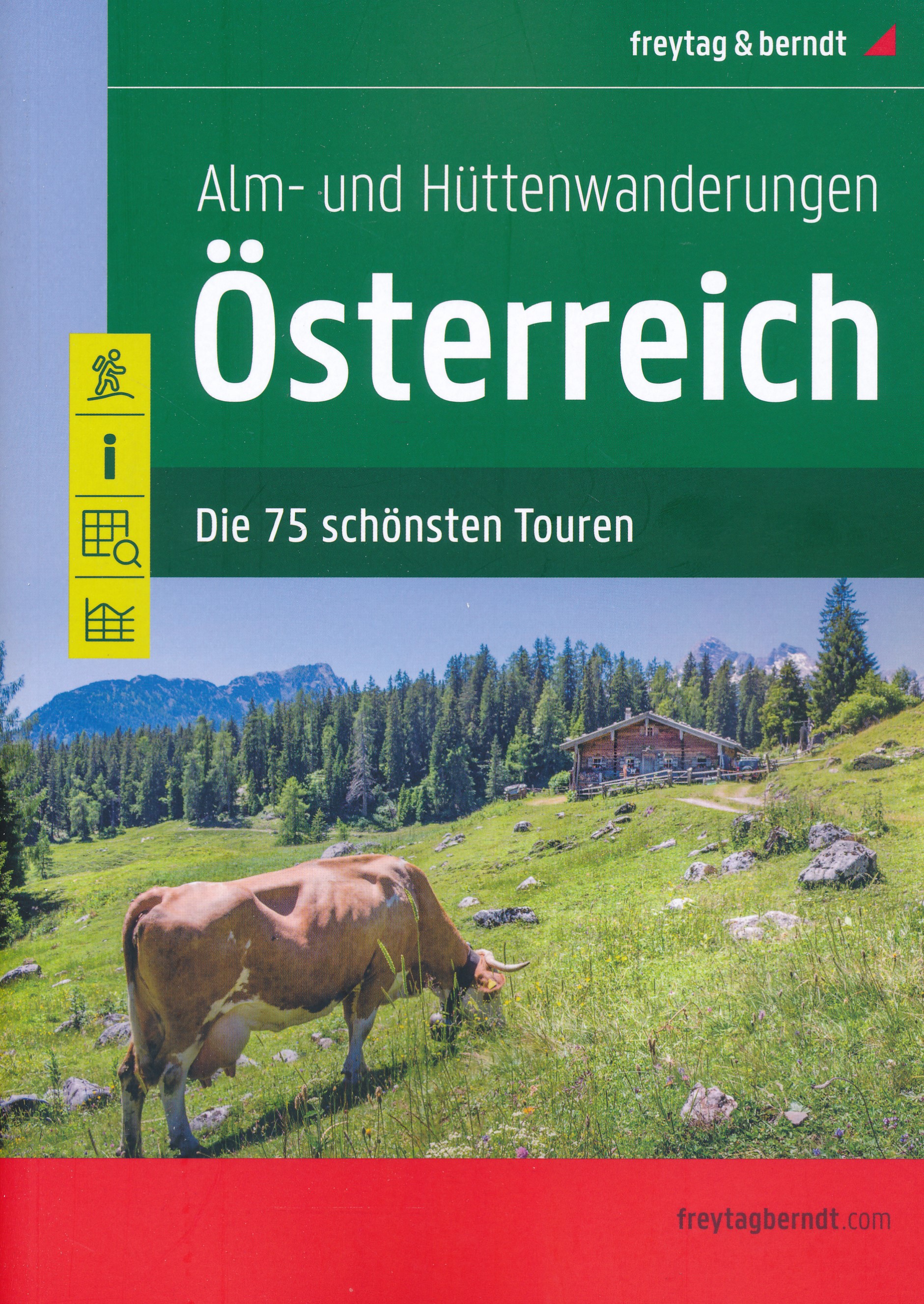
- Austria F&B Alp and Hut-to-Hut Hiking Guide
- A comprehensive guidebook detailing walking routes in Austria. The 101 walks reflect the diversity of this popular region and cover Austria`s magnificent Alps - including the Ratikon, Silvretta, Stubai and Zillertal - as well as the Dachsteingebirge, Hohe Tauern and the Karawanken. Graded according to difficulty and ranging from short walks of... Leer más

United Kingdom
- DK Eyewitness Road Trips Northern & Central Italy
- With its snow-capped mountain ranges and beautiful hill towns, Italy is an ideal destination for a leisurely road trip. It`s yours to explore with Road Trips Northern and Central Italy, our redesigned and newly updated guide containing 25 drives across the region, from the dramatic coastline of the Cinque Terre to the lakes of Lombardy and the... Leer más

United Kingdom
2012
- Le Massif Glières-Parmelan à pied FFRP Topo-guide No. P473
- Le Massif Glières-Parmelan à pied, FFRP topo-guide Ref. No. P743, with 20 day walks of varying length and difficulty in the French Alps, north-east of Lake Annecy between Thônes and La Roche-sur-Foron. Each walk is presented on a separate colour extract from IGN’s topographic survey of France at 1:25,000, with its description cross-referenced... Leer más

United Kingdom
- Walking Easy In The Italian and French Alps
- A how-to book for recreational walkers of all ages. It includes information on alpine walks with directions and maps, sightseeing excursions, discount travel and much more. Leer más

United Kingdom
- Pilgrimage: The Great Pilgrim Routes of Britain and Europe
- Shortlisted for a 2018 Edward Stanford Travel Writing Award.Ten historic pilgrim routes of Western Europe, inspiration for today`s long distance walker. Pilgrimage in Europe is thriving on a massive scale. In 1990 the cathedral at Santiago de Compostela recorded less than 5000 pilgrims: today that figure is at least 200,000 a year. Author Derry... Leer más

United Kingdom
2015
- Eastern Provence: Côte d’Azur to the Alps Sunflower Landscape Guide
- This guide, half of a two-volume set, is intended for motorists who want to tour eastern Provence and the Cote d`Azur by car and enjoy some superb walks en route. The drives have been described in such detail that there is no need to make constant reference to a map. The walks selected - all set in areas of great natural beauty and historical... Leer más

United Kingdom
2018
- Drôme à pied du Vercors à la Provence 50PR
- La Drôme à pied, FFRP topo-guide Ref. No.D026, with 50 day walks of varying length and difficulty in the department of Drôme between the Rhône and the foothills of the Alps. Each walk is presented on a separate colour extract from IGN’s topographic survey of France at 1:25,000, with its description cross-referenced to the map. Looking at the... Leer más

United Kingdom
- Schladming - Ramsau am Dachstein - Haus im Ennstal - Filzmoos - Stoderzinken F&B WK5201
- Schadming - Ramsau am Dachstein - Haus im Ennstal - Filzmoos - Stoderzinken area of the Austrian Alps presented at 1:35,000 in a series of contoured and GPS compatible outdoor leisure map from Freytag & Berndt with hiking and cycling routes, mountain huts, campsites and youth hostels, local bus stops, plus other tourist information. Cartography... Leer más
United Kingdom
- Walking Easy in the Italian Alps
- A pocket-sized guide that provides detailed information on 50 scenic Alpine day-walks that range from comfortable, level strolls to steeper, more challenging hikes - all within the capacity of the recreational walker. Non-hiking excursions to areas of local interest are also highlighted. This book features tips on everything from what clothes... Leer más
United Kingdom
2019
- Haute-Savoie a Pied - 54 circuits dont 8 adaptés à la marche nordique
- But don`t be fooled: if Haute-Savoie is home to the Mecca of mountaineering, it is also a hiker`s paradise! Beyond the GR® trails (the prestigious GR® 5 and GR® Tour du Mont Blanc), discover the diversity of the landscapes of a department with dynamic demography and economy. Pure lake waters, freshness of deep forests, distant horizons of... Leer más

United Kingdom
2014
- Vogesen - die schönsten Tal- und Höhenwanderungen
- Rother’s Walking Guide to the Côte d`Azur covers 44 day and multiple-day excursions between Meton and Marseille. The guide includes tours that range from walks on the Îles de Lérins over beach hikes at St.Tropez to solid mountain tours in the Massiv de I`Estérel or the Lake Alps; the famous crossing of the Calanques and a long-distance tour in... Leer más
United Kingdom
2018
- Environs de Gap à pied 46PR
- Les Environs de Gap à pied, FFRP topo-guide ref. no. P051, one of the titles in an extensive series of light, A5-size, high quality paperback guides published by the Fédération Française de la Randonnée Pédestre in association with local authorities, ramblers’ clubs, etc. The guides have *colour extracts from the French topographic survey at... Leer más
United Kingdom
2017
- Le PNR du Haute-Jura à pied PN15
- Le Parc du Haute-Jura à pied, FFRP topo-guide Ref. No. PN15, with 41 day walks of varying length and difficulty in the French Jura, plus several two- to seven-days long tours including a section of GR9. Each day walk is presented on a separate colour extract from IGN’s topographic survey of France at 1:25,000, with its description... Leer más
Mapas

United Kingdom
- Mattsee - Wallersee - Irrsee - Fuschl - Mondsee - Oberndorf F&B WK391
- Mattsee - Wallersee - Irrsee - Fuschl - Mondsee - Oberndorf - Salzburg - Wolfgangsee area of the Austrian Alps presented at 1:50,000 in a series of contoured and GPS compatible outdoor leisure map from Freytag & Berndt with hiking and cycling routes, mountain huts, campsites and youth hostels, local bus stops, plus other tourist information. To... Leer más

United Kingdom
- Grosses Walsertal - Feldkirch - Bludenz - Laterns - Liechtenstein F&B WK375
- Grosses Walsertal - Feldkirch - Bludenz - Laterns - Liechtenstein area of the Austrian Alps presented at 1:50,000 in a series of contoured and GPS compatible outdoor leisure map from Freytag & Berndt with hiking and cycling routes, mountain huts, campsites and youth hostels, local bus stops, plus other tourist information. Coverage inclused the... Leer más

United Kingdom
- Eastern Rhodopes / Rodopi Geopsis 131
- Eastern Rhodopes Mountains on the border of north-eastern Greece and Bulgaria on a waterproof and tear-resistant, contoured and GPS compatible map from Geopsis highlighting nine recommended hiking trails and the local section of the E6 cross-Europe long-distance route. All place names are in both Greek and Latin alphabet, with several villages... Leer más

United Kingdom
- Faaker See - Ossiacher See - Villach - Dreiländereck - Unteres Gailtal F&B WK224
- Faaker See - Ossiacher See - Villach - Dreiländereck - Unteres Gailtal area of Carinthia presented at 1:50,000 in a series of contoured and GPS compatible outdoor leisure map from Freytag & Berndt with hiking and cycling routes, mountain huts, campsites and youth hostels, local bus stops, plus other tourist information.To see the list of... Leer más

United Kingdom
- Seetaler Alpen - Seckauer Alpen - Judenburg - Knittelfeld F&B WK212
- Seetaler Alpen - Seckauer Alpen - Judenburg - Knittelfeld area of the Austrian Alps presented at 1:50,000 in a series of contoured and GPS compatible outdoor leisure map from Freytag & Berndt with hiking and cycling routes, mountain huts, campsites and youth hostels, local bus stops, plus other tourist information.To see the list of currently... Leer más

United Kingdom
- Central Carinthia - Gurktal Alps - Friesach - Feldkirchen - St. Veit an der Glan F&B WK231
- Hemmaland - Gurktal - Metnitztal - St. Veit a.d. Glan - Feldkirchen area of the Austrian Alps presented at 1:50,000 in a series of contoured and GPS compatible outdoor leisure map from Freytag & Berndt with hiking and cycling routes, mountain huts, campsites and youth hostels, local bus stops, plus other tourist information.To see the list of... Leer más

United Kingdom
- Wienviertel East - March - Thayatal - Mistelbach F&B WK014
- Wienviertel East - March - Thayatal – Mistelbach area of north-eastern Austria presented at 1:50,000 in a series of contoured and GPS compatible outdoor leisure map from Freytag & Berndt with hiking and cycling routes, mountain huts, campsites and youth hostels, local bus stops, plus other tourist information.To see the list of currently... Leer más

United Kingdom
- Goms - Aletsch
- Goms - Aletsch area of the Bernese Oberland at 1:50,000 in a series from Hallwag covering Switzerland’s popular hiking regions on light, waterproof and tear-resistant maps highlighting long-distance paths: the nine national routes plus special regional routes, as well as other local hiking trails.Cartography is similar to that used both in... Leer más

United Kingdom
- Pyhrn-Priel - Grünau - Almtal - Steyral - Kalkalpen National Park - Bad Aussee F&B WK081
- Pyhrn - Priel - Eisenwurzen - Grünau - Almtal - Steyral - Kalkalpen NP area of central Austria presented at 1:50,000 in a series of contoured and GPS compatible outdoor leisure map from Freytag & Berndt with hiking and cycling routes, mountain huts, campsites and youth hostels, local bus stops, plus other tourist information.To see the list of... Leer más

United Kingdom
- Western Rhodopes / Rodopi - Falakro Geopsis 133
- Central Rhodopes Mountains on the border of north-eastern Greece and Bulgaria on a waterproof and tear-resistant, contoured and GPS compatible map from Geopsis highlighting nine recommended hiking trails and the local section of the E6 cross-Europe long-distance route. All place names are in both Greek and Latin alphabet, with several villages... Leer más

United Kingdom
- Zell am See - Kaprun - Saalbach F&B WK382
- Zell-am-See - Kaprun - Saalbach area of the Austrian Alps presented at 1:50,000 in a series of contoured and GPS compatible outdoor leisure map from Freytag & Berndt with hiking and cycling routes, mountain huts, campsites and youth hostels, local bus stops, plus other tourist information. To see the list of currently available titles in this... Leer más

United Kingdom
- Grossglockner - Sonnblick - Kaprun - Zell am See F&B WK120
- Grossglockner - Sonnblick - Kaprun - Zell am See area of the Austrian Alps presented at 1:50,000 in a series of contoured and GPS compatible outdoor leisure map from Freytag & Berndt with hiking and cycling routes, mountain huts, campsites and youth hostels, local bus stops, plus other tourist information.To see the list of currently available... Leer más

United Kingdom
- Graz and Surroundings - Region Hügelland-Schöcklland – Gleisdorf – Weiz – Raabklamm F&B WK133
- Graz and Environs area of south-eastern Austria presented at 1:50,000 in a series of contoured and GPS compatible outdoor leisure map from Freytag & Berndt with hiking and cycling routes, mountain huts, campsites and youth hostels, local bus stops, plus other tourist information.To see the list of currently available titles in this series... Leer más

United Kingdom
- Hochschwab - Aflenz - Wildalpen - Salzatal F&B WK5041
- Hochschwab - Aflenz - Wildalpen - Salzatal area of eastern Austria presented at 1:35,000 in a series of contoured and GPS compatible outdoor leisure map from Freytag & Berndt with hiking and cycling routes, mountain huts, campsites and youth hostels, local bus stops, plus other tourist information. Cartography is an enlargement of the... Leer más

United Kingdom
- Mostviertel - Strudengau - Donauland - Amstetten - Waidhofen a.d. Ybbs - Steyr F&B WK052
- Mostviertel - Strudengau - Donauland - Amstetten - Waidhofen a.d. Ybbs - Steyr area of eastern Austria presented at 1:50,000 in a series of contoured and GPS compatible outdoor leisure map from Freytag & Berndt with hiking and cycling routes, mountain huts, campsites and youth hostels, local bus stops, plus other tourist information.To see the... Leer más