
Alps
Descripción

The Alps, main mountain range of Europe, extending from France to Slovenia, including Austria, Italy, Germany, Switzerland, Liechtenstein. Highest summit is Mont Blanc (4.810), on the frontier of France, Switzerland and Italy, home of the popular Tour du Mont Blanc.
The Alps are, contrary to what most people think, not the largest mountain range in Europe. The Carpathians actually are more extensive, but not as high.
Often, hikers from outside Europe ask where to go in the Alps, which trail is best. Obviously, this is something every individual has to decide upon herself. The range of hiking opportunities in the Alps is huge. Beautiful country walks are within reach of snow capped mountains where someone else is sweating on a rope to get over a glacier. There are plenty of long distance trails combining different areas, although most people stick to one area. Some like to stay in a hotel and make day walks. Others fancy a hut-tour.
Let's be clear on another point: the facilities in the Alps are among the best in the world. Some would argue they are over the top. Thousands of huts – and very good ones too – lots of ski lifts, well marked trails.
Okay, we from Traildino do have some advice. First, take into account the local culture of an area. Many Alpine regions have a long and rich history which is there to enjoy. The different countries sharing the Alps are all very different, and the regional differences are equally astonishing. This is really a part of the fun here: enjoying nature, enjoying people and hospitality. Second tip: famous is not best. You will probably think of flying to the Matterhorn or Mont Blanc or something equally famous. Needless to say: these area's are very busy and by no means the most impressive or beautiful. Pretty as they are, also the different national parks draw many visitors and hikers are packed in large huts when aiming at the high peaks. If that's what you want: fine. If you prefer a small hut where a local warden makes you the best dinner you've ever had and where you can have a chat with the other three guests while inhaling the sounds and fumes of the end of the day, than virtually every region in the Alps has its charms.
Mapa

Senderos en región
- AdlerwegGPX
- Aletsch PanoramawegGPX
- AlpannoniaGPX
- Alpen Weitwanderweg
- Alpenkranz Uri
- Alpenpanorama-WegGPX
- AlpenpässewegGPX
- Alta Via dei GigantiGPX
- Alta Via dei Monti LiguriGPX
- Alta Via Della Valle d'Aosta No 1
- Alta Via Della Valle d'Aosta No 2
- Alta Via Dolomiti 1GPX
- Alta Via Dolomiti 10
- Alta Via Dolomiti 2GPX
- Alta Via Dolomiti 3GPX
- Alta Via Dolomiti 4GPX
- Alta Via Dolomiti 5
- Alta Via Dolomiti 6GPX
- Alta Via Dolomiti 7
- Alta Via Dolomiti 8
- Alta Via Dolomiti 9
- ArnowegGPX
- Ämtlerweg
- Bassa Via del GardaGPX
- Berliner HöhenwegGPX
- Berner Voralpenweg
- Chemin des BissesGPX
- Chemin du VignobleGPX
- Dachstein-Tauern Panoramaweg
- E10GPX
- E2GPX
- E4GPX
- E5GPX
- E6GPX
- Eisenwurzenweg - 8GPX
- EmmenuferwegGPX
- Freiburger VoralpenwegGPX
- Furka HöhenwegGPX
- Gailtaler HöhenwegGPX
- GoethewegGPX
- GR5GPX
- GR50 - Tour des ÉcrinsGPX
- GR510 - Sentier des huit valléesGPX
- GR54 - Tour de l'Oisans et des ÉcrinsGPX
- GR541
- GR549
- GR55 - Tour de la VanoiseGPX
- GR56 - Tour de l'UbayeGPX
- GR58 - Tour du QueyrasGPX
- GR65 - Via PodiensisGPX
- GR653 - Via TolosanaGPX
- GR653D - Voie d’ArlesGPX
- GR9GPX
- GR91 - Traversée du VercorsGPX
- GR93GPX
- GR94 - Tour des Hautes-AlpesGPX
- GR946
- GR95GPX
- GR96 - Traversée des BaugesGPX
- Grande Traversata del Gran Paradiso
- Grande Traversata delle AlpiGPX
- Grenzpfad NapfberglandGPX
- GTPA - Grande Traversée des PréalpesGPX
- Haute Route Chamonix-ZermattGPX
- Heidiland Wandertour
- Heilbronner HöhenwegGPX
- Hintere Gasse
- KalkalpenwegGPX
- Karnischer HöhenwegGPX
- Karwendel Höhenweg
- Kesch Trek
- Kreuzecker Höhenweg
- Lasörling HöhenwegGPX
- Lötschberg PanoramawegGPX
- Lechtaler HöhenwegGPX
- Liechtensteiner PanoramawegGPX
- Mariazeller Wege - 6GPX
- MaximilianswegGPX
- Meraner HöhenwegGPX
- Mittelbünden PanoramawegGPX
- Nationalpark PanoramawegGPX
- Nord-Süd Wanderweg - 5GPX
- Nordalpenweg - 1GPX
- Obwaldner HöhenwegGPX
- Pragelpass-WegGPX
- Prättigauer HöhenwegGPX
- Rätikon Höhenweg
- Rheintaler HöhenwegGPX
- Route du Temps
- Rupertiweg - 10GPX
- Salzburger AlmenwegGPX
- Salzsteigweg - 9GPX
- Sanetsch Muveran WegGPX
- Südalpenweg - 3GPX
- Schanfigger HöhenwegGPX
- Schladminger Tauern Höhenweg
- Schwyzer HöhenwegGPX
- SeealpentourGPX
- Senda SegantiniGPX
- Senda SursilvanaGPX
- Sentiero CristallinaGPX
- Sentiero della PaceGPX
- Sentiero Lago di LuganoGPX
- Sentiero VerzascaGPX
- Slovene Geological Path
- Slovenska Planinska PotGPX
- Slovenska Planinska Pot (extended)
- Stubaier HöhenwegGPX
- Sub-Alpine Trail
- Tauernhöhenweg
- Thurgauer PanoramawegGPX
- ThurwegGPX
- Tiroler Höhenweg
- TMB - Tour du Mont BlancGPX
- Tour des CombinsGPX
- Tour des Dents du MidiGPX
- Tour des Grands Barrages
- Tour du Augstbordhorn
- Tour du BeaufortainGPX
- Tour du MatterhornGPX
- Tour du Saint-BernardGPX
- Tour du Val de BagnesGPX
- Tour du WildhornGPX
- Tour Monte RosaGPX
- Tour Val d'HérensGPX
- Trans-Swiss TrailGPX
- Traumpfad München-VenedigGPX
- Venediger HöhenwegGPX
- Verwall Höhenweg
- Via AlpinaGPX
- Via EngiadinaGPX
- Via FrancigenaGPX
- Via GebennensisGPX
- Via JacobiGPX
- Via RhenanaGPX
- Via SbrinzGPX
- Via SplugaGPX
- Via StockalperGPX
- Via ValtellinaGPX
- Voralpenweg - 4GPX
- Walk of Peace
- Walliser SonnenwegGPX
- WALSA-wegGPX
- Weg der SchweizGPX
- Züri Oberland HöhenwegGPX
- Zürich-Zugerland PanoramawegGPX
- Zentralalpenweg - 2GPX


Enlaces
Datos
Informes
Guías y mapas
Hospedaje
Organizaciones
Operadores turísticos
GPS
Otro
Libros

United Kingdom
2019
- Haute-Savoie a Pied - 54 circuits dont 8 adaptés à la marche nordique
- But don`t be fooled: if Haute-Savoie is home to the Mecca of mountaineering, it is also a hiker`s paradise! Beyond the GR® trails (the prestigious GR® 5 and GR® Tour du Mont Blanc), discover the diversity of the landscapes of a department with dynamic demography and economy. Pure lake waters, freshness of deep forests, distant horizons of... Leer más

United Kingdom
2017
- Sentiers de St- Jacques via le Puy - Moissac to Roncevaux GR65
- Continuation and end of the Puy road, through Quercy, Béarn and Basque Country. More than 15 days of hiking.Chemins de St- Jacques: Moissac - Roncevaux (Roncesvalles), FFRP topoguide Ref. no. 653, covering the last, 345-km long section of the Way of St. James in France along the GR65 between Le Puy-en-Velay to the Spanish border. Current... Leer más
United Kingdom
2020
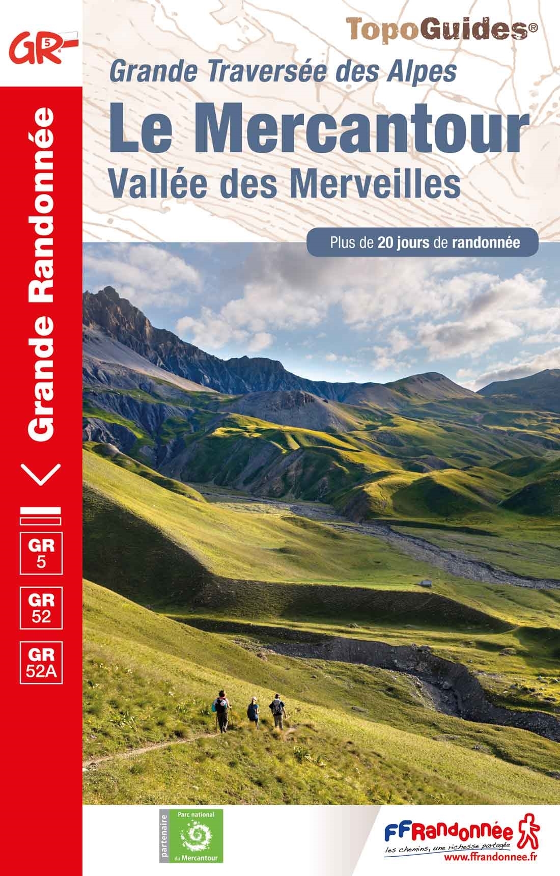
- Le Mercantour - Vallee des Merveilles GR5/GR52/52A
- Le Mercantour: Larche – Nice/Menton, Vallée des Merveilles, FFRP topoguide Ref. No. 507, covering 450km of long-distance routes: the last section of the GR5 in the French Alps from Larche to Nice, an alternative variant off GR5 along the GR52 leading via the Vallée des Merveilles to Menton, plus GR52A – Panoramique du Mecantour from Col du... Leer más

United Kingdom
2014
- Vogesen - die schönsten Tal- und Höhenwanderungen
- Rother’s Walking Guide to the Côte d`Azur covers 44 day and multiple-day excursions between Meton and Marseille. The guide includes tours that range from walks on the Îles de Lérins over beach hikes at St.Tropez to solid mountain tours in the Massiv de I`Estérel or the Lake Alps; the famous crossing of the Calanques and a long-distance tour in... Leer más

United Kingdom
- Rhön Kompass 2-Map Set 460
- Rhön region of central Germany, straddling the borders between Bavaria, Hesse and Thuringia, in a set of two detailed, contoured and GPS compatible maps at 1:50,000 from Kompass with local and long-distance footpaths, cycling routes, accommodation, etc.KOMPASS HIKING & RECREATIONAL MAPS: this title is part of an extensive series covering... Leer más

United Kingdom
2019
- Du Léman à la Vanoise - par le Mont Blanc et le Beaufortain GR5
- The first, 206-km long Alpine section of the GR5 from Lake Geneva, past Mont Blanc and across the Col de la Croix-du-Bonhomme, to Landry north of the Vanoise Massif, FFRP topo-guide ref. no. 504, with colour maps from the IGN TOP25 series at 1:25,000. Also included is a tour of the Dents du Midi. Current edition of this title was published in... Leer más

United Kingdom
- Cortina d`Ampezzo Kompass 55
- Map No. 55, Cortina d`Ampezzo - with a panorama map on the reverse, from Kompass, printed on sturdy, waterproof and tear-resistant synthetic paper in their series of walking maps of selected areas of Italy at 1:50,000, with hiking routes on a topographic base, various types of accommodation, recreational facilities, places of interest, etc.... Leer más

United Kingdom
2012
- GR93/GR94 Tours dans les Hautes-Alpes FFRP Topo-guide No. 940
- Tours dans les Hautes-Alpes, FFRP topoguide Ref. no. 940, covering 691km of hiking routes along the GR93 and GR94 in the French Alps west of Gap. The routes can be combined, as required, into shorter or longer circuits. Current edition of this title was published in June 2012.ABOUT THE FFRP (Fédération française de la randonnée pédestre)... Leer más

United Kingdom
- Ely, Wisbech & Downham Market OS Landranger Active Map 143 (waterproof)
- Cambridgeshire around Ely, Wisbech and Downham Market, including part of the E2 European Long-distance Path, on a waterproof and tear-resistant OS Active version of map No. 143 from the Ordnance Survey’s Landranger series at 1:50,000, with contoured and GPS compatible topographic mapping plus tourist information.MOBILE DOWNLOADS: As well as the... Leer más

United Kingdom
2020
- La Traversee der Alpes La Vanoise - PN de la Vanoise GR5/GR55
- 15 days in altitude from the Tarentaise to Modane, heart of the Maurienne. Description also of Via Alpina.La Vanoise (including Parc National de la Vanoise), FFRP topoguide Ref. no. 530, covering the second section of the GR5 in the French Alps between Landry and Modane, its lower variant on the GR5E along the river Arc, plus the traverse of... Leer más

United Kingdom
- Maidstone, Royal Tunbridge Wells, Sevenoaks & Tonbridge OS Landranger Active Map 188 (waterproof)
- Maidstone, Tunbridge Wells and the High Weald area, including a section of the North Downs Way / E2 European Long-distance Path, on a waterproof and tear-resistant OS Active version of map No. 188 from the Ordnance Survey’s Landranger series at 1:50,000, with contoured and GPS compatible topographic mapping plus tourist information.MOBILE... Leer más

United Kingdom
- Bremerhaven - Cuxhaven Kompass 400
- Bremerhaven - Cuxhaven (No. 400), a detailed, GPS compatible map at 1:50,000 from Kompass with local and long-distance footpaths, cycling routes, accommodation, etc, printed on durable, waterproof and tear-resistant synthetic paper. KOMPASS HIKING & RECREATIONAL MAPS:This title is part of an extensive series covering Austria, much of Germany... Leer más

United Kingdom
2019
- La Traversée des Alpes de la Maurienne a l`Ubaye GR5/GR56
- 9 days from Modane to Larche by the GR5, as much for the tour of Ubaye.Grande Traversée des Alpes: de la Maurienne a l`Ubaye, FFRP topoguide Ref. No. 531, covering the third stage of the GR5 in the French Alps from Modane to Larche, plus the Tour de l`Ubaye at its southern end, in all 272km for hiking routes. Current edition of this title was... Leer más

United Kingdom
2015
- GR654 Chemins de St-Jacques: Vézelay - Périgueux FFRP Topo-guide No. 6542
- Chemins de St-Jacques: Vézelay - Périgueux, FFRP topoguide Ref. no. 6542, covering the 744km route along the GR654 the Way of St. Jamezs from Vézelay via Limoges to Périgueux. Current edition of this title was published in March 2015.ABOUT THE FFRP (Fédération française de la randonnée pédestre) TOPOGUIDES: published in a handy A5 paperback... Leer más

United Kingdom
- Traunstein - Waginger See Kompass 16
- Traunstein - Waginger See area of southern Bavaria on a detailed, GPS compatible map at 1:50,000 from Kompass with local and long-distance footpaths, cycling routes, accommodation, etc, printed on durable, waterproof and tear-resistant synthetic paper.KOMPASS HIKING & RECREATIONAL MAPS: this title is part of an extensive series covering... Leer más
Mapas

United Kingdom
- Arlberg - Verwallgruppe Kompass 33
- Arlberg – Verwallgruppe area of the Austrian Alps, including Lech, St. Anton and Ischgl, on a detailed, GPS compatible map at 1:50,000 from Kompass with local and long-distance footpaths, cycling routes, accommodation, etc, printed on durable, waterproof and tear-resistant synthetic paper.KOMPASS HIKING & RECREATIONAL MAPS: this title is part... Leer más

United Kingdom
- Villars-de-Lans - Mont Aiguille - PNR du Vercors IGN 3236OT
- Topographic survey of France at 1:25,000 in IGN`s excellent TOP25 / Série Bleue series. All the maps are GPS compatible, with a 1km UTM grid plus latitude and longitude lines at 5’ intervals. Contours are at 5m intervals except for mountainous areas where the maps have contours at 10m intervals, vividly enhanced by hill shading and graphics for... Leer más

United Kingdom
- Siena - Volterra - Massa Marittima - Roccastrada Kompass 2462
- Siena - Volterra - Massa Marittima - Rocca Strada map at 1:50,000 from Kompass, printed on durable, waterproof and tear-resistant synthetic paper. Coverage includes Colle di Va d’Elsa, Casole d’Elsa, Metallifere hills, etc. Contours are at 40m intervals, with a 2-km UTM grid. Extensive overprint includes GEA - Grande Escursione Appenninica,... Leer más

United Kingdom
- Morzine - Massif du Chablais - Les Portes du Soleil IGN 3528ET
- Topographic survey of France at 1:25,000 in IGN`s excellent TOP25 / Série Bleue series. All the maps are GPS compatible, with a 1km UTM grid plus latitude and longitude lines at 5’ intervals. Contours are at 5m intervals except for mountainous areas where the maps have contours at 10m intervals, vividly enhanced by hill shading and graphics for... Leer más

United Kingdom
- Vals Freeride Map
- The best rides in the freeride hot spots of the Alps – this is the simple formula of the Freeride Maps. The first map available to freeriders is making the locals freeride knowledge available to a broad public.All ridable slopes, drops and couloirs are marked as freeride corridors in different colours for three difficulty ratings: blue for... Leer más

United Kingdom
- Adige / Etsch Cycle Route - Landeck to Verona Bikeline Map-Guide
- The Adige/Etsch Cycle Route, a 345-km long cycle trail from Landeck in the Austrian Alps to Verona, presented by the Verlag Esterbauer in a guide with maps at 1:75,000 showing the route and its variants. Extensive information is conveyed by symbols, indicating road surface, campsites and other accommodation, repair workshops, recreational... Leer más

United Kingdom
- Zermatt Freeride Map
- The best rides in the freeride hot spots of the Alps – this is the simple formula of the Freeride Maps. The first map available to freeriders is making the locals freeride knowledge available to a broad public.All ridable slopes, drops and couloirs are marked as freeride corridors in different colours for three difficulty ratings: blue for... Leer más

United Kingdom
- Hochschwab - Veitschalpe - Eisenerz - Bruck an der Mur F&B WK041
- Hochschwab - Veitschalpe - Eisenerz - Bruck an der Mur area of eastern Austria presented at 1:50,000 in a series of contoured and GPS compatible outdoor leisure map from Freytag & Berndt with hiking and cycling routes, mountain huts, campsites and youth hostels, local bus stops, plus other tourist information.To see the list of currently... Leer más

United Kingdom
- Franconian Switzerland South Kompass 171
- The southern part of the Franconian Switzerland (Fränkische Schweiz) area of Bavaria on a detailed, contoured and GPS compatible map at 1:50,000 from Kompass with local and long-distance footpaths, cycling routes, accommodation, etc. printed on durable, waterproof and tear-resistant synthetic paper. KOMPASS HIKING & RECREATIONAL MAPS: this... Leer más

United Kingdom
- Massif de la Vanoise IGN 75003
- Vanoise Massif and the National Park region in a series of GPS compatible, contoured TOP 75 maps at 1:75,000 from the IGN, highlighting local and long-distance hiking paths, cycling routes and sites for other recreational activities. The map includes five large panels showing the areas around Mont Jovet, Champagny-en-Vanoise, Pointe de... Leer más

United Kingdom
- Alps - Northern Italy MairDumont Road Atlas SPIRAL-BOUND
- Alpine Countries Road Atlas from MairDumont in an A4 spiral-bound format with street plans of 22 main towns and mapping of the whole of Europe for route planning, presented with the publisher’s innovative system of providing peel-on/peel-off stickers for making selected locations more prominent when navigating.Coverage extends from the German... Leer más
United Kingdom
- Vogelsberg - North Wetterau 2-Map Set Kompass 846
- Vogelsberg - Nördliche Wetterau (No. 846), a detailed, GPS compatible map at 1:50,000 from Kompass with local and long-distance footpaths, cycling routes, accommodation, etc, printed on durable, waterproof and tear-resistant synthetic paper. KOMPASS HIKING & RECREATIONAL MAPS:This title is part of an extensive series covering Austria, much of... Leer más

United Kingdom
- Val Formazza - Alpe Devero - Binntal - Valle di Goms SUPERCEDED
- 1:25,000 hiking map to the north west of Val Formazza including Monte Cervadone and Blinnenhorn. Published in association with the CAI, the Italian Alpine Club, who are responsible for the trails. Trails are marked on the map. The key information and more detailed information on the rear of the sheet are in Italian, German and English. Printed... Leer más

United Kingdom
- Triglav - Kranjska Gora - Bohinj
- Triglav - Kranjska Gora - Bohinj area of the Triglav National Park in the Julian Alps at 1:25,000 on a double-sided, contoured and GPS compatible hiking map from Sidarta with details of 27 mountain huts, each annotated with main trails leading to it; also climbing areas, natural heritage sites, etc. The map is double-sided and covers the... Leer más
United Kingdom
- Lake Constance F&B Leisure & Panorama
- Lake Constance area at 1:75,000 on a touring and cycling map from Freytag & Berndt prominently highlighting scenic roads and special tourist routes, recommended cycling routes, and locations worth visiting. Coverage extends from north of Ravensburg in Germany to St. Gallen in Switzerland, and includes Bregenz and Dornbirn in Austria.On the... Leer más