E10
Descripción
- Name E10 (E10)
- Distancia de sendero 2,880 km, 1,790 millas
- Duración en días 145 días
- Inicio de sendero Nuorgam (Fin)
- Fin de sendero Tarifa (Es)
- Clasificación Traildino EW, Paseo fácil, sendero en la naturaleza

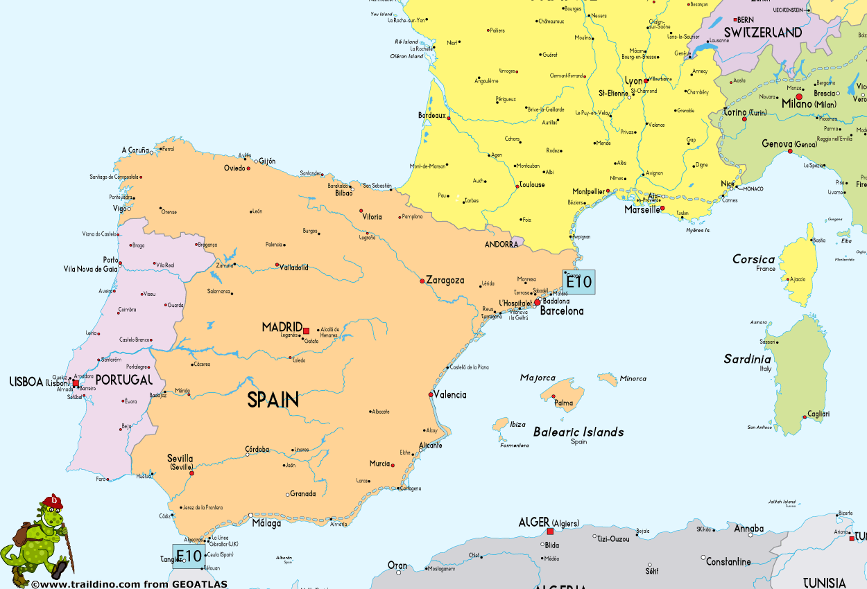
E10: Nuorgam (Fin) - Tarifa (Es), 2880 km
Lapland - Baltic Sea – Šumava – Alps
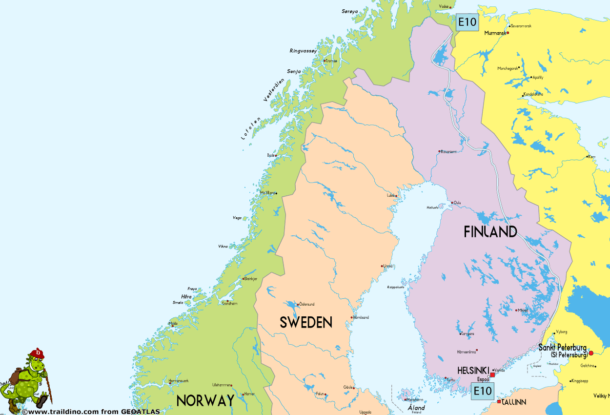
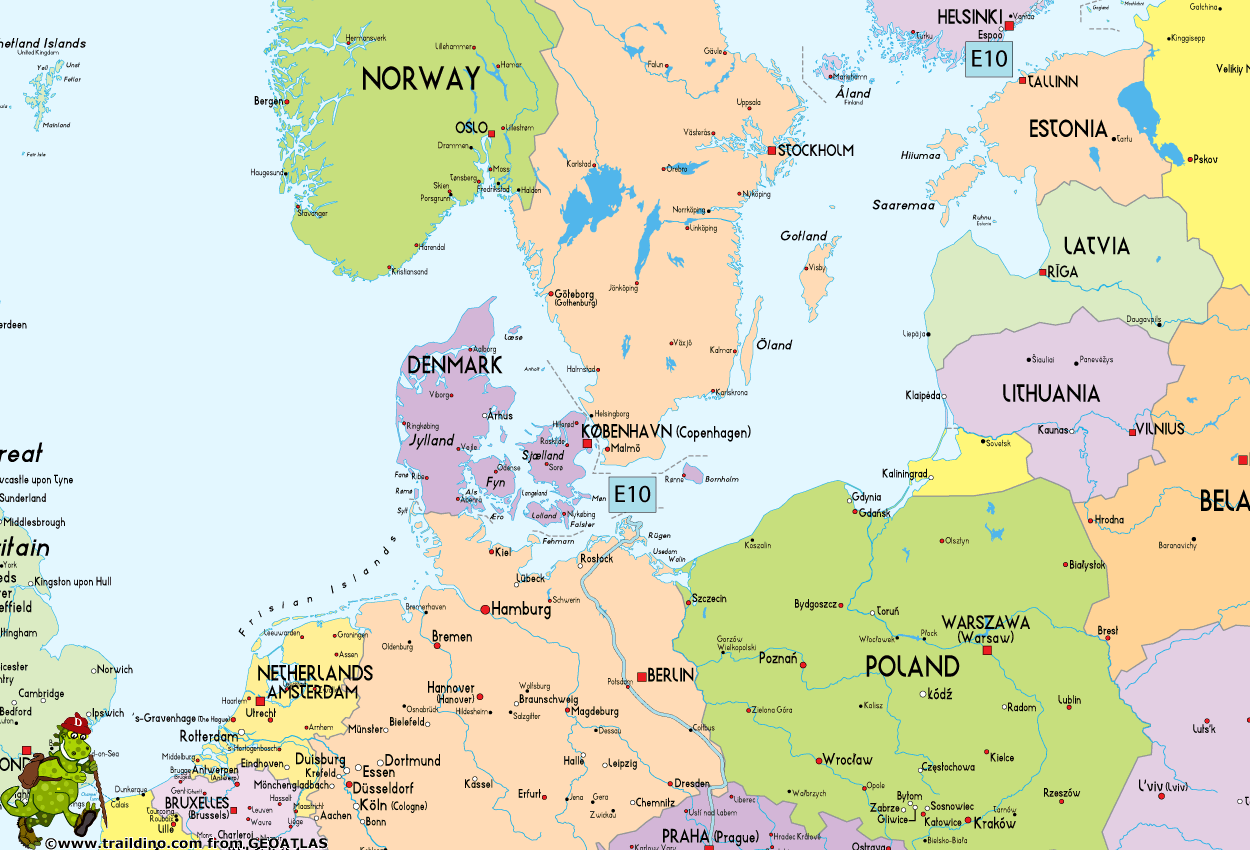
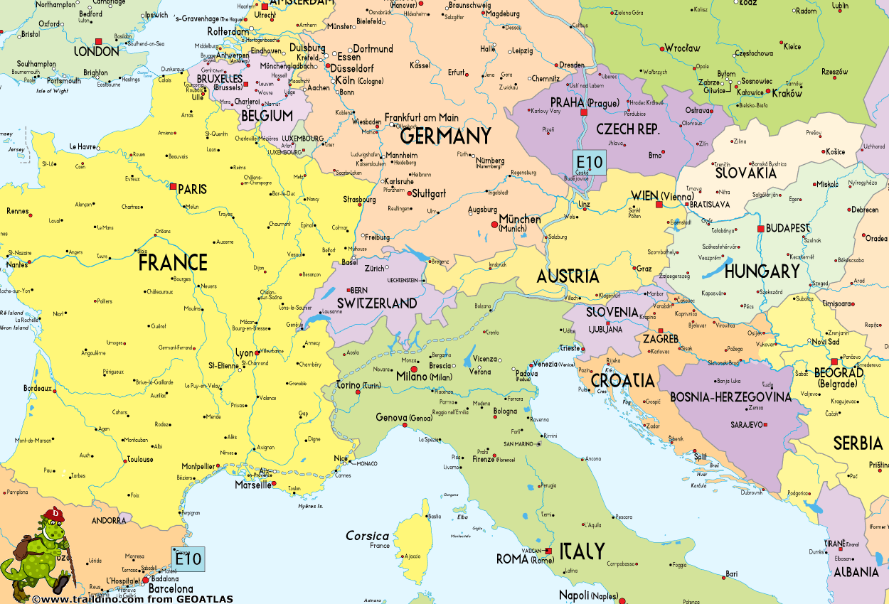
Adding up to 2880 km (marked part only), this trail heads south from the northern border of Finland with Norway, crossing over by ferry to Rostock, and continuing across Germany, the Czech Republic, Austria, Italy and southern France into Spain to end in its southern tip, Tarifa. However, a continuous trail in fact only runs to Bozen in Italy at the moment. The French section is incomplete. But then again the Spanish section is partly in order.
Finland
Important Note: Suomen Latu ry from Finland is not a member of the ERA anymore. The information below is outdated information, just in case you are interested anyway. The proposed E10 trail through Finland is probably incomplete and unmarked.
- Trail is described in literature, but not marked (except some parts in the north and in the south)
- South Karelia: from Uukuniemi to Lappeenranta, 190 km marked
- Boat from Helsinki or Hanko to Rügen in Germany
Germany
- Starting on island of Rügen
- Local trails, marked, small parts missing
Czech Republic
- Local trails, well marked
Austria
- Connecting trail from Germany
- Rupertiweg - 10, Weitwanderweg 10 (WWW 10)
Italy
- From the Austrian border till Bolzano on mountain trails, marked
- From Bolzano to the French border: missing
France
- Missing
Spain
Calificaciones

- jasse lelong Abril 2011
- Calificación 8
Mapa
Enlaces
Datos
- Wandern auf dem E 10 in Brandenburg (Alemán)
Excellent page by Fernwege.de on the German part of the E10, with sketch maps, route description, GPS donwload, documentation.
- E10 – Outdoor Wiki (Alemán)
Overview
- Europ. Fernwanderweg E10 (Alemán)
A short fact sheet of the European Long Distance Trail E10, running through Austria.
- European Long Distance trails on Wanderbares Deutschland (Alemán)
Wanderbares Deutschland offers the trail information for Germany on behalf of the Deutscher Wanderverband (German Ramblers' Association). Click on "Übersicht Europäische Wanderwege" on the left, to get to the information of the E-Paths.
- Hiking in Finland
Detailed info on the Finnish section of trail E6 and E10.
- www.ekarjala.fi - Recreation areas and hiking trails in South Karelia
The E10 goes through this region for 190 km.
Informes
Guías y mapas
Hospedaje
Organizaciones
- Österreichischer Touristenklub (Alemán)
One of Austria's Alpine Organisations, and also responsible for the E-paths in Austria.
- Deutscher Wanderverband (Alemán)
Platform for hiking in Germany. The Wanderverband is an association for the many local German hiking organisations. Germany has a rich hiking tradition, and many many local organisations. The website offers a good overview of hiking possibilities. However, the description of the different trails should be looked for at a different website: Wanderbares Deutschland (http://www.wanderbares-deutschland.de). The Deutscher Wanderverband is member of the European Ramblers' Association.
- FEDME - Federación Española de Deportes de Montaña y Escalada (Español)
The FEDME is the Spanish hiking and mountaineering organisation, realising and maintaining - together with the regional hiking organisations - the Senderos de Gran Recorrido, or the GRs, long distance trails. You will find a database of all the GR's here. Often, it's wise to visit one of the regional organisations' webpage for more information. The FEDME is member of the European Ramblers' Organisation and looks after the 5 European Long Distance Paths crossing the countrY: E3, E4, E7, E10, E12.
- FFRP - Federation Francaise de la Randonnée Pédestre (Francés)
Official website of the French Federation for Long Distance Hiking. Offering all you need for hiking in France. The FFRP maintains all long distance hikes - Grandes Randonnées - in France. The organisation participates in the European Ramblers' Organisation.
- FIE Italia - Federazione Italiana Escursionismo (Italiano)
Federazione Italiana Escursionismo - Italian Hiking Federation. They maintain many of the long distance trails in Italy. The FIE is member of the European Ramblers' Organisation.
- KČT - Klub českých turistů - Czech Tourist Club (Czech)
The KČT is the Czech umbrella organisation for hiking. Their website gives a lot of information; a tiny part is in English. As member of the European Ramblers' Association, they are responsible for the European Long Distance Paths E3 and E10 in the Czech Republic.
- Naturfreunde Bundesorganisation (Alemán)
The Austrian Branch of the Naturfreunde organisation. They cooperate in the maintenance of the E-paths in Austria.
- Oesterreichischer Alpenverein Sektion Weitwanderer (Alemán)
Austrian Alpine Association, dept. Long Distance Walkers, with everything you need to know about long distance hiking in Austria.They offer information on the European Long Distance Paths too.
Operadores turísticos
GPS
Otro
Libros

United Kingdom
- South Tyrol Kompass Hiking & Recreational Kompass Ring-binder Atlas No. 2703: Bormio - Merano - Bolzano - Cortina d`Ampezzo
- Italian South Tyrol, including many popular areas of the Dolomites, on waterproof and tear-resistant, contoured and GPS-compatible maps at 1:35,000 from Kompass presented in a ring-binder atlas and highlighting hiking paths, cycle and horse riding trails, various accommodation options, etc. Each removable sheet is double-sided and 30.5x26cm... Leer más
Mapas

United Kingdom
- Ebermannstadt E10
- Ebermannstadt in a series of GPS compatible recreational editions of the Bavarian topographic survey at 1:25,000, with waymarked hiking trails and cycling routes, campsites and youth hostels, etc. Coverage includes Gößweinstein, Waischenfeld, Wiesenttal, Pottenstein, Pretzfeld, Heiligenstadt i.OFr.Contours used in this map vary between 5 to 20m... Leer más
Foro

- Highline 2014-03-18 21:43:50
kml or gpx
- I am looking for a .kml or a .gpx file for the E10 in Czech Republic. Any ideas on where to find?
- DebBoyd 2015-07-21 16:16:10
- http://hiking.waymarkedtrails.org/en/relation/165997
- gorn 2018-11-25 21:50:02
- We are currently working on it. The problem is that out marking system is very stable and developed, but at the same time somewhat inflexible. Currently the relation in openstreetmap you have linked is the best what we have.