Islas Marshall
Descripción
Enlaces
Datos
Informes
Guías y mapas
Hospedaje
Organizaciones
Operadores turísticos
GPS
Otro
Libros
Bol.com
Netherlands
Netherlands
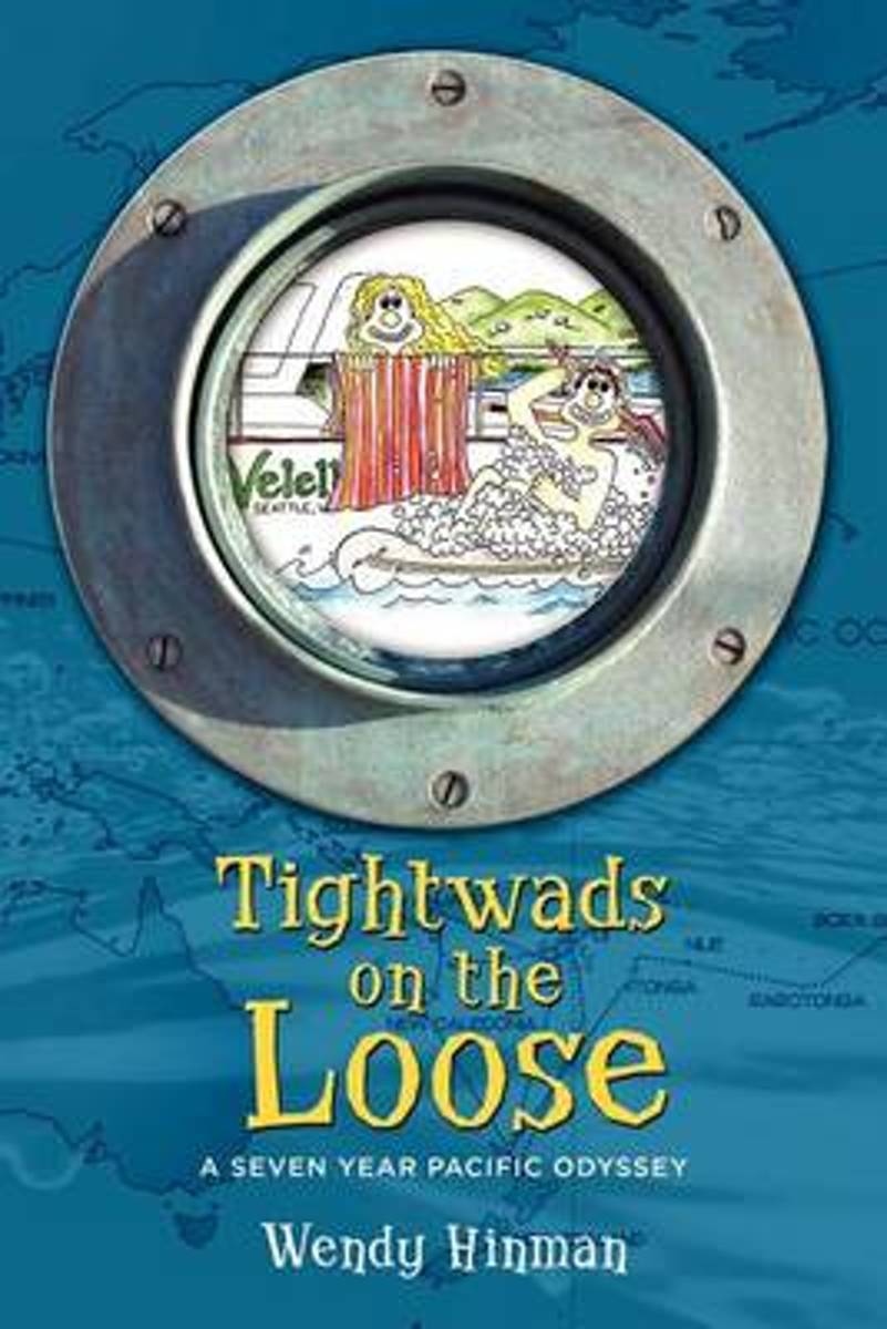
- Tightwads on the Loose
- Everyone dreams of tropical escape. But what happens when you escape for too long? Imagine spending 24 hours a day with your spouse in 31 not-so-square feet . . . for years; crossing the Pacific Ocean on two gallons of fuel; and tossing spaghetti marinara around your living room, then cleaning it up while bouncing like ice in a martini shaker.... Leer más
- Also available from:
- Bol.com, Belgium

Bol.com
Belgium
Belgium
- Tightwads on the Loose
- Everyone dreams of tropical escape. But what happens when you escape for too long? Imagine spending 24 hours a day with your spouse in 31 not-so-square feet . . . for years; crossing the Pacific Ocean on two gallons of fuel; and tossing spaghetti marinara around your living room, then cleaning it up while bouncing like ice in a martini shaker.... Leer más
Mapas
Stanfords
United Kingdom
United Kingdom
- Admiralty Routeing Chart 5141(8) - Malacca Strait to Marshall Islands - August
- NEW EDITION OUT ON 10/10/2019Essential for use in passage planning for ocean voyages, Routeing Charts include routes and distances between major ports, ocean currents, ice limits, load lines and wind roses. They also contain expected meteorological and oceanographic conditions for each month of the year.Individual chart scales of 1:5,000,000,... Leer más
Stanfords
United Kingdom
United Kingdom
- Admiralty Routeing Chart 5141(1) - Malacca Strait to Marshall Islands - January
- NEW EDITION OUT ON 10/10/2019Essential for use in passage planning for ocean voyages, Routeing Charts include routes and distances between major ports, ocean currents, ice limits, load lines and wind roses. They also contain expected meteorological and oceanographic conditions for each month of the year.Individual chart scales of 1:5,000,000,... Leer más
Stanfords
United Kingdom
United Kingdom
- Admiralty Routeing Chart 5141(9) - Malacca Strait to Marshall Islands - September
- NEW EDITION OUT ON 10/10/2019Essential for use in passage planning for ocean voyages, Routeing Charts include routes and distances between major ports, ocean currents, ice limits, load lines and wind roses. They also contain expected meteorological and oceanographic conditions for each month of the year.Individual chart scales of 1:5,000,000,... Leer más
Stanfords
United Kingdom
United Kingdom
- Admiralty Routeing Chart 5141(2) - Malacca Strait to Marshall Islands - February
- NEW EDITION OUT ON 10/10/2019Essential for use in passage planning for ocean voyages, Routeing Charts include routes and distances between major ports, ocean currents, ice limits, load lines and wind roses. They also contain expected meteorological and oceanographic conditions for each month of the year.Individual chart scales of 1:5,000,000,... Leer más
Stanfords
United Kingdom
United Kingdom
- Admiralty Routeing Chart 5141(10) - Malacca Strait to Marshall Islands - October
- NEW EDITION OUT ON 10/10/2019Essential for use in passage planning for ocean voyages, Routeing Charts include routes and distances between major ports, ocean currents, ice limits, load lines and wind roses. They also contain expected meteorological and oceanographic conditions for each month of the year.Individual chart scales of 1:5,000,000,... Leer más
Stanfords
United Kingdom
United Kingdom
- Admiralty Routeing Chart 5141(3) - Malacca Strait to Marshall Islands - March
- NEW EDITION OUT ON 10/10/2019Essential for use in passage planning for ocean voyages, Routeing Charts include routes and distances between major ports, ocean currents, ice limits, load lines and wind roses. They also contain expected meteorological and oceanographic conditions for each month of the year.Individual chart scales of 1:5,000,000,... Leer más
Stanfords
United Kingdom
United Kingdom
- Admiralty Routeing Chart 5141(11) - Malacca Strait to Marshall Islands - November
- NEW EDITION OUT ON 10/10/2019Essential for use in passage planning for ocean voyages, Routeing Charts include routes and distances between major ports, ocean currents, ice limits, load lines and wind roses. They also contain expected meteorological and oceanographic conditions for each month of the year.Individual chart scales of 1:5,000,000,... Leer más
Stanfords
United Kingdom
United Kingdom
- Admiralty Routeing Chart 5141(12) - Malacca Strait to Marshall Islands - December
- NEW EDITION OUT ON 10/10/2019Essential for use in passage planning for ocean voyages, Routeing Charts include routes and distances between major ports, ocean currents, ice limits, load lines and wind roses. They also contain expected meteorological and oceanographic conditions for each month of the year.Individual chart scales of 1:5,000,000,... Leer más
Stanfords
United Kingdom
United Kingdom
- Admiralty Routeing Chart 5141(4) - Malacca Strait to Marshall Islands - April
- NEW EDITION OUT ON 10/10/2019Essential for use in passage planning for ocean voyages, Routeing Charts include routes and distances between major ports, ocean currents, ice limits, load lines and wind roses. They also contain expected meteorological and oceanographic conditions for each month of the year.Individual chart scales of 1:5,000,000,... Leer más
Stanfords
United Kingdom
United Kingdom
- Admiralty Routeing Chart 5141(5) - Malacca Strait to Marshall Islands - May
- NEW EDITION OUT ON 10/10/2019Essential for use in passage planning for ocean voyages, Routeing Charts include routes and distances between major ports, ocean currents, ice limits, load lines and wind roses. They also contain expected meteorological and oceanographic conditions for each month of the year.Individual chart scales of 1:5,000,000,... Leer más
Stanfords
United Kingdom
United Kingdom
- Admiralty Routeing Chart 5141(6) - Malacca Strait to Marshall Islands - June
- NEW EDITION OUT ON 10/10/2019Essential for use in passage planning for ocean voyages, Routeing Charts include routes and distances between major ports, ocean currents, ice limits, load lines and wind roses. They also contain expected meteorological and oceanographic conditions for each month of the year.Individual chart scales of 1:5,000,000,... Leer más
Stanfords
United Kingdom
United Kingdom
- Admiralty Routeing Chart 5141(7) - Malacca Strait to Marshall Islands - July
- NEW EDITION OUT ON 10/10/2019Essential for use in passage planning for ocean voyages, Routeing Charts include routes and distances between major ports, ocean currents, ice limits, load lines and wind roses. They also contain expected meteorological and oceanographic conditions for each month of the year.Individual chart scales of 1:5,000,000,... Leer más

