
Pembrokeshire
Descripción
Region and county in the South West of Wales. The coastline is of special interest. Here runs the Pembrokeshire Coast National Trail, a lovely - and long - walk with great vistas.
Senderos en región
Enlaces
Datos
Informes
Guías y mapas
Hospedaje
Organizaciones
Operadores turísticos
GPS
Otro
Libros

Stanfords
United Kingdom
United Kingdom
- Coast - The Walks
- Accompanying BBC2`s BAFTA award-winning television series, ”Coast: The Walks” will inspire you to explore the best that the coastline of the British Isles has to offer. With more than 50 fantastic walks around Great Britain and Ireland, this practical guidebook features a variety of town and rural routes that are designed to suit both... Leer más


Stanfords
United Kingdom
United Kingdom
- St David`s & Haverfordwest OS Landranger Active Map 157 (waterproof)
- Pembrokeshire Coast National Park between Pembroke in the south and Fishguard in the north including St Davids, and with coverage extending inland beyond Haverfordwest, on a waterproof and tear-resistant OS Active version of map No. 157 from the Ordnance Survey’s Landranger series at 1:50,000, with contoured and GPS compatible topographic... Leer más

Stanfords
United Kingdom
United Kingdom
- Cadair Idris & Bala Lake OS Explorer Active Map OL23 (waterproof)
- Cadair Idris and Llyn Tegid area of the Snowdonia National Park on a detailed topographic and GPS compatible map OL23, waterproof version, from the Ordnance Survey’s 1:25,000 Explorer series. Coverage extends from Bala in the north-east to the coast between Barmouth and Ynyslas, and includes Dolgellau, Tywin, Machynlleth, the epaks of Moel... Leer más

Stanfords
United Kingdom
United Kingdom
- Cardigan & Mynydd Preseli OS Landranger Active Map 145 (waterproof)
- The coast of Wales between Dinas Head and New Quay, including Cardigan and the northern part of the Pembrokeshire Coast National Park, on a waterproof and tear-resistant OS Active version of map No. 145 from the Ordnance Survey’s Landranger series at 1:50,000, with contoured and GPS compatible topographic mapping plus tourist information.MOBILE... Leer más

The Book Depository
United Kingdom
United Kingdom
- Short Walks on the Pembrokeshire Coast - Giving Access to All
- Giving Access for All Leer más

Stanfords
United Kingdom
United Kingdom
- Coastal Pub Walks: North Wales: Walks to amazing coastal pubs on the Wales Coast Path
- These attractive and cleverly structured guides will give walkers ten of the best short circular walks along the 870-mile long Wales Coast Path.With clear information, an overview and introduction for each walk, expertly written numbered directions, large scale Ordnance Survey maps, and interpretation of points of interest along the way, these... Leer más
- Also available from:
- The Book Depository, United Kingdom

The Book Depository
United Kingdom
United Kingdom
- Coastal Pub Walks: North Wales
- Walks to amazing coastal pubs on the Wales Coast Path Leer más

Stanfords
United Kingdom
2021
United Kingdom
2021
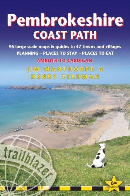
- Pembrokeshire Coast Path, Trailblazer 6
- The Pembrokeshire Coast Path follows a National Trail for 186 miles (299km) around the magnificent coastline of the Pembrokeshire Coast National Park in south-west Wales. Renowned for its unspoilt sandy beaches, secluded coves, tiny fishing villages and off-shore islands rich in bird and marine life, this National Trail provides some of the... Leer más
- Also available from:
- The Book Depository, United Kingdom
- De Zwerver, Netherlands

The Book Depository
United Kingdom
2021
United Kingdom
2021
- Pembrokeshire Coast Path (Trailblazer British Walking Guides)
- Practical trekking guide to walking the whole path, Maps, Planning Places to Stay, Places to Eat Leer más


Stanfords
United Kingdom
United Kingdom
- Snowdonia Coast: Circular walks along the Wales Coast Path
- These attractive and cleverly structured guides give walkers ten of the finest walks along each of the main sections of the Wales Coast Path in a popular pocketable format.With clear information, an overview and introduction for each walk, expertly written numbered directions, large scale Ordnance Survey maps, superb eye-grabbing panoramic... Leer más
- Also available from:
- The Book Depository, United Kingdom

The Book Depository
United Kingdom
United Kingdom
- The Snowdonia Coast
- Circular walks along the Wales Coast Path Leer más

Stanfords
United Kingdom
United Kingdom
- Tenby & Pembroke OS Landranger Active Map 158 (waterproof)
- Southern coast of Wales between Pentywyn, Tenby and Pembroke, including part of the Pembrokeshire Coast National Park, on a waterproof and tear-resistant OS Active version of map No. 158 from the Ordnance Survey’s Landranger series at 1:50,000, with contoured and GPS compatible topographic mapping plus tourist information.MOBILE DOWNLOADS: As... Leer más
- Also available from:
- The Book Depository, United Kingdom


The Book Depository
United Kingdom
2019
United Kingdom
2019
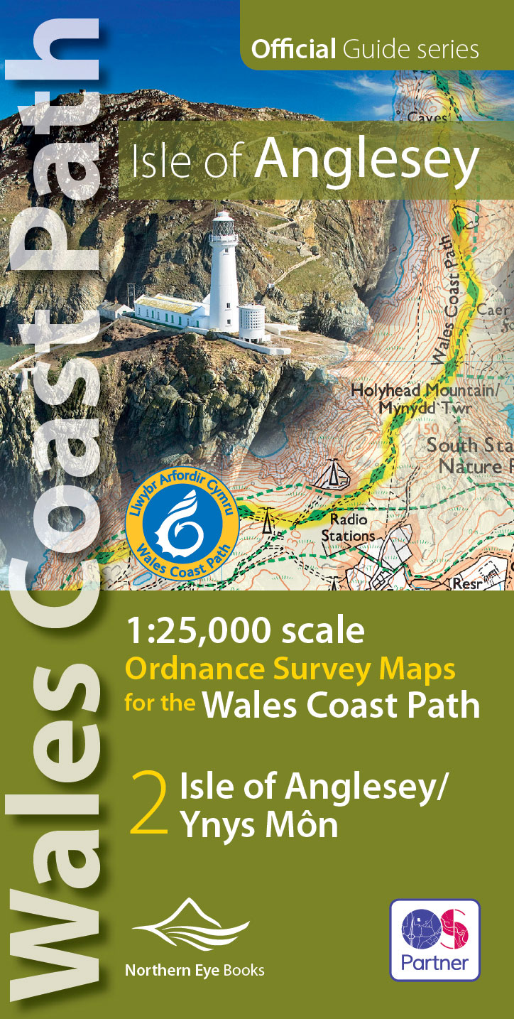
- Isle of Anglesey Coast Path Map
- 1:25,000 scale Ordnance Survey mapping for the entire Isle of Anglesey Coast Path Leer más
- Also available from:
- De Zwerver, Netherlands
De Zwerver
Netherlands
2019
Netherlands
2019
- Wandelkaart Wales Coast Path: Isle of Anglesey | Northern Eye Books
- 1:25,000 scale Ordnance Survey mapping for the entire Isle of Anglesey Coast Path Leer más

Stanfords
United Kingdom
2018
United Kingdom
2018
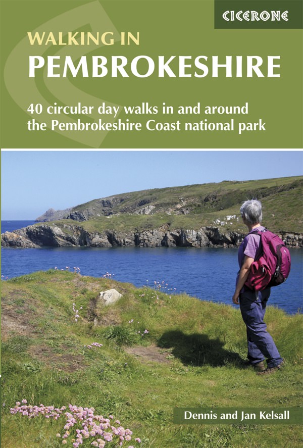
- Pembrokeshire Walking (40 walks)
- Guidebook to 40 circular walks in Pembrokeshire in Wales. The routes, which range from 1 to 12 miles, take in the dramatic beauty of the national park and its coast, the Daugleddau and the Preseli Hills, while exploring wooded gorges, prehistoric hillforts and medieval castles.Step-by-step route descriptions are accompanied by 1:50,000 mapping.... Leer más
- Also available from:
- The Book Depository, United Kingdom
- De Zwerver, Netherlands

The Book Depository
United Kingdom
2018
United Kingdom
2018
- Walking in Pembrokeshire
- 40 circular walks in and around the Pembrokeshire Coast National Park Leer más
De Zwerver
Netherlands
2018
Netherlands
2018
- Wandelgids Walking in Pembrokeshire | Cicerone
- Guidebook to 40 circular walks in Pembrokeshire in Wales. Routes take in the dramatic beauty of the national park and its coast, the Daugleddau and the Preseli Hills, while exploring wooded gorges, prehistoric hillforts and medieval castles. Walks range from 1 to 12 miles and route descriptions are accompanied by 1:50,000 OS map extracts. Leer más


Stanfords
United Kingdom
United Kingdom
- Pembrokeshire - Walks to Coastal Viewpoints: Circular walks with the most stunning views in Pembrokeshire
- A new addition to the popular Top 10 Walks: Wales Coast Path series - handy, pocket-sized, full colour walking guides written by experts.This attractive and cleverly constructed guide will give walkers ten of the best short circular walks to stunning coastal viewpoints in Pembrokeshire. With clear information, an overview and introduction for... Leer más
- Also available from:
- The Book Depository, United Kingdom

The Book Depository
United Kingdom
United Kingdom
- Pembrokeshire - Walks to Coastal Viewpoints
- Circular walks with the most stunning views in Pembrokeshire Leer más
Mapas

Stanfords
United Kingdom
United Kingdom
- North Pembrokeshire OS Explorer Map OL35 (paper)
- The northern coast of Pembrokeshire between Cardigan and St Davids on a detailed topographic and GPS compatible map OL35, paper version, from the Ordnance Survey’s 1:25,000 Explorer series. Coverage includes Pembrokeshire Coast National Park, Goodwick, Fishguard, Llys-y-fran Reservoir, Ramsey Island, the Pembrokeshire Coast Path National Trail... Leer más

Stanfords
United Kingdom
United Kingdom
- St David`s and Haverfordwest / Tyddewi a Hwlffordd 1818-1820
- Map No. 157, St David`s and Haverfordwest / Tyddewi a Hwlffordd 1818-1820, in the Cassini Historical Series of old Ordnance Survey mapping of England and Wales at 1:50,000 in a format designed to offer a convenient comparison with the present day coverage from the OS, and most locations in three different editions. Old historical maps have been... Leer más
Stanfords
United Kingdom
United Kingdom
- St David`s and Haverfordwest / Tyddewi a Hwlffordd 1922-1923
- Map No. 157, St David`s and Haverfordwest / Tyddewi a Hwlffordd 1922-1923, in the Cassini Historical Series of old Ordnance Survey mapping of England and Wales at 1:50,000 in a format designed to offer a convenient comparison with the present day coverage from the OS, and most locations in three different editions. Old historical maps have been... Leer más
Stanfords
United Kingdom
United Kingdom
- St David`s and Haverfordwest / Tyddewi a Hwlffordd 1901-1912
- Map No. 157, St David`s and Haverfordwest / Tyddewi a Hwlffordd 1901-1912, in the Cassini Historical Series of old Ordnance Survey mapping of England and Wales at 1:50,000 in a format designed to offer a convenient comparison with the present day coverage from the OS, and most locations in three different editions. Old historical maps have been... Leer más
Stanfords
United Kingdom
United Kingdom
- St David`s and Haverfordwest / Tyddewi a Hwlffordd 1818-1923 (3-map set)
- Map No. 157, St David`s and Haverfordwest / Tyddewi a Hwlffordd 1818-1923 (3-map set), in the Cassini Historical Series of old Ordnance Survey mapping of England and Wales at 1:50,000 in a format designed to offer a convenient comparison with the present day coverage from the OS, and most locations in three different editions. Old historical... Leer más
Stanfords
United Kingdom
United Kingdom
- Tenby and Pembroke / Dinbych-y-pysgod & Penfro 1818-1913 (3-map set)
- Map No. 158, Tenby and Pembroke / Dinbych-y-pysgod & Penfro 1818-1913 (3-map set), in the Cassini Historical Series of old Ordnance Survey mapping of England and Wales at 1:50,000 in a format designed to offer a convenient comparison with the present day coverage from the OS, and most locations in three different editions. Old historical maps... Leer más
Stanfords
United Kingdom
United Kingdom
- Tenby and Pembroke / Dinbych-y-pysgod & Penfro 1818-1831
- Map No. 158, Tenby and Pembroke / Dinbych-y-pysgod & Penfro 1818-1831, in the Cassini Historical Series of old Ordnance Survey mapping of England and Wales at 1:50,000 in a format designed to offer a convenient comparison with the present day coverage from the OS, and most locations in three different editions. Old historical maps have been... Leer más

Stanfords
United Kingdom
United Kingdom
- England Coast Path Adventure Map - Minehead to Brean Down
- The A-Z Adventure Series of maps combines the best of OS and A-Z, creating the perfect companion for walkers, off-road cyclists, horse riders and anyone wishing to explore the great outdoors.This official Minehead to Brean Down Adventure Map covers a 58 mile (93km) section of the England Coast Path, a new National Trail around England`s coast.... Leer más
Stanfords
United Kingdom
United Kingdom
- Tenby and Pembroke / Dinbych-y-pysgod & Penfro 1922-1923
- Map No. 158, Tenby and Pembroke / Dinbych-y-pysgod & Penfro 1922-1923, in the Cassini Historical Series of old Ordnance Survey mapping of England and Wales at 1:50,000 in a format designed to offer a convenient comparison with the present day coverage from the OS, and most locations in three different editions. Old historical maps have been... Leer más

Stanfords
United Kingdom
United Kingdom
- Pembrokeshire Coast A-Z Adventure Atlas
- Pembrokeshire Coast Adventure Atlas at 1:25,000 in a series of handy A5 size Adventure Atlases from Geographers` A-Z Map Company with cartography from the Ordnance Survey’s Explorer series. Coverage extends along the coast from Cardigan to Tenby and Amroth and includes the Pembrokeshire Coast Paths - now a section of the Wales Coast Path.To see... Leer más
Stanfords
United Kingdom
United Kingdom
- Tenby and Pembroke / Dinbych-y-pysgod & Penfro 1901-1902
- Map No. 158, Tenby and Pembroke / Dinbych-y-pysgod & Penfro 1901-1902, in the Cassini Historical Series of old Ordnance Survey mapping of England and Wales at 1:50,000 in a format designed to offer a convenient comparison with the present day coverage from the OS, and most locations in three different editions. Old historical maps have been... Leer más

Stanfords
United Kingdom
2022
United Kingdom
2022
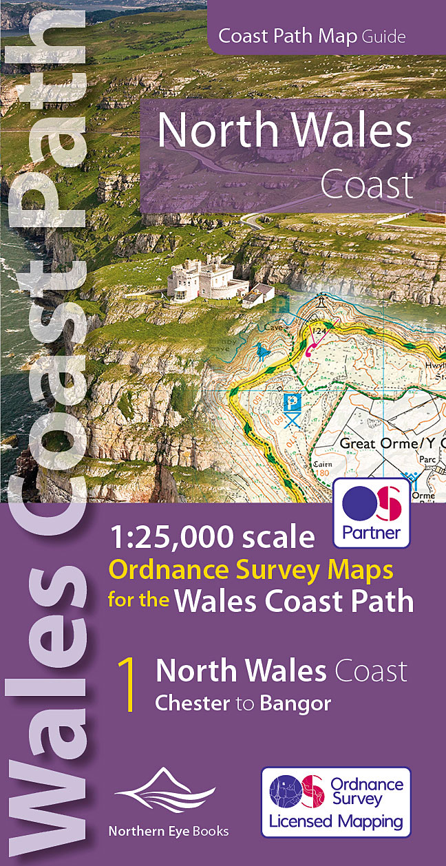
- North Wales Coast - Chester to Bangor - Wales Coast Path Map-Booklet
- One of seven handy, lightweight, pocket sized map bookscovering the whole of the 870 mile/1400 kilometre Wales Coast Path. This volume covers North Wales from Chester to Bangor and includes enhanced large scale (1:25,000) Ordnance Survey mapping in a handy atlas format, with extracts from large scale Explorer maps 266, 265, 264 and OL17.The... Leer más
- Also available from:
- The Book Depository, United Kingdom
- De Zwerver, Netherlands

The Book Depository
United Kingdom
2022
United Kingdom
2022
- North Wales Coast Path Map
- 1:25,000 scale Ordnance Survey mapping for the Wales Coast Path Leer más
De Zwerver
Netherlands
2022
Netherlands
2022
- Wandelkaart North Wales Coast Path Map | Northern Eye Books
- One of seven handy, lightweight, pocket sized map bookscovering the whole of the 870 mile/1400 kilometre Wales Coast Path. This volume covers North Wales from Chester to Bangor and includes enhanced large scale (1:25,000) Ordnance Survey mapping in a handy atlas format, with extracts from large scale Explorer maps 266, 265, 264 and OL17.The... Leer más

Stanfords
United Kingdom
United Kingdom
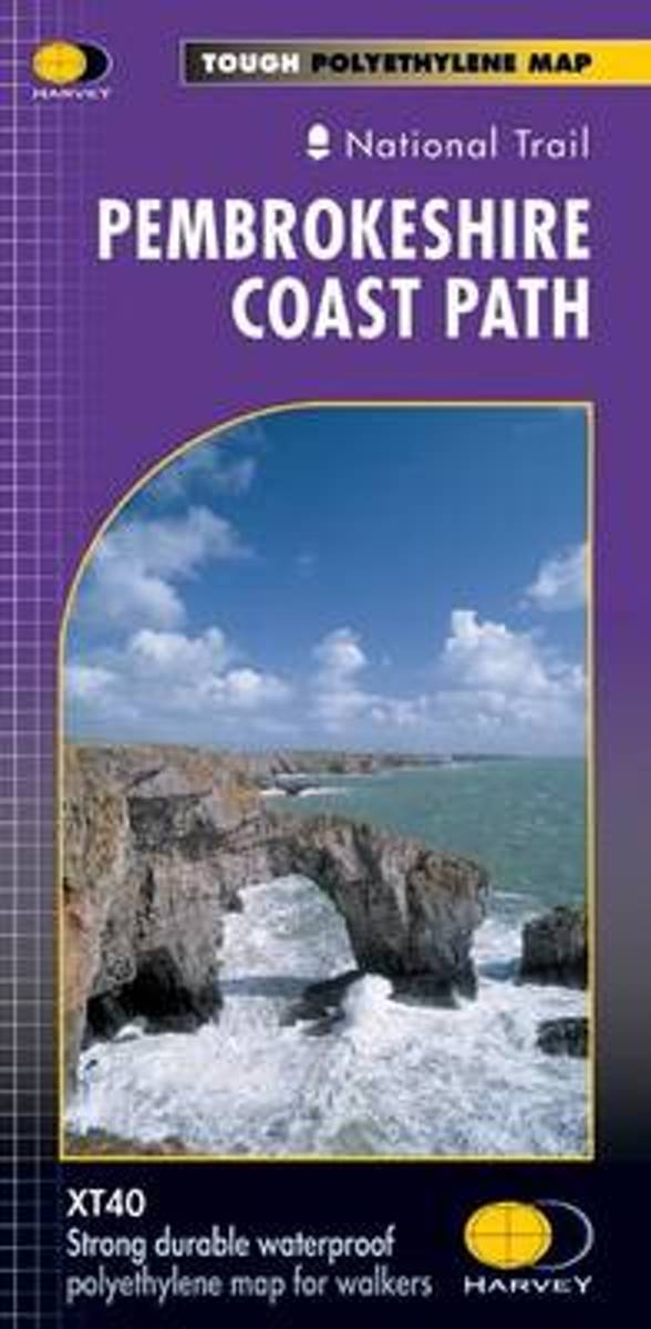
- Pembrokeshire Coast Path Harvey National Trail XT40
- Pembrokeshire Coast Path, a 265km / 165 mile section of the Wales Coast Path, presented at 1:40,000 on a light, waterproof and tear-resistant map from Harvey Map Services. The route is shown on nine panels.Maps in the Harvey’s series covering Great Britain’s national trails and other long-distance footpaths are printed on light, waterproof and... Leer más
- Also available from:
- Bol.com, Netherlands
- Bol.com, Belgium
Bol.com
Netherlands
Netherlands
- Pembroke Coast Path XT40
- Pembrokeshire Coast Path, a 265km / 165 mile section of the Wales Coast Path, presented at 1:40,000 on a light, waterproof and tear-resistant map from Harvey Map Services. The route is shown on nine panels.Maps in the Harvey Leer más
Bol.com
Belgium
Belgium
- Pembroke Coast Path XT40
- Pembrokeshire Coast Path, a 265km / 165 mile section of the Wales Coast Path, presented at 1:40,000 on a light, waterproof and tear-resistant map from Harvey Map Services. The route is shown on nine panels.Maps in the Harvey Leer más
Stanfords
United Kingdom
2017
United Kingdom
2017
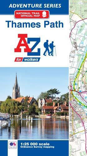
- Thames Path A-Z Adventure Atlas
- The A-Z Adventure series features the accuracy and quality of Ordnance Survey`s Explorer mapping in a convenient book, therefore eliminating the need to fold and re-fold a large sheet map to the desired area. OS Explorer is Ordnance Survey`s most detailed mapping at a scale of 1:25 000 showing public rights of way, open access land, national... Leer más
- Also available from:
- Bol.com, Netherlands
- Bol.com, Belgium
Bol.com
Netherlands
2017
Netherlands
2017
- Thames Path Adventure Atlas
- The A-Z Adventure series features the accuracy and quality of Ordnance Survey`s Explorer mapping in a convenient book, therefore eliminating the need to fold and re-fold a large sheet map to the desired area. OS Explorer is Ordnance Survey`s most detailed mapping at a scale of 1:25 000 showing public rights of way, open access land, national... Leer más
Bol.com
Belgium
2017
Belgium
2017
- Thames Path Adventure Atlas
- The A-Z Adventure series features the accuracy and quality of Ordnance Survey`s Explorer mapping in a convenient book, therefore eliminating the need to fold and re-fold a large sheet map to the desired area. OS Explorer is Ordnance Survey`s most detailed mapping at a scale of 1:25 000 showing public rights of way, open access land, national... Leer más

Stanfords
United Kingdom
United Kingdom
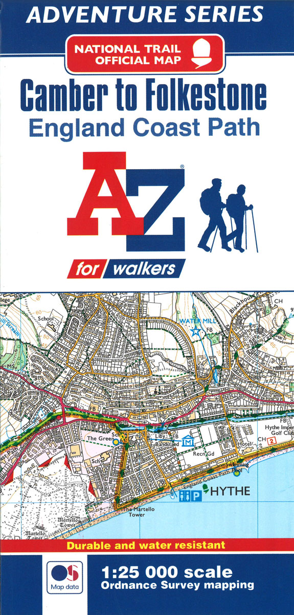
- England Coast Path - Camber to Folkestone Adventure Map
- The A-Z Adventure Series of maps combines the best of OS and A-Z, creating the perfect companion for walkers, off-road cyclists, horse riders and anyone wishing to explore the great outdoors.This official Camber to Folkestone Adventure Map section of the England Coast Path, a new National Trail around England`s coast. More than just a path, it... Leer más
- Also available from:
- Bol.com, Netherlands
- Bol.com, Belgium
Bol.com
Netherlands
Netherlands
- England Coast Path Camber to Folkestone Adventure Map
- The A-Z Adventure Series of maps combines the best of OS and A-Z, creating the perfect companion for walkers, off-road cyclists, horse riders and anyone wishing to explore the great outdoors.This official Camber to Folkestone Adventure Map section of the England Coast Path, a new National Trail around England`s coast. More than just a path, it... Leer más
Bol.com
Belgium
Belgium
- England Coast Path Camber to Folkestone Adventure Map
- The A-Z Adventure Series of maps combines the best of OS and A-Z, creating the perfect companion for walkers, off-road cyclists, horse riders and anyone wishing to explore the great outdoors.This official Camber to Folkestone Adventure Map section of the England Coast Path, a new National Trail around England`s coast. More than just a path, it... Leer más