Euskadi
Descripción
Autonomous region in the north of Spain.
Senderos en estado
Enlaces
Datos
Informes
Guías y mapas
Hospedaje
Organizaciones
Operadores turísticos
GPS
Otro
Libros


The Book Depository
United Kingdom
United Kingdom

The Book Depository
United Kingdom
United Kingdom
- 400 Kilometer rückwärts auf dem Camino del Norte
- Allein & off-season von Ribadeo nach Bilbao Leer más


Stanfords
United Kingdom
United Kingdom
- Purbeck & South Dorset - Poole, Dorchester - Weymouth & Swanage OS Explorer Active Map OL15 (waterproof)
- Purbeck and the southern part of Dorset on a detailed topographic and GPS compatible map OL15, waterproof version, from the Ordnance Survey’s 1:25,000 Explorer series. Coverage extends from Poole and Swanage in the east to Bridport in the west, and includes Dorchester, Tolpuddle, Bere Regis, Wareham, Weymouth, Chesil Beach, Portland Bill, the... Leer más
- Also available from:
- The Book Depository, United Kingdom

The Book Depository
United Kingdom
United Kingdom


The Book Depository
United Kingdom
2019
United Kingdom
2019
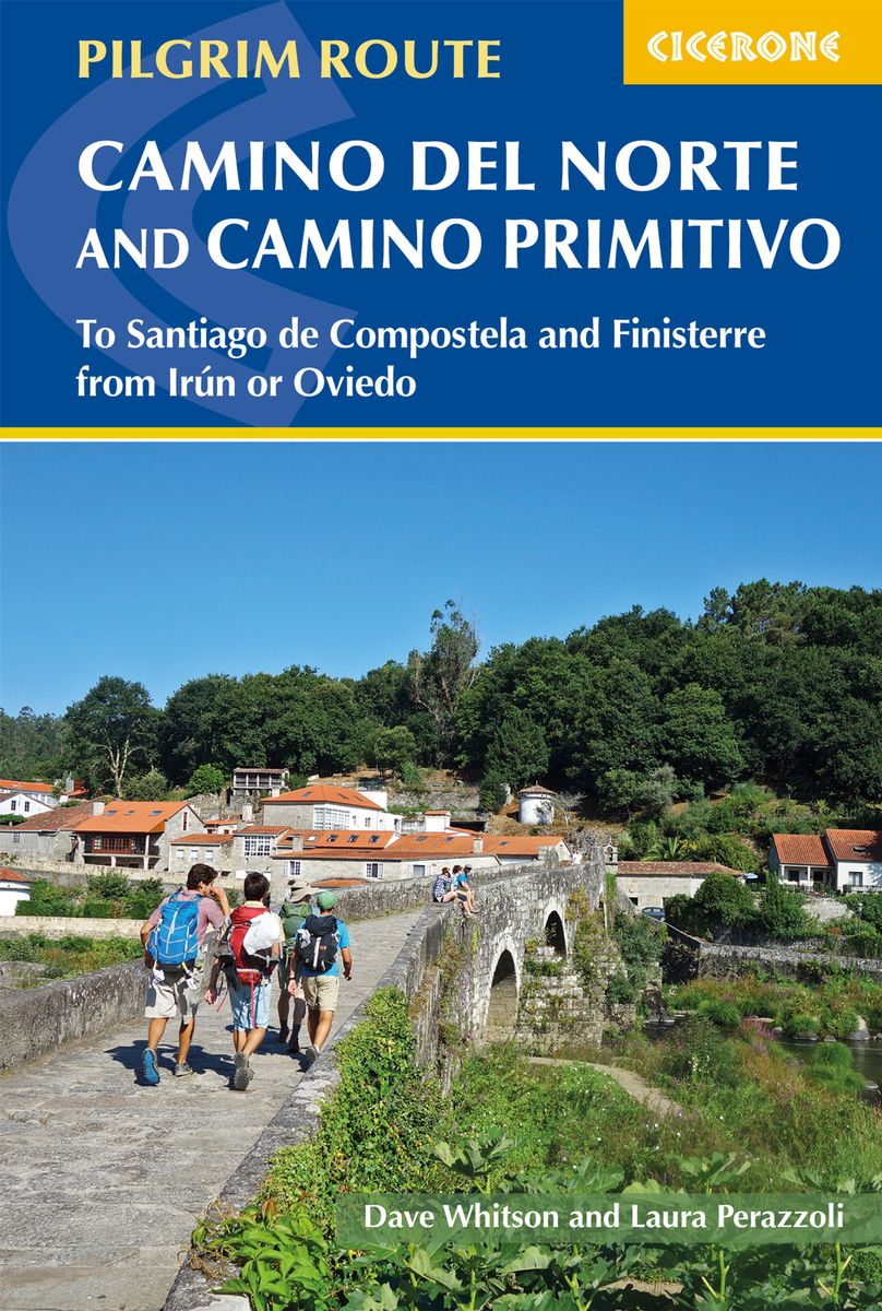
- The Camino del Norte and Camino Primitivo
- To Santiago de Compostela and Finisterre from Irun or Oviedo Leer más
- Also available from:
- De Zwerver, Netherlands
De Zwerver
Netherlands
2019
Netherlands
2019
- Wandelgids - Pelgrimsroute The Camino del Norte and Camino Primitivo | Cicerone
- Guidebook to walking the Camino del Norte and Camino Primitivo pilgrim routes to Santiago de Compostela in northwest Spain. The 817km Camino del Norte from Irún via Bilbao and Santander takes around 5 weeks to complete. The 355km Camino Primitivo takes about 2 weeks. Includes the Camino Finisterre from Santiago to the coast. Leer más

The Book Depository
United Kingdom
2023
United Kingdom
2023
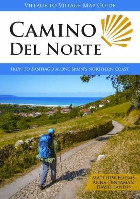
- Camino del Norte
- Irun to Santiago along Spain's Northern Coast Leer más
- Also available from:
- De Zwerver, Netherlands
De Zwerver
Netherlands
2023
Netherlands
2023
- Wandelgids Camino Del Norte | Village to Village Press
- Irun to Santiago along Spain's Northern Coast Leer más

- Also available from:
- De Zwerver, Netherlands
Bol.com
Netherlands
Netherlands
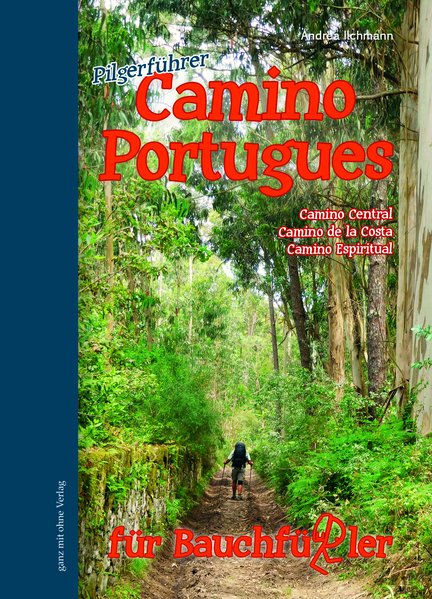
- Camino Portugues für Bauchfüßler
- Camino Central, Camino de la Costa, Camino Espiritual Leer más
- Also available from:
- Bol.com, Belgium
Bol.com
Belgium
Belgium
- Camino Portugues für Bauchfüßler
- Camino Central, Camino de la Costa, Camino Espiritual Leer más
Bol.com
Netherlands
Netherlands
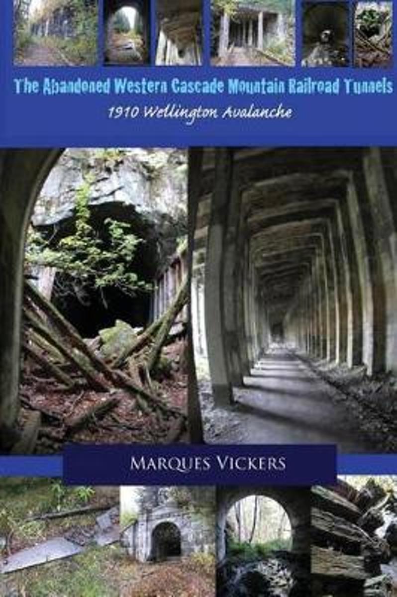
- The Abandoned Western Cascade Mountain Railroad Tunnels
- The creation of the train routes through the Western Washington Cascade Mountains proved a monumental challenge. The conflict arose between the engineering capabilities of man and the treacherous topography and inclimate weather of the region. The nine miles of track connecting the towns of Stevens Pass, Wellington and Scenic, Washington... Leer más
- Also available from:
- Bol.com, Belgium
Bol.com
Belgium
Belgium
- The Abandoned Western Cascade Mountain Railroad Tunnels
- The creation of the train routes through the Western Washington Cascade Mountains proved a monumental challenge. The conflict arose between the engineering capabilities of man and the treacherous topography and inclimate weather of the region. The nine miles of track connecting the towns of Stevens Pass, Wellington and Scenic, Washington... Leer más
Bol.com
Netherlands
Netherlands
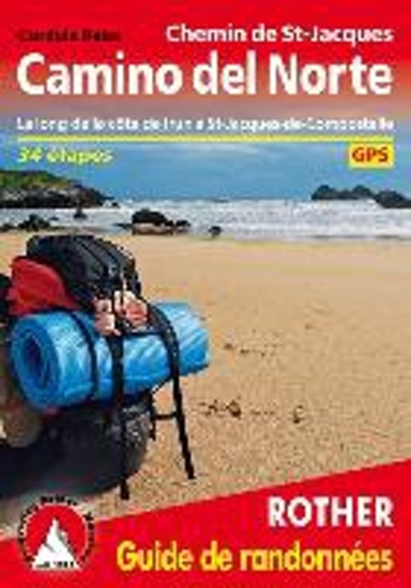
- Camino del Norte (französische Ausgabe)
- Le Chemin de St-Jacques le long de la côte d'Irun à St-Jacques-de-Compostelle. 34 étapes. GPS-Tracks Leer más
- Also available from:
- Bol.com, Belgium
Bol.com
Belgium
Belgium
- Camino del Norte (französische Ausgabe)
- Le Chemin de St-Jacques le long de la côte d'Irun à St-Jacques-de-Compostelle. 34 étapes. GPS-Tracks Leer más
Bol.com
Netherlands
2018
Netherlands
2018
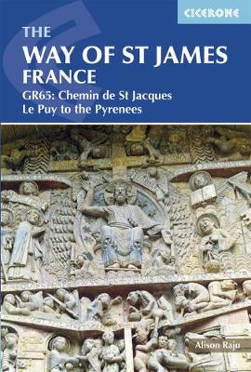
- The Way of St James - Le Puy to the Pyrenees
- This comprehensive guidebook describes the Way of St James (Camino de Santiago) pilgrim route through France. Also known as the Chemin de St Jacques or GR65, the 730km (454 mile) route runs from Le Puy-en-Velay in central France to Saint-Jean-Pied-de-Port in the Pyrenees. People have been walking it as a pilgrimage route for over 1000 years,... Leer más
- Also available from:
- Bol.com, Belgium
Bol.com
Belgium
2018
Belgium
2018
- The Way of St James - Le Puy to the Pyrenees
- This comprehensive guidebook describes the Way of St James (Camino de Santiago) pilgrim route through France. Also known as the Chemin de St Jacques or GR65, the 730km (454 mile) route runs from Le Puy-en-Velay in central France to Saint-Jean-Pied-de-Port in the Pyrenees. People have been walking it as a pilgrimage route for over 1000 years,... Leer más

Stanfords
United Kingdom
United Kingdom
- Purbeck & South Dorset - Poole, Dorchester - Weymouth & Swanage OS Explorer Map OL15 (paper)
- Purbeck and the southern part of Dorset on a detailed topographic and GPS compatible map OL15, paper version, from the Ordnance Survey’s 1:25,000 Explorer series. Coverage extends from Poole and Swanage in the east to Bridport in the west, and includes Dorchester, Tolpuddle, Bere Regis, Wareham, Weymouth, Chesil Beach, Portland Bill, the final... Leer más
- Also available from:
- The Book Depository, United Kingdom
- Bol.com, Netherlands
- Bol.com, Belgium
- De Zwerver, Netherlands

The Book Depository
United Kingdom
United Kingdom

Bol.com
Netherlands
Netherlands
- Purbeck & South Dorset, Poole, Dorchester, Weymouth & Swanage
- OS Explorer is the Ordnance Survey's most detailed map and is recommended for anyone enjoying outdoor activities like walking, horse riding and off-road cycling. The OS Explorer range of OL maps now includes a digital version of the paper map, accessed through the OS smartphone app, OS Maps. Providing complete GB coverage the series details... Leer más
Bol.com
Belgium
Belgium
- Purbeck & South Dorset, Poole, Dorchester, Weymouth & Swanage
- OS Explorer is the Ordnance Survey's most detailed map and is recommended for anyone enjoying outdoor activities like walking, horse riding and off-road cycling. The OS Explorer range of OL maps now includes a digital version of the paper map, accessed through the OS smartphone app, OS Maps. Providing complete GB coverage the series details... Leer más

De Zwerver
Netherlands
Netherlands
Mapas

Stanfords
United Kingdom
United Kingdom
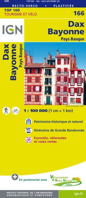
- Dax - Bayonne - Pays Basque IGN TOP100 166
- Discover the new double-sided laminated edition of TOP100 road maps of France from the Institut Géographique National (IGN); exceptionally detailed, contoured road maps which include the cycle paths and greenways of the AF3V (French Association for the Development of Cycle Paths and Greenways), ideal for exploring the French countryside by car,... Leer más
- Also available from:
- De Zwerver, Netherlands
De Zwerver
Netherlands
2023
Netherlands
2023

Stanfords
United Kingdom
2015
United Kingdom
2015
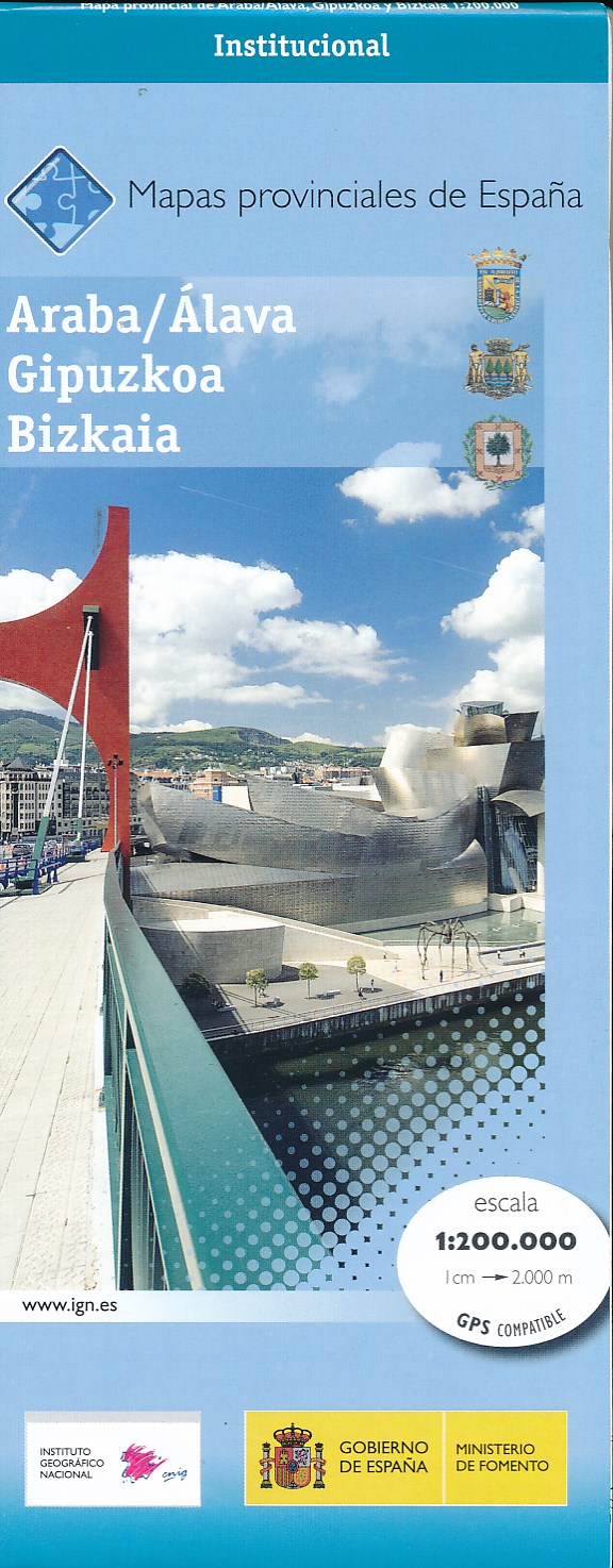
- Araba/Alava, Guipuzcoa & Vizcaya Provinces 200K CNIG Map No. 1
- Contoured, GPS-compatible, indexed road map at 1:200,000 from CNIG - Spain’s civilian survey organization, with exceptionally informative presentation of the landscape and highlighting for facilities and places of interest including campsites and paradors.Maps in CNIG’s 200K Provincial Series provide an excellent picture the topography through... Leer más
- Also available from:
- De Zwerver, Netherlands
De Zwerver
Netherlands
2015
Netherlands
2015
- Wegenkaart - landkaart Mapa Provincial Alava Guipuzcoa Vizcaya | CNIG - Instituto Geográfico Nacional
- Contoured, GPS-compatible, indexed road map at 1:200,000 from CNIG - Spain’s civilian survey organization, with exceptionally informative presentation of the landscape and highlighting for facilities and places of interest including campsites and paradors.Maps in CNIG’s 200K Provincial Series provide an excellent picture the topography through... Leer más
De Zwerver
Netherlands
2017
Netherlands
2017
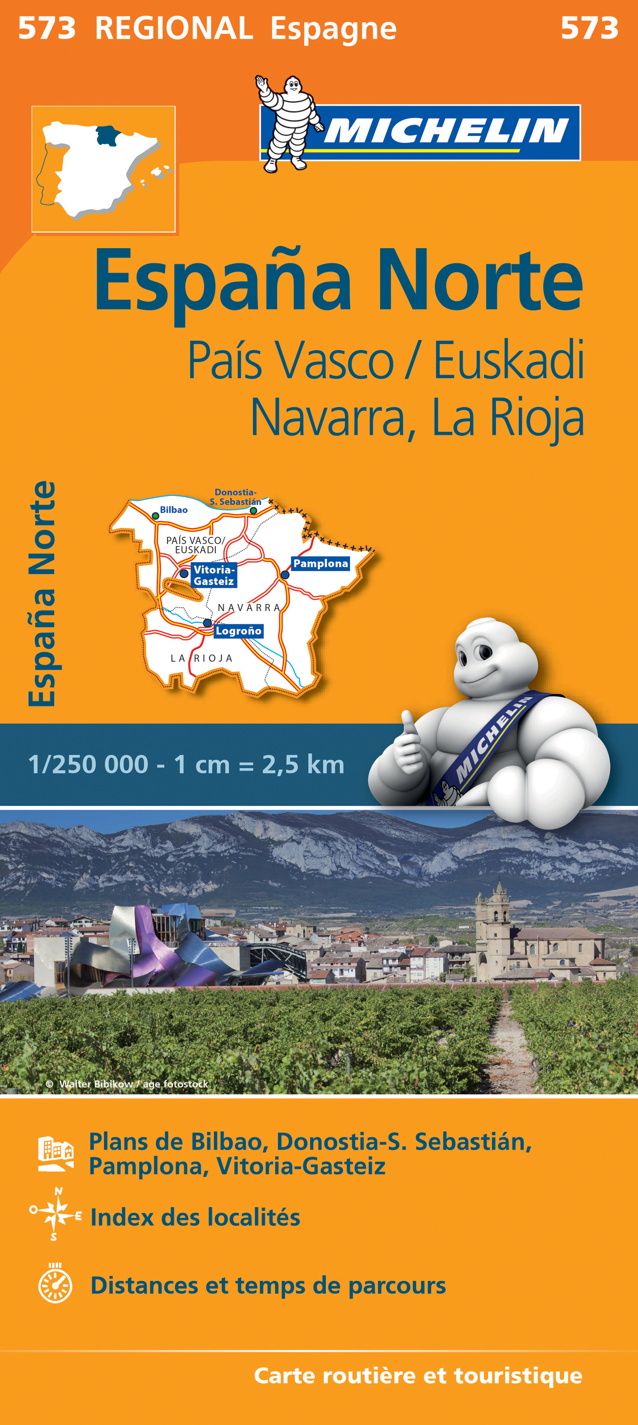
De Zwerver
Netherlands
Netherlands
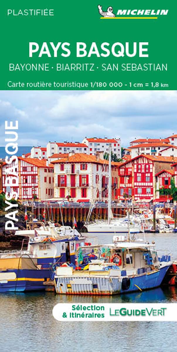
- Wegenkaart - landkaart 573 Pais Vasco - Euskadi - Navarra -La Rioja - Pamplona - Baskenland | Michelin
- Une carte fiable pour parcourir les régions d'Europe Leer más
Más mapas…