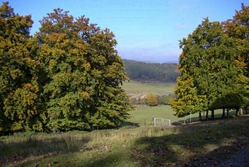
Rhein-Kyll-Weg
Descripción
- Name Rhein-Kyll-Weg (HWW14)
- Distancia de sendero 124 km, 77 millas
- Duración en días 6 días
- Inicio de sendero Weißenthurm
- Fin de sendero Kronenburg
- Clasificación Traildino EW, Paseo fácil, sendero en la naturaleza
Rhein-Kyll-Weg, Hauptwanderweg 14 Eifelverein, HWW14, Weißenthurm - Stadtkyll – Kronenburg, 124 km, 6 days
This is an east-west trail (Hauptwanderweg, HWW) maintained by the Eifelverein, running through the Eifel in the West of Germany bordering with belgium and Luxembourg. The trail connects the river Rhine, via the Nettetal, Nitztal and Kylltal till the village of Kronenburg.
Select some tracks
☐Hocheifelweg, 25km


