
Bayern
Descripción
Senderos en estado
- AlemannenwegGPX
- Alpen Weitwanderweg
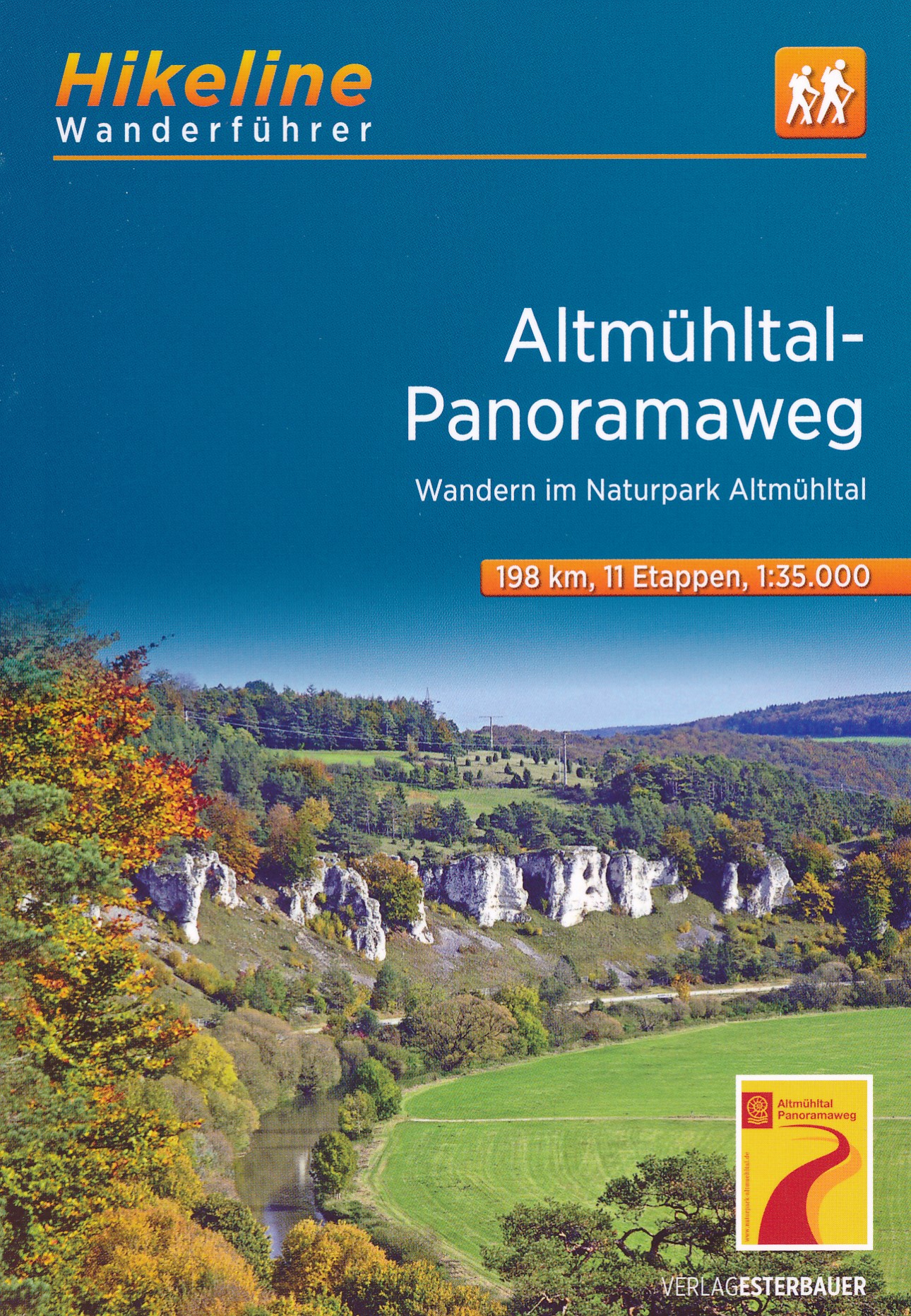
- Altmühltal PanoramawegGPX
- Badener Weg
- BöhmwegGPX
- Bodensee RundwegGPX
- BurgenwegGPX
- Burgundenweg
- DonausteigGPX
- E6GPX
- E8GPX
- ErzwegGPX
- EselswegGPX
- Europäische Wasserscheideweg
- FrankenwegGPX
- Frankenweg (Schwäbischer Albverein)GPX
- Frankenweg Odenwald
- Fränkischer GebirgswegGPX
- Fränkischer Rotwein WanderwegGPX
- GlasschleifererwegGPX
- GoethewegGPX
- GoldsteigGPX
- GunthersteigGPX
- Höhenweg Fichtelgebirge
- Höhenweg Steinwaldweg
- Heilbronner HöhenwegGPX
- Hessenweg 3GPX
- Hessenweg 5GPX
- Hessenweg 9GPX
- HochrhönerGPX
- HohenzollernwegGPX
- JurasteigGPX
- König LudwigwegGPX
- Kelten ErlebniswegGPX
- KunigundenwegGPX
- Lech Höhenweg
- LechwegGPX
- Main-WerrawegGPX
- Maintal Höhenringweg
- MaximilianswegGPX
- NordwaldkammwegGPX
- NurtschwegGPX
- Oberallgäuer RundwanderwegGPX
- PandurensteigGPX
- PrälatenwegGPX
- Rhön HöhenwegGPX
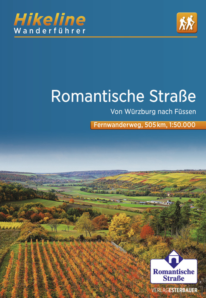
- Romantische StrasseGPX
- Schwäbisch Allgäuer WanderwegGPX
- SpessartwegGPX
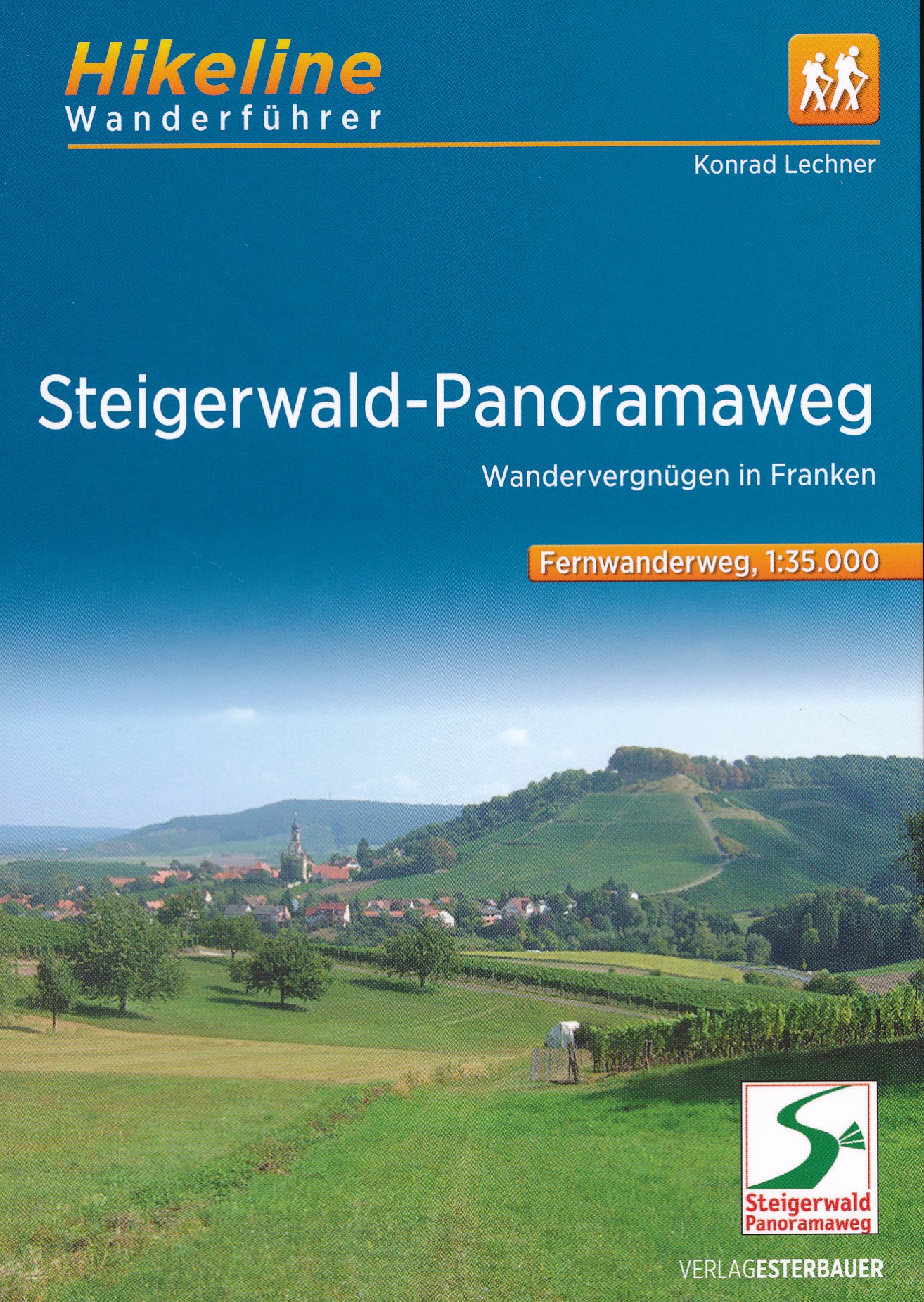
- Steigerwald PanoramawegGPX
- Stromberg-Schwäbischer Waldweg
- Traumpfad München-VenedigGPX
- Via Claudia AugustaGPX
- Westweg FichtelgebirgeGPX
- ZeugenbergrundeGPX
Enlaces
Datos
Informes
Guías y mapas
Hospedaje
Organizaciones
Operadores turísticos
GPS
Otro
Libros

Stanfords
United Kingdom
United Kingdom
- Istria Kompass 238
- Istria at 1:75,000 on a double-sided, waterproof and tear-resistant, detailed contoured map from Kompass, with hiking and cycling routes, street plans of 10 main towns, plus tourist information. Coverage extends north beyond the Croatian border to include Trieste and the coast of Slovenia. Contours at 50m intervals and spot heights present the... Leer más

Stanfords
United Kingdom
United Kingdom
- Rhön Kompass 2-Map Set 460
- Rhön region of central Germany, straddling the borders between Bavaria, Hesse and Thuringia, in a set of two detailed, contoured and GPS compatible maps at 1:50,000 from Kompass with local and long-distance footpaths, cycling routes, accommodation, etc.KOMPASS HIKING & RECREATIONAL MAPS: this title is part of an extensive series covering... Leer más

- Also available from:
- De Zwerver, Netherlands

The Book Depository
United Kingdom
2021
United Kingdom
2021
- Also available from:
- De Zwerver, Netherlands

- Also available from:
- De Zwerver, Netherlands

The Book Depository
United Kingdom
2012
United Kingdom
2012
- Bayrischer Wald Wanderfuhrer Unterwegs zwischen Donau und Bo
- Handzame gids met een goede beschrijving van een groot aantal dagtochten in dit gebied. De gids is in spiraalbinding en elke pagina is op scheur- en watervast papier gedrukt. Daar is echt over nagedacht! Treckencharakteristik Länge, Höhenmeter und Touren Die Tourenauswahl in diesem Buch stellt Ihnen neben den Top-Touren auf die höchsten Berge... Leer más
- Also available from:
- De Zwerver, Netherlands
.jpg)
De Zwerver
Netherlands
2012
Netherlands
2012
- Wandelgids Hikeline Bayerischer Wald | Esterbauer
- Handzame gids met een goede beschrijving van een groot aantal dagtochten in dit gebied. De gids is in spiraalbinding en elke pagina is op scheur- en watervast papier gedrukt. Daar is echt over nagedacht! Treckencharakteristik Länge, Höhenmeter und Touren Die Tourenauswahl in diesem Buch stellt Ihnen neben den Top-Touren auf die höchsten Berge... Leer más
De Zwerver
Netherlands
2022
Netherlands
2022
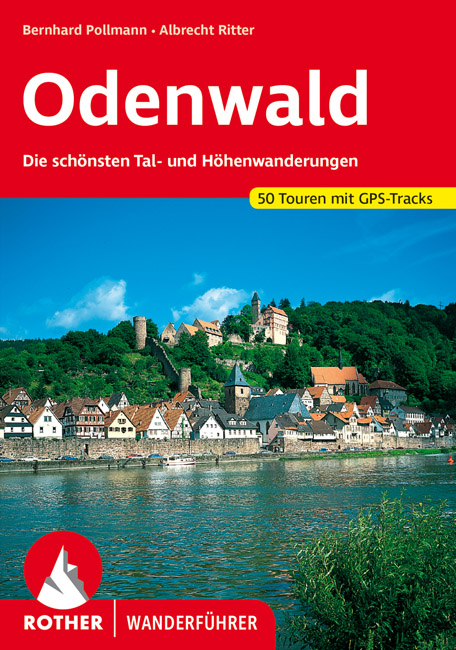
- Wandelgids Odenwald | Rother Bergverlag
- Uitstekende wandelgids met een groot aantal dagtochten in dal en hooggebergte. Met praktische informatie en beperkt kaartmateriaal! Wandelingen in verschillende zwaarte weergegeven in rood/blauw/zwart. Der Odenwald, der von der Bergstraße, dem Neckar und dem Main begrenzt wird, bietet einen reichen Schatz an Natur und Kultur. Neben den... Leer más
Bol.com
Netherlands
Netherlands
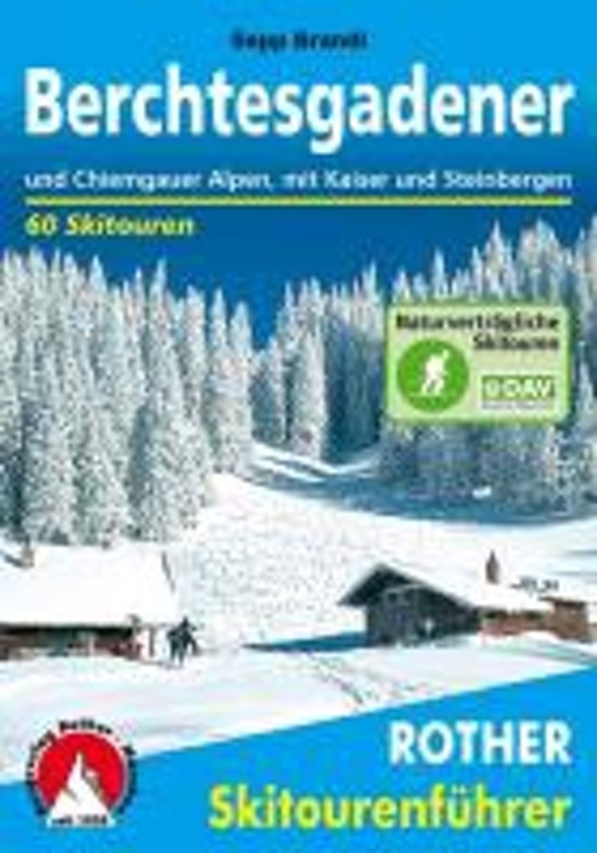
- Berchtesgadender und Chiemgauer Alpen
- Die Berge um das Dreil ndereck von Bayern, Salzburg und Tirol, bieten Skitouren f r jeden Geschmack: Hier locken die Chiemgauer und Dientner Berge mit reizvollem Almgl nde, w hrend das Kaisergebirge, die Loferer und Leoganger Steinberge sowie das Steinerne Meer die Skibergsteiger mit Fr hjahrsfirn unter grandioser Felskulisse bezaubern. In den... Leer más
- Also available from:
- Bol.com, Belgium
Bol.com
Belgium
Belgium
- Berchtesgadender und Chiemgauer Alpen
- Die Berge um das Dreil ndereck von Bayern, Salzburg und Tirol, bieten Skitouren f r jeden Geschmack: Hier locken die Chiemgauer und Dientner Berge mit reizvollem Almgl nde, w hrend das Kaisergebirge, die Loferer und Leoganger Steinberge sowie das Steinerne Meer die Skibergsteiger mit Fr hjahrsfirn unter grandioser Felskulisse bezaubern. In den... Leer más

De Zwerver
Netherlands
2011
Netherlands
2011
- Wandelgids Hikeline Rund um die Zugspitze | Esterbauer
- Handzame gids met een goede beschrijving van een groot aantal dagtochten in dit gebied. De gids is in spiraalbinding en elke pagina is op scheur- en watervast papier gedrukt. Daar is echt over nagedacht! Streckencharakteristik Länge, Höhenmeter und Etappen Die insgesamt 50 Touren dieses Buches decken eine große Bandbreite von kurzen... Leer más

Bol.com
Netherlands
2020
Netherlands
2020
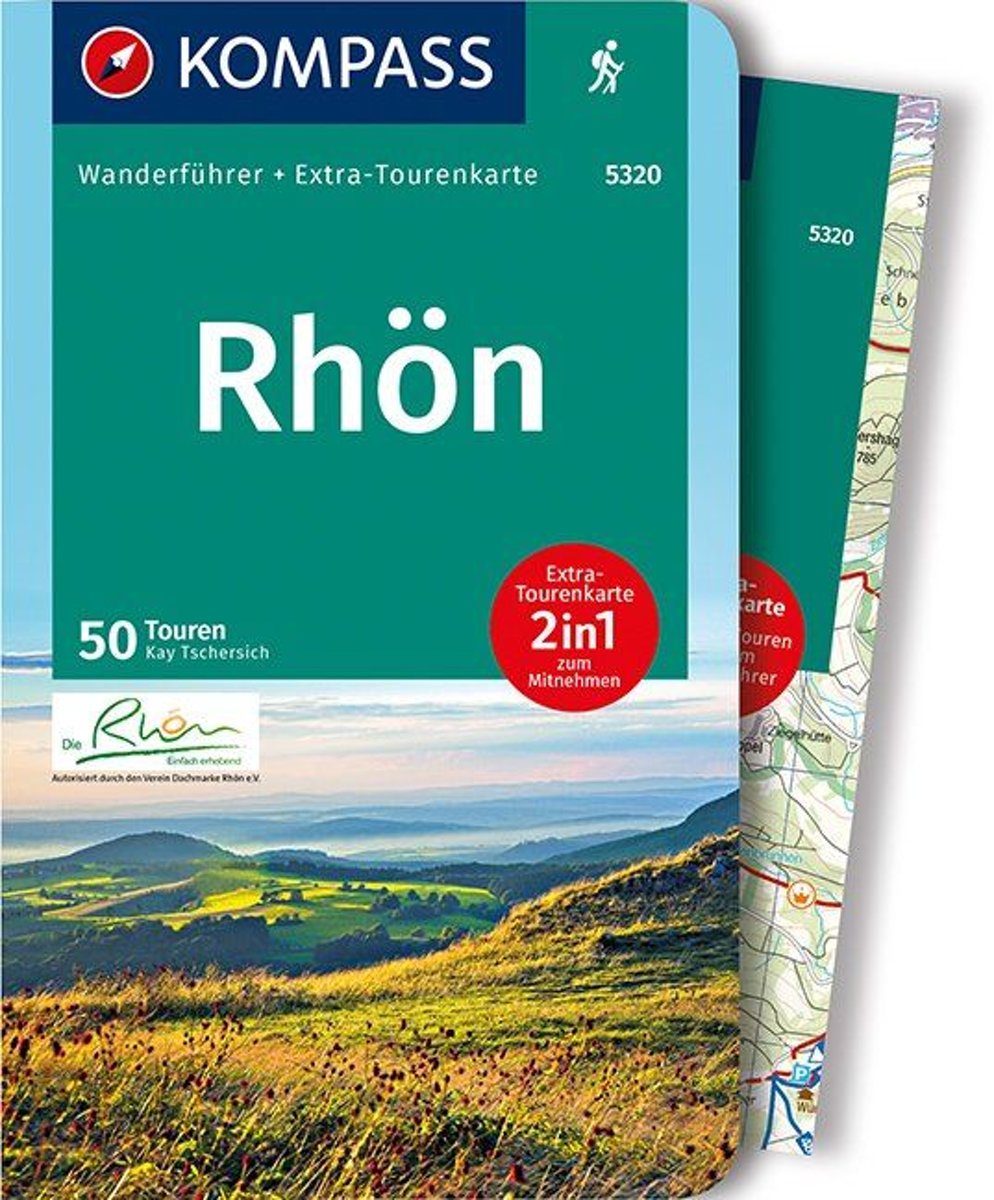
- WF5320 Rhön Kompass
- Destination:. Die Rhön ist ein faszinierend vielfältiges Mittelgebirge, das Teile der Bundesländer Bayern, Hessen und Thüringen zu einem Naturgroßraum vereint. Über die Hälfte des Gebietes ist als Biosphärenreservat ausgewiesen.. Zwischen Meiningen und Fulda gelegen, wird die Rhöner Region von den Flüssen Fulda, Fränkische Saale und Werra... Leer más
- Also available from:
- Bol.com, Belgium
Bol.com
Belgium
2020
Belgium
2020
- WF5320 Rhön Kompass
- Destination:. Die Rhön ist ein faszinierend vielfältiges Mittelgebirge, das Teile der Bundesländer Bayern, Hessen und Thüringen zu einem Naturgroßraum vereint. Über die Hälfte des Gebietes ist als Biosphärenreservat ausgewiesen.. Zwischen Meiningen und Fulda gelegen, wird die Rhöner Region von den Flüssen Fulda, Fränkische Saale und Werra... Leer más
De Zwerver
Netherlands
2012
Netherlands
2012
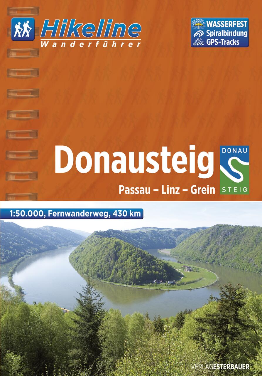
- Wandelgids Hikeline Donausteig | Esterbauer
- Handzame gids met een goede beschrijving van een meerdaagse tocht in dit gebied. De gids is in spiraalbinding en elke pagina is op scheur- en watervast papier gedrukt. Daar is echt over nagedacht! Der im Sommer 2010 neu eröffnete Donausteig startet im bayerisch-oberösterreichischen Grenzgebiet in der Drei-Flüsse-Stadt Passau und verläuft... Leer más
De Zwerver
Netherlands
2021
Netherlands
2021
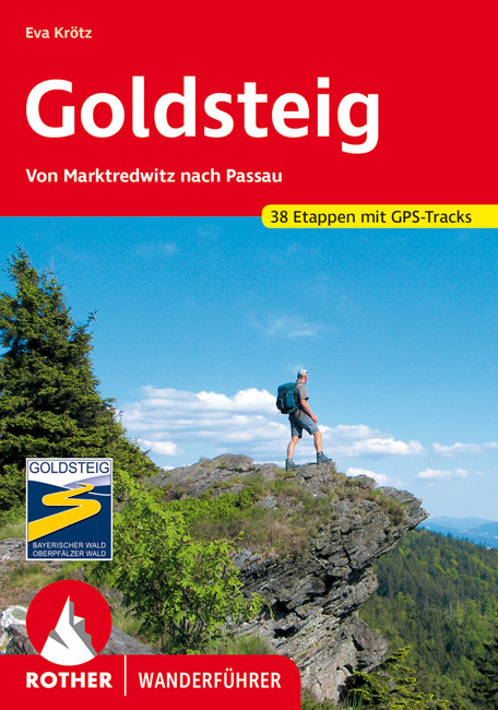
- Wandelgids 118 Goldsteig - Von Marktredwitz nach Passau | Rother Bergverlag
- Uitstekende wandelgids van de Goldsteig route in 38 etappes, van Marktredwitz naar Passau. Met voldoende en duidelijke informatie en goed kaartmateriaal. 200 Seiten mit 100 Farbabbildungen, 38 Höhenprofile, 38 Wanderkärtchen im Maßstab 1:75.000, eine Übersichtskarte Im August 2007 ist der Startschuss für den neuen, rund 660 km langen... Leer más
Más libros…
Mapas

Stanfords
United Kingdom
United Kingdom
- Mostviertel - Strudengau - Donauland - Amstetten - Waidhofen a.d. Ybbs - Steyr F&B WK052
- Mostviertel - Strudengau - Donauland - Amstetten - Waidhofen a.d. Ybbs - Steyr area of eastern Austria presented at 1:50,000 in a series of contoured and GPS compatible outdoor leisure map from Freytag & Berndt with hiking and cycling routes, mountain huts, campsites and youth hostels, local bus stops, plus other tourist information.To see the... Leer más

Stanfords
United Kingdom
United Kingdom
- Zell am See - Kaprun - Saalbach F&B WK382
- Zell-am-See - Kaprun - Saalbach area of the Austrian Alps presented at 1:50,000 in a series of contoured and GPS compatible outdoor leisure map from Freytag & Berndt with hiking and cycling routes, mountain huts, campsites and youth hostels, local bus stops, plus other tourist information. To see the list of currently available titles in this... Leer más

Stanfords
United Kingdom
United Kingdom
- Thermenregion Innviertel - Imber Moor - Kobernausserwald - Braunau - Burghausen - Marktl F&B WK431
- Thermenregion Innviertel - Imber Moor - Kobernausserwald - Braunau - Burghausen – Marktl area of central Austria presented at 1:50,000 in a series of contoured and GPS compatible outdoor leisure map from Freytag & Berndt with hiking and cycling routes, mountain huts, campsites and youth hostels, local bus stops, plus other tourist information.... Leer más

Stanfords
United Kingdom
United Kingdom
- Central Rhodopes / Rodopi Geopsis 132
- Central Rhodopes Mountains on the border of north-eastern Greece and Bulgaria on a waterproof and tear-resistant, contoured and GPS compatible map from Geopsis highlighting nine recommended hiking trails and the local section of the E6 cross-Europe long-distance route. All place names are in both Greek and Latin alphabet, with several villages... Leer más

Stanfords
United Kingdom
United Kingdom
- Danube Cycle Trail - Passau - Eferding - Sauwald - Schärding F&B WK432
- Danube Cycle Trail: Passau - Eferding - Sauwald – Schärding area of central Austria presented at 1:50,000 in a series of contoured and GPS compatible outdoor leisure map from Freytag & Berndt with hiking and cycling routes, mountain huts, campsites and youth hostels, local bus stops, plus other tourist information. To see the list of currently... Leer más

Stanfords
United Kingdom
United Kingdom
- Hohe Wand - Schneebergland - Gutenstein Alps - Piestingtal - Lilienfeld F&B WK012
- Hohe Wand - Piestingtal - Triestingtal - Gölsental - Gutensteier Alpen – Lilienfeld area south-west of Vienna presented at 1:50,000 in a series of contoured and GPS compatible outdoor leisure map from Freytag & Berndt with hiking and cycling routes, mountain huts, campsites and youth hostels, local bus stops, plus other tourist information.To... Leer más

Stanfords
United Kingdom
United Kingdom
- Eastern Rhodopes / Rodopi Geopsis 131
- Eastern Rhodopes Mountains on the border of north-eastern Greece and Bulgaria on a waterproof and tear-resistant, contoured and GPS compatible map from Geopsis highlighting nine recommended hiking trails and the local section of the E6 cross-Europe long-distance route. All place names are in both Greek and Latin alphabet, with several villages... Leer más

Stanfords
United Kingdom
United Kingdom
- Western Rhodopes / Rodopi - Falakro Geopsis 133
- Central Rhodopes Mountains on the border of north-eastern Greece and Bulgaria on a waterproof and tear-resistant, contoured and GPS compatible map from Geopsis highlighting nine recommended hiking trails and the local section of the E6 cross-Europe long-distance route. All place names are in both Greek and Latin alphabet, with several villages... Leer más

Stanfords
United Kingdom
United Kingdom
- Bohemian Forest - Mühlviertel - Lipno Dam F&B WK262
- Bohemian Forest - Mühlviertel - Moldau/Vltava Reservoir area straddling the border of Austria, Czech Republic and Germany presented at 1:50,000 in a series of contoured and GPS compatible outdoor leisure map from Freytag & Berndt with hiking and cycling routes, mountain huts, campsites and youth hostels, local bus stops, plus other tourist... Leer más

Stanfords
United Kingdom
United Kingdom
- Naturpark Frankenhohe
- Frankenhöhe Regional Park, map no. 50-17 covering an area around Rothenburg ob der Tauber and Ansbach, in a series of special contoured and GP-compatible recreational maps from the Bavarian state survey organization, with cartography of the German topographic survey at 1:50,000 and extensive additional tourist overprint highlighting waymarked... Leer más

Stanfords
United Kingdom
United Kingdom
- Uffenheim F06
- Uffenheim in a series of GPS compatible recreational editions of the Bavarian topographic survey at 1:25,000, with waymarked hiking trails and cycling routes, campsites and youth hostels, etc. Coverage includes Iphofen, Markt Einersheim, Mainbernheim, Ippesheim, Markt Bibart, Sugenheim.Contours used in this map vary between 5 to 20m according... Leer más

Stanfords
United Kingdom
United Kingdom
- Munich North N11
- Munich Nord in a series of GPS compatible recreational editions of the Bavarian topographic survey at 1:25,000, with waymarked hiking trails and cycling routes, campsites and youth hostels, etc. Coverage includes Dachau, Oberschleißheim, Garching b.München, Karlsfeld, Unterschleißheim, Eching.Contours used in this map vary between 5 to 20m... Leer más
Stanfords
United Kingdom
United Kingdom
- Regen
- Regen in a series of GPS compatible recreational editions of the Bavarian topographic survey at 1:25,000, with waymarked hiking trails and cycling routes, campsites and youth hostels, etc. Coverage includes Bischofsmais, Frauenau, Kirchberg i.Wald, Rinchnach, Schönberg, Zwiesel.Contours used in this map vary between 5 to 20m according to the... Leer más
Stanfords
United Kingdom
United Kingdom
- Neunburg vorm Wald H15
- Neunburg vorm Wald in a series of GPS compatible recreational editions of the Bavarian topographic survey at 1:25,000, with waymarked hiking trails and cycling routes, campsites and youth hostels, etc. Coverage includes Roding, Schönthal, Rötz, Neukirchen-Balbini, Stamsried, Pemfling.Contours used in this map vary between 5 to 20m according to... Leer más

Stanfords
United Kingdom
United Kingdom
- Fichtelgebirge Regional Park West
- The western part of the Fichtelgebirge Regional Park, map no. 50-12 covering an area around Bayreuth, Wunsiedel, Kemnath and Münchberg, in a series of special contoured and GP-compatible recreational maps from the Bavarian state survey organization, with cartography of the German topographic survey at 1:50,000 and extensive additional tourist... Leer más