
Odenwald
Descripción
A highland area in Hessen, Bayern and baden-Württemberg.
Senderos en región
Enlaces
Datos
Informes
Guías y mapas
Hospedaje
Organizaciones
Operadores turísticos
GPS
Otro
Libros
De Zwerver
Netherlands
2012
Netherlands
2012
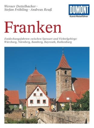
- Reisgids Kunstreiseführer Franken | Dumont
- Für Kunstliebhaber und Geschichtsinteressierte ist die Region im Norden Bayerns dank ihrer Fülle an herausragenden Sehenswürdigkeiten ein kleines Juwel. Allein die von der Bau- und Handwerkskunst vieler Jahrhunderte geprägten Städte wie Nürnberg, Bamberg, Bayreuth, Coburg, Würzburg oder Rothenburg rechtfertigen einen Besuch. Eingebettet sind... Leer más
De Zwerver
Netherlands
2020
Netherlands
2020

De Zwerver
Netherlands
2015
Netherlands
2015
- Wandelgids Nibelungensteig | Conrad Stein Verlag
- OutdoorHandbuch. 1. Auflage. Leer más

De Zwerver
Netherlands
2017
Netherlands
2017
- Wandelgids 411 Kautokeino - Nordkap E1 | Conrad Stein Verlag
- Handzaam boekje met de routebeschrijving inclusief een heleboel praktische informatie. De beschrijving is uitstekend, maar kaarten zijn wat beperkt. Duits. Die 330 km lange Wanderung auf dem E1 von Kautokeino zum Nordkap ist ein unvergessliches Wanderabenteuer. In 15 Etappen laufen Sie durch die Wildnis Nordnorwegens und überqueren die... Leer más


Bol.com
Netherlands
Netherlands
- Hessens Schl sser und Burgen
- Die Landschaften Hessens zwischen Rhein, Schiefergebirge, Weserbergland, Werra, Rh n, Spessart und Odenwald k nnen auf eine lange Geschichte zur ckblicken. Im Verh ltnis zur Gr e des Bundeslandes ist die Anzahl der Burgruinen hier erstaunlich hoch, was darauf schlie en l sst, dass der Burgenbau in dieser Region bereits vom fr hen Mittelalter... Leer más
- Also available from:
- Bol.com, Belgium
Bol.com
Belgium
Belgium
- Hessens Schl sser und Burgen
- Die Landschaften Hessens zwischen Rhein, Schiefergebirge, Weserbergland, Werra, Rh n, Spessart und Odenwald k nnen auf eine lange Geschichte zur ckblicken. Im Verh ltnis zur Gr e des Bundeslandes ist die Anzahl der Burgruinen hier erstaunlich hoch, was darauf schlie en l sst, dass der Burgenbau in dieser Region bereits vom fr hen Mittelalter... Leer más


Bol.com
Netherlands
Netherlands
- Geo Naturpark Bergstrasse, Odenwald WK764
- Deze Kompass wandelkaart, schaal 1:75 000, is ideaal om uw route uit te stippelen en om onderweg te gebruiken • naast de bekende bestemmingen, worden ook de minder bekende vermeld • openbaar vervoer bij begin- of eindpunt van een route aangegeven • eenvoudige wandelingen tot pittige (berg)tochten, voor getrainde en ongetrainde wandelaars • met... Leer más
- Also available from:
- Bol.com, Belgium
Bol.com
Belgium
Belgium
- Geo Naturpark Bergstrasse, Odenwald WK764
- Deze Kompass wandelkaart, schaal 1:75 000, is ideaal om uw route uit te stippelen en om onderweg te gebruiken • naast de bekende bestemmingen, worden ook de minder bekende vermeld • openbaar vervoer bij begin- of eindpunt van een route aangegeven • eenvoudige wandelingen tot pittige (berg)tochten, voor getrainde en ongetrainde wandelaars • met... Leer más

De Zwerver
Netherlands
2021
Netherlands
2021
De Zwerver
Netherlands
2022
Netherlands
2022
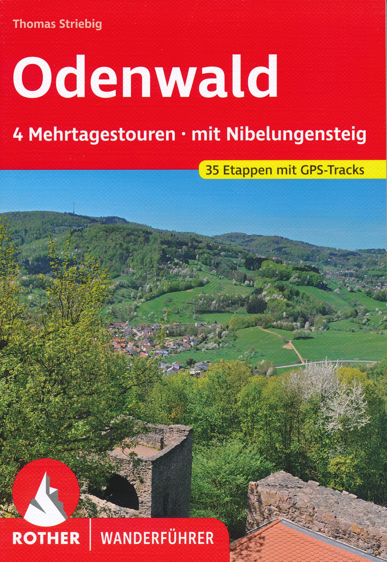
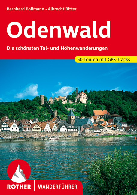
- Wandelgids Odenwald | Rother Bergverlag
- Uitstekende wandelgids met een groot aantal dagtochten in dal en hooggebergte. Met praktische informatie en beperkt kaartmateriaal! Wandelingen in verschillende zwaarte weergegeven in rood/blauw/zwart. Der Odenwald, der von der Bergstraße, dem Neckar und dem Main begrenzt wird, bietet einen reichen Schatz an Natur und Kultur. Neben den... Leer más
Bol.com
Netherlands
Netherlands
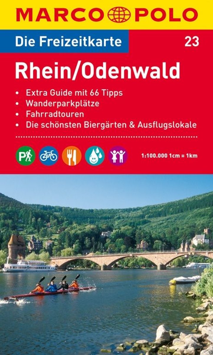
- Marco Polo FZK23 Rijn - Odenwald
- Een kaart en een reisgids in een handige omslag van stevig plastic, Op de kaart worden bezienswaardigheden aangegeven en heel kort beschreven met een afbeelding erbij, In de gids is de gedetailleerde informatie te vinden, Ook de op de kaart gemarkeerde wandel- en fietstochten worden in de gids beschreven, Door de gebruikte kleuren is alle... Leer más
- Also available from:
- Bol.com, Belgium
Bol.com
Belgium
Belgium
- Marco Polo FZK23 Rijn - Odenwald
- Een kaart en een reisgids in een handige omslag van stevig plastic, Op de kaart worden bezienswaardigheden aangegeven en heel kort beschreven met een afbeelding erbij, In de gids is de gedetailleerde informatie te vinden, Ook de op de kaart gemarkeerde wandel- en fietstochten worden in de gids beschreven, Door de gebruikte kleuren is alle... Leer más

Bol.com
Netherlands
Netherlands
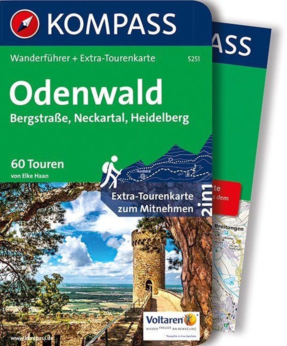
- WF5251 Odenwald Kompass
- Destination:. Der Odenwald liegt zwischen Rhein, Main und Neckar in den Bundesländern Hessen, Baden-Württembergund Bayern.. Die größten Städte sind Heidelberg im Neckartal und Darmstadt an der Bergstraße.. Der Geo-Naturpark Bergstraße-Odenwald umfasst 3500 km2 Täler, Höhen und Weinberge im hessischbayerischen Naturpark Bergstraße-Odenwald und... Leer más
- Also available from:
- Bol.com, Belgium
Bol.com
Belgium
Belgium
- WF5251 Odenwald Kompass
- Destination:. Der Odenwald liegt zwischen Rhein, Main und Neckar in den Bundesländern Hessen, Baden-Württembergund Bayern.. Die größten Städte sind Heidelberg im Neckartal und Darmstadt an der Bergstraße.. Der Geo-Naturpark Bergstraße-Odenwald umfasst 3500 km2 Täler, Höhen und Weinberge im hessischbayerischen Naturpark Bergstraße-Odenwald und... Leer más
- Also available from:
- Bol.com, Belgium
Mapas

Stanfords
United Kingdom
United Kingdom
- Alpe della Luna 17
- Map No. 16, Monte Carpegna - Sasso di Simone, in series of contoured, GPS compatible hiking maps at 1:25,000 from the Istituto Geografico Adriatico, covering mainly the spine of the Apennines along the borders of Tuscany, Emilia-Romagna, Umbria and the Marches.Map in this series have contours at 25m intervals with additional shading and... Leer más

Stanfords
United Kingdom
United Kingdom
- Foreste Casentinesi NP Monti Editore 20
- Map No. 20, Foreste Casentinesi: Campigna, Camaldoli, Chiusi dell Verna, in series of contoured, GPS compatible hiking maps at 1:25,000 from the Istituto Geografico Adriatico, covering mainly the spine of the Apennines along the borders of Tuscany, Emilia-Romagna, Umbria and the Marches.Map in this series have contours at 25m intervals with... Leer más

Stanfords
United Kingdom
United Kingdom
- Alpe di San Benedetto 21
- Map No. 21, Alpe di San Benedetto: Passo del Muraglione – San Godenzo – Dicomano, in series of contoured, GPS compatible hiking maps at 1:25,000 from the Istituto Geografico Adriatico, covering mainly the spine of the Apennines along the borders of Tuscany, Emilia-Romagna, Umbria and the Marches.Map in this series have contours at 25m intervals... Leer más

Stanfords
United Kingdom
United Kingdom
- Colline di Rimini
- Map No. 124, Colline di Rimini, in a series of GPS compatible hiking maps at 1:50,000 from the Istituto Geografico Adriatico, covering parts of central Italy: eastern Tuscany, with northern Umbria and the Marches, plus the south-eastern of part of Emilia-Romagna. This title covers the holiday resorts on the Adriatic coast around Rimini,... Leer más

Stanfords
United Kingdom
United Kingdom
- Alta Valle del Lamone 22
- Map No. 22, Alta Valle del Lamone: Alto Appennino Faentino – Anello di Marradi, in series of contoured, GPS compatible hiking maps at 1:25,000 from the Istituto Geografico Adriatico, covering mainly the spine of the Apennines along the borders of Tuscany, Emilia-Romagna, Umbria and the Marches.Map in this series have contours at 25m intervals... Leer más

Stanfords
United Kingdom
United Kingdom
- Spessart - Main - Odenwald Cycling Map
- Spessart - Main – Odenwald on a waterproof, tear-resistant, GPS compatible cycling map at 1:75,000 from the ADFC (Allgemeiner Deutscher Fahrrad-Club - the official German cycling federation), in a series of maps with extensive overprint for long-distance and local cycling routes. GPS waypoints, route profiles, details of online links for... Leer más
Stanfords
United Kingdom
United Kingdom
- Appennino Tosco-Romagnolo East
- Map No. 135, Appennino Tosco-Romagnolo East, in a series of GPS compatible hiking maps at 1:50,000 from the Istituto Geografico Adriatico, covering parts of central Italy: eastern Tuscany, with northern Umbria and the Marches, plus the south-eastern of part of Emilia-Romagna.The maps have contours at 50m intervals with additional shading and... Leer más
Stanfords
United Kingdom
United Kingdom
- Alta Valle del Santerno 23
- Map No. 22, Alta Valle del Lamone: Alto Appennino Faentino – Anello di Marradi, in series of contoured, GPS compatible hiking maps at 1:25,000 from the Istituto Geografico Adriatico, covering mainly the spine of the Apennines along the borders of Tuscany, Emilia-Romagna, Umbria and the Marches.Map in this series have contours at 25m intervals... Leer más
Stanfords
United Kingdom
United Kingdom
- Alta Val Tiberina
- Map No. 125, Alta Val Tiberina, in a series of GPS compatible hiking maps at 1:50,000 from the Istituto Geografico Adriatico, covering parts of central Italy: eastern Tuscany, with northern Umbria and the Marches, plus the south-eastern of part of Emilia-Romagna.The maps have contours at 50m intervals with additional shading and numerous spot... Leer más
Stanfords
United Kingdom
United Kingdom
- Colline di Forlí
- Map No. 127, Colline di Forlí, in a series of GPS compatible hiking maps at 1:50,000 from the Istituto Geografico Adriatico, covering parts of central Italy: eastern Tuscany, with northern Umbria and the Marches, plus the south-eastern of part of Emilia-Romagna.The maps have contours at 50m intervals with additional shading and numerous spot... Leer más

Stanfords
United Kingdom
United Kingdom
- Odenwald - Heidelberg - Bergstrasse 35K Kümmerly + Frey Map No. 35
- Odenwald - Heidelberg – Bergstrasse area of Germany at 1:35,000 from Kümmerly+Frey in a series GPS compatible, double-sided maps printed on durable, waterproof and tear-resistant plastic paper; contoured, with hiking and cycle routes, other recreational activities, etc.Maps in this series are at a scale of either 1:50,000 or 1:35,000. Contour... Leer más
Stanfords
United Kingdom
United Kingdom
- Riviera Cesenate - San Marino
- Map No. 128, Riviera Cesenate - San Marino, in a series of GPS compatible hiking maps at 1:50,000 from the Istituto Geografico Adriatico, covering parts of central Italy: eastern Tuscany, with northern Umbria and the Marches, plus the south-eastern of part of Emilia-Romagna.The maps have contours at 50m intervals with additional shading and... Leer más
Stanfords
United Kingdom
United Kingdom
- Monte Fumaiolo - Monte Comero 18
- Map No. 18, Monte Fumaiolo - Alto Tevere, in series of contoured, GPS compatible hiking maps at 1:25,000 from the Istituto Geografico Adriatico, covering mainly the spine of the Apennines along the borders of Tuscany, Emilia-Romagna, Umbria and the Marches.Map in this series have contours at 25m intervals with additional shading and numerous... Leer más

Stanfords
United Kingdom
United Kingdom
- Rhine - Neckar Cycling Atlas
- Cycling atlas of the Rhine - Neckar region of Germany at 1:75,000 in a series of handy size spiral bound atlases from Verlag Esterbauer, Europe’s leading publishers of cycling maps. The guide includes over 1000km of cycling trails in the region between Worms and Karlsruhe, including around Heidelberg and in the Odenwald Natural Park.Cycling... Leer más
Stanfords
United Kingdom
United Kingdom
- Alta Val Marecchia
- Map No. 126, Alta Val Marecchia, in a series of GPS compatible hiking maps at 1:50,000 from the Istituto Geografico Adriatico, covering parts of central Italy: eastern Tuscany, with northern Umbria and the Marches, plus the south-eastern of part of Emilia-Romagna.The maps have contours at 50m intervals with additional shading and numerous spot... Leer más