
Dordogne
Descripción
Dordogne is both a départment and a well known region in France, located roughly in the South West, between Bordeaux and the Massif Central. The region is popular for its castles, old cities and prehistoric sites. And it is well served by hiking trails.
Senderos en región
Enlaces
Datos
Informes
Guías y mapas
Hospedaje
Organizaciones
Operadores turísticos
GPS
Otro
Libros

Stanfords
United Kingdom
2011
United Kingdom
2011
- Le Parc de Millevaches en Limousin à pied FFRP Topo-guide No. PN17
- Le Parc de Millevaches en Limousin à pied, topo-guide Ref. No. PN017, with 18 day walks of varying length and difficulty, plus 270kms of hiking circuits in the department of Creuse. Current edition of this title was published in March 2011.To see the list of other FFRP guides with day walks please click on the series link.ABOUT THE FFRP... Leer más

Stanfords
United Kingdom
2019
United Kingdom
2019
- Le Lot à pied
- Le Lot à pied, FFRP topo-guide Ref. No. D046, with 40 day walks of varying length and difficulty in the department of Lot in the heart of the Dordogne, near Gourdon, Figeac, etc. Coverage extends from the Dordogne River to south of Cahors. Current edition of this title was published in April 2016.To see the list of other FFRP guides with day... Leer más

Stanfords
United Kingdom
2015
United Kingdom
2015
- GR654 Chemins de St-Jacques: Vézelay - Périgueux FFRP Topo-guide No. 6542
- Chemins de St-Jacques: Vézelay - Périgueux, FFRP topoguide Ref. no. 6542, covering the 744km route along the GR654 the Way of St. Jamezs from Vézelay via Limoges to Périgueux. Current edition of this title was published in March 2015.ABOUT THE FFRP (Fédération française de la randonnée pédestre) TOPOGUIDES: published in a handy A5 paperback... Leer más

Stanfords
United Kingdom
2013
United Kingdom
2013
- GR6/61/62/63/66/67: Grande Traversee du Gard, Mont Aigoual - Avignon FFRP Topo-guide No. 603
- Grande Traversée du Gard: Mont Aigoual - Avignon, FFRP topoguide, Ref. No. 603, covering ten GR routes in the Cevennes and in the department of Gard: GR6 from Beaucaire to Meyrueis (164.5km), GR63 from Avignon to Col de la Lusette (142.5km), GR67 – a 120.5km circuit from Anduze, GR66 – an 81km tour of Mont Aigoual starting at L’Espérou, plus... Leer más

Stanfords
United Kingdom
2019
United Kingdom
2019
- Volcan du Cantal - Pays de Saint-Flour - Haute-Auvergne GR400/4
- Volcan du Cantal: Pays de Saint-Flour et de Ruynes-en-Margeride, FFRP topoguide, Ref. No. 400, covering 600kms of long-distance paths in the Cantal region of the Massif Central, which can also be walked as shorter circuits. Current edition of this title was published in July 2013.To see other titles in this series please click on the series... Leer más

Stanfords
United Kingdom
2012
United Kingdom
2012
- GR62B/GR36/GR46 Le Chemin de Conques à Toulouse FFRP Topo-guide No. 3646
- Le Chemin de Conques à Toulouse, FFRP topoguide Ref. no. 3646, covering 563kms of various GR routes in the region of Quercy and the Gorges of the Aveyron between Conques and Cahors in the north and Toulouse and Albi in the south: le Chemin de Conques à Toulouse along the GR62B, 36 and 46; GR 36 from Cahors to Albi; GR46 along the Gorges of the... Leer más
Stanfords
United Kingdom
2018
United Kingdom
2018
- Volcans et lacs d`Auvergne - Pays du Val d`Allier GR30/GR41
- Volcans et lacs d`Auvergne, FFRP topoguide Ref. no. 305, covering in all 886km of hiking trails across the volcanic landscape of the Auvergne west and south of Clermont-Ferrand, including sections of GR 30 and GR41. Current edition of this title was published in June 2014.ABOUT THE FFRP (Fédération française de la randonnée pédestre)... Leer más
Stanfords
United Kingdom
2021
United Kingdom
2021
- Volcan du Cantal et Pays de Saint-Flour - Haute-Auvergne GR400/4
- Volcan du Cantal: Pays de Saint-Flour et de Ruynes-en-Margeride, FFRP topoguide, Ref. No. 400, covering 600kms of long-distance paths in the Cantal region of the Massif Central, which can also be walked as shorter circuits. Current edition of this title was published in July 2013.To see other titles in this series please click on the series... Leer más
- Also available from:
- The Book Depository, United Kingdom


Stanfords
United Kingdom
2021
United Kingdom
2021
- Tour des Monts d`Aubrac GRP/GR60/GR6
- Tour des Monts d`Aubrac, FFRP topoguide Ref. No. 616, covering 259kms of hiking circuits in the Massif Central along the GR6, GR60 and GR65. Current edition of this title was published in May 2016.ABOUT THE FFRP (Fédération française de la randonnée pédestre) TOPOGUIDES: published in a handy A5 paperback format, the guides are the best... Leer más
- Also available from:
- The Book Depository, United Kingdom


The Book Depository
United Kingdom
2018
United Kingdom
2018
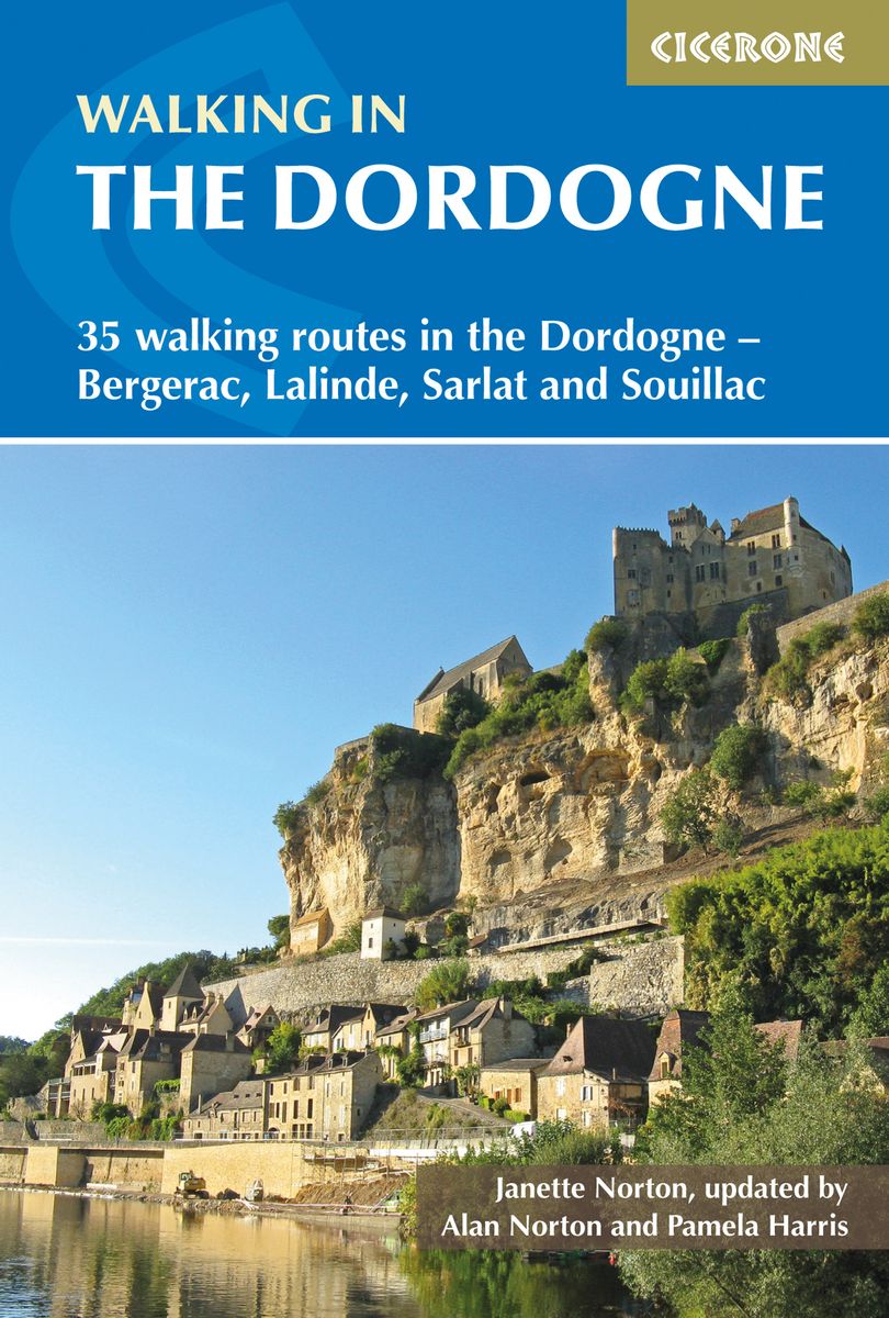
- Walking in the Dordogne
- 35 walking routes in the Dordogne - Sarlat, Bergerac, Lalinde and Souillac Leer más
- Also available from:
- De Zwerver, Netherlands
De Zwerver
Netherlands
2018
Netherlands
2018
- Wandelgids walking in the Dordogne | Cicerone
- This guidebook describes 35 walking routes in France's beautiful Dordogne region, based around Sarlat and Souillac regions (Perigord Noir) and Bergerac (Perigord Poupre). The walks range from short walks to mountain circuits, and explore the spectacular gorges, chateaux and medieval villages of the region. Leer más

- Also available from:
- De Zwerver, Netherlands
De Zwerver
Netherlands
2018
Netherlands
2018
Stanfords
United Kingdom
2021
United Kingdom
2021
- Tour du Mont-Lozere et du Causse Méjean GR6/GR68
- Tours du Mont-Lozère et du Causse Méjean, FFRP topo-guide Ref. No. 631, with the two circular tours, a 117-km Tour du Mont Lozère and a 111-km Tour du Causse Méjean, plus additional trails along the GR7 and GR70.ABOUT THE FFRP (Fédération française de la randonnée pédestre) TOPOGUIDES: published in a handy A5 paperback format, the guides are... Leer más
- Also available from:
- The Book Depository, United Kingdom


Bol.com
Netherlands
2013
Netherlands
2013
- ANWB Actief / Dordogne
- Wandelen, fietsen, autotochten maken en bezienswaardigheden bezoeken; met een ANWB Actief reisgids heeft u alle mogelijkheden. Iedere ANWB Actief reisgids biedt 30 unieke dagtochten. Bij elke dagtocht wordt de lengte, duur, moeilijkheidsgraad en horeca vermeld. - Duidelijk kaartwerk per route - Downloadbare gps-tracks voor de wandel- en... Leer más
- Also available from:
- Bol.com, Belgium
Bol.com
Belgium
2013
Belgium
2013
- ANWB Actief / Dordogne
- Wandelen, fietsen, autotochten maken en bezienswaardigheden bezoeken; met een ANWB Actief reisgids heeft u alle mogelijkheden. Iedere ANWB Actief reisgids biedt 30 unieke dagtochten. Bij elke dagtocht wordt de lengte, duur, moeilijkheidsgraad en horeca vermeld. - Duidelijk kaartwerk per route - Downloadbare gps-tracks voor de wandel- en... Leer más
Mapas

Stanfords
United Kingdom
United Kingdom
- Bordeaux Editions Benoit Wine Wall Map
- The Bordeaux wine growing region of France on a map showing its famous vineyards along the confluence of the Garonne and the Dordogne, with additional lists of the Appellations and different classifications for Médoc, Saint-Emilion, Graves, etc. The map is surrounded by a frame of the region’s famous labels from the Ch. Lafite, Latour and... Leer más

Stanfords
United Kingdom
United Kingdom
- Bordeaux Wine Map
- The Bordeaux wine growing region of France on a map showing its famous vineyards along the confluence of the Garonne and the Dordogne, with additional lists of the Appellations and different classifications for Médoc, Saint-Emilion, Graves, etc. The map is surrounded by a frame of the region’s famous labels from the Ch. Lafite, Latour and... Leer más

Stanfords
United Kingdom
2019
United Kingdom
2019
- Pyrénées Orientales et tours du Capcir, du Carlit et de Cerdagne GR10/GR36
- More than 30 days of hiking, including 12 to join Banyuls in Mérens-les-Vals.Pyrénées Orientales, FFRP topoguide, Ref. No. 1092, covering the fourth and last section of the GR10 along the Pyrenees from the Atlantic to the Mediterranean – a 196-km long walk from Mérens-les-Vals to Banyuls-sur-Mer. The guide also covers a 177-km trail along the... Leer más


Stanfords
United Kingdom
United Kingdom
- Perigord Noir - Haut-Quercy IGN 75026
- Périgord Noir - Haut-Quercy region in a series of GPS compatible, contoured TOP 75 maps at 1:75,000 from the IGN, highlighting local and long-distance hiking paths, cycling routes and sites for other recreational activities. The map includes five large panels showing the areas around Saint-Léon-sur-Vézère, Domme, Floirac, Lacave, and... Leer más

Stanfords
United Kingdom
United Kingdom
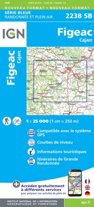
- Figeac - Cajarc IGN 2238SB
- Topographic survey of France at 1:25,000 in IGN`s excellent TOP25 / Série Bleue series. All the maps are GPS compatible, with a 1km UTM grid plus latitude and longitude lines at 5’ intervals. Contours are at 5m intervals except for mountainous areas where the maps have contours at 10m intervals, vividly enhanced by hill shading and graphics for... Leer más
- Also available from:
- The Book Depository, United Kingdom
- De Zwerver, Netherlands

De Zwerver
Netherlands
Netherlands

Stanfords
United Kingdom
United Kingdom
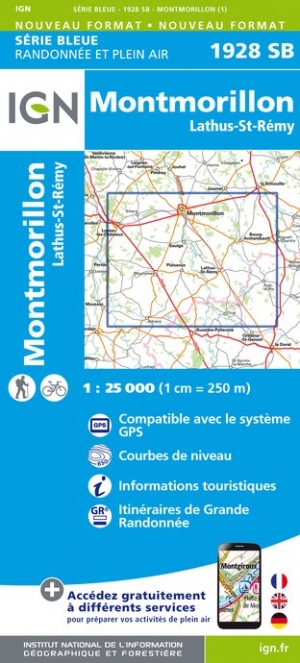
- Montmorillon - Lathus-St-Remy IGN 1928SB
- Topographic survey of France at 1:25,000 in IGN`s excellent TOP25 / Série Bleue series. All the maps are GPS compatible, with a 1km UTM grid plus latitude and longitude lines at 5’ intervals. Contours are at 5m intervals except for mountainous areas where the maps have contours at 10m intervals, vividly enhanced by hill shading and graphics for... Leer más
- Also available from:
- The Book Depository, United Kingdom
- De Zwerver, Netherlands

De Zwerver
Netherlands
Netherlands

Stanfords
United Kingdom
United Kingdom
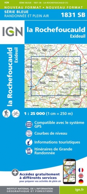
- La Rochefoucauld - Exideuil IGN 1831SB
- Topographic survey of France at 1:25,000 in IGN`s excellent TOP25 / Série Bleue series. All the maps are GPS compatible, with a 1km UTM grid plus latitude and longitude lines at 5’ intervals. Contours are at 5m intervals except for mountainous areas where the maps have contours at 10m intervals, vividly enhanced by hill shading and graphics for... Leer más
- Also available from:
- The Book Depository, United Kingdom
- De Zwerver, Netherlands

De Zwerver
Netherlands
Netherlands

Stanfords
United Kingdom
United Kingdom
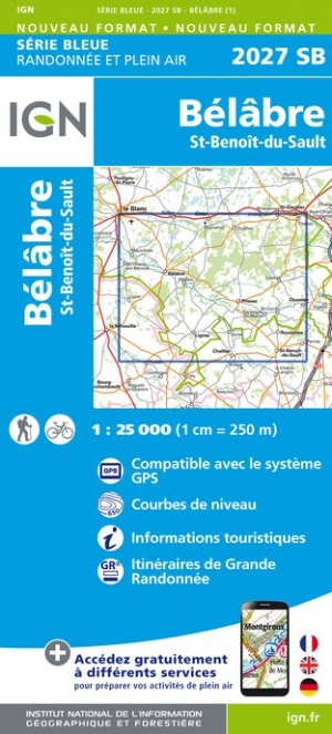
- Belabre - St-Benoit-du-Sault IGN 2027SB
- Topographic survey of France at 1:25,000 in IGN`s excellent TOP25 / Série Bleue series. All the maps are GPS compatible, with a 1km UTM grid plus latitude and longitude lines at 5’ intervals. Contours are at 5m intervals except for mountainous areas where the maps have contours at 10m intervals, vividly enhanced by hill shading and graphics for... Leer más
- Also available from:
- The Book Depository, United Kingdom
- De Zwerver, Netherlands

De Zwerver
Netherlands
Netherlands

Stanfords
United Kingdom
United Kingdom
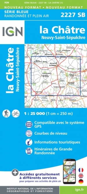
- la Chatre - Neuvy-Saint-Sepulchre IGN 2227SB
- Topographic survey of France at 1:25,000 in IGN`s excellent TOP25 / Série Bleue series. All the maps are GPS compatible, with a 1km UTM grid plus latitude and longitude lines at 5’ intervals. Contours are at 5m intervals except for mountainous areas where the maps have contours at 10m intervals, vividly enhanced by hill shading and graphics for... Leer más
- Also available from:
- The Book Depository, United Kingdom
- De Zwerver, Netherlands

De Zwerver
Netherlands
Netherlands

Stanfords
United Kingdom
United Kingdom
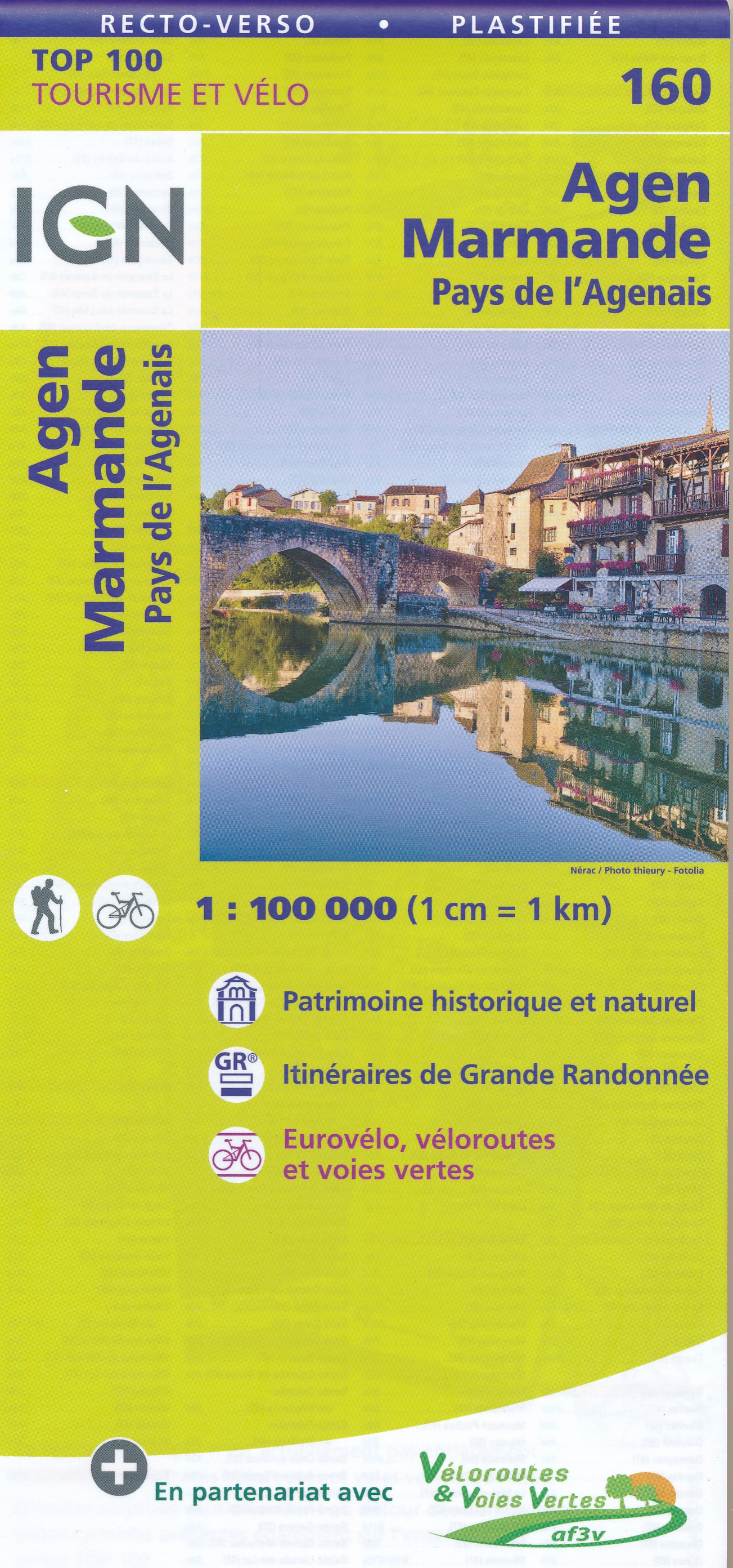
- Agen - Marmande - Pays de l`Agenais IGN TOP100 160
- Discover the new double-sided laminated edition of TOP100 road maps of France from the Institut Géographique National (IGN); exceptionally detailed, contoured road maps which include the cycle paths and greenways of the AF3V (French Association for the Development of Cycle Paths and Greenways), ideal for exploring the French countryside by car,... Leer más
- Also available from:
- The Book Depository, United Kingdom
- De Zwerver, Netherlands

De Zwerver
Netherlands
Netherlands

Stanfords
United Kingdom
United Kingdom
- Les Eyzies-de-Tayac-Sireuil - Vallees de la Dordogne et de la Vezere IGN 1936ET
- Topographic survey of France at 1:25,000 in IGN`s excellent TOP25 / Série Bleue series. All the maps are GPS compatible, with a 1km UTM grid plus latitude and longitude lines at 5’ intervals. Contours are at 5m intervals except for mountainous areas where the maps have contours at 10m intervals, vividly enhanced by hill shading and graphics for... Leer más
- Also available from:
- The Book Depository, United Kingdom


Stanfords
United Kingdom
United Kingdom
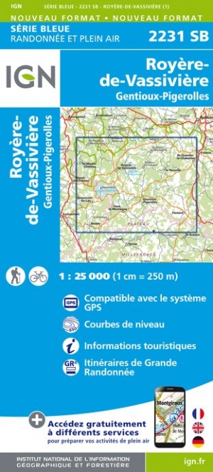
- Royere-de-Vassiviere - Gentioux-Pigerolles IGN 2231SB
- Topographic survey of France at 1:25,000 in IGN`s excellent TOP25 / Série Bleue series. All the maps are GPS compatible, with a 1km UTM grid plus latitude and longitude lines at 5’ intervals. Contours are at 5m intervals except for mountainous areas where the maps have contours at 10m intervals, vividly enhanced by hill shading and graphics for... Leer más
- Also available from:
- The Book Depository, United Kingdom
- De Zwerver, Netherlands

De Zwerver
Netherlands
Netherlands

Stanfords
United Kingdom
United Kingdom
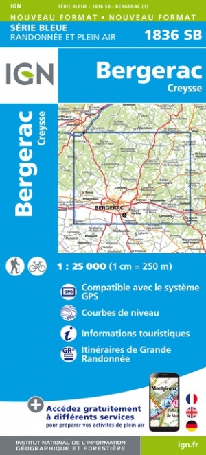
- Bergerac - Creysse IGN 1836SB
- Topographic survey of France at 1:25,000 in IGN`s excellent TOP25 / Série Bleue series. All the maps are GPS compatible, with a 1km UTM grid plus latitude and longitude lines at 5’ intervals. Contours are at 5m intervals except for mountainous areas where the maps have contours at 10m intervals, vividly enhanced by hill shading and graphics for... Leer más
- Also available from:
- The Book Depository, United Kingdom
- De Zwerver, Netherlands

De Zwerver
Netherlands
Netherlands

Stanfords
United Kingdom
United Kingdom
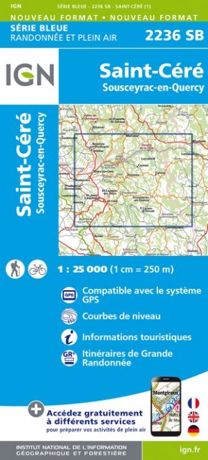
- Saint-Cere - Sousceyrac-en-Quercy IGN 2236SB
- In de loop van de periode 2014-2018 gaat IGN de 25.000 serie vervangen: de oude versies Est en Ouest (E en O aanduiding achter het nummer van de kaart) gaan verdwijnen en worden vervangen door een kaart met nummer en gevolgd door de letters SB. In de meeste gevalen is het een samenvoeging van de E en O kaart, de SB kaart beslaat dan ook een... Leer más
- Also available from:
- The Book Depository, United Kingdom
- De Zwerver, Netherlands

The Book Depository
United Kingdom
United Kingdom
- St-Cere / Sousceyrac-en-Quercy
- In de loop van de periode 2014-2018 gaat IGN de 25.000 serie vervangen: de oude versies Est en Ouest (E en O aanduiding achter het nummer van de kaart) gaan verdwijnen en worden vervangen door een kaart met nummer en gevolgd door de letters SB. In de meeste gevalen is het een samenvoeging van de E en O kaart, de SB kaart beslaat dan ook een... Leer más
De Zwerver
Netherlands
Netherlands
- Wandelkaart - Topografische kaart 2236SB Saint-Céré, Sousceyrac-en-Quercy | IGN - Institut Géographique National
- In de loop van de periode 2014-2018 gaat IGN de 25.000 serie vervangen: de oude versies Est en Ouest (E en O aanduiding achter het nummer van de kaart) gaan verdwijnen en worden vervangen door een kaart met nummer en gevolgd door de letters SB. In de meeste gevalen is het een samenvoeging van de E en O kaart, de SB kaart beslaat dan ook een... Leer más