
Macao
Descripción

Macau is a former Portuguese colony on the southcoast of China. From Hong Kong, a convenient 60 km ferry-ride across the Pearl River Estuary will take you there. Macau consists of the Macau Peninsula and the islands of Taipa and Coloane, now connected by the Cotai Strip landfill.
Being a small, densely populated and heavily urbanized place, long distance hiking is no option in Macau. Yet, there is a network of well-maintained nature trails worth exploring in the hills of Taipa and Coloane. Try the circular Coloane Trail, The Taipa Grande and Taipa Pequena Trails.
Macau's climate is subtropical with very high temperatures and humidity in summer (April - September). For maximum views and dry weather, try November, December, January, February or March.
Senderos
Enlaces
Datos
Informes
Guías y mapas
Hospedaje
Organizaciones
Operadores turísticos
GPS
Otro
Libros


United Kingdom
2014
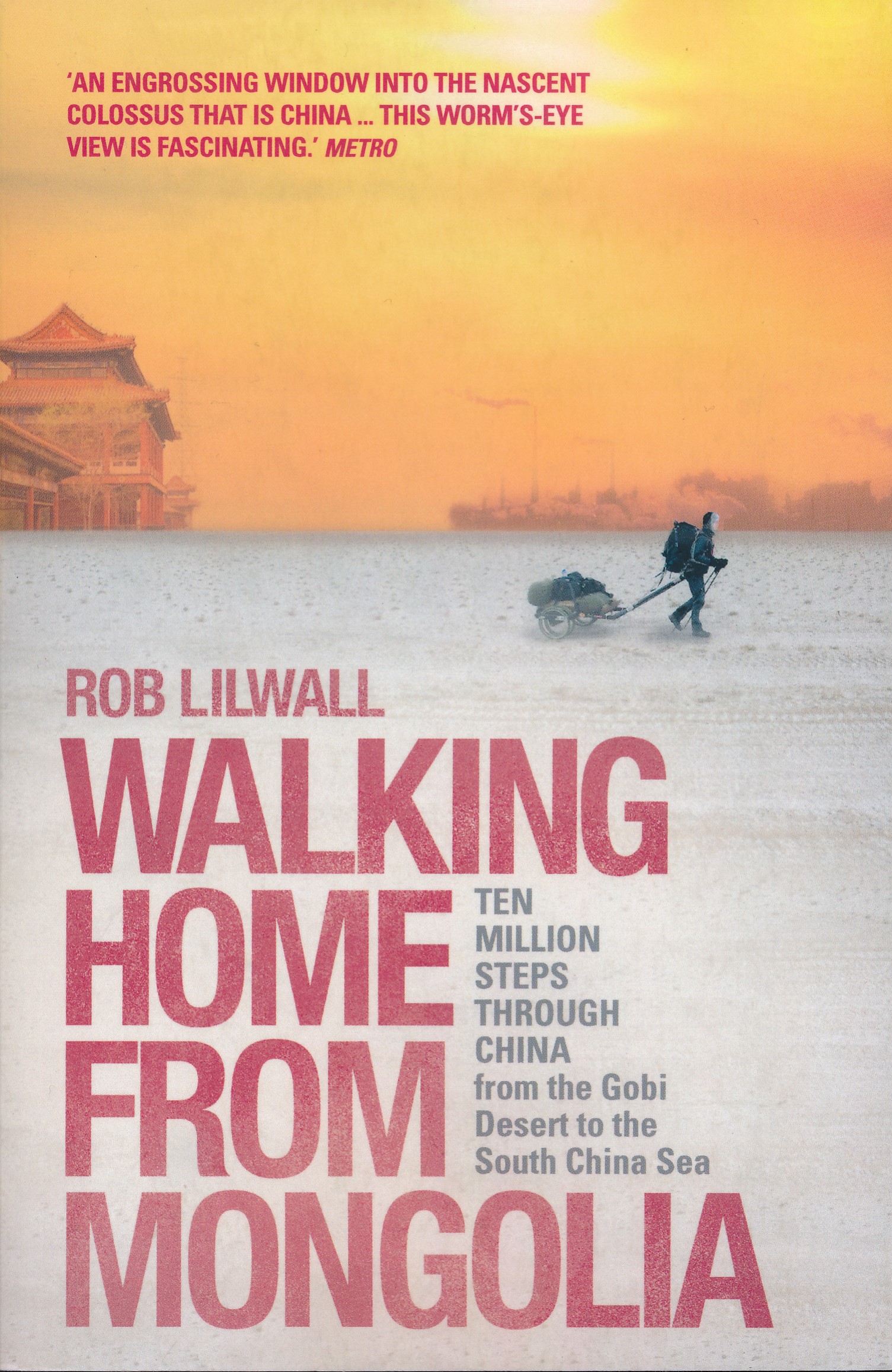
- Walking Home From Mongolia
- Ten Million Steps Through China, From the Gobi Desert to the South China Sea Leer más
- Also available from:
- De Zwerver, Netherlands
Netherlands
2014
- Reisverhaal Walking Home From Mongolia | Hodder & Stoughton
- Ten Million Steps Through China, from the Gobi Desert to the South China Sea Leer más

Netherlands
- The Kurious Kid Presents
- The Kurious Kid Presents Pandas - A Awesome Amazing Super Spectacular facts & photo book on Pandas for Kids( a childrens book about Pandas) Probably the most loved animal in the whole world is the panda bear! With that gentle face, it looks so cute! Called the What is cuter than a little puppy? What is more adorable that a kitten playing with a... Leer más
- Also available from:
- Bol.com, Belgium
Belgium
- The Kurious Kid Presents
- The Kurious Kid Presents Pandas - A Awesome Amazing Super Spectacular facts & photo book on Pandas for Kids( a childrens book about Pandas) Probably the most loved animal in the whole world is the panda bear! With that gentle face, it looks so cute! Called the What is cuter than a little puppy? What is more adorable that a kitten playing with a... Leer más

Netherlands
- An Author's Perspective on Independent Publishing
- Lee Foster has published a new book about the independent publishing process, titled An Author's Perspective on Independent Publishing: Why Self-Publishing May Be Your Best Option. After doing 16 books with traditional publishers, why did Lee switch to doing four books "independently" published or "indie?" Why does he now recommend this path... Leer más
- Also available from:
- Bol.com, Belgium
Belgium
- An Author's Perspective on Independent Publishing
- Lee Foster has published a new book about the independent publishing process, titled An Author's Perspective on Independent Publishing: Why Self-Publishing May Be Your Best Option. After doing 16 books with traditional publishers, why did Lee switch to doing four books "independently" published or "indie?" Why does he now recommend this path... Leer más

Netherlands
2018
- Reisgids National Geographic China | Kosmos Uitgevers
- Kleurrijke reisgids van China met veel illustraties. Goede beschrijvingen van land, volk en geschiedenis. Prettige leesgids om enthousiast te worden. National Geographic Reisgids China is een exclusieve gids met sublieme fotografie die u meeneemt naar de bekende en minder bekende bezienswaardigheden. De experts van National Geographic nemen een... Leer más
Netherlands
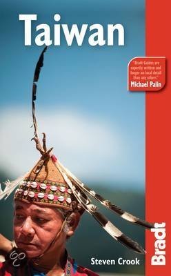
- The Bradt Travel Guide Taiwan
- <DIV><P style="MARGIN: 0in 0in 0pt">Written by an author who has lived in Taiwan for 19 years, Bradt’s brand-new <I>Taiwan</I> explores the island’s breathtaking mountains, bird-rich forests and quaint villages where folk religion thrives. Travellers are discovering there’s much more to Taiwan than... Leer más
- Also available from:
- Bol.com, Belgium
Belgium
- The Bradt Travel Guide Taiwan
- <DIV><P style="MARGIN: 0in 0in 0pt">Written by an author who has lived in Taiwan for 19 years, Bradt’s brand-new <I>Taiwan</I> explores the island’s breathtaking mountains, bird-rich forests and quaint villages where folk religion thrives. Travellers are discovering there’s much more to Taiwan than... Leer más
Netherlands
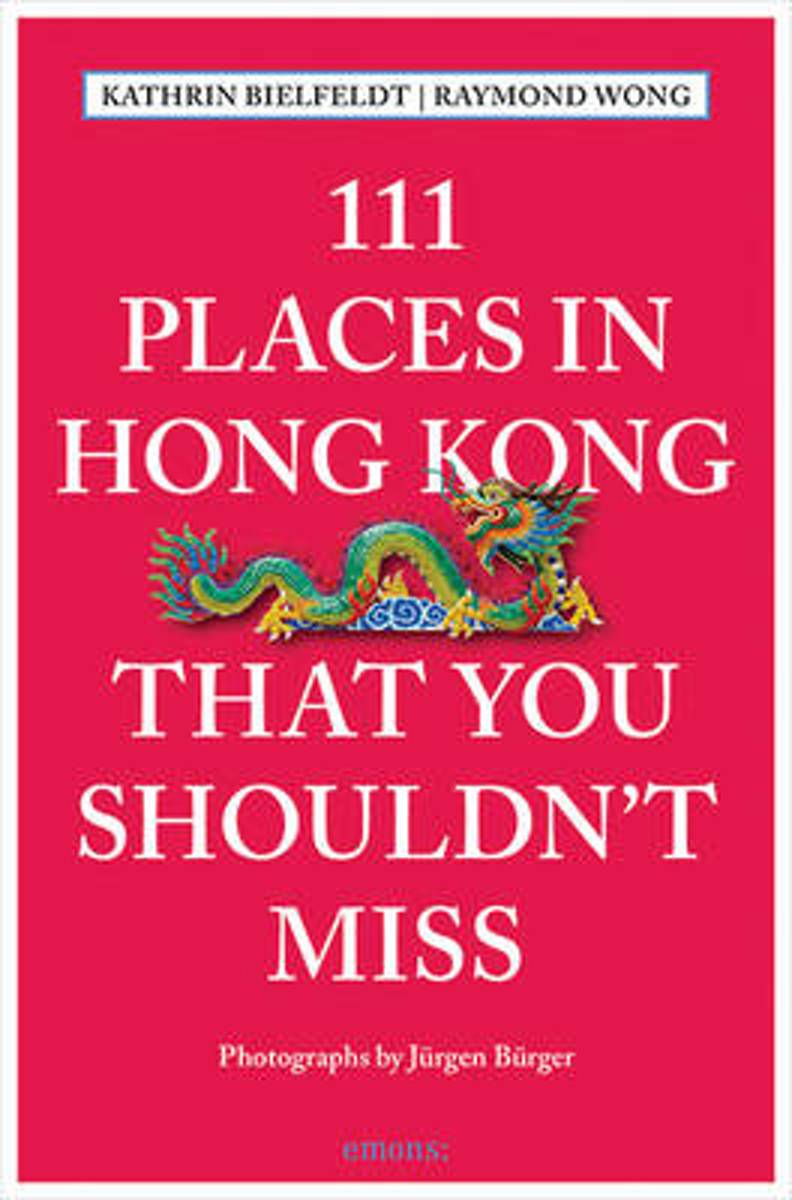
- 111 Places in Hong Kong That You Shouldn't Miss
- From zero to hundred in 175 years no other metropolis has as compressed and chequered a history as Hong Kong, with its striking and seamless blend of eastern and western cultures. Famous for its cosmopolitan nightlife, cutting-edge fashion, culinary sophistication, and entertainment, Hong Kong also conceals a trove of lesser-known and... Leer más
- Also available from:
- Bol.com, Belgium
Belgium
- 111 Places in Hong Kong That You Shouldn't Miss
- From zero to hundred in 175 years no other metropolis has as compressed and chequered a history as Hong Kong, with its striking and seamless blend of eastern and western cultures. Famous for its cosmopolitan nightlife, cutting-edge fashion, culinary sophistication, and entertainment, Hong Kong also conceals a trove of lesser-known and... Leer más
Netherlands
2016
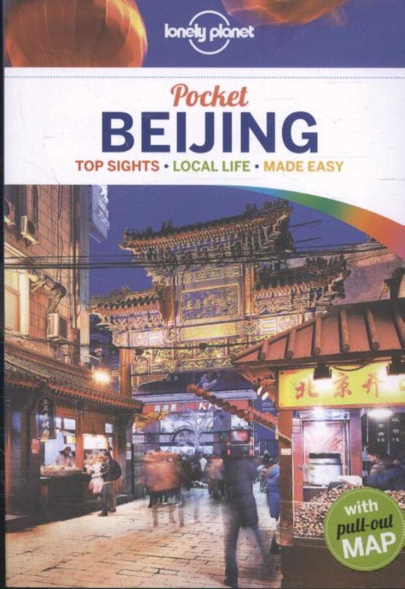
- Lonely Planet Pocket Beijing dr 4
- Lonely Planet: The world's leading travel guide publisher Lonely Planet Pocket Beijing is your passport to the most relevant, up-to-date advice on what to see and skip, and what hidden discoveries await you. Sample the city's most famous dish, Peking Duck; wander the ancient alleys known as hutong; and explore the world's largest palace complex... Leer más
- Also available from:
- Bol.com, Belgium
- De Zwerver, Netherlands
Belgium
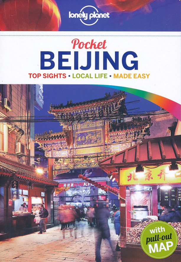
2016
- Lonely Planet Pocket Beijing dr 4
- Lonely Planet: The world's leading travel guide publisher Lonely Planet Pocket Beijing is your passport to the most relevant, up-to-date advice on what to see and skip, and what hidden discoveries await you. Sample the city's most famous dish, Peking Duck; wander the ancient alleys known as hutong; and explore the world's largest palace complex... Leer más
Netherlands
2016
- Reisgids Pocket Beijing | Lonely Planet
- Klein compact stadgidsje voor Beijing met alle essentiele informatie voor een paar dagen. Eten & drinken, Accomodaties en bezienswaardigheden. Met stadsplattegrond. Lonely Planet Pocket Beijing is your passport to the most relevant, up-to-date advice on what to see and skip, and what hidden discoveries await you. Sample the city’s most famous... Leer más
Netherlands
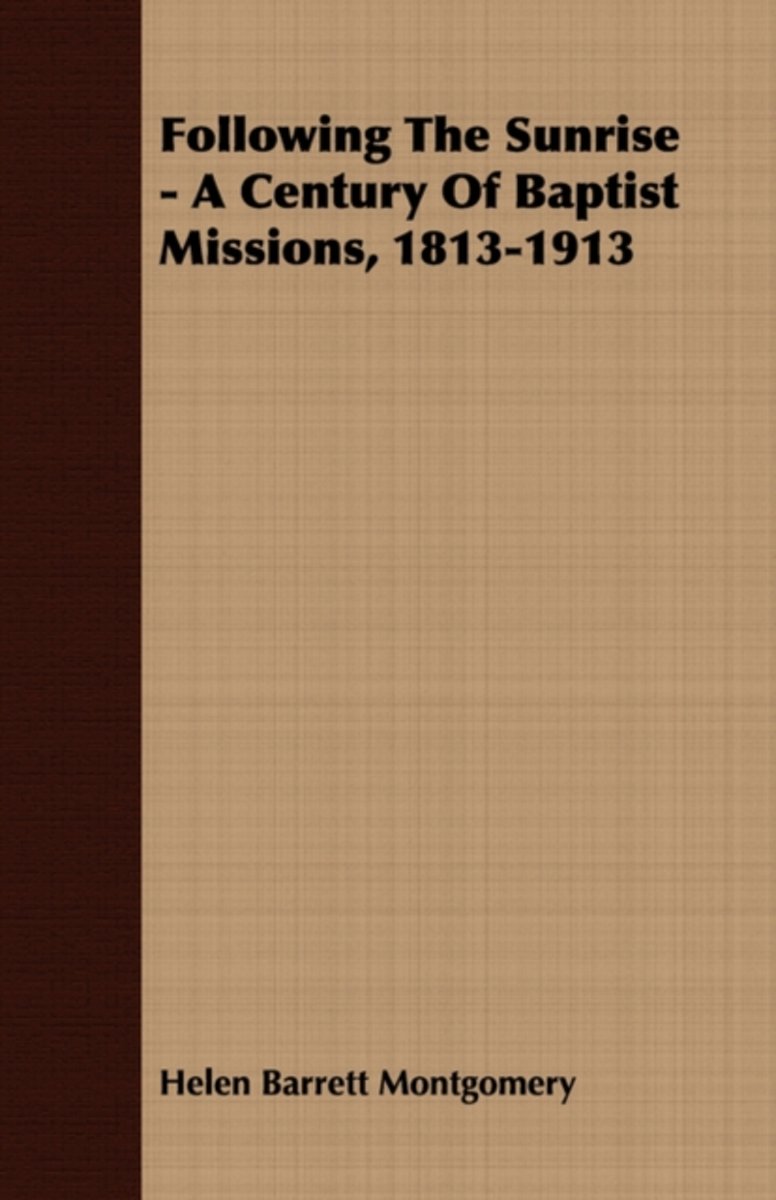
- Following The Sunrise - A Century Of Baptist Missions, 1813-1913
- FOLLOWING THE SUNRISE A Century of Baptist Missions, 1813-1913 By HELEN BARRETT MONTGOMERY Author of Christus Redemptor M and Western Women in Eastern Lands I am the Light oi the World. He that foiloweth me shall not walk in darkness, but shall have the light of life. 41 The people that walked in darkness have seen a great light, Published in... Leer más
- Also available from:
- Bol.com, Belgium
Belgium
- Following The Sunrise - A Century Of Baptist Missions, 1813-1913
- FOLLOWING THE SUNRISE A Century of Baptist Missions, 1813-1913 By HELEN BARRETT MONTGOMERY Author of Christus Redemptor M and Western Women in Eastern Lands I am the Light oi the World. He that foiloweth me shall not walk in darkness, but shall have the light of life. 41 The people that walked in darkness have seen a great light, Published in... Leer más
.jpg)
Netherlands
2012
- Reisgids Te gast in China | Informatie Verre Reizen
- Uitgeverij Informatie Verre Reizen heeft haar nieuwe pocketreeks uitgebreid met TE GAST IN China. Deze uitgave bevat bijdragen van zes auteurs die een bijzondere band hebben met het land. Op levendige wijze en met kennis van zaken doorbreken ze in deze gevarieerde bundel het bekende cliché beeld over China. In deze uitgave laten we zien dat het... Leer más

Netherlands
- Great Sedona Hikes Revised Fourth Edition
- This is the most up-to-date Sedona hiking guide available. The Sedona hiking trail system is constantly changing. Other Sedona hiking guides books are printed in China which can result in long delays in incorporating changes, we keep Great Sedona Hikes Revised Fourth Edition up-to-date by constantly hiking the trails and updating our book. Our... Leer más
- Also available from:
- Bol.com, Belgium
Belgium
- Great Sedona Hikes Revised Fourth Edition
- This is the most up-to-date Sedona hiking guide available. The Sedona hiking trail system is constantly changing. Other Sedona hiking guides books are printed in China which can result in long delays in incorporating changes, we keep Great Sedona Hikes Revised Fourth Edition up-to-date by constantly hiking the trails and updating our book. Our... Leer más
Netherlands
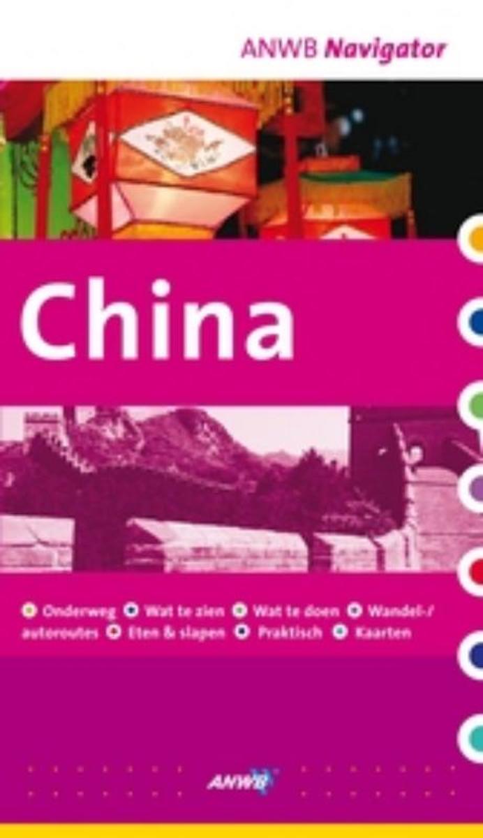
- China
- De Navigator reisgidsen zijn luxe uitgevoerde gidsen, boordevol informatie.ANWB Navigator combineert een glossy uitstraling met een grote toegankelijkheid. Naast traditionele onderwerpen als geschiedenis en bezienswaardigheden biedt ANWB Navigator u nog veel meer.Bijvoorbeeld informatie over shoppen, hoe het openbaar vervoer werkt, fotos van... Leer más
- Also available from:
- Bol.com, Belgium
Belgium
- China
- De Navigator reisgidsen zijn luxe uitgevoerde gidsen, boordevol informatie.ANWB Navigator combineert een glossy uitstraling met een grote toegankelijkheid. Naast traditionele onderwerpen als geschiedenis en bezienswaardigheden biedt ANWB Navigator u nog veel meer.Bijvoorbeeld informatie over shoppen, hoe het openbaar vervoer werkt, fotos van... Leer más
Netherlands
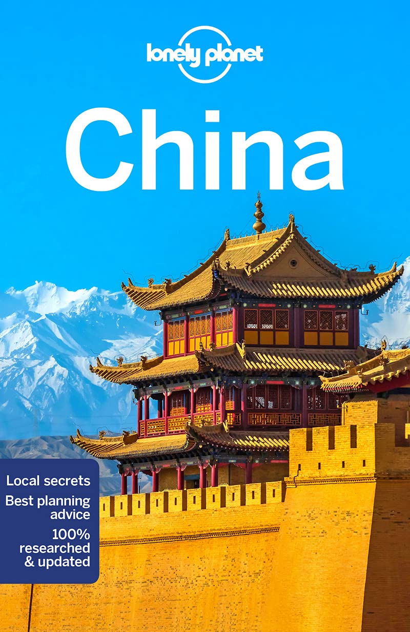
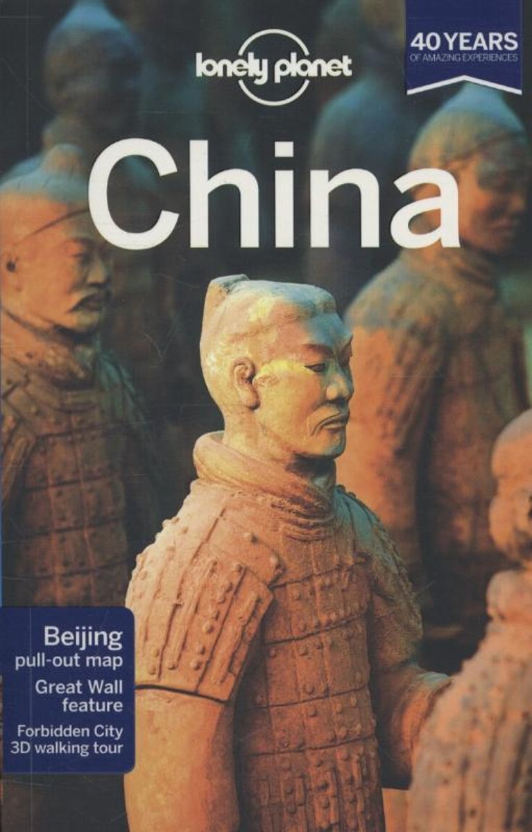
- Lonely Planet China dr 13
- Lonely Planet: The world's leading travel guide publisher Lonely Planet China is your passport to all the most relevant and up-to-date advice on what to see, what to skip, and what hidden discoveries await you. Pass through the Gate of Supreme Harmony in Beijing's Forbidden City, hike along the Great Wall, or slurp up wonton soup amid... Leer más
- Also available from:
- Bol.com, Belgium
Belgium
- Lonely Planet China dr 13
- Lonely Planet: The world's leading travel guide publisher Lonely Planet China is your passport to all the most relevant and up-to-date advice on what to see, what to skip, and what hidden discoveries await you. Pass through the Gate of Supreme Harmony in Beijing's Forbidden City, hike along the Great Wall, or slurp up wonton soup amid... Leer más
Netherlands
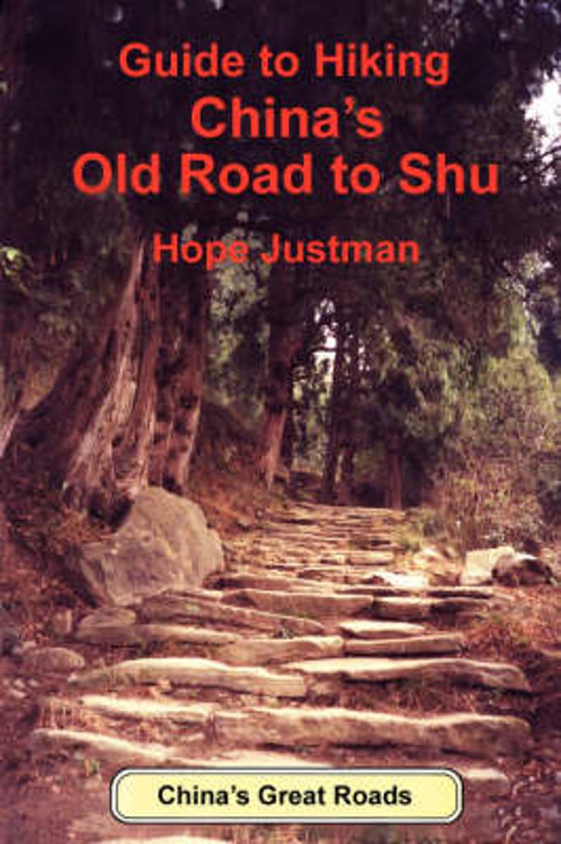
- Guide To Hiking China's Old Road To Shu
- This is the first guidebook specifically written for people who speak no Chinese but would like to go hiking on their own in China off the beaten track. The hikes are through the beautiful Qinling and Daba Mountains in Sichuan and Shaanxi Province along the few remaining stretches of one of China's old imperial roads known as the Road to Shu.... Leer más
- Also available from:
- Bol.com, Belgium
Belgium
- Guide To Hiking China's Old Road To Shu
- This is the first guidebook specifically written for people who speak no Chinese but would like to go hiking on their own in China off the beaten track. The hikes are through the beautiful Qinling and Daba Mountains in Sichuan and Shaanxi Province along the few remaining stretches of one of China's old imperial roads known as the Road to Shu.... Leer más
Mapas

United Kingdom
- Admiralty Routeing Chart 5150(1) - East China Sea - January
- Essential for use in passage planning for ocean voyages, Routeing Charts include routes and distances between major ports, ocean currents, ice limits, load lines and wind roses. They also contain expected meteorological and oceanographic conditions for each month of the year.Individual chart scales of 1:5,000,000, 1:10,000,000 and 1:20,000,000... Leer más

United Kingdom
- Admiralty Routeing Chart 5150(9) - East China Sea - September
- Essential for use in passage planning for ocean voyages, Routeing Charts include routes and distances between major ports, ocean currents, ice limits, load lines and wind roses. They also contain expected meteorological and oceanographic conditions for each month of the year.Individual chart scales of 1:5,000,000, 1:10,000,000 and 1:20,000,000... Leer más
United Kingdom
- Admiralty Routeing Chart 5149(5) - South China Sea - May
- Essential for use in passage planning for ocean voyages, Routeing Charts include routes and distances between major ports, ocean currents, ice limits, load lines and wind roses. They also contain expected meteorological and oceanographic conditions for each month of the year.Individual chart scales of 1:5,000,000, 1:10,000,000 and 1:20,000,000... Leer más

United Kingdom
- Admiralty Routeing Chart 5149(6) - South China Sea - June
- Essential for use in passage planning for ocean voyages, Routeing Charts include routes and distances between major ports, ocean currents, ice limits, load lines and wind roses. They also contain expected meteorological and oceanographic conditions for each month of the year.Individual chart scales of 1:5,000,000, 1:10,000,000 and 1:20,000,000... Leer más

United Kingdom
- Admiralty Routeing Chart 5150(2) - East China Sea - February
- Essential for use in passage planning for ocean voyages, Routeing Charts include routes and distances between major ports, ocean currents, ice limits, load lines and wind roses. They also contain expected meteorological and oceanographic conditions for each month of the year.Individual chart scales of 1:5,000,000, 1:10,000,000 and 1:20,000,000... Leer más

United Kingdom
- Admiralty Routeing Chart 5150(10) - East China Sea - October
- Essential for use in passage planning for ocean voyages, Routeing Charts include routes and distances between major ports, ocean currents, ice limits, load lines and wind roses. They also contain expected meteorological and oceanographic conditions for each month of the year.Individual chart scales of 1:5,000,000, 1:10,000,000 and 1:20,000,000... Leer más

United Kingdom
- Mount Gongga Glaciers
- Mount Gongga Glaciers on a detailed, contoured map at 1:25,000 published by the Chinese Institute of Glaciology and based on surveys carries out in early 1980s and aerial photography from December 1996. The map has contours at 20m intervals, enhanced by shading, plus graphics and/or colouring for exposed rock, scree, moraine, crevasses,... Leer más

United Kingdom
- Admiralty Routeing Chart 5149(7) - South China Sea - July
- Essential for use in passage planning for ocean voyages, Routeing Charts include routes and distances between major ports, ocean currents, ice limits, load lines and wind roses. They also contain expected meteorological and oceanographic conditions for each month of the year.Individual chart scales of 1:5,000,000, 1:10,000,000 and 1:20,000,000... Leer más

United Kingdom
- Admiralty Routeing Chart 5150(3) - East China Sea - March
- Essential for use in passage planning for ocean voyages, Routeing Charts include routes and distances between major ports, ocean currents, ice limits, load lines and wind roses. They also contain expected meteorological and oceanographic conditions for each month of the year.Individual chart scales of 1:5,000,000, 1:10,000,000 and 1:20,000,000... Leer más

United Kingdom
- Admiralty Routeing Chart 5150(11) - East China Sea - November
- Essential for use in passage planning for ocean voyages, Routeing Charts include routes and distances between major ports, ocean currents, ice limits, load lines and wind roses. They also contain expected meteorological and oceanographic conditions for each month of the year.Individual chart scales of 1:5,000,000, 1:10,000,000 and 1:20,000,000... Leer más

United Kingdom
- China West ITMB
- Western China on a double-sided, indexed road map from ITMB at 1:3,000,000, with three insets providing a street plan of central Lhasa, a wider coverage of the city and a plan of the Norbulingka complex. The map divides the region north/south and coverage extends east to approx. 106° (Lanzhou/Chengou).The map has altitude colouring in feet,... Leer más

United Kingdom
- Admiralty Routeing Chart 5149(8) - South China Sea - August
- Essential for use in passage planning for ocean voyages, Routeing Charts include routes and distances between major ports, ocean currents, ice limits, load lines and wind roses. They also contain expected meteorological and oceanographic conditions for each month of the year.Individual chart scales of 1:5,000,000, 1:10,000,000 and 1:20,000,000... Leer más

United Kingdom
- Admiralty Routeing Chart 5150(4) - East China Sea - April
- Essential for use in passage planning for ocean voyages, Routeing Charts include routes and distances between major ports, ocean currents, ice limits, load lines and wind roses. They also contain expected meteorological and oceanographic conditions for each month of the year.Individual chart scales of 1:5,000,000, 1:10,000,000 and 1:20,000,000... Leer más

United Kingdom
- Admiralty Routeing Chart 5150(12) - East China Sea - December
- Essential for use in passage planning for ocean voyages, Routeing Charts include routes and distances between major ports, ocean currents, ice limits, load lines and wind roses. They also contain expected meteorological and oceanographic conditions for each month of the year.Individual chart scales of 1:5,000,000, 1:10,000,000 and 1:20,000,000... Leer más

United Kingdom
- Admiralty Routeing Chart 5149(9) - South China Sea - September
- Essential for use in passage planning for ocean voyages, Routeing Charts include routes and distances between major ports, ocean currents, ice limits, load lines and wind roses. They also contain expected meteorological and oceanographic conditions for each month of the year.Individual chart scales of 1:5,000,000, 1:10,000,000 and 1:20,000,000... Leer más