
China
Descripción

To say China is vast and varied in all respects, is nothing less than an understatement. Climate varies from continental to temperate to subtropical. Landscapes range from relatively low plains and ranges in the east and southeast, to high mountains and plateaus as you move west, culminating in the Tibetan Himalaya and the world's highest: Mount Everest (8848 m). Further to the north and northwest you will encounter merciless deserts like the Gobi and Taklamakan, and more high mountain ranges such as the remote Kunlun, Tianshan and Pamir.
Mighty rivers like the Yangtze (Chang Jiang) and Yellow River (Huang He) flow down from the west through ever more populated areas to find their way into the East and South China Seas. Other famous rivers such as the Mekong (known in China as Lancang), the Brahmaputra and the Indus rivers originate on the Tibetan plateau, and eventually flow south towards the Bay of Bengal and the Indian Ocean. Without exception these rivers have helped create spectacular mountain landscapes, gorges and isolated valleys, making for wonderful hiking and exploring.
Is hiking a popular Chinese passtime? Long distance hiking as such may not be, but pilgrimages up the so-called Sacred Mountains, be it Taoist or Buddhist, definitely are a Chinese favorite. Countless Chinese, old and young alike, are seen scrambling up the slopes of mountains such as Emeishan, Taishan and Huashan. The same goes for mountains famed as inspiration for poets and painters, such as Huangshan. Hiking famous Chinese mountains often means climbing seemingly endless flights of stairs. Be prepared to share the paths with many, many others, and if lucky you are rewarded with breathtaking views.
A challenge popular with foreigners is hiking the Great Wall, usually as a 1- to 7-day hike along more or less intact Great Wall sections near Beijing. Others go for what is considered full length, all the way from Jiayuguan in the west to Laolongtou, the Old Dragon's Head sticking out into the Yellow Sea in the east near Shanhaiguan pass. Completing this full length hike will take you many months, covering a distance of at least 4000 km. With no real provisions for hikers along the way, it requires serious planning and preparation. Not nearly as popular, but a nonetheless interesting venture is retracing the legendary Long March by Mao Zedong and his Red Army. We have included the Great Wall and the Long March under Trails.
Several regions deserve special mention for hiking: the reasonably accessible mountains and valleys of Sichuan and Yunnan provinces, and likewise the minority areas of Guizhou and Guangxi provinces. For the more tough and adventurous: the remote Kunlun and Muztag Ata mountains of Xinjiang province near Kashgar and Kalakuli lake, the Pamir (Congling) mountains in the west of Xinjiang on the border with Kyrgyzstan and Tajikistan, the Tianshan (Heavenly) mountains in the northwest of Xinjiang province, and last but not least: Tibet with it's most famous hike and pilgrimage trail around Mount Kailash, and so much more...
Senderos
Regiones
Montañas
Enlaces
Datos
Informes
Guías y mapas
Hospedaje
Organizaciones
Operadores turísticos
GPS
Otro
Libros


United Kingdom
2014
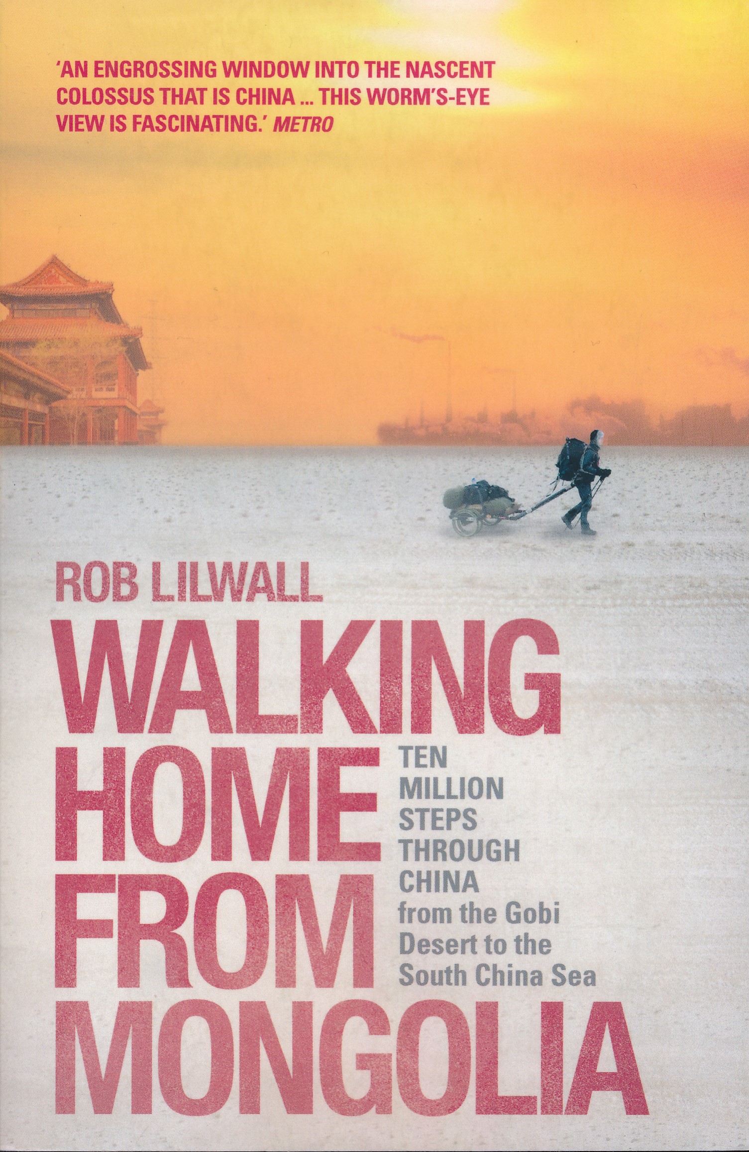
- Walking Home From Mongolia
- Ten Million Steps Through China, From the Gobi Desert to the South China Sea Leer más
- Also available from:
- De Zwerver, Netherlands
Netherlands
2014
- Reisverhaal Walking Home From Mongolia | Hodder & Stoughton
- Ten Million Steps Through China, from the Gobi Desert to the South China Sea Leer más

Netherlands
- Enchanting Hong Kong
- Hong Kong surely has few rivals worldwide for being a major city in an outstanding natural setting, surrounded by hills, islands, beaches, waterfalls, wildlife and South China village traditions. Enchanting Hong Kong reveals this multi-faceted destination for a broad spectrum of visitors ranging from those making a short business trip but with... Leer más
- Also available from:
- Bol.com, Belgium
Belgium
- Enchanting Hong Kong
- Hong Kong surely has few rivals worldwide for being a major city in an outstanding natural setting, surrounded by hills, islands, beaches, waterfalls, wildlife and South China village traditions. Enchanting Hong Kong reveals this multi-faceted destination for a broad spectrum of visitors ranging from those making a short business trip but with... Leer más

Netherlands
2017
- Reisgids City Guide Shanghai | Lonely Planet
- De perfecte reisgids voor zowel de georganiseerde als de zelfstandige reiziger. Naast een algemene inleiding van het land / streek vol met praktische informatie over hoe je er het beste kunt reizen: slapen, eten, vervoer, excursies ... alles kun je er in vinden. Shànghǎi: few cities in the world evoke so much history, excess, glamour, mystique... Leer más

Netherlands
- The Mental Preparation of Fencers and Others
- Here is an extraordinary book that every serious fencer needs to read over and over, because each reading will bring new insights. It delivers what it promises - a path toward preparation for competition and ultimately for life itself. Dr. Kogler combines the best of a wide variety of disciplines ancient and modern. His insights range back... Leer más
- Also available from:
- Bol.com, Belgium
Belgium
- The Mental Preparation of Fencers and Others
- Here is an extraordinary book that every serious fencer needs to read over and over, because each reading will bring new insights. It delivers what it promises - a path toward preparation for competition and ultimately for life itself. Dr. Kogler combines the best of a wide variety of disciplines ancient and modern. His insights range back... Leer más

Netherlands
- Discover China
- Lonely Planet: The world's leading travel guide publisher Lonely PlanetDiscover China is your passport to the most relevant, up-to-date advice on what to see and skip, and what hidden discoveries await you. Explore the Forbidden City in Beijing, marvel at the Terracotta Warriors in Xi'an, or wander around the pagodas and lilting willows of... Leer más
- Also available from:
- Bol.com, Belgium
Belgium
- Discover China
- Lonely Planet: The world's leading travel guide publisher Lonely PlanetDiscover China is your passport to the most relevant, up-to-date advice on what to see and skip, and what hidden discoveries await you. Explore the Forbidden City in Beijing, marvel at the Terracotta Warriors in Xi'an, or wander around the pagodas and lilting willows of... Leer más
Netherlands
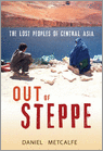
- Out Of Steppe
- Central Asia is the general name for the landmass between Iran, China, Siberia and Afghanistan. An area of enormous diversity both geographically and ethnically, it has been shaped by trade and commerce (the Silk Road) and by many invaders, including Alexander the Great, Genghis Khan and Stalin. Today the area is divided into five 'stans:... Leer más
- Also available from:
- Bol.com, Belgium
Belgium
- Out Of Steppe
- Central Asia is the general name for the landmass between Iran, China, Siberia and Afghanistan. An area of enormous diversity both geographically and ethnically, it has been shaped by trade and commerce (the Silk Road) and by many invaders, including Alexander the Great, Genghis Khan and Stalin. Today the area is divided into five 'stans:... Leer más
Netherlands
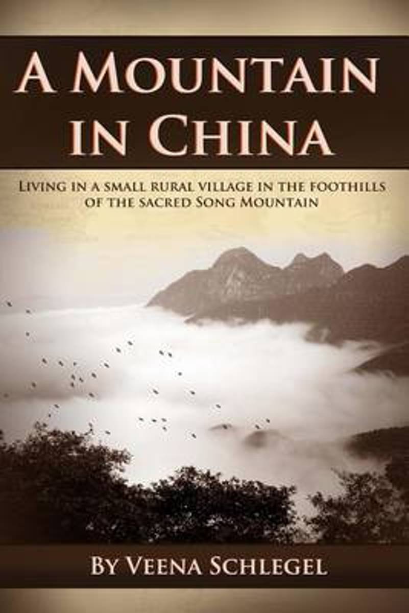
- A Mountain in China
- A Mountain in China is the fascinating account of an English woman s travels to Song Mountain, in Henan Province, China. Part memoir, part travelogue, Veena Schlegel takes us to the heart of what has made this mountain a place of pilgrimage for millenia. The peaks and valleys of Song Mountain gave refuge to Taoist mystics long before it became... Leer más
- Also available from:
- Bol.com, Belgium
Belgium
- A Mountain in China
- A Mountain in China is the fascinating account of an English woman s travels to Song Mountain, in Henan Province, China. Part memoir, part travelogue, Veena Schlegel takes us to the heart of what has made this mountain a place of pilgrimage for millenia. The peaks and valleys of Song Mountain gave refuge to Taoist mystics long before it became... Leer más

Netherlands
- Small Steps With Paws and Hooves
- ''The clouds disappeared and gave us a clear day. No more excuses. No more newspapers, radio, beds, hot water, china mugs…''Meet Barnie, 11 months old, dangerously learning to walk… Tess the dog, who likes rolling in smelly things… Ben the cart horse, who barely fits through a stile… Spud, a young mother recovering from cancer treatment, who... Leer más
- Also available from:
- Bol.com, Belgium
Belgium
- Small Steps With Paws and Hooves
- ''The clouds disappeared and gave us a clear day. No more excuses. No more newspapers, radio, beds, hot water, china mugs…''Meet Barnie, 11 months old, dangerously learning to walk… Tess the dog, who likes rolling in smelly things… Ben the cart horse, who barely fits through a stile… Spud, a young mother recovering from cancer treatment, who... Leer más
Netherlands
2009
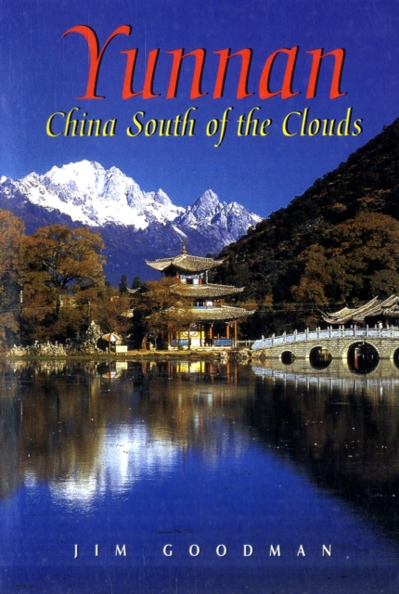
- Yunnan
- Wedged between Tibet and the exotic lands of Southeast Asia, Yunnan Province is one of the least known and most beguiling regions of China. A mountainous wonderland, it is home to 24 diverse, colourful ethnic cultures. With a name meaning 'South of the Clouds', Yunnan boasts sparkling blue skies, red earth and green forests. The picturesque... Leer más
- Also available from:
- Bol.com, Belgium
Belgium
2009
- Yunnan
- Wedged between Tibet and the exotic lands of Southeast Asia, Yunnan Province is one of the least known and most beguiling regions of China. A mountainous wonderland, it is home to 24 diverse, colourful ethnic cultures. With a name meaning 'South of the Clouds', Yunnan boasts sparkling blue skies, red earth and green forests. The picturesque... Leer más

Netherlands
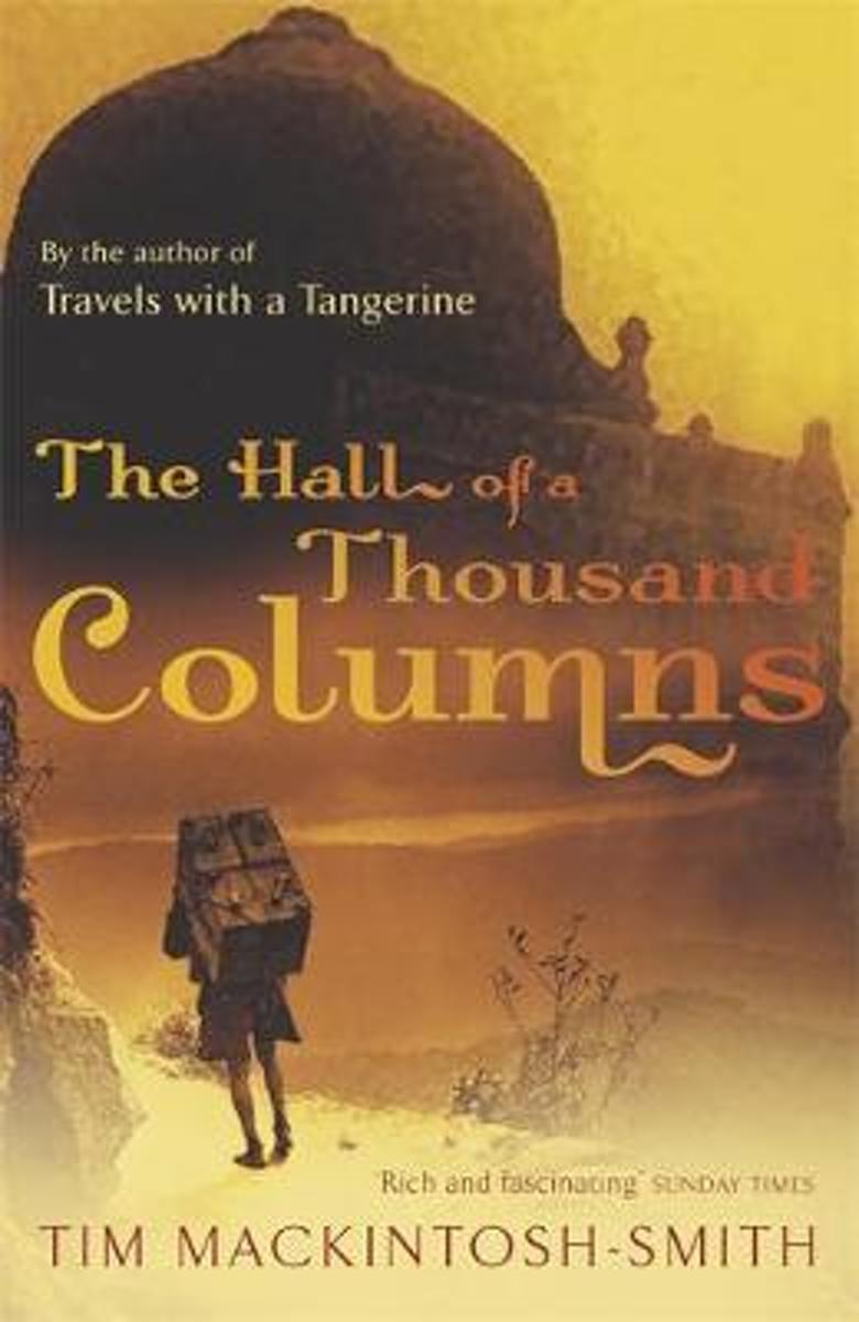
- Hall of a Thousand Columns
- All the best armchair travellers are sceptics. Those of the fourteenth century were no exception: for them, there were lies, damned lies, and Ibn Battutah's India. Born in 1304, Ibn Battutah left his native Tangier as a young scholar of law; over the course of the thirty years that followed he visited most of the known world between Morocco and... Leer más
- Also available from:
- Bol.com, Belgium
Belgium
- Hall of a Thousand Columns
- All the best armchair travellers are sceptics. Those of the fourteenth century were no exception: for them, there were lies, damned lies, and Ibn Battutah's India. Born in 1304, Ibn Battutah left his native Tangier as a young scholar of law; over the course of the thirty years that followed he visited most of the known world between Morocco and... Leer más
Netherlands
2014
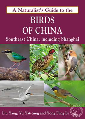
- Natuurgids a Naturalist's guide to the Birds of China | John Beaufoy
- This easy-to-use identification guide to the 280 bird species most commonly seen in Southeast China is perfect for resident and visitor alike. High quality photographs from the region's top nature photographers are accompanied by detailed species descriptions which include nomenclature, size, distribution, habits and habitat. The user-friendly... Leer más
Netherlands
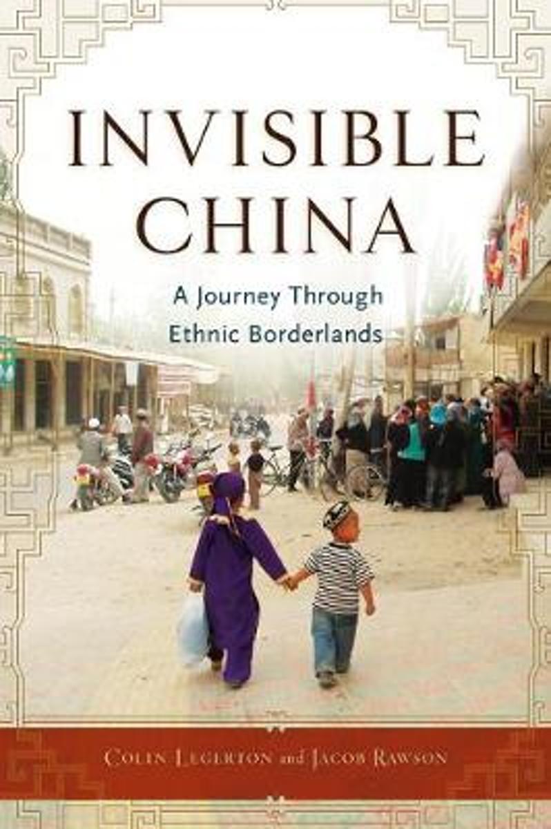
- Invisible China
- In this eloquent and eye-opening adventure narrative, Colin Legerton and Jacob Rawson bring a hitherto unrevealed side of China to light. They journey to the farthest reaches of the country to meet the minority peoples who dwell there. They engage in a heated discussion of human rights with Daur and Ewenki village cadres; celebrate Muhammads... Leer más
- Also available from:
- Bol.com, Belgium
Belgium
- Invisible China
- In this eloquent and eye-opening adventure narrative, Colin Legerton and Jacob Rawson bring a hitherto unrevealed side of China to light. They journey to the farthest reaches of the country to meet the minority peoples who dwell there. They engage in a heated discussion of human rights with Daur and Ewenki village cadres; celebrate Muhammads... Leer más
Mapas

United Kingdom
- Admiralty Routeing Chart 5149(2) - South China Sea - February
- Essential for use in passage planning for ocean voyages, Routeing Charts include routes and distances between major ports, ocean currents, ice limits, load lines and wind roses. They also contain expected meteorological and oceanographic conditions for each month of the year.Individual chart scales of 1:5,000,000, 1:10,000,000 and 1:20,000,000... Leer más

United Kingdom
- Admiralty Routeing Chart 5149(10) - South China Sea - October
- Essential for use in passage planning for ocean voyages, Routeing Charts include routes and distances between major ports, ocean currents, ice limits, load lines and wind roses. They also contain expected meteorological and oceanographic conditions for each month of the year.Individual chart scales of 1:5,000,000, 1:10,000,000 and 1:20,000,000... Leer más

United Kingdom
- Admiralty Routeing Chart 5150(6) - East China Sea - June
- Essential for use in passage planning for ocean voyages, Routeing Charts include routes and distances between major ports, ocean currents, ice limits, load lines and wind roses. They also contain expected meteorological and oceanographic conditions for each month of the year.Individual chart scales of 1:5,000,000, 1:10,000,000 and 1:20,000,000... Leer más

United Kingdom
- Admiralty Routeing Chart 5149(3) - South China Sea - March
- Essential for use in passage planning for ocean voyages, Routeing Charts include routes and distances between major ports, ocean currents, ice limits, load lines and wind roses. They also contain expected meteorological and oceanographic conditions for each month of the year.Individual chart scales of 1:5,000,000, 1:10,000,000 and 1:20,000,000... Leer más

United Kingdom
- Admiralty Routeing Chart 5149(11) - South China Sea - November
- Essential for use in passage planning for ocean voyages, Routeing Charts include routes and distances between major ports, ocean currents, ice limits, load lines and wind roses. They also contain expected meteorological and oceanographic conditions for each month of the year.Individual chart scales of 1:5,000,000, 1:10,000,000 and 1:20,000,000... Leer más

United Kingdom
- Admiralty Routeing Chart 5150(7) - East China Sea - July
- Essential for use in passage planning for ocean voyages, Routeing Charts include routes and distances between major ports, ocean currents, ice limits, load lines and wind roses. They also contain expected meteorological and oceanographic conditions for each month of the year.Individual chart scales of 1:5,000,000, 1:10,000,000 and 1:20,000,000... Leer más

United Kingdom
- Admiralty Routeing Chart 5149(4) - South China Sea - April
- Essential for use in passage planning for ocean voyages, Routeing Charts include routes and distances between major ports, ocean currents, ice limits, load lines and wind roses. They also contain expected meteorological and oceanographic conditions for each month of the year.Individual chart scales of 1:5,000,000, 1:10,000,000 and 1:20,000,000... Leer más

United Kingdom
- Admiralty Routeing Chart 5149(12) - South China Sea - December
- Essential for use in passage planning for ocean voyages, Routeing Charts include routes and distances between major ports, ocean currents, ice limits, load lines and wind roses. They also contain expected meteorological and oceanographic conditions for each month of the year.Individual chart scales of 1:5,000,000, 1:10,000,000 and 1:20,000,000... Leer más

United Kingdom
- Admiralty Routeing Chart 5150(8) - East China Sea - August
- Essential for use in passage planning for ocean voyages, Routeing Charts include routes and distances between major ports, ocean currents, ice limits, load lines and wind roses. They also contain expected meteorological and oceanographic conditions for each month of the year.Individual chart scales of 1:5,000,000, 1:10,000,000 and 1:20,000,000... Leer más
United Kingdom
- Admiralty Routeing Chart 5149(5) - South China Sea - May
- Essential for use in passage planning for ocean voyages, Routeing Charts include routes and distances between major ports, ocean currents, ice limits, load lines and wind roses. They also contain expected meteorological and oceanographic conditions for each month of the year.Individual chart scales of 1:5,000,000, 1:10,000,000 and 1:20,000,000... Leer más

United Kingdom
- Admiralty Routeing Chart 5150(1) - East China Sea - January
- Essential for use in passage planning for ocean voyages, Routeing Charts include routes and distances between major ports, ocean currents, ice limits, load lines and wind roses. They also contain expected meteorological and oceanographic conditions for each month of the year.Individual chart scales of 1:5,000,000, 1:10,000,000 and 1:20,000,000... Leer más

United Kingdom
- Admiralty Routeing Chart 5150(9) - East China Sea - September
- Essential for use in passage planning for ocean voyages, Routeing Charts include routes and distances between major ports, ocean currents, ice limits, load lines and wind roses. They also contain expected meteorological and oceanographic conditions for each month of the year.Individual chart scales of 1:5,000,000, 1:10,000,000 and 1:20,000,000... Leer más

United Kingdom
- Admiralty Routeing Chart 5149(6) - South China Sea - June
- Essential for use in passage planning for ocean voyages, Routeing Charts include routes and distances between major ports, ocean currents, ice limits, load lines and wind roses. They also contain expected meteorological and oceanographic conditions for each month of the year.Individual chart scales of 1:5,000,000, 1:10,000,000 and 1:20,000,000... Leer más

United Kingdom
- Admiralty Routeing Chart 5150(2) - East China Sea - February
- Essential for use in passage planning for ocean voyages, Routeing Charts include routes and distances between major ports, ocean currents, ice limits, load lines and wind roses. They also contain expected meteorological and oceanographic conditions for each month of the year.Individual chart scales of 1:5,000,000, 1:10,000,000 and 1:20,000,000... Leer más

United Kingdom
- Admiralty Routeing Chart 5150(10) - East China Sea - October
- Essential for use in passage planning for ocean voyages, Routeing Charts include routes and distances between major ports, ocean currents, ice limits, load lines and wind roses. They also contain expected meteorological and oceanographic conditions for each month of the year.Individual chart scales of 1:5,000,000, 1:10,000,000 and 1:20,000,000... Leer más