
Umbria
Descripción
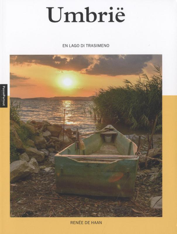
Region in the center of Italy.
Enlaces
Datos
Informes
Guías y mapas
Hospedaje
Organizaciones
Operadores turísticos
GPS
Otro
Libros

Stanfords
United Kingdom
2005
United Kingdom
2005
- Walking and Eating in Tuscany & Umbria
- In Walking and Eating in Tuscany and Umbria, James Lasdun and Pia Davis offer forty walks through the spectacular countryside of both regions. Arranged for the utmost flexibility the guide includes half-day outings easily accessible from a city base to day walks that can be linked together in a series. These itineraries are designed to combine... Leer más

Stanfords
United Kingdom
United Kingdom
- DK Eyewitness Road Trips Northern & Central Italy
- With its snow-capped mountain ranges and beautiful hill towns, Italy is an ideal destination for a leisurely road trip. It`s yours to explore with Road Trips Northern and Central Italy, our redesigned and newly updated guide containing 25 drives across the region, from the dramatic coastline of the Cinque Terre to the lakes of Lombardy and the... Leer más

Stanfords
United Kingdom
United Kingdom
- Parco Nazionale del Stelvio / NP Stilfser Joch Kompass 072
- Parco Nazionale del Stelvio (NP Stilfser Joch) on a GPS compatible hiking and recreational map at 1:50,000 from Kompass printed on durable, waterproof and tear-resistant synthetic paper.KOMPASS HIKING MAPS OF ITALY:This title is part of an extensive series of walking maps from Kompass covering selected areas of Italy at mainly 1:50,000, with a... Leer más

Stanfords
United Kingdom
United Kingdom
- Sardinia North 4-Map Set Kompass 2497
- The northern part of Sardinia on a set of four double-sided, contoured and GPS compatible recreational maps at 1:50,000 from Kompass. Extensive overprint highlights hiking trails, cycle and selected mountain bike routes, and horse riding paths. Symbols indicate various types of accommodation including campsites, youth hostels, “Friends of... Leer más

Stanfords
United Kingdom
United Kingdom
- Cortina d`Ampezzo Kompass 55
- Map No. 55, Cortina d`Ampezzo - with a panorama map on the reverse, from Kompass, printed on sturdy, waterproof and tear-resistant synthetic paper in their series of walking maps of selected areas of Italy at 1:50,000, with hiking routes on a topographic base, various types of accommodation, recreational facilities, places of interest, etc.... Leer más

Stanfords
United Kingdom
2021
United Kingdom
2021
- Lonely Planet Best Day Walks Italy
- Lonely Planet`s Best Day Walks Italy is your passport to 60 easy escapes into nature. Stretch your legs outside the city by picking a hike that works for you, from just a couple of hours to a full day, from easy to hard. Hike the Dolomites, explore the Italian Lakes, and stroll Sardinia`s coast. Get to the heart of Italy and begin your journey... Leer más
- Also available from:
- The Book Depository, United Kingdom
- De Zwerver, Netherlands


Stanfords
United Kingdom
2019
United Kingdom
2019
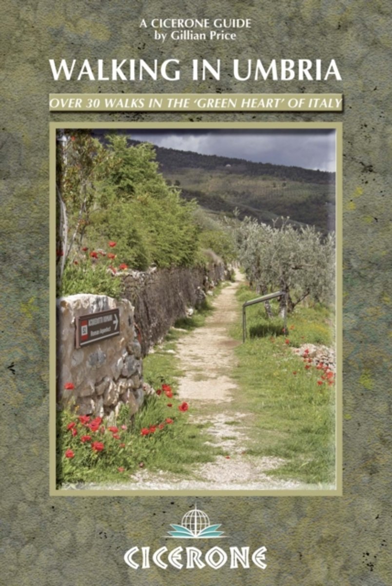
- Walking in Umbria: 40 walks in the `Green Heart` of Italy
- This guidebook by Italian walking expert Gillian Price describes 40 varied day walks in the region of Umbria, taking in the towns of Assisi, Perugia, Orvieto and Norcia. The walks range from 2.5km to 19km in length, the majority of the routes are circular, and several wonderful traverses have been included, with the return to the start point... Leer más
- Also available from:
- The Book Depository, United Kingdom
- De Zwerver, Netherlands

The Book Depository
United Kingdom
2019
United Kingdom
2019
- Walking in Umbria
- 40 walks in the 'Green Heart' of Italy Leer más

De Zwerver
Netherlands
2019
Netherlands
2019
- Wandelgids Walking in Umbria - Umbrië | Cicerone
- This guidebook describes 40 walks in Umbria, among the ancient towns of Assisi, Perugia, Orvieto and Norcia. Known as the 'green heart' of Italy, the region of Umbria is home to hills reaching up to the Apennines and Sibillini mountains, as well as ancient villages, Roman and Etruscan ruins, dense woodland and nature reserves. Leer más

Stanfords
United Kingdom
2017
United Kingdom
2017
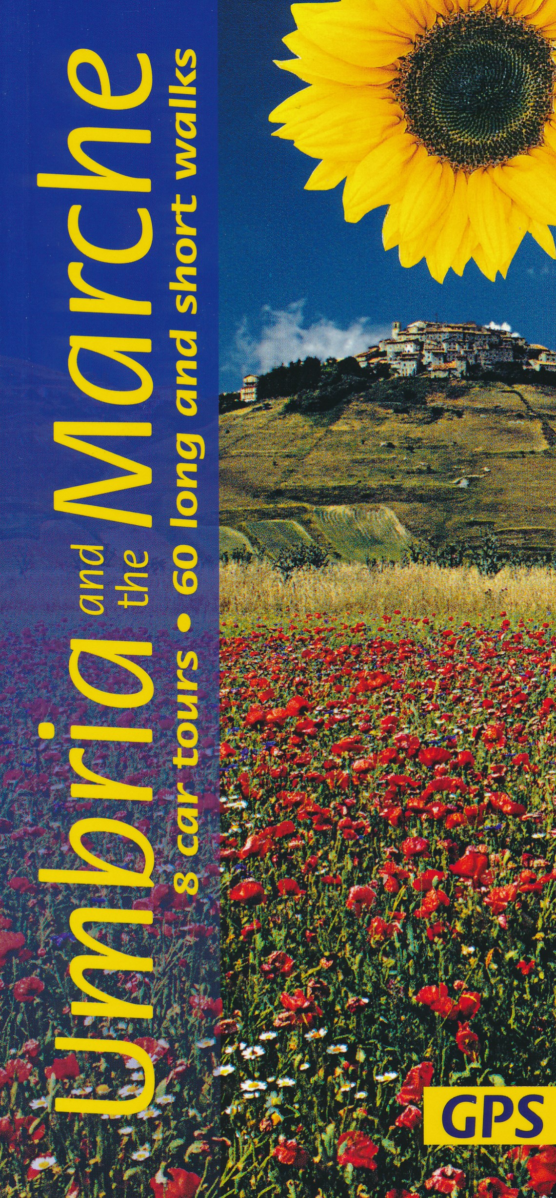
- Umbria and the Marche Sunflower Landscape Guide
- Umbria promotes itself as `Italy`s Green Heart`, and this description applies equally well to the lesser-known neighbouring region of the Marche. The main focal points of this guide are the two most beautiful areas of the Apennines in the region – the idyllic, deeply-etched valley of Valnerina in Umbria and the legendary Monti Sibillini which... Leer más
- Also available from:
- De Zwerver, Netherlands
Bol.com
Netherlands
Netherlands
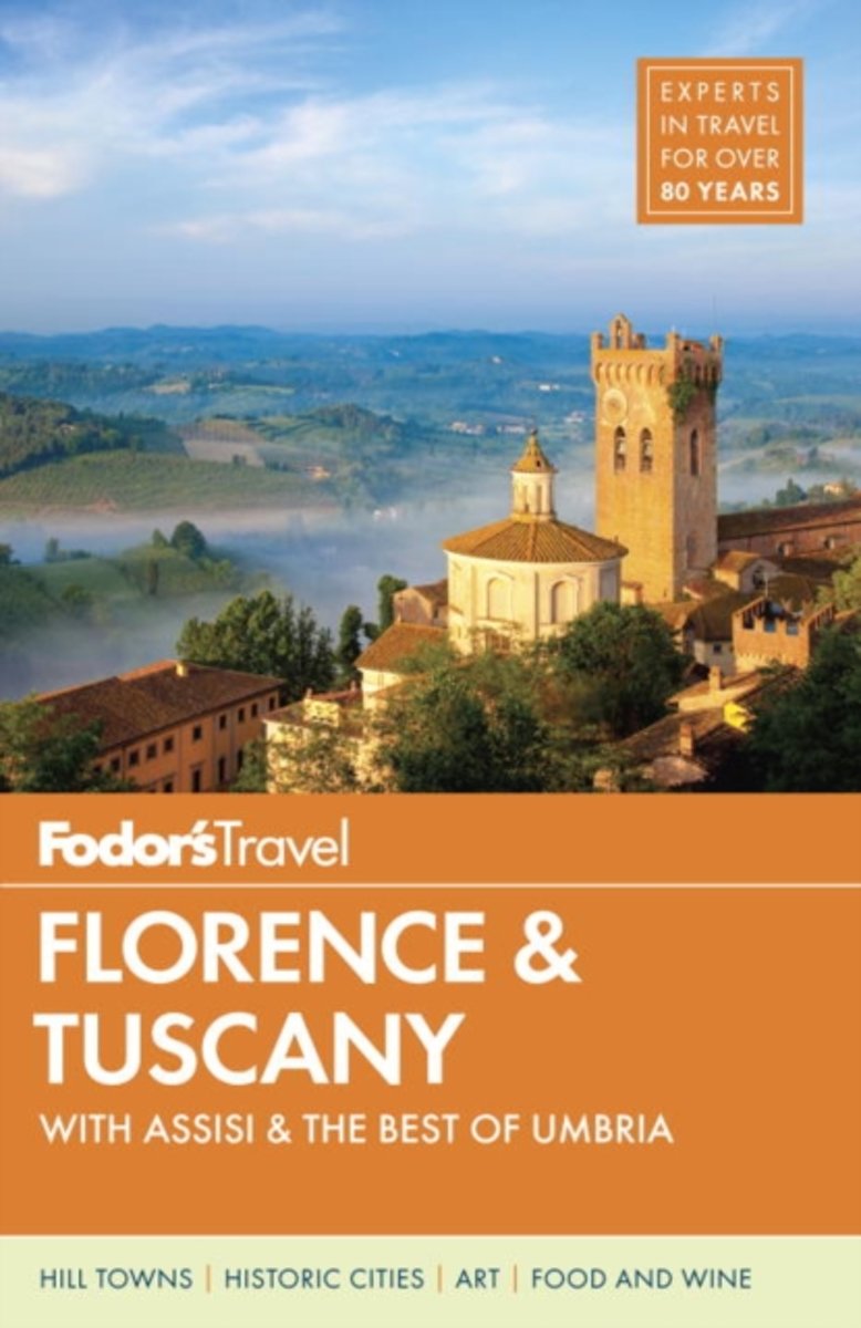
- Fodor's Florence & Tuscany
- -NEW THIS EDITION: This new, updated edition includes top new restaurant and hotel recommendations for all of Florence, Tuscany, and Umbria, as well as all the best classic spots. -ILLUSTRATED FEATURES: Illustrated full-color features on Renaissance Art, Florence's unforgettable Duomo and Santa Croce, hiking in the Cinque Terre, Siena's Piazza... Leer más
- Also available from:
- Bol.com, Belgium
Bol.com
Belgium
Belgium
- Fodor's Florence & Tuscany
- -NEW THIS EDITION: This new, updated edition includes top new restaurant and hotel recommendations for all of Florence, Tuscany, and Umbria, as well as all the best classic spots. -ILLUSTRATED FEATURES: Illustrated full-color features on Renaissance Art, Florence's unforgettable Duomo and Santa Croce, hiking in the Cinque Terre, Siena's Piazza... Leer más
De Zwerver
Netherlands
2022
Netherlands
2022

Stanfords
United Kingdom
2013
United Kingdom
2013
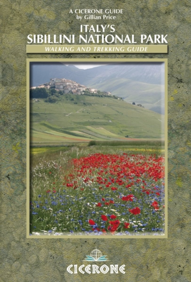
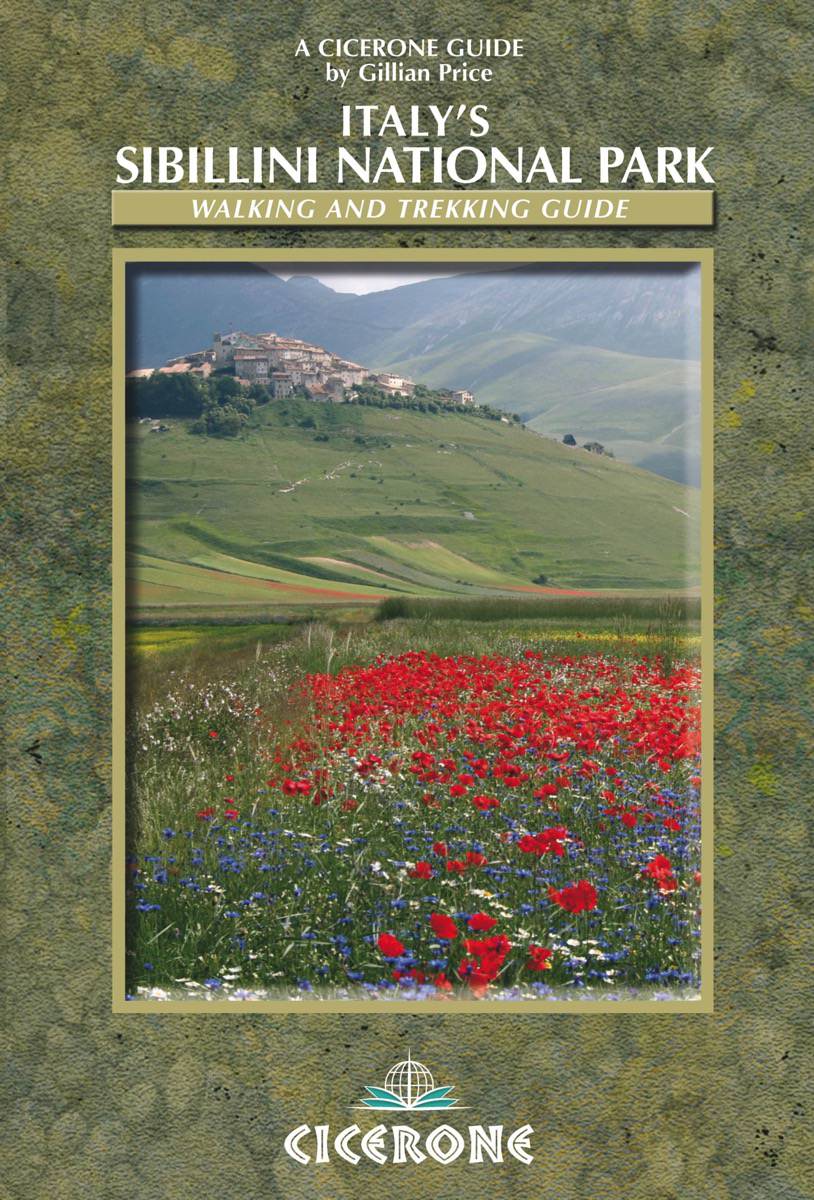
- Italy’s Sibillini National Park
- Italy’s Sibillini National Park is Gillian Price’s Cicerone guide to some of the finest walking opportunities near Monti Sibillini in the north-east of the country. The guide describes everything from short strolls to an eight-day trek that encircles the massif and its beautiful national park. This is the first English language guide to the... Leer más
- Also available from:
- The Book Depository, United Kingdom
- Bol.com, Netherlands
- Bol.com, Belgium
- De Zwerver, Netherlands

The Book Depository
United Kingdom
2013
United Kingdom
2013
- Italy's Sibillini National Park
- Walking and Trekking Guide Leer más
Bol.com
Netherlands
2013
Netherlands
2013
- Italy's Sibillini National Park
- This guidebook describes 21 day walks, and one 8-day trek (Grande Anello dei Sibillini) in Italy's Sibillini National Park. Including short strolls and suitable for all walkers, with day walks ranging from 3.5 to 20.5km, the Sibillini in Italy's Apennines are easily reached from the budget airline destinations on the Adriatic coast and from... Leer más
Bol.com
Belgium
2013
Belgium
2013
- Italy's Sibillini National Park
- This guidebook describes 21 day walks, and one 8-day trek (Grande Anello dei Sibillini) in Italy's Sibillini National Park. Including short strolls and suitable for all walkers, with day walks ranging from 3.5 to 20.5km, the Sibillini in Italy's Apennines are easily reached from the budget airline destinations on the Adriatic coast and from... Leer más
De Zwerver
Netherlands
2013
Netherlands
2013
- Wandelgids Italy's Sibillini National Park | Cicerone
- Walking and trekking guidebook to Italy's Sibillini National Park in the Apennines. 21 day walks and an 8-stage multi-day trek, the 120km Grande Anello dei Sibillini are explored alongside sketch maps and plenty of practical information. Easily reached from airports on the Adriatic coast and Rome, the Sibillini straddles the Marche and Umbria. Leer más

Stanfords
United Kingdom
2014
United Kingdom
2014
- Umbria Walking Guide - Over 30 walks in the `Green Heart` of Italy
- This guidebook by Italian walking expert Gillian Price describes 40 varied circular day walks in the region of Umbria, set between Rome and Florence and dotted with UNESCO World Heritage towns such as Orvieto, Norcia, Perugia, Gubbio, Spoleto and Assisi. The landscape, like that of neighbouring Tuscany, is one of rolling hills and deep... Leer más
- Also available from:
- Bol.com, Netherlands
- Bol.com, Belgium
Bol.com
Netherlands
2014
Netherlands
2014
- Walking in Umbria
- This guidebook by Italian walking expert Gillian Price describes 40 varied circular day walks in the region of Umbria, set between Rome and Florence and dotted with UNESCO World Heritage towns such as Orvieto, Norcia, Perugia, Gubbio, Spoleto and Assisi. The landscape, like that of neighbouring Tuscany, is one of rolling hills and deep... Leer más
Bol.com
Belgium
2014
Belgium
2014
- Walking in Umbria
- This guidebook by Italian walking expert Gillian Price describes 40 varied circular day walks in the region of Umbria, set between Rome and Florence and dotted with UNESCO World Heritage towns such as Orvieto, Norcia, Perugia, Gubbio, Spoleto and Assisi. The landscape, like that of neighbouring Tuscany, is one of rolling hills and deep... Leer más
Bol.com
Netherlands
Netherlands
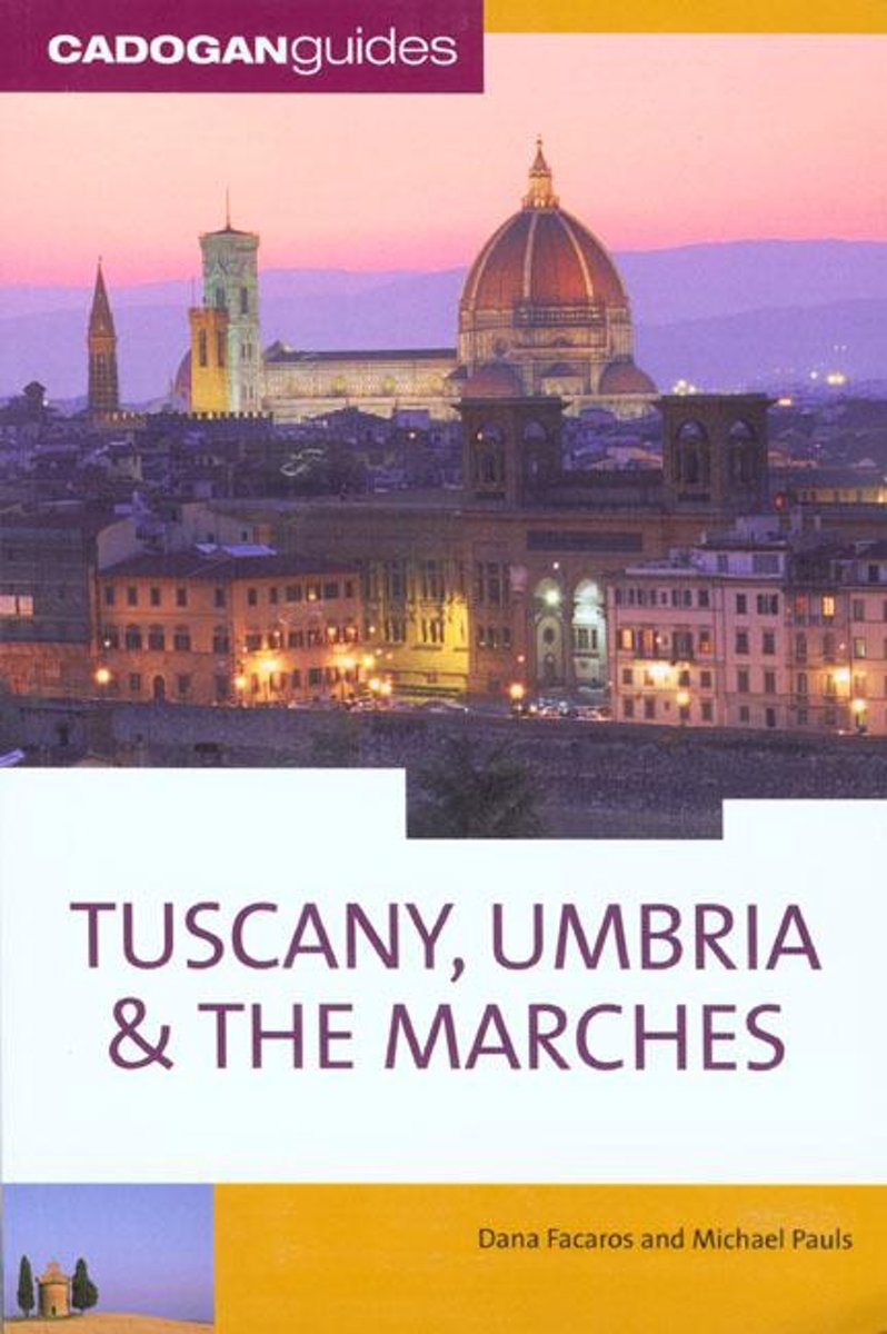
- Tuscany Umbria and the Marches
- This work delves into Tuscany's lavish natural beauty: the dense concentration of Renaissance art that spills out of Florence into Pisa, Lucca and Arezzo. It helps the reader cheer on Siena's frenzied Palio; wander through the sumptuous vineyards of Chianti; explore the medieval hill towns of green Umbria; and visit historic Perugia over the... Leer más
- Also available from:
- Bol.com, Belgium
Bol.com
Belgium
Belgium
- Tuscany Umbria and the Marches
- This work delves into Tuscany's lavish natural beauty: the dense concentration of Renaissance art that spills out of Florence into Pisa, Lucca and Arezzo. It helps the reader cheer on Siena's frenzied Palio; wander through the sumptuous vineyards of Chianti; explore the medieval hill towns of green Umbria; and visit historic Perugia over the... Leer más

Stanfords
United Kingdom
United Kingdom
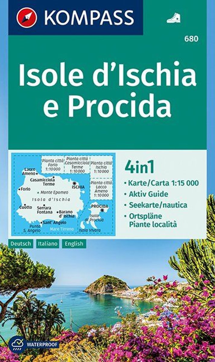
- Ischia and Procida Islands Kompass 680
- Map No. 680, Ischia and Procida, with street plan of Ischia town, Forio, Cassamicciola Terme and Lacco Ameno, plus a booklet which includes English. Printed on sturdy, waterproof and tear-resistant synthetic paper, this title is part of a series of walking maps from Kompass covering selected areas of Italy at 1:50,000, with hiking routes on a... Leer más
- Also available from:
- Bol.com, Netherlands
- Bol.com, Belgium
Bol.com
Netherlands
Netherlands
- Isole d' Ischia e Procida 1:15 000
- Deze zeer gedetailleerde Kompass wandelkaart, schaal 1:15 000, is ideaal om uw route uit te stippelen en om onderweg te gebruiken; naast de bekende bestemmingen, worden ook de minder bekende vermeld; openbaar vervoer bij begin- of eindpunt van een route aangegeven; eenvoudige wandelingen tot pittige (berg)tochten, voor getrainde en ongetrainde... Leer más
Bol.com
Belgium
Belgium
- Isole d' Ischia e Procida 1:15 000
- Deze zeer gedetailleerde Kompass wandelkaart, schaal 1:15 000, is ideaal om uw route uit te stippelen en om onderweg te gebruiken; naast de bekende bestemmingen, worden ook de minder bekende vermeld; openbaar vervoer bij begin- of eindpunt van een route aangegeven; eenvoudige wandelingen tot pittige (berg)tochten, voor getrainde en ongetrainde... Leer más
Más libros…
Mapas

Stanfords
United Kingdom
United Kingdom
- Elba & the Tuscan Archipelago 25K Ed. Multigraphic Map No. 502
- Elba and the Tuscan Archipelago at 1:25,000 in a series of hiking maps from Edizioni Multigraphic covering Tuscany, parts of Umbria, and the adjoining areas. The cartography is rather old fashioned and sometimes not as clear as in the other map series but for many areas, especially for parts of Tuscany, these are the only hiking maps available.... Leer más

Stanfords
United Kingdom
United Kingdom
- Garfagnana Edizioni Multigraphic 701
- Garfagnana at 1:50,000 in a series of hiking maps from Edizioni Multigraphic covering Tuscany, parts of Umbria, and the adjoining areas. The cartography is rather old fashioned and sometimes not as clear as in the other map series but for many areas, especially for parts of Tuscany, these are the only hiking maps available. Most maps have... Leer más

Stanfords
United Kingdom
United Kingdom
- Appennino Tosco-Romagnolo East
- Map No. 135, Appennino Tosco-Romagnolo East, in a series of GPS compatible hiking maps at 1:50,000 from the Istituto Geografico Adriatico, covering parts of central Italy: eastern Tuscany, with northern Umbria and the Marches, plus the south-eastern of part of Emilia-Romagna.The maps have contours at 50m intervals with additional shading and... Leer más

Stanfords
United Kingdom
United Kingdom
- Alpi Bellunesi Kompass 77
- Belluno and Alpi Bellunesi in the southern Dolomites on a GPS compatible hiking and recreational map at 1:50,000 from Kompass. KOMPASS HIKING MAPS OF ITALY: this title is part of an extensive series of walking maps from Kompass covering selected areas of Italy at mainly 1:50,000, with a GPS compatible, contoured topographic base, extensive... Leer más

Stanfords
United Kingdom
United Kingdom
- Valsugana - Trento - Piné - Levico - Lavarone Kompass 75
- Valsugana - Trento - Piné - Levico – Lavarone area of southern Dolomites on a GPS compatible hiking and recreational map at 1:50,000 from Kompass, printed on durable, waterproof and tear-resistant synthetic paper. On the reverse is a panorama of the Trentino region, extending from Monte Baldo and the northern part of Lake Garda northwards to... Leer más

Stanfords
United Kingdom
United Kingdom
- Monti Sibillini National Park Kompass 2474
- Monti Sibillini National Park in Umbria and the Marches on a GPS compatible hiking and recreational map at 1:50,000 from Kompass, printed on durable, waterproof and tear-resistant synthetic paper. Contours are at 40m intervals, with a 2-km UTM grid. In addition to the region’s numerous local hiking trails and several long-distance routes,... Leer más

Stanfords
United Kingdom
United Kingdom
- Lake Trasimeno - Val d`Orcia - Montepulciano - Monte Amiata Kompass 2463
- Lake Trasimeno - Val d`Orcia - Montepulciano - Monte Amiata area on a double-sided map at 1:50,000 from Kompass, printed on durable, waterproof and tear-resistant synthetic paper. Coverage includes Val di Chiana, Cortona, Montalcino, Asciano, Arcidosso, Fabro, Magione, etc. Contours are at 40m intervals, with a 2-km UTM grid. Extensive... Leer más

Stanfords
United Kingdom
United Kingdom
- Gran Sasso and Monti della Laga National Park Kompass 2476
- Gran Sasso and Monti della Laga National Park in Umbria, the Marches, Lazio and Abruzzo on a double-sided, GPS compatible hiking and recreational map at 1:50,000 from Kompass, printed on durable, waterproof and tear-resistant synthetic paper. Contours are at 40m intervals, with a 2-km UTM grid. In addition to the region’s numerous local hiking... Leer más
Stanfords
United Kingdom
United Kingdom
- Elba Kompass 2468
- Elba on a map at 1:25,000 from Kompass, with a street plan of Portoferraio and coverage of the nearby Capraia and Pianosa at 1:50,000. Contours are at 20m intervals, with relief shading and graphics/colouring to indicate different types of the terrain. An overprint highlights hiking trails, including the GTE – Grande Traversata Elbana,... Leer más

Stanfords
United Kingdom
United Kingdom
- Crete Senesi 2 - Crete Senesi 25K Ed. Multigraphic Map No. 518
- Crete Senesi 2 - Crete Senesi at 1:25,000 in a series of hiking maps from Edizioni Multigraphic covering Tuscany, parts of Umbria, and the adjoining areas. The cartography is rather old fashioned and sometimes not as clear as in the other map series but for many areas, especially for parts of Tuscany, these are the only hiking maps available.... Leer más

Stanfords
United Kingdom
United Kingdom
- Parco Regionale Migliarino - S. Rossore - Massaciuccoli Edizioni Multigraphic 503
- Mountains and Hills of Pisa, Lucca and Livorno at 1:25,000 in a series of hiking maps covering Tuscany, parts of Umbria, and the adjoining areas. The cartography is rather old fashioned and sometimes not as clear as in the other map series but for many areas, especially for parts of Tuscany, these are the only hiking maps available. Most maps... Leer más
Stanfords
United Kingdom
United Kingdom
- Alta Val Tiberina
- Map No. 125, Alta Val Tiberina, in a series of GPS compatible hiking maps at 1:50,000 from the Istituto Geografico Adriatico, covering parts of central Italy: eastern Tuscany, with northern Umbria and the Marches, plus the south-eastern of part of Emilia-Romagna.The maps have contours at 50m intervals with additional shading and numerous spot... Leer más

Stanfords
United Kingdom
United Kingdom
- Ponte di Legno - Alta Val Camonica - Passo del Tonale Kompass 107
- Ponte di Legno - Alta Val Camonica area of northern Italy on a GPS compatible hiking and recreational map at 1:50,000 from Kompass, printed on durable, waterproof and tear-resistant synthetic paper.KOMPASS HIKING MAPS OF ITALY:This title is part of an extensive series of walking maps from Kompass covering selected areas of Italy at mainly... Leer más

Stanfords
United Kingdom
United Kingdom
- Vipiteno / Sterzing Kompass 44
- Map No. 44, Vipiteno/Sterzing, from Kompass, printed on waterproof and tear-resistant synthetic paper in a series of walking maps of selected areas of Italy at 1:50,000, with hiking routes on a topographic base, various types of accommodation, recreational facilities, places of interest, etc. Kompass are Europe’s largest publishers of walking... Leer más

Stanfords
United Kingdom
United Kingdom
- Lecco - Valle Brembane - Alpi Orobie Kompass 105
- Map No. 105, Lecco - Valle Brembane, from Kompass, now published on sturdy, waterproof and tear-resistant plastic paper, in a series providing detailed coverage of the Dolomites and Lake Garda area and supplementing their main series of walking maps of Italy at 1:50,000. Maps in this series have a more detailed base and smaller contour interval... Leer más