
Alaska
Descripción
Alaska is a state in the far northwest. Very remote wilderness, often only reachable by plane. A large part lies above the Arctic Circle. Abundant wildlife.
Denali is the best known national park in Alaska, with America's highest mountain, Mount McKinley, 20,300 feet. Good place for backcountry hiking (no trails).
Backcountry hiking is also the way to explore the other great parks, like Glacier Bay and Gates of the Arctic. The Tongass National Forest and Chugach Sate Park offer hiking trails.
Mapa

Senderos en estado
Enlaces
Datos
Informes
Guías y mapas
Hospedaje
Organizaciones
Operadores turísticos
GPS
Otro
Libros

Stanfords
United Kingdom
United Kingdom
- Travelling Solo
- Solo travellers can tallor a vacation to their individual tastes, energies, and timetable; go wherever they wish; do exactly what they want to do; and meet fascinating people of all ages and all walks of life along the way. Ideas and advice for more than 250trips for solo travellers - each as varied as the ages, budgets, tastes, and interests... Leer más

Stanfords
United Kingdom
2020
United Kingdom
2020
- DK Eyewitness Alaska
- Adventure awaits in the Arctic corner of the worldWhether you want to spot grizzly bears in Denali National Park, uncover the traditions of Alaska`s Native groups or race along the scenic Haines Highway, your DK Eyewitness travel guide makes sure you experience all that Alaska has to offer.Epic in scale and wild to the core, Alaska beckons with... Leer más

Stanfords
United Kingdom
United Kingdom
- DK Eyewitness USA
- Spectacular scenery, vibrant cities and captivating culture - welcome to the USA.Whether you want to hike in breathtaking Yosemite National Park, take a road trip from coast to coast or sample southern soul food in the Deep South, your DK Eyewitness travel guide makes sure you experience all that the USA has to offer.Dramatic and diverse, the... Leer más

Stanfords
United Kingdom
United Kingdom
- Cloud Peak Wilderness WY
- Map No. 720, Cloud Peak Wilderness in Wyoming, at 1:45,000 in an extensive series of GPS compatible, contoured hiking maps of USA’s national and state parks or forests and other popular recreational areas. Cartography based on the national topographic survey, with additional tourist information.The maps, with most titles now printed on light,... Leer más

Stanfords
United Kingdom
United Kingdom
- Weminuche Wilderness CO NGS Trails Illustrated Map 140
- Map No. 140, Weminuche Wilderness, CO, in an extensive series of GPS compatible, contoured hiking maps of USA’s national and state parks or forests and other popular recreational areas. Cartography based on the national topographic survey, with additional tourist information.The maps, with most titles now printed on light, waterproof and... Leer más

Stanfords
United Kingdom
United Kingdom
- Gunnison - Pitkin CO
- Map No. 132, Gunnison - Pitkin, CO, in an extensive series of GPS compatible, contoured hiking maps of USA’s national and state parks or forests and other popular recreational areas. Cartography based on the national topographic survey, with additional tourist information.The maps, with most titles now printed on light, waterproof and... Leer más

Stanfords
United Kingdom
United Kingdom
- Clinch Ranger District - Jefferson National Forest VA/KY NGS Trails Illustrated Map 793
- Map No. 793, Jefferson Nationa Forest: Clinch Ranger District, VA/KY, in an extensive series of GPS compatible, contoured hiking maps of USA’s national and state parks or forests and other popular recreational areas. Cartography based on the national topographic survey, with additional tourist information.The maps, with most titles now printed... Leer más

Stanfords
United Kingdom
United Kingdom
- Kebler Pass - Paonia Reservoir CO
- Map No. 133, Kebler Pass - Paonia Reservoir, CO, in an extensive series of GPS compatible, contoured hiking maps of USA’s national and state parks or forests and other popular recreational areas. Cartography based on the national topographic survey, with additional tourist information.The maps, with most titles now printed on light, waterproof... Leer más

Stanfords
United Kingdom
United Kingdom
- Mammoth Cave National Park KY
- Map No. 234, Mammoth Cave National Park, KY, in an extensive series of GPS compatible, contoured hiking maps of USA’s national and state parks or forests and other popular recreational areas. Cartography based on the national topographic survey, with additional tourist information.The maps, with most titles now printed on light, waterproof and... Leer más

Stanfords
United Kingdom
United Kingdom
- Carbondale CO
- Map No. 143, Carbondale, CO, in an extensive series of GPS compatible, contoured hiking maps of USA’s national and state parks or forests and other popular recreational areas. Cartography based on the national topographic survey, with additional tourist information.The maps, with most titles now printed on light, waterproof and tear-resistant... Leer más

Stanfords
United Kingdom
United Kingdom
- Angeles National Forest CA
- Map No. 811, Angeles National Forest, CA, in an extensive series of GPS compatible, contoured hiking maps of USA’s national and state parks or forests and other popular recreational areas. Cartography based on the national topographic survey, with additional tourist information.The maps, with most titles now printed on light, waterproof and... Leer más

Stanfords
United Kingdom
United Kingdom
- Tahoe National Forest - Yuba & American Rivers CA
- Map No. 804, Tahoe National Forest: Yuba and American Rivers, CA, in an extensive series of GPS compatible, contoured hiking maps of USA’s national and state parks or forests and other popular recreational areas. Cartography based on the national topographic survey, with additional tourist information.The maps, with most titles now printed on... Leer más

Stanfords
United Kingdom
United Kingdom
- Missoula - Mission Mountains MT
- Map No. 724, Missoula - Mission Mountains in Montana at 1:70,000, part of an extensive series of GPS compatible, contoured hiking maps of USA’s national and state parks or forests and other popular recreational areas. Cartography, based on the national topographic survey, has extensive additional tourist information.The maps, printed on light,... Leer más

Stanfords
United Kingdom
United Kingdom
- Cache La Poudre - Big Thompson CO
- Map No. 101, Cache La Poudre - Big Thompson, CO, in an extensive series of GPS compatible, contoured hiking maps of USA’s national and state parks or forests and other popular recreational areas. Cartography based on the national topographic survey, with additional tourist information.The maps, with most titles now printed on light, waterproof... Leer más

Stanfords
United Kingdom
United Kingdom
- Paria Canyon - Kanab - Vermillion Cliffs NM - Grand Staircase-Escalante NM AZ/UT
- Map No. 859 covering at 1:75,000 the Paria Canyon - Kanab (Vermillion Cliffs National Monument & Grand Staircase-Escalante National Monument) area of northern Arizona and southern Utah. The title is part of an extensive series in the National Geographic’s Trails Illustrated imprint of GPS compatible, contoured hiking maps of USA’s national and... Leer más
Mapas

Stanfords
United Kingdom
United Kingdom
- Hahns Peak - Steamboat Lake CO
- Map No. 116, Hahns Peak - Steamboat Lake in Colorado, at 1:40.680 in an extensive series of GPS compatible, contoured hiking maps of USA’s national and state parks or forests and other popular recreational areas. Cartography based on the national topographic survey, with additional tourist information.The maps, with most titles now printed on... Leer más

Stanfords
United Kingdom
United Kingdom
- Fish Lake - Manti UT
- Map No. 707, Fish Lake - Capitol Reef are un Utah at 1:90,000 in an extensive series of GPS compatible, contoured hiking maps of USA’s national and state parks or forests and other popular recreational areas. Cartography based on the national topographic survey, with additional tourist information.The maps, with most titles now printed on... Leer más

Stanfords
United Kingdom
United Kingdom
- Salida - St Elmo - Shavano Peak CO
- Map No. 130, Salida - St Elmo - Shavano Peak in Colorado, at 1:40,680 in an extensive series of GPS compatible, contoured hiking maps of USA’s national and state parks or forests and other popular recreational areas. Cartography based on the national topographic survey, with additional tourist information.The maps, with most titles now printed... Leer más
Stanfords
United Kingdom
United Kingdom
- Kenai NWR - Chugach National Forest AK
- Map No. 760, Kenai NWR/Chugach National Forest, AK, in an extensive series of GPS compatible, contoured hiking maps of USA’s national and state parks or forests and other popular recreational areas. Cartography based on the national topographic survey, with additional tourist information.The maps, with most titles now printed on light,... Leer más

Stanfords
United Kingdom
United Kingdom
- Lassen Volcanic National Park CA
- Map No. 268, Lassen Volcanic National Park in California at 1:50,000, part of an extensive series of GPS compatible, contoured hiking maps of USA’s national and state parks or forests and other popular recreational areas. Cartography, based on the national topographic survey, has extensive additional tourist information.The maps, printed on... Leer más

Stanfords
United Kingdom
United Kingdom
- Glacier National Park - Two Medicine MT
- Map No. 315, Glacier National Park: Two Medicine, MT, in an extensive series of GPS compatible, contoured hiking maps of USA’s national and state parks or forests and other popular recreational areas. Cartography based on the national topographic survey, with additional tourist information.The maps, with most titles now printed on light,... Leer más

Stanfords
United Kingdom
United Kingdom
- Badlands National Park SD
- Map No. 239, Badlands National Park, SD, in an extensive series of GPS compatible, contoured hiking maps of USA’s national and state parks or forests and other popular recreational areas. Cartography based on the national topographic survey, with additional tourist information.The maps, with most titles now printed on light, waterproof and... Leer más
Stanfords
United Kingdom
United Kingdom
- Allegheny National Forest
- Map No. 739, Allegheny National Forest South in Pennsylvania at 1:70,000, in an extensive series of GPS compatible, contoured hiking maps of USA’s national and state parks or forests and other popular recreational areas. Cartography is based on the national topographic survey, with additional tourist information.The maps, with most titles now... Leer más

Stanfords
United Kingdom
United Kingdom
- Grand Gulch Plateau UT
- Map No. 706, Grand Gulch, UT, in an extensive series of GPS compatible, contoured hiking maps of USA’s national and state parks or forests and other popular recreational areas. Cartography based on the national topographic survey, with additional tourist information.The maps, with most titles now printed on light, waterproof and tear-resistant... Leer más

Stanfords
United Kingdom
United Kingdom
- San Rafael Swell UT
- Map No. 712, San Rafael Swell, UT, in an extensive series of GPS compatible, contoured hiking maps of USA’s national and state parks or forests and other popular recreational areas. Cartography based on the national topographic survey, with additional tourist information.The maps, with most titles now printed on light, waterproof and... Leer más

Stanfords
United Kingdom
United Kingdom
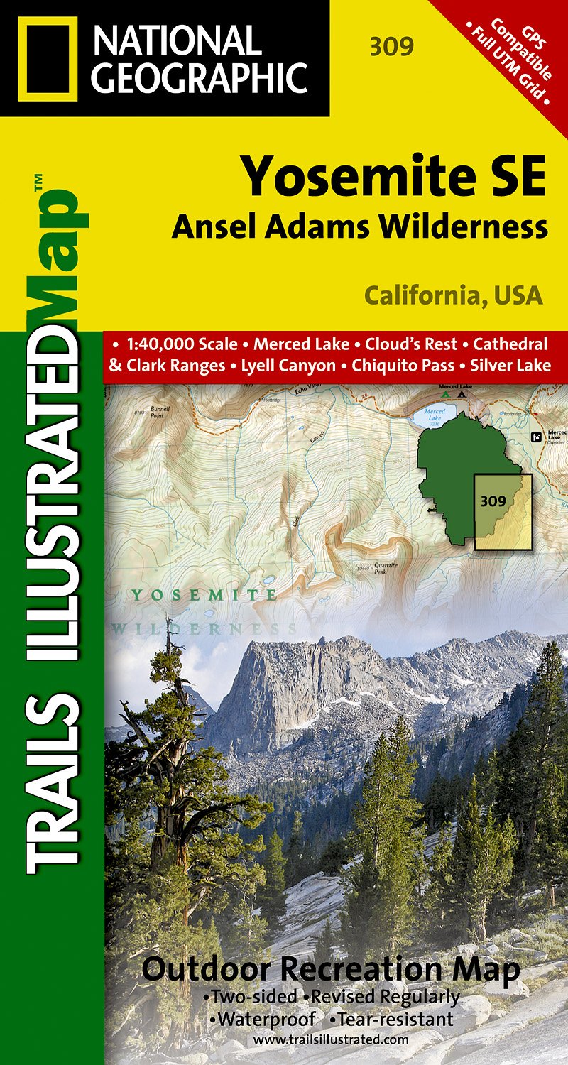
- Yosemite SE - Ansel Adams Wilderness CA
- Map No. 309, Yosemite SE: Ansel Adams Wilderness, CA, in an extensive series of GPS compatible, contoured hiking maps of USA’s national and state parks or forests and other popular recreational areas. Cartography based on the national topographic survey, with additional tourist information.The maps, with most titles now printed on light,... Leer más
- Also available from:
- The Book Depository, United Kingdom
- De Zwerver, Netherlands

The Book Depository
United Kingdom
United Kingdom
- Yosemite Se, Ansel Adams Wilderness
- Trails Illustrated National Parks Leer más
De Zwerver
Netherlands
Netherlands
- Wandelkaart 309 Yosemite SE - Ansel Adams Wilderness | National Geographic
- Prachtige geplastificeerde kaart van het nationaal park. Met alle recreatieve voorzieningen als campsites, maar ook met topografische details en wandelroutes ed. Door uitgekiend kleurgebruik zeer prettig in gebruik. Scheur en watervast! Coverage of the Tuolomne Meadows and Hoover Wilderness area of Yosemite National Park includes Ansel Adams... Leer más

Stanfords
United Kingdom
United Kingdom
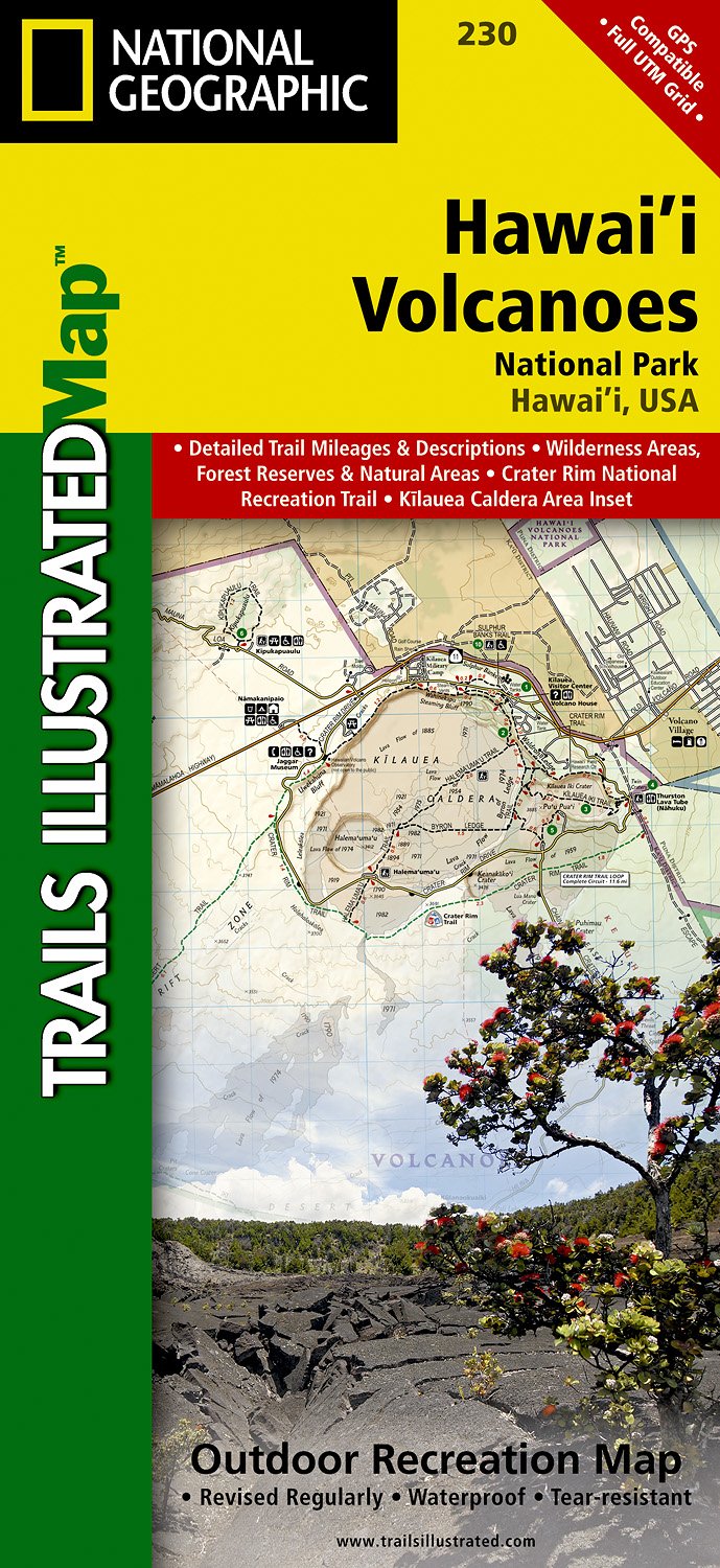
- Hawaii Volcanoes National Park HI
- Map No. 230, Hawaii Volcanoes National Park, HI, in an extensive series of GPS compatible, contoured hiking maps of USA’s national and state parks or forests and other popular recreational areas. Cartography based on the national topographic survey, with additional tourist information. The map, printed on light, waterproof and tear-resistant... Leer más
- Also available from:
- The Book Depository, United Kingdom
- De Zwerver, Netherlands

The Book Depository
United Kingdom
United Kingdom
- Hawaii Volcanoes National Park
- Trails Illustrated National Parks Leer más
De Zwerver
Netherlands
Netherlands
- Wandelkaart 230 Hawaii Volcanoes National Park | National Geographic
- Prachtige geplastificeerde kaart van het bekende nationaal park. Met alle recreatieve voorzieningen als campsites, maar ook met topografische details en wandelroutes ed. Door uitgekiend kleurgebruik zeer prettig in gebruik. Scheur en watervast! Map No. 230, Hawaii Volcanoes National Park, HI, in an extensive series of GPS compatible, contoured... Leer más

Stanfords
United Kingdom
United Kingdom
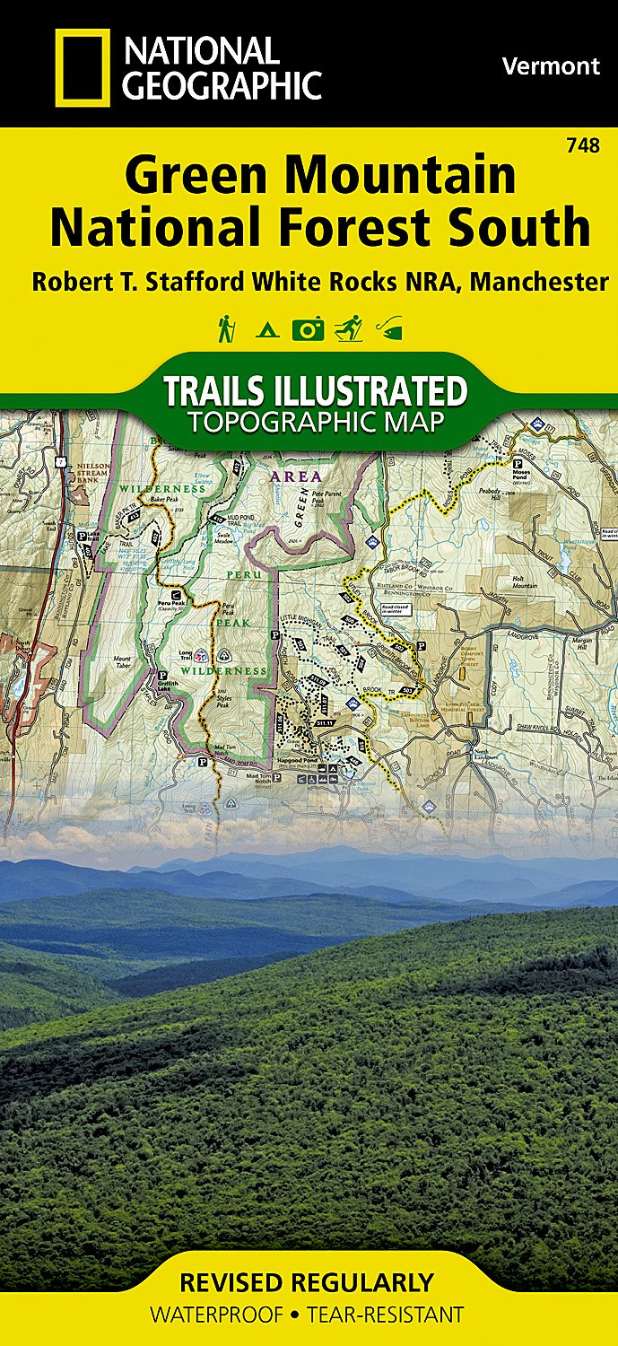
- Green Mountain National Forest South - Robert T Stafford White Rocks NRA - Manchester VT
- Map No. 748, Green Mountain National Forest: White Rocks NRA - Manchester area in Vermont, in an extensive series of GPS compatible, contoured hiking maps of USA’s national and state parks or forests and other popular recreational areas. Cartography based on the national topographic survey, with additional tourist information.The maps, with... Leer más
- Also available from:
- The Book Depository, United Kingdom
- De Zwerver, Netherlands

The Book Depository
United Kingdom
United Kingdom
- Green Mountains N.f., White Rocks Nra/manchester
- Trails Illustrated Other Rec. Areas Leer más
De Zwerver
Netherlands
Netherlands
- Wandelkaart - Topografische kaart 748 Green Mountain National Forest South - Robert T. Stafford White Rocks NRA - Manchester | National Geographic
- Prachtige geplastificeerde kaart van het bekende nationaal park. Met alle recreatieve voorzieningen als campsites, maar ook met topografische details en wandelroutes ed. Door uitgekiend kleurgebruik zeer prettig in gebruik. Scheur en watervast! National Geographic's Green Mountain National Forest South Trails Illustrated topographic map is... Leer más

Stanfords
United Kingdom
United Kingdom
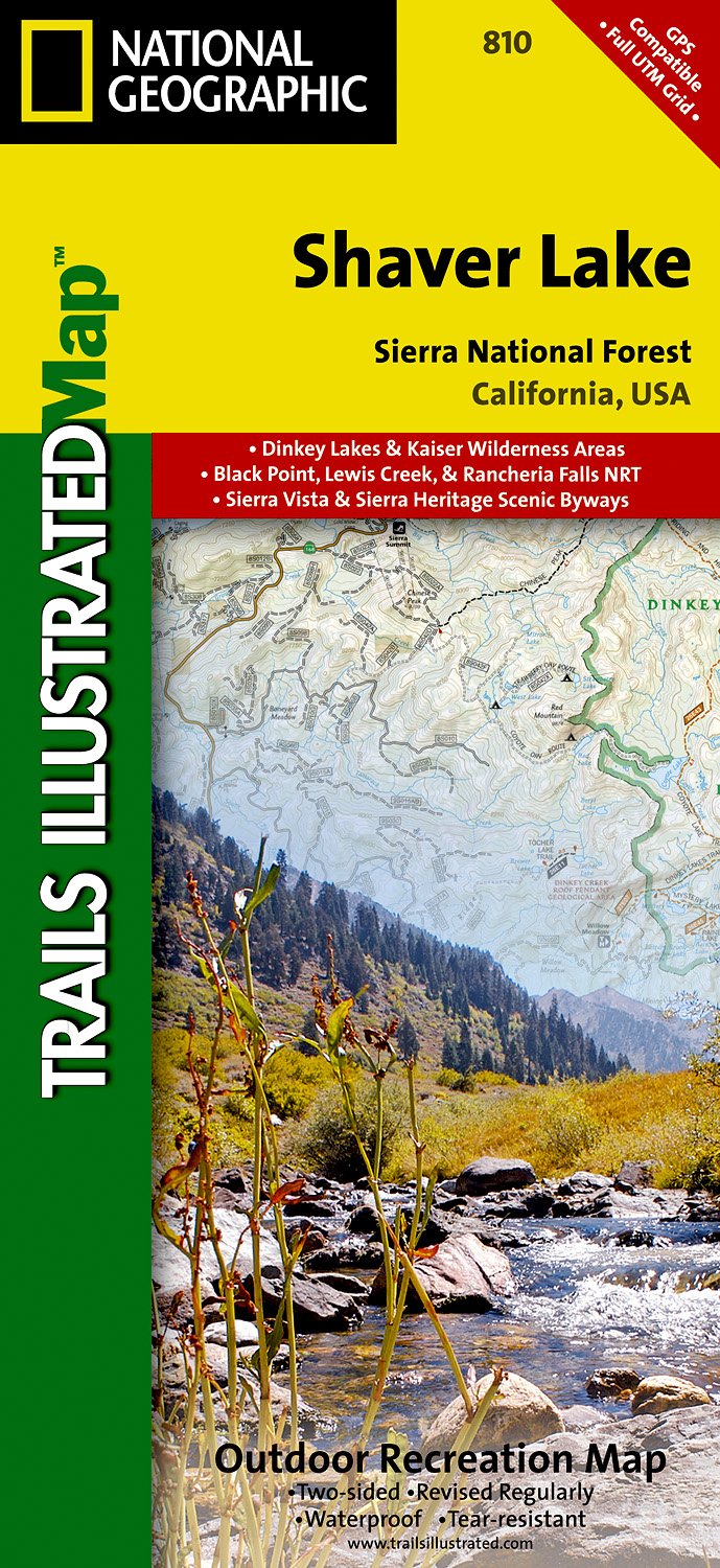
- Shaver Lake - Sierra National Forest CA
- Map No. 810, Shaver Lake / Sierra National Forest, CA, in an extensive series of GPS compatible, contoured hiking maps of USA’s national and state parks or forests and other popular recreational areas. Cartography based on the national topographic survey, with additional tourist information.The maps, with most titles now printed on light,... Leer más
- Also available from:
- The Book Depository, United Kingdom
- De Zwerver, Netherlands

The Book Depository
United Kingdom
United Kingdom
- Shaver Lake/sierra National Forest
- Trails Illustrated Other Rec. Areas Leer más
De Zwerver
Netherlands
Netherlands
- Wandelkaart - Topografische kaart 810 Shaver Lake - Sierra National Forest | National Geographic
- Prachtige geplastificeerde kaart van het bekende nationaal park. Met alle recreatieve voorzieningen als campsites, maar ook met topografische details en wandelroutes ed. Door uitgekiend kleurgebruik zeer prettig in gebruik. Scheur en watervast! Trails Illustrated Shaver Lake / Sierra National Forest is the second of five exciting new maps for... Leer más

Stanfords
United Kingdom
United Kingdom
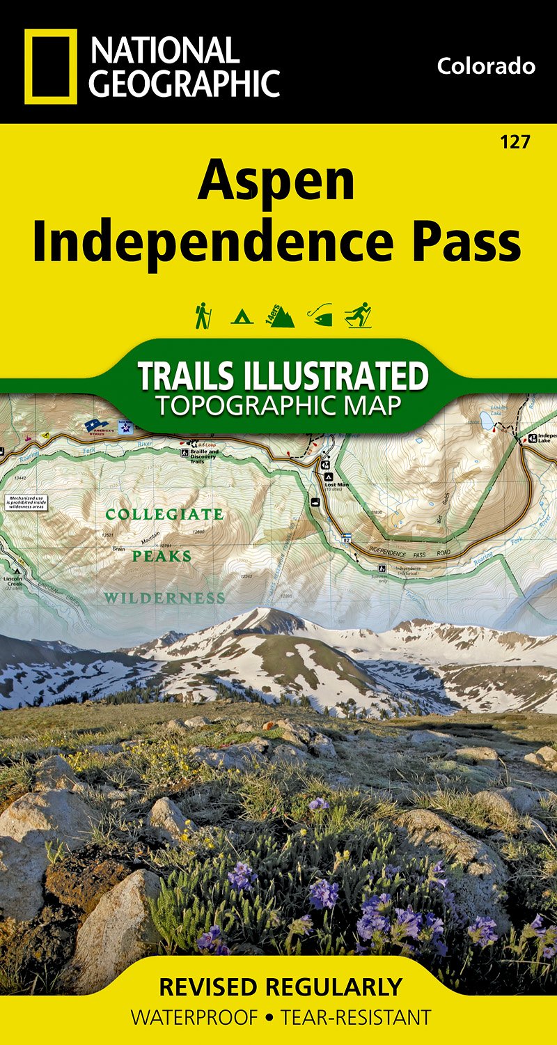
- Aspen - Independence Pass CO
- Map No. 127, Aspen - Independence Pass, in an extensive series of GPS compatible, contoured hiking maps of USA’s national and state parks or forests and other popular recreational areas. Cartography based on the national topographic survey, with additional tourist information.The maps, with most titles now printed on light, waterproof and... Leer más
- Also available from:
- The Book Depository, United Kingdom
- De Zwerver, Netherlands

De Zwerver
Netherlands
Netherlands
- Wandelkaart - Topografische kaart 127 Trails Illustrated Aspen, Independence Pass | National Geographic
- Prachtige geplastificeerde kaart van het bekende nationaal park. Met alle recreatieve voorzieningen als campsites, maar ook met topografische details en wandelroutes ed. Door uitgekiend kleurgebruik zeer prettig in gebruik. Scheur en watervast! Beautiful waterproof and tear-resistant topographical hiking map of a well-loved National Park, with... Leer más