
Sierra Nevada
Descripción
Enlaces
Datos
Informes
Guías y mapas
Hospedaje
Organizaciones
Operadores turísticos
GPS
Otro
Libros

Stanfords
United Kingdom
United Kingdom
- DK Eyewitness `Back Roads` California
- Take to the open road with Back Roads California and discover 24 leisurely drives through the state`s idyllic hamlets, gorgeous beaches and sprawling vineyards. Tour the Pacific Coast Highway, explore the vineyards of the Napa Valley, or drive through Yosemite National Park. Packed with insider tips and information, this easy-to-use guide... Leer más

Stanfords
United Kingdom
United Kingdom
- Sierra Nevada Mountain Guidebook
- Sierra Nevada Mountain Guidebook in English from Editorial Penibetica, publishers of a wide range of detailed, contoured walking maps of popular hiking areas of Andalucía. Colour extracts from their maps, overprinted with 40 routes, accompany the text.The guide is divided into colour-coded sections covering walks from different locations such... Leer más

The Book Depository
United Kingdom
United Kingdom
- Five-Star Trails: Lake Tahoe
- 40 Unforgettable Hikes in the Central Sierra Nevada Leer más

Stanfords
United Kingdom
United Kingdom
- Alpujarras Tour & Trail Super-Durable Map
- For the best adventures, use the best map. The Moorish white villages of the Alpujarras are well known to day trippers from the Costa del Sol. For walkers this is an idyllic region with stone-laid donkey trails linking the tipico villages and stretching up the southern slopes of the Sierra Nevada to Mulhacen; at 3,483 metres the highest... Leer más
- Also available from:
- The Book Depository, United Kingdom
- De Zwerver, Netherlands


The Book Depository
United Kingdom
United Kingdom
- Sierra North
- Backcountry Trips in California's Sierra Nevada Leer más

The Book Depository
United Kingdom
United Kingdom
- Sierra South
- Backcountry Trips in California's Sierra Nevada Leer más
The Book Depository
United Kingdom
United Kingdom

The Book Depository
United Kingdom
United Kingdom
- Hiking the Sierra Nevada
- A Guide to the Area's Greatest Hiking Adventures Leer más
Bol.com
Netherlands
Netherlands
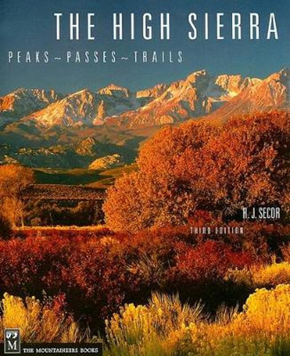
- High Sierra
- **Please note we have a few edits and updates for THE HIGH SIERRA: Peaks, Passes, Trails, 3rd Ed. Please download the edits HERE so your copy reflects the appropriate changes and additions. Thank you.** ''The Sierra climbing bible'' - The Los Angeles Times ''The best field guide to the region.'' - Men's Journal ''The guide to the Sierra... Leer más
- Also available from:
- Bol.com, Belgium
Bol.com
Belgium
Belgium
- High Sierra
- **Please note we have a few edits and updates for THE HIGH SIERRA: Peaks, Passes, Trails, 3rd Ed. Please download the edits HERE so your copy reflects the appropriate changes and additions. Thank you.** ''The Sierra climbing bible'' - The Los Angeles Times ''The best field guide to the region.'' - Men's Journal ''The guide to the Sierra... Leer más
Bol.com
Netherlands
Netherlands
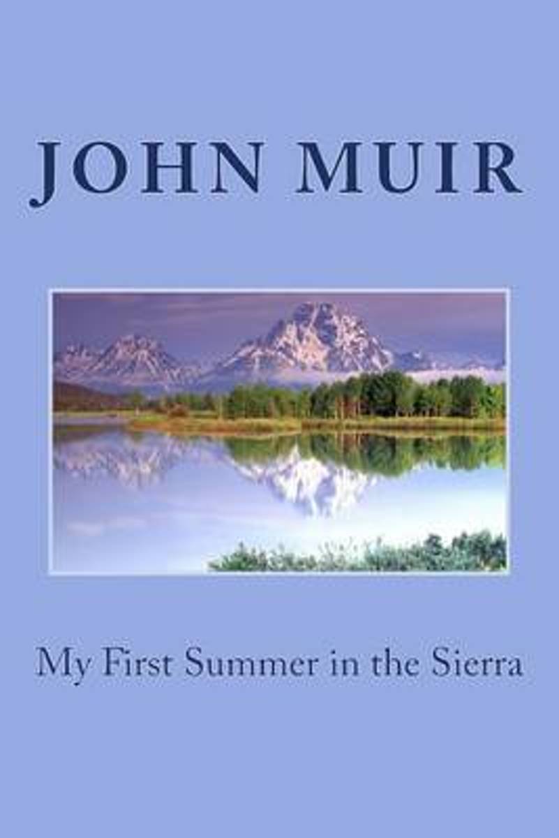
- My First Summer in the Sierra
- John Muir, a young Scottish immigrant, had not yet become the famed conservationist whom he liked to call "John o' the Mountains" when he first trekked into the foothills of the Sierra Nevada not long after the end of the Civil War. Having caught a glimpse of such magical places as Tuolumne Meadows and El Capitan, Muir ached to return, and in... Leer más
- Also available from:
- Bol.com, Belgium
Bol.com
Belgium
Belgium
- My First Summer in the Sierra
- John Muir, a young Scottish immigrant, had not yet become the famed conservationist whom he liked to call "John o' the Mountains" when he first trekked into the foothills of the Sierra Nevada not long after the end of the Civil War. Having caught a glimpse of such magical places as Tuolumne Meadows and El Capitan, Muir ached to return, and in... Leer más
Bol.com
Netherlands
Netherlands
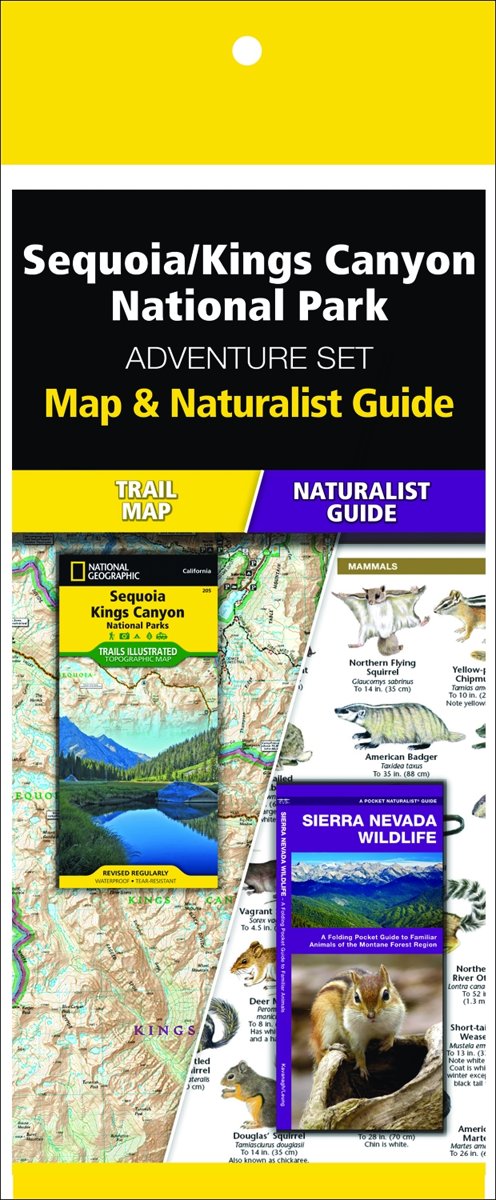
- Sequoia/Kings Canyon National Park Adventure Set
- The Sequoia & Kings Canyon Adventure Set consists of a Pocket Naturalist Guide and National Geographic map. These lightweight references are ideal to take hiking or driving while exploring this spectacular region. Waterford's folding pocket-sized, Sierra Nevada Wildlife guide is a beautifully illustrated reference to over 140 familiar and... Leer más
- Also available from:
- Bol.com, Belgium
Bol.com
Belgium
Belgium
- Sequoia/Kings Canyon National Park Adventure Set
- The Sequoia & Kings Canyon Adventure Set consists of a Pocket Naturalist Guide and National Geographic map. These lightweight references are ideal to take hiking or driving while exploring this spectacular region. Waterford's folding pocket-sized, Sierra Nevada Wildlife guide is a beautifully illustrated reference to over 140 familiar and... Leer más

Bol.com
Netherlands
Netherlands
- Sierra Nevada Tree Identifier
- This handy book is designed to allow users to quickly identify the trees they encounter in the Sierra Nevada. Unlike other tree identification manuals, it limits its scope. A total of 38 of the most common species are included, along with information on distinguishing similar tree varieties, a discussion of plant relationships, a listing of... Leer más
- Also available from:
- Bol.com, Belgium
Bol.com
Belgium
Belgium
- Sierra Nevada Tree Identifier
- This handy book is designed to allow users to quickly identify the trees they encounter in the Sierra Nevada. Unlike other tree identification manuals, it limits its scope. A total of 38 of the most common species are included, along with information on distinguishing similar tree varieties, a discussion of plant relationships, a listing of... Leer más
Bol.com
Netherlands
Netherlands
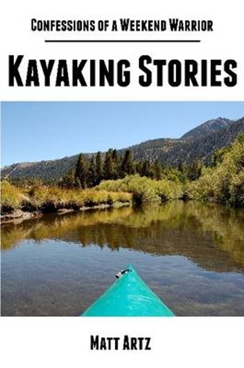
- Confessions of a Weekend Warrior
- From Southern California to Botswana, the Sierra Nevada Mountains to South Africa, and Greece to the Mojave Desert, this short collection of hiking stories illustrates life's little adventures -weekend and other relatively short trips here and there designed to quench your desire for wildness. Because even the shortest outing can leave a... Leer más
- Also available from:
- Bol.com, Belgium
Bol.com
Belgium
Belgium
- Confessions of a Weekend Warrior
- From Southern California to Botswana, the Sierra Nevada Mountains to South Africa, and Greece to the Mojave Desert, this short collection of hiking stories illustrates life's little adventures -weekend and other relatively short trips here and there designed to quench your desire for wildness. Because even the shortest outing can leave a... Leer más
De Zwerver
Netherlands
2020
Netherlands
2020
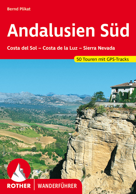
- Wandelgids 267 Andalusië süd - zuid - Costa del Sol - Costa de la Luz - Sierra Nevada | Rother Bergverlag
- Duitstalige wandelgids met zeer goed beschreven wandelingen in de genoemde gebieden. Redelijk kaartmateriaal, vooral de beschrijving van de route en de praktische info die er bij hoort is goed. Andalusien Süd – vom Cabo de Trafalgar bis zum Cabo de Gata Andalusien, die südlichste Region des spanischen Festlandes, vereint in kleinerem Maßstab... Leer más
Bol.com
Netherlands
Netherlands
- Hiking Sequoia and Kings Canyon National Parks
- Sequoia and Kings Canyon National Parks, situated in California's rugged Sierra Nevada, boast some of the most spectacular landscapes on the continent: towering groves of giant sequoia trees, crystalline trout rivers, jagged peaks and alpine meadows, and Mount Whitney, the highest mountain in the lower 48. Discover over 80 of the best hikes in... Leer más
- Also available from:
- Bol.com, Belgium
Bol.com
Belgium
Belgium
- Hiking Sequoia and Kings Canyon National Parks
- Sequoia and Kings Canyon National Parks, situated in California's rugged Sierra Nevada, boast some of the most spectacular landscapes on the continent: towering groves of giant sequoia trees, crystalline trout rivers, jagged peaks and alpine meadows, and Mount Whitney, the highest mountain in the lower 48. Discover over 80 of the best hikes in... Leer más
Mapas
Stanfords
United Kingdom
United Kingdom
- Bachimala - Valles de Chistau y Bielsa Editorial Alpina
- Bachimala area of the High Pyrenees in Spain on a contoured and GPS compatible map at 1:25,000 from Editorial Alpina, with a booklet including English language descriptions of recommended walks, extensive accommodation list, etc. With the peak of Gran Bachimala towards the north-eastern corner of the map, coverage extends west to Bielsa and... Leer más

Stanfords
United Kingdom
United Kingdom
- Muntanya d’Alinyà Editorial Alpina
- Muntanya d’Alinyà, including Serra d’Aubenç and Serra de Turp, in an extensive and very popular series of walking maps from Editorial Alpina covering the Pyrenees, Catalonia and other selected hiking areas in Spain, including Picos de Europa, Sierra Nevada and parts of Andalucía, Majorca, etc. Scales vary from 1:50,000 to 1:10,000, with the... Leer más

Stanfords
United Kingdom
United Kingdom
- Andalusia Autonomous Community CNIG Physical Road Map
- Andalucía Autonomous Region of Spain at 1:400,000 on a large physical map from the IGN/CNIG - country’s civilian survey organization providing an excellent picture of the region’s topography, from the peaks of Sierra Nevada to the marshes of the Doñana National Park.Relief shading is enhanced by bright altitude colouring, with plenty of names... Leer más

Stanfords
United Kingdom
United Kingdom
- Sierra Nevada - Las Alpujarras CNIG Map
- Sierra Nevada Mountain, southern Spain’s most popular national park, on GPS compatible map at 1:100,000 from IGN/CNIG with cartography based on their civilian topographic survey of Spain, plus a panorama drawing of the mountains as seen from the coast. The map covers a large area, extending from Granada in the west to beyond Gérgal in the east,... Leer más

Stanfords
United Kingdom
United Kingdom
- Landscapes along the River Ter Ed. Alpina 40K Map
- Landscapes along the River Ter map in an extensive and very popular series of walking maps from Editorial Alpina covering the Pyrenees, Catalonia and other selected hiking areas in Spain, including Picos de Europa, Sierra Nevada and parts of Andalucía, Majorca, etc. Scales vary from 1:50,000 to 1:10,000, with the majority of the titles at... Leer más

Stanfords
United Kingdom
United Kingdom
- Valles de Belagua y Roncal Editorial Alpina
- Valles de Belagua & Roncal in an extensive and very popular series of walking maps from Editorial Alpina covering the Pyrenees, Catalonia and other selected hiking areas in Spain, including Picos de Europa, Sierra Nevada and parts of Andalucía, Majorca, etc. Scales vary from 1:50,000 to 1:10,000, with the majority of the titles at 1:25,000. The... Leer más

Stanfords
United Kingdom
United Kingdom
- Vall de Barravés - Ribagorça Editorial Alpina
- Val de Barravés - Ribagorça at 1:25,000 in an extensive and very popular series of walking maps from Editorial Alpina covering the Pyrenees, Catalonia and other selected hiking areas in Spain, including Picos de Europa, Sierra Nevada and parts of Andalucía, Majorca, etc.Scales of maps in this series vary from 1:50,000 to 1:10,000, with the... Leer más

Stanfords
United Kingdom
United Kingdom
- GR 240: Tour of the Sierra Nevada (Sendero Sulayr)
- A tour around the Sierra Nevada presented in an English language guide from Editorial Penibética, with contoured mapping at 1:40,000, detailed descriptions of each stage, route profiles, numerous colour photographs, etc.The guide divides the route into 19 stages of between 2h 30’ and 7h 30’, covering it in an anti-clockwise direction starting... Leer más

Stanfords
United Kingdom
United Kingdom
- Sierra Nevada - the Traverse at 3000m Editorial Piolet Hiking Map
- Sierra Nevada: The Traverse at 3000m Altitude map at 1:25,000 in a series of GPS compatible maps from Editorial Piolet with cartography based on Spain’s civilian topographic survey overprinted with hiking routes and other tourist information. The map highlights the course of “La Integral de los 3000” route across the highest part of the Sierra... Leer más

Stanfords
United Kingdom
United Kingdom
- Val d`Aran by UTMB Editorial Alpina Trail running race Map
- Val d`Aran in an extensive and very popular series of walking maps from Editorial Alpina covering the Pyrenees, Catalonia and other selected hiking areas in Spain, including Picos de Europa, Sierra Nevada and parts of Andalucía, Majorca, etc. Scales vary from 1:50,000 to 1:10,000, with the majority of the titles at 1:25,000. The maps have... Leer más

Stanfords
United Kingdom
United Kingdom
- Andalucía East: Granada - Almería - Murcia 500K CNIG Regional Map No. 12
- The eastern part of Andalucía with Granada and Sierra Nevada, extending along the Mediterranean coast from Velez-Malága to Cartagena and Mar Menor, at 1:500,000 in a series of regional road maps from the country’s civilian survey organization IGN-CNIG (Instituto Geográfico Nacional - Centro Nacional de Información Geográfica), vividly... Leer más
Stanfords
United Kingdom
United Kingdom
- Sant Llorenc del Munt i l`Obac Editorial Alpina
- Sant Llorenç del Munt i l`Obac area at 1:25,000 in an extensive and very popular series of walking maps from Editorial Alpina. Contours are at 10m intervals, enhanced by relief shading and vegetation colouring. The map has UTM grid and 1’ margin ticks. In addition to footpaths, the overprint shows various types of accommodation (hotels,... Leer más

Stanfords
United Kingdom
United Kingdom
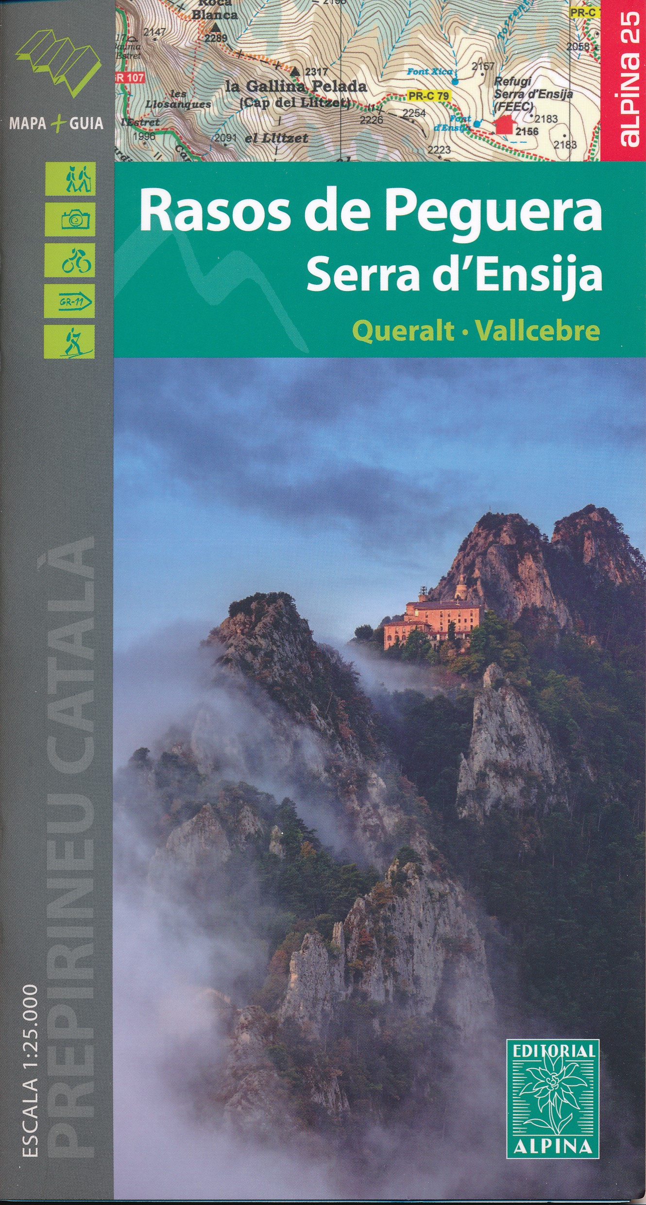
- Rasos de Peguera - Serra d`Ensija Editorial Alpina
- Rasos de Peguera - Serra d`Ensija in an extensive and very popular series of walking maps from Editorial Alpina covering the Pyrenees, Catalonia and other selected hiking areas in Spain, including Picos de Europa, Sierra Nevada and parts of Andalucía, Majorca, etc. Scales vary from 1:50,000 to 1:10,000, with the majority of the titles at... Leer más
- Also available from:
- The Book Depository, United Kingdom
- De Zwerver, Netherlands


Stanfords
United Kingdom
United Kingdom
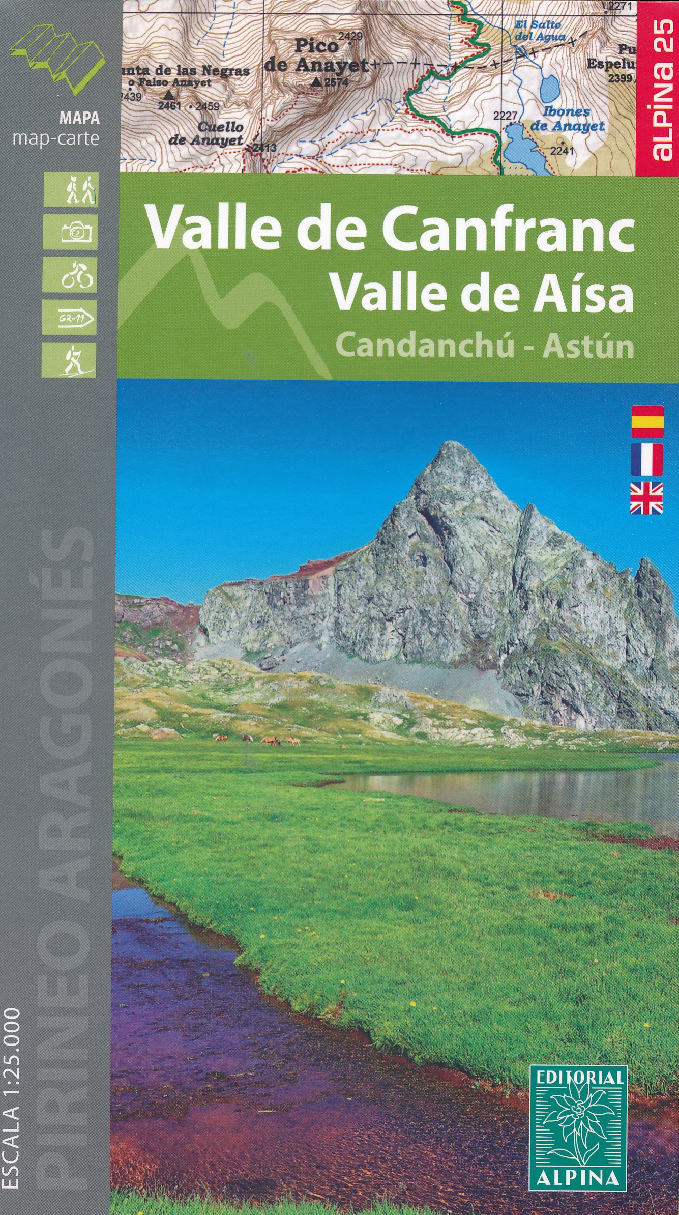
- Valle de Canfranc - Valle de Aisa - Candanchu - Astun Editorial Alpina
- Valle de Canfranc - Valle de Aisa in an extensive and very popular series of walking maps from Editorial Alpina covering the Pyrenees, Catalonia and other selected hiking areas in Spain, including Picos de Europa, Sierra Nevada and parts of Andalucía, Majorca, etc. Scales vary from 1:50,000 to 1:10,000, with the majority of the titles at... Leer más
- Also available from:
- The Book Depository, United Kingdom
- De Zwerver, Netherlands


Stanfords
United Kingdom
United Kingdom
- Delta of the Ebro – Serra de Montsià Editorial Alpina
- The Delta of the Ebro – Serra de Montsià in an extensive and very popular series of walking maps from Editorial Alpina covering the Pyrenees, Catalonia and other selected hiking areas in Spain, including Picos de Europa, Sierra Nevada and parts of Andalucía, Majorca, etc. Scales vary from 1:50,000 to 1:10,000, with the majority of the titles... Leer más
- Also available from:
- The Book Depository, United Kingdom

The Book Depository
United Kingdom
United Kingdom
- Delta de l'Ebre PN - Serra de Montsia
- The Delta of the Ebro – Serra de Montsià in an extensive and very popular series of walking maps from Editorial Alpina covering the Pyrenees, Catalonia and other selected hiking areas in Spain, including Picos de Europa, Sierra Nevada and parts of Andalucía, Majorca, etc. Scales vary from 1:50,000 to 1:10,000, with the majority of the titles... Leer más