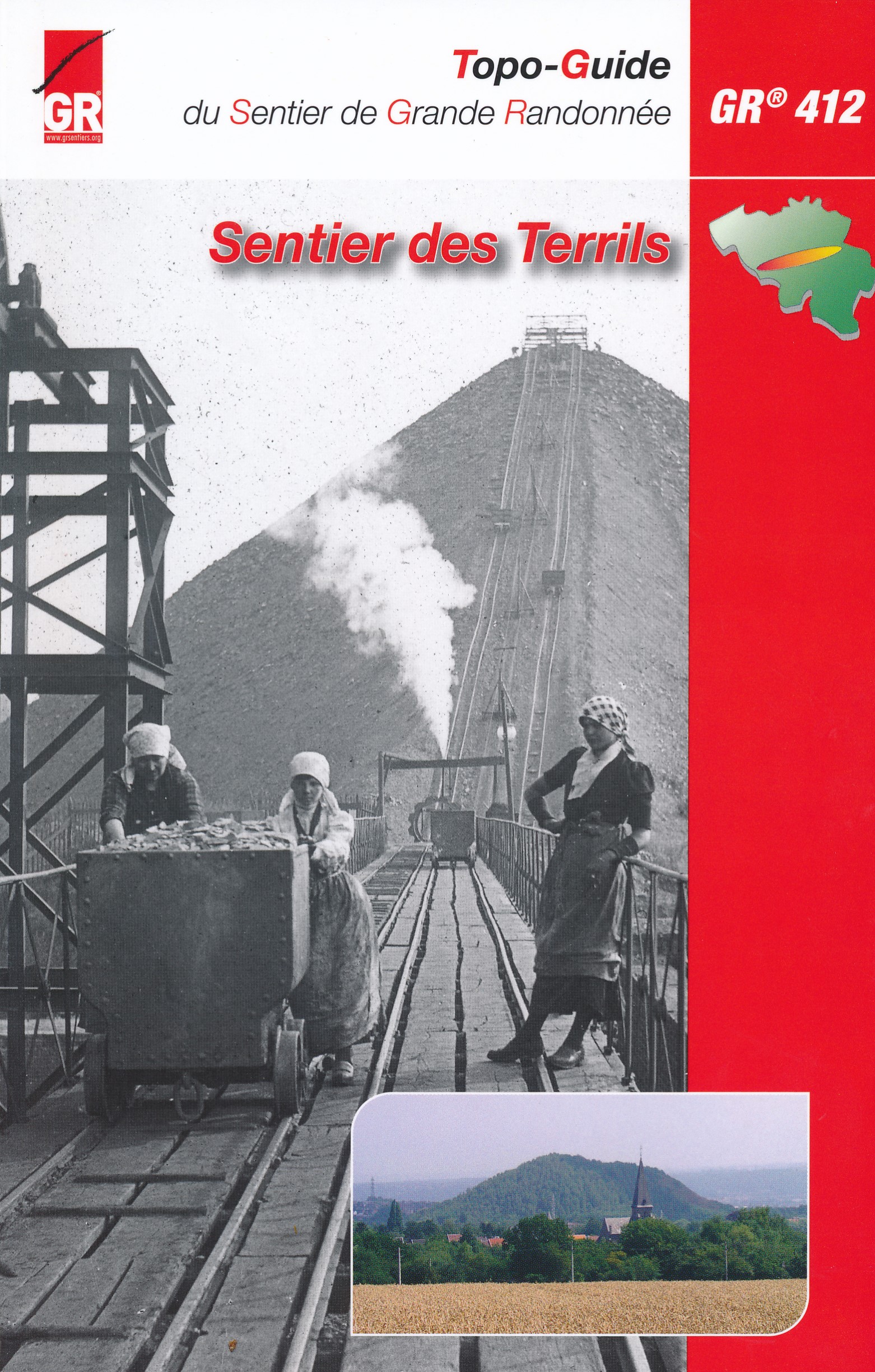
GR412 - Sentier des Terrils
Descripción
- Name GR412 - Sentier des Terrils (GR142)
- Distancia de sendero 279 km, 173 millas
- Duración en días 14 días
- Inicio de sendero Blegny-Mine
- Fin de sendero Bernissart
- Clasificación Traildino EW, Paseo fácil, sendero en la naturaleza


412
Sentier des Terrils, 279 km
This is a mineworkers trail. A Terril is a spoil tip from the mines. This GR climbs some of them, offering good views. Generations of mineworkers had their lifes in these villages and mines.
Select some tracks
☐GR 412 Sentier des Terrils, 308km
☐GR 412 Ouest - Sentier des Terrils, 141km
☐GR 412 Boucle 1 Boucle Noire, 21km
☐Boucle du site minier du Martinet GR 412 variante, 1.4km
☐GR412 Circuit 1 Tour de Flémalle, 2.5km
☐GR 412 - Circuit 1 Tour de Flémalle C1, 20km
☐GR 412 Boucle 2 Les Coteaux, 9.4km
☐GR 412 Boucle 3 Hasard-Bas Bois, 11km
☐GR 412 - Circuit n° 2 Saint-Nicolas - Espérance - Gosson, 13km
☐De Laon à Verzenay, 8.1km
☐GR 412 alternative
☐GR 412 Liaison gare de Namur, 5km
☐GR 412 Liaison GR 573 et gare d'Angleur, 9.4km
☐GR 412 Liaison gare de Thulin, 1.8km
☐GR 412 Boucle Noire variante sommet terril des Piges, 0.4km
Mapa

Enlaces
Datos
Informes
Guías y mapas
Hospedaje
Organizaciones
Operadores turísticos
GPS
Otro
Libros

Stanfords
United Kingdom
United Kingdom
- Alpujarras Tour & Trail Super-Durable Map
- For the best adventures, use the best map. The Moorish white villages of the Alpujarras are well known to day trippers from the Costa del Sol. For walkers this is an idyllic region with stone-laid donkey trails linking the tipico villages and stretching up the southern slopes of the Sierra Nevada to Mulhacen; at 3,483 metres the highest... Leer más
- Also available from:
- The Book Depository, United Kingdom
- De Zwerver, Netherlands


Más libros…