
Dolomiti
Descripción
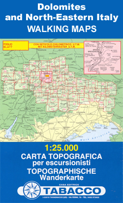
Mapa

Senderos en región
- Alta Via Dolomiti 1GPX
- Alta Via Dolomiti 10
- Alta Via Dolomiti 2GPX
- Alta Via Dolomiti 3GPX
- Alta Via Dolomiti 4GPX
- Alta Via Dolomiti 5
- Alta Via Dolomiti 6GPX
- Alta Via Dolomiti 7
- Alta Via Dolomiti 8
- Alta Via Dolomiti 9
- Südalpenweg - 3GPX
- Sentiero della PaceGPX
- Tiroler Höhenweg
- Traumpfad München-VenedigGPX
- Via AlpinaGPX
Enlaces
Datos
Informes
Guías y mapas
Hospedaje
Organizaciones
Operadores turísticos
GPS
Otro
Libros

Stanfords
United Kingdom
2019
United Kingdom
2019
- Dolomites
- Several new walks have been added in this 3rd edition; the maps have been redesigned with waypoints which correspond to coloured waypoints in the text, and free downloadable GPS tracks are now available for all the walks. Colour coding on the Contents page enables you to see at a glance the grading of various walks. As far as we know, this is... Leer más

Stanfords
United Kingdom
2016
United Kingdom
2016
- Dolomites & Eastern South Tyrol
- This comprehensive guide, covers all aspects of the area - history, legends, customs, food, art and architecture, transport and other practicalities. Detailed plans of the major towns and villages include locations of places to stay and eat; separate index entries list over 150 recommended restaurants. Each chapter covers a specific area, with... Leer más

Stanfords
United Kingdom
2015
United Kingdom
2015
- Dolomites Shorter Walks: 50 Varied Day Walks in the Mountains
- Shorter Walks in the Dolomites is Gillian Price’s Cicerone guide to a selection of the best rambles in the mountains of northern Italy. The walks range from Nova Levante in the west to the Austrian border and the guide covers a range of walks varying from short strolls to full-day expeditions and includes both high-mountain and valley walks. A... Leer más

Stanfords
United Kingdom
United Kingdom
- DK Eyewitness Venice and the Veneto
- Welcome to this enchanting corner of ItalyWhether you want to wander around a magical maze of canals, sample delicious cuisine, ramble through majestic mountains or relive fascinating history, your DK Eyewitness travel guide makes sure you experience all that Venice and the Veneto have to offer.The jewel of the Veneto, Venice is a dreamlike... Leer más

Stanfords
United Kingdom
United Kingdom
- Dolomites & Eastern South Tyrol SUPERCEDED
- This comprehensive guide, covers all aspects of the area - history, legends, customs, food, art and architecture, transport and other practicalities. Detailed plans of the major towns and villages include locations of places to stay and eat; separate index entries list over 150 recommended restaurants. Each chapter covers a specific area, with... Leer más

Stanfords
United Kingdom
United Kingdom
- Ortles / Ortler - Cevedale Kompass 077
- Ortles/Ortler - Cevedale area at 1:25,000 on a durable, waterproof and tear-resistant map from Kompass in their series of detailed maps of the Dolomites.CARTOGRAPHY: Kompass maps of the Dolomites at 1:25,000 have contours at 25-m intervals. An overprint shows local and long-distance footpaths, including all the high level routes (Alte Vie). The... Leer más

Stanfords
United Kingdom
United Kingdom
- Naturno / Naturns - Laces / Latsch - Val Senales / Schnalstal Kompass 051
- Map No. 051, Naturno/Naturns - Laces/Latsch, from Kompass, printed on waterproof and tear-resistant synthetic paper in a series providing detailed coverage of the Dolomites and Lake Garda area and supplementing their main series of walking maps of Italy at 1:50,000. Maps in this series have a more detailed base and smaller contour interval than... Leer más

Stanfords
United Kingdom
United Kingdom
- Cortina d`Ampezzo Kompass 55
- Map No. 55, Cortina d`Ampezzo - with a panorama map on the reverse, from Kompass, printed on sturdy, waterproof and tear-resistant synthetic paper in their series of walking maps of selected areas of Italy at 1:50,000, with hiking routes on a topographic base, various types of accommodation, recreational facilities, places of interest, etc.... Leer más

Stanfords
United Kingdom
United Kingdom
- Monti di Fundres / Pfunderer Berge Kompass 081
- Monti di Fundres / Pfunderer Berge area at 1:25,000 on a durable, waterproof and tear-resistant map from Kompass in their series of detailed maps of the Dolomites.CARTOGRAPHY: Kompass maps of the Dolomites at 1:25,000 have contours at 25-m intervals. An overprint shows local and long-distance footpaths, including all the high level routes (Alte... Leer más

Stanfords
United Kingdom
United Kingdom
- Pale di San Martino - Primiero San Martino di Castrozza - Paneveggio - Valle del Vanoi Kompass 622
- Pale di S.Martino - Fiera di Primiero - Panaveggio - Valle del Vanoi area at 1:25,000 on a durable, waterproof and tear-resistant map from Kompass in their series of detailed maps of the Dolomites.CARTOGRAPHY: Kompass maps of the Dolomites at 1:25,000 have contours at 25-m intervals. An overprint shows local and long-distance footpaths,... Leer más

Stanfords
United Kingdom
United Kingdom
- Dolomiti di Braies - Pragser Dolomiten Kompass 145
- Map No. 145, Dolomiti di Braies - Pragser Dolomiten at 1:25,000 printed on sturdy waterproof and tear-resistant plastic paper. The map is part of Kompass series providing detailed coverage of the Dolomites and Lake Garda area and supplementing their main series of walking maps of Italy at 1:50,000. Maps in this series have a more detailed base... Leer más

Stanfords
United Kingdom
United Kingdom
- Parco Nazionale del Stelvio / NP Stilfser Joch Kompass 072
- Parco Nazionale del Stelvio (NP Stilfser Joch) on a GPS compatible hiking and recreational map at 1:50,000 from Kompass printed on durable, waterproof and tear-resistant synthetic paper.KOMPASS HIKING MAPS OF ITALY:This title is part of an extensive series of walking maps from Kompass covering selected areas of Italy at mainly 1:50,000, with a... Leer más

Stanfords
United Kingdom
United Kingdom
- Sardinia North 4-Map Set Kompass 2497
- The northern part of Sardinia on a set of four double-sided, contoured and GPS compatible recreational maps at 1:50,000 from Kompass. Extensive overprint highlights hiking trails, cycle and selected mountain bike routes, and horse riding paths. Symbols indicate various types of accommodation including campsites, youth hostels, “Friends of... Leer más

Stanfords
United Kingdom
United Kingdom
- Brunico / Bruneck - Plan de Corones / Kronplatz Kompass 045
- Brunico/Bruneck - Plan de Corones/Kronplatz area at 1:25,000 on a durable, waterproof and tear-resistant map from Kompass in their series of detailed maps of the Dolomites.CARTOGRAPHY: Kompass maps of the Dolomites at 1:25,000 have contours at 25-m intervals. An overprint shows local and long-distance footpaths, including all the high level... Leer más

Stanfords
United Kingdom
United Kingdom
- Bolzano and Environs Kompass 54
- Map No. 54, Bolzano and Environs, from Kompass, printed on waterproof and tear-resistant synthetic paper in a series of walking maps of selected areas of Italy at 1:50,000, with hiking routes on a topographic base, various types of accommodation, recreational facilities, places of interest, etc. Kompass are Europe’s largest publishers of... Leer más
Mapas

Stanfords
United Kingdom
United Kingdom
- Styrian Winelands - Southwest Styria F&B WK411
- Styrian Winelands area south-eastern Austria presented at 1:50,000 in a series of contoured and GPS compatible outdoor leisure map from Freytag & Berndt with hiking and cycling routes, mountain huts, campsites and youth hostels, local bus stops, plus other tourist information. To see the list of currently available titles in this series please... Leer más

Stanfords
United Kingdom
United Kingdom
- Goms - Aletsch
- Goms - Aletsch area of the Bernese Oberland at 1:50,000 in a series from Hallwag covering Switzerland’s popular hiking regions on light, waterproof and tear-resistant maps highlighting long-distance paths: the nine national routes plus special regional routes, as well as other local hiking trails.Cartography is similar to that used both in... Leer más

Stanfords
United Kingdom
United Kingdom
- Merano Kompass 053
- Map No. 053, Merano - with a panorama map on the reverse, from Kompass printed on waterproof and tear-resistant synthetic paper in a series providing detailed coverage of the Dolomites and Lake Garda area and supplementing their main series of walking maps of Italy at 1:50,000. Maps in this series have a more detailed base and smaller contour... Leer más

Stanfords
United Kingdom
United Kingdom
- Lake Maggiore - Lake Orta - Lake Varese K+F Outdoor Map 8
- Lake Maggiore - Lake Orta - Lake Varese area at 1:50,000 in a series of waterproof and tear-resistant, GPS compatible and contoured recreational maps from Kümmerly + Frey with both local and long-distance hiking and cycling trails, ski routes, sites for other outdoor pursuits, accommodation, bus stops, etc. An inset provides a small road map of... Leer más

Stanfords
United Kingdom
United Kingdom
- Livigno and Environs
- Livigno and its environs on a detailed, contoured and GPS compatible map at 1:25,000 from Litografia Artistica Cartographical in their Global Map imprint, highlighting hiking trails, huts, ski lifts, etc. The map is double-sided, with a very generous overlap, and extends from the Swiss approaches to the Lago di Livigno Dam to Rifigio Dosde, and... Leer más
Stanfords
United Kingdom
United Kingdom
- Dolomiti di Braies / Pragser Dolomiten - Marebbe / Ennberg Tabacco 031
- Dolomiti di Braies/Pragser Dolomiten - Marebbe/Ennberg area in a series of Tabacco maps at 1:25,000 covering the Dolomites and the mountains of north-eastern Italy - Stanfords’ most popular coverage for this region, with excellent cartography and extensive overprint for hiking routes and other recreational activities, local bus stops, etc.... Leer más

Stanfords
United Kingdom
United Kingdom
- Val de Peio - Val di Rabbi - Val di Sole Tabacco 048
- Val de Peio - Val di Rabbi - Val di Sole area in a series of Tabacco maps at 1:25,000 covering the Dolomites and the mountains of north-eastern Italy - Stanfords’ most popular coverage for this region, with excellent cartography and extensive overprint for hiking routes and other recreational activities, local bus stops, etc. Additional... Leer más

Stanfords
United Kingdom
United Kingdom
- Perugia - Assisi - Città di Castello - Gubbio Kompass 2464
- Perugia - Assisi - Città di Castello – Gubbio area in Umbria and the Marches on a double-sided, GPS compatible hiking and recreational map at 1:50,000 from Kompass on durable, waterproof and tear-resistant synthetic paper. Contours are at 40m intervals, with a 2-km UTM grid. In addition to the region’s numerous local hiking trails and several... Leer más

Stanfords
United Kingdom
United Kingdom
- Val di Fassa - Dolomiti Fassane Tabacco 06
- Val di Fassa - Dolomiti Fassane area in a series of Tabacco maps at 1:25,000 covering the Dolomites and the mountains of north-eastern Italy - Stanfords’ most popular coverage for this region, with excellent cartography and extensive overprint for hiking routes and other recreational activities, local bus stops, etc. Additional overprint in... Leer más

Stanfords
United Kingdom
United Kingdom
- Monti Lessini - Gruppo della Carega - Recoaro Terme Kompass 100
- Map No. 100, Monti Lessini - Gruppo della Carega - Recoaro Terme, from Kompass in a series of walking maps of selected areas of Italy at 1:50,000, with hiking routes on a topographic base, various types of accommodation, recreational facilities, places of interest, etc. Kompass are Europe’s largest publishers of walking maps, with extensive... Leer más

Stanfords
United Kingdom
United Kingdom
- Sardinia Central 4-Map Set Kompass 2498
- The central part of Sardinia on a set of four double-sided, contoured and GPS compatible recreational maps at 1:50,000 from Kompass. Extensive overprint highlights hiking trails, cycle and selected mountain bike routes, and horse riding paths. Symbols indicate various types of accommodation including campsites, youth hostels, “Friends of... Leer más

Stanfords
United Kingdom
United Kingdom
- Lago di Bolsena - Acquapendente - Orvieto - Pitigliano - Sorano Kompass 2471
- Lago di Bolsena – Orvieto area at 1:50,000 from Kompass on a map printed on durable, waterproof and tear-resistant synthetic paper. Coverage includes Acquapendente, Ficulle, Santa Flora, Valentano, Montefiascone, Selva del Lamone, etc. Contours are at 40m intervals, with a 2-km UTM grid. Extensive overprint includes cycling and selected... Leer más

Stanfords
United Kingdom
United Kingdom
- Regglberg - Latemar - Val d`Ega / Eggental Kompass 630
- Regglberg - Latemar - Val d`Ega/Eggental area of the Dolomites a waterproof and tear-resistant, contoured and GPS compatible map at 1:25,000 from Kompass. Contour interval is 25m, with extensive overprint for hiking trails, cycle routes including mountain bike trails, accommodation and recreational facilities, etc.To see the list of Kompass... Leer más

Stanfords
United Kingdom
United Kingdom
- Gran Paradiso - Valle d`Aosta - Valle del`Orco Kompass 86
- Gran Paradiso - Valle d`Aosta area of the Italian Alps on a GPS compatible hiking and recreational map at 1:50,000 from Kompass on durable, waterproof and tear-resistant synthetic paper. Coverage includes Cogne, Valgrisenche, Val di Rhèmes, Valsavarenche, Valle Soana and Val dell’Orco, as well as a section of the GTA – Grande Travesata delle... Leer más

Stanfords
United Kingdom
United Kingdom
- Lake Como K+F Outdoor Map 9
- Lake Como area at 1:50,000 on a double-sided, waterproof and tear-resistant, GPS compatible and contoured recreational maps from Kümmerly + Frey with both local and long-distance hiking and cycling trails, ski routes, sites for other outdoor pursuits, accommodation, bus stops, etc. Coverage includes the northern part of Lake Lugano and extends... Leer más