
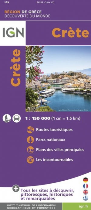
Crete
Descripción
Senderos en región
Enlaces
Datos
Informes
Guías y mapas
Hospedaje
Organizaciones
Operadores turísticos
GPS
Otro
Libros

Stanfords
United Kingdom
2021
United Kingdom
2021
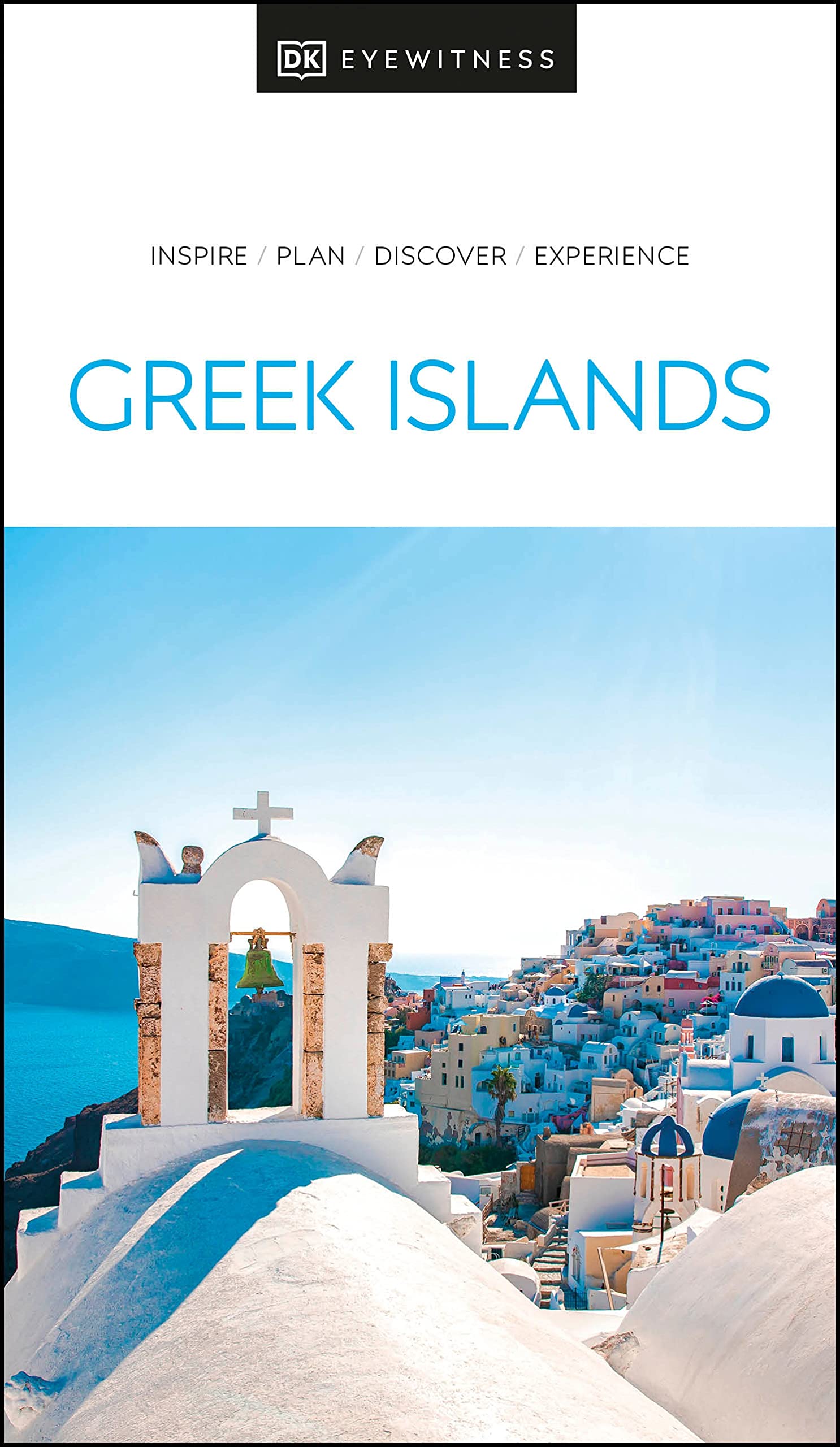
- DK Eyewitness Greek Islands
- Explore hundreds of irresistible islands.Whether you want to follow in the footsteps of legendary heroes at the Minoan palace, swim in the turquoise waters of idyllic Zakynthos bay, or watch the sun set over Corfu from Kaiser`s throne, your DK Eyewitness travel guide makes sure you experience all that the Greek Islands have to offer.The perfect... Leer más
- Also available from:
- De Zwerver, Netherlands
De Zwerver
Netherlands
2021
Netherlands
2021
- Reisgids Eyewitness Travel The Greek Islands - Griekse Eilanden | Dorling Kindersley
- Explore hundreds of irresistible islands.Whether you want to follow in the footsteps of legendary heroes at the Minoan palace, swim in the turquoise waters of idyllic Zakynthos bay, or watch the sun set over Corfu from Kaiser`s throne, your DK Eyewitness travel guide makes sure you experience all that the Greek Islands have to offer.The perfect... Leer más

Stanfords
United Kingdom
United Kingdom
- DK Eyewitness Travel Guide The Greek Islands
- Discover the Greek Islands with this essential travel guide, designed to help you create your own unique trip and to transport you to this beautiful region of Greece before you`ve even packed your case - explore Corfu`s atmospheric Old Town, admire Santorini`s brilliant white-and-blue-washed houses, explore archaeological sites on Delos, wander... Leer más

Stanfords
United Kingdom
United Kingdom
- Rick Steves Mediterranean Cruise Ports (Fifth Edition)
- Set sail and dive into Europe`s magnificent port cities with Rick Steves Mediterranean Cruise Ports! Inside you`ll find:*Rick`s expert advice on making the most of your time on a cruise and experiencing each city, with thorough coverage of 23 ports of call*Practical travel strategies including how to choose and book your cruise, adjusting to... Leer más

Stanfords
United Kingdom
2017
United Kingdom
2017
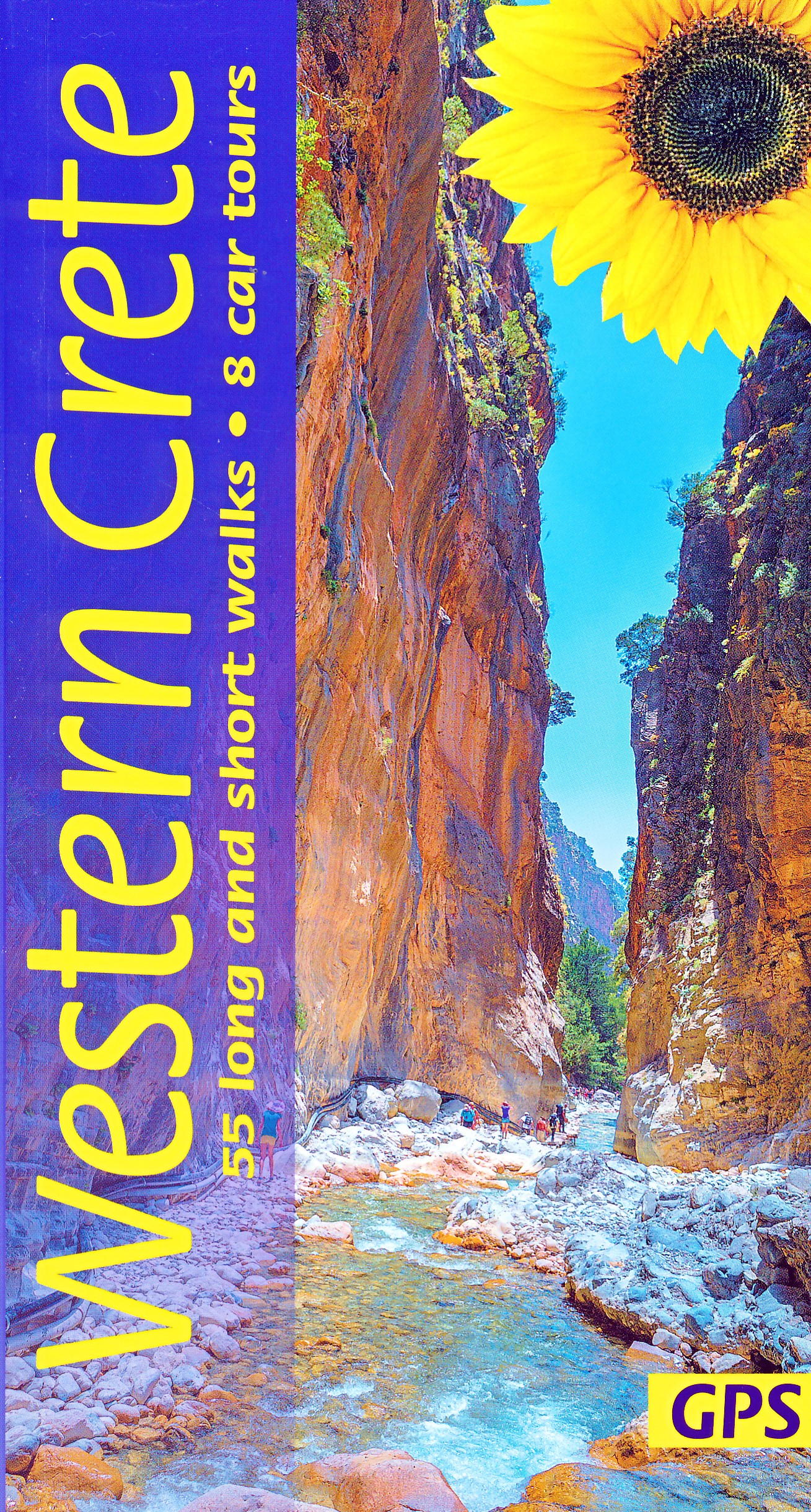
- Eastern Crete Sunflower Landscape Guide
- This new 5th edition of Eastern Crete was revised on the ground just a few months prior to publication. There are almost double the number of walks from the previous edition, and all the maps have been redrawn using OpenStreetMap source material with GPS tracking.Key features:50 long and short walks, colour-coded for grade1:50,000 topo maps... Leer más

Stanfords
United Kingdom
United Kingdom
- DK Eyewitness Top 10 Crete 14/5/20
- Picturesque Venetian ports, snow-capped mountains, awe-inspiring Minoan ruins, golden sands and glistening waters - Crete is an island paradise quite unlike any other. Your DK Eyewitness Top 10 travel guide ensures you`ll find your way around Crete with absolute ease.Our newly updated Top 10 travel guide breaks down the best of Crete into... Leer más

Stanfords
United Kingdom
2015
United Kingdom
2015
- Western Crete: Car Tours and Walks
- Western Crete is the Sunflower Landscapes guide to exploring the best walking and touring possibilities on the island. The guide covers a range of routes including walks in Kambi, Rodopos, Kallergi and the Samaria and Diktamos Gorges. A double-sided, fold-out touring map at the back of the book gives an overview of Crete and the location of... Leer más

Stanfords
United Kingdom
2017
United Kingdom
2017
- Western Crete Sunflower Landscape Guide
- Portable guidebook of walks and car tours in the Sunflower/Landscapes series. Includes a pull-out map. Leer más

The Book Depository
United Kingdom
2023
United Kingdom
2023
- Western Crete Sunflower Walking Guide
- 55 long and short walks, 8 car tours Leer más
- Also available from:
- De Zwerver, Netherlands
De Zwerver
Netherlands
2023
Netherlands
2023
- Wandelgids Western Crete - Kreta west | Sunflower books
- 55 long and short walks, 8 car tours Leer más

The Book Depository
United Kingdom
2023
United Kingdom
2023
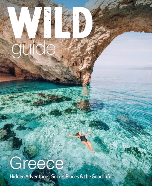
- Wild Guide Greece
- Hidden Places, Great Adventures and the Good Life (including the mainland, Crete, Corfu, Rhodes and over 20 other islands) Leer más
- Also available from:
- De Zwerver, Netherlands
De Zwerver
Netherlands
2023
Netherlands
2023
- Reisgids Wild Guide Greece | Wild Things Publishing
- Hidden Places, Great Adventures and the Good Life (including the mainland, Crete, Corfu, Rhodes and over 20 other islands) Leer más

The Book Depository
United Kingdom
United Kingdom
- Crete East walking guide
- This Rother Walking Guide to Crete East presents the hiker with a wide variety of 50 tour recommendations encompassing all regions of the eastern part of the island. The selections range from the bathing suit walk to hikes reaching hidden bays, excursions to picturesque villages and secluded monasteries, to tours of the alpine mountain terrain.... Leer más
De Zwerver
Netherlands
2017
Netherlands
2017
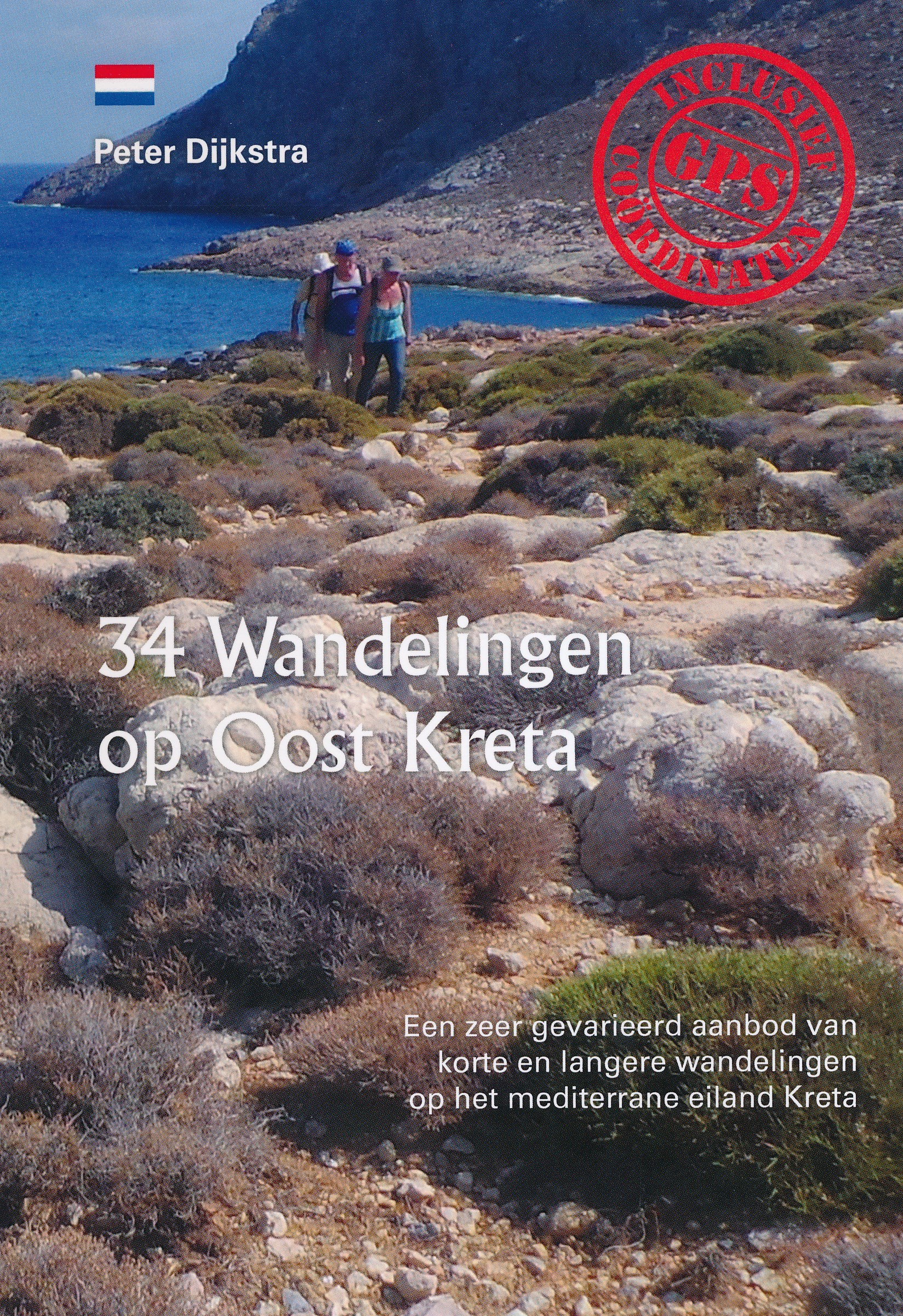
- Wandelgids 34 Wandelingen op Oost Kreta | Peter Dijkstra
- Al meer dan 17 jaar verblijven Peter Dijkstra en zijn vrouw Loes in de zomer op Kreta, het grootste eiland van Griekenland. In het zuidoosten van Kreta, volgens velen het mooiste gebied, runnen zij Tania Apartments, een vakantieverblijf met 10 bungalows. Peter Dijkstra is een gedreven wandelaar die in de loop der jaren reeds honderden... Leer más

Bol.com
Netherlands
2017
Netherlands
2017
- Griechenland: Trans Kreta E4
- Kein Geheimtipp und dennoch etwas in Vergessenheit geraten ist das ber 500 km lange Teilst ck des europ ischen Fernwanderweges E4 auf Kreta. Bereits seit den 1970er-Jahren geh rt dieser Abschnitt zu einem der beliebtesten des l ngsten europ ischen Fernwanderweges und ist somit ein echter Trekkingklassiker.Wer gut markierte Pfade und verl... Leer más
- Also available from:
- Bol.com, Belgium
- De Zwerver, Netherlands
Bol.com
Belgium
2017
Belgium
2017
- Griechenland: Trans Kreta E4
- Kein Geheimtipp und dennoch etwas in Vergessenheit geraten ist das ber 500 km lange Teilst ck des europ ischen Fernwanderweges E4 auf Kreta. Bereits seit den 1970er-Jahren geh rt dieser Abschnitt zu einem der beliebtesten des l ngsten europ ischen Fernwanderweges und ist somit ein echter Trekkingklassiker.Wer gut markierte Pfade und verl... Leer más

De Zwerver
Netherlands
2017
Netherlands
2017
- Wandelgids E4 Kreta Lefka Ori und Lasithi | Conrad Stein Verlag
- OutdoorHandbuch. 3. Auflage. Leer más
Bol.com
Netherlands
Netherlands
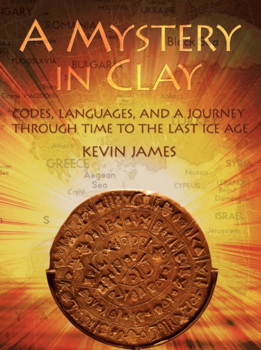
- A Mystery in Clay
- At the outset, A Mystery in Clay evolved out of a sense of curiosity surrounding an enigmatic disk unearthed on Crete, the famous, or perhaps infamous Phaistos Disk. The strangeness of the object itself has inspired many attempts to decode it. The fact that none of these attempts have been provably successful has inspired a groundswell of... Leer más
- Also available from:
- Bol.com, Belgium
Bol.com
Belgium
Belgium
- A Mystery in Clay
- At the outset, A Mystery in Clay evolved out of a sense of curiosity surrounding an enigmatic disk unearthed on Crete, the famous, or perhaps infamous Phaistos Disk. The strangeness of the object itself has inspired many attempts to decode it. The fact that none of these attempts have been provably successful has inspired a groundswell of... Leer más
Mapas

Stanfords
United Kingdom
United Kingdom
- Western Crete Terrain Editions 448
- Western Crete at 1:100,000 on an indexed, GPS compatible road map from Terrain Editions, printed on light, waterproof and tear-resistant plastic paper, with a street plan of central Chania.This title is part of a series which covers Crete in three sheets. The maps have contours at 100m intervals, enhanced by relief shading with spot heights and... Leer más
- Also available from:
- De Zwerver, Netherlands

De Zwerver
Netherlands
Netherlands
- Wandelkaart - Fietskaart - Wegenkaart - landkaart 448 Western Crete - Kreta West | Terrain maps
- Western Crete at 1:100,000 on an indexed, GPS compatible road map from Terrain Editions, printed on light, waterproof and tear-resistant plastic paper, with a street plan of central Chania.This title is part of a series which covers Crete in three sheets. The maps have contours at 100m intervals, enhanced by relief shading with spot heights and... Leer más

Stanfords
United Kingdom
2016
United Kingdom
2016
- The Cretan Way - A 28 Day Walk
- The Cretan Way is a 500km walking route which takes you from east to west across the varied and spectacular landscapes of Crete. It is the ideal way to discover the rural, mountainous and costal regions of this incredible island. This guide is based on a 28-day walk.This guide includes practical information, maps at a scale of 1:25.000 of... Leer más
- Also available from:
- De Zwerver, Netherlands

De Zwerver
Netherlands
2016
Netherlands
2016
- Wandelgids The Cretan Way E4 | Anavasi
- The Cretan Way is a 500km walking route which takes you from east to west across the varied and spectacular landscapes of Crete. It is the ideal way to discover the rural, mountainous and costal regions of this incredible island. This guide is based on a 28-day walk.This guide includes practical information, maps at a scale of 1:25.000 of... Leer más

Stanfords
United Kingdom
United Kingdom
- Eastern Crete Terrain Editions 450
- Eastern Crete at 1:100,000 on an indexed, GPS compatible road map from Terrain Editions, printed on light, waterproof and tear-resistant plastic paper, with a street plan of central Aghios Nikolaos.This title is part of a series which covers Crete in three sheets. The maps have contours at 100m intervals, enhanced by relief shading with spot... Leer más
- Also available from:
- De Zwerver, Netherlands

De Zwerver
Netherlands
Netherlands
- Wandelkaart - Fietskaart - Wegenkaart - landkaart 450 Eastern Crete - Kreta Oost | Terrain maps
- Eastern Crete at 1:100,000 on an indexed, GPS compatible road map from Terrain Editions, printed on light, waterproof and tear-resistant plastic paper, with a street plan of central Aghios Nikolaos.This title is part of a series which covers Crete in three sheets. The maps have contours at 100m intervals, enhanced by relief shading with spot... Leer más

Stanfords
United Kingdom
United Kingdom
- Crete Senesi 2 - Crete Senesi 25K Ed. Multigraphic Map No. 518
- Crete Senesi 2 - Crete Senesi at 1:25,000 in a series of hiking maps from Edizioni Multigraphic covering Tuscany, parts of Umbria, and the adjoining areas. The cartography is rather old fashioned and sometimes not as clear as in the other map series but for many areas, especially for parts of Tuscany, these are the only hiking maps available.... Leer más
Stanfords
United Kingdom
United Kingdom
- Crete Anavasi Adventure Atlas
- The new `Adventure Atlas of Crete` by Ananvasi is the ultimate tool to discover the island.Find all the information you need to go hiking, canyoning, climbing, swimming on beautiful beaches; explore abandoned villages, Minaon peak sanctuaries, cave-churches, Byzantine and Ottoman castles. Whatever you want to visit in Crete you will find it in... Leer más

Stanfords
United Kingdom
United Kingdom
- Central Crete Terrain Editions 449
- Central Crete at 1:100,000 on an indexed, GPS compatible road map from Terrain Editions, printed on light, waterproof and tear-resistant plastic paper, with street plans of central Heraklion and Rethymno.This title is part of a series which covers Crete in three sheets. The maps have contours at 100m intervals, enhanced by relief shading with... Leer más
- Also available from:
- De Zwerver, Netherlands

De Zwerver
Netherlands
Netherlands
- Wandelkaart - Fietskaart - Wegenkaart - landkaart 449 Central Crete - Kreta centraal | Terrain maps
- Central Crete at 1:100,000 on an indexed, GPS compatible road map from Terrain Editions, printed on light, waterproof and tear-resistant plastic paper, with street plans of central Heraklion and Rethymno.This title is part of a series which covers Crete in three sheets. The maps have contours at 100m intervals, enhanced by relief shading with... Leer más

Stanfords
United Kingdom
United Kingdom
- Siena and Crete - Senesi West Edizioni Multigraphic 517
- Crete Senesi 1 - Val d`Arbia at 1:25,000 in a series of hiking maps from Edizioni Multigraphic covering Tuscany, parts of Umbria, and the adjoining areas. The cartography is rather old fashioned and sometimes not as clear as in the other map series but for many areas, especially for parts of Tuscany, these are the only hiking maps available.... Leer más

Stanfords
United Kingdom
United Kingdom
- Eschenbach in der Oberpfalz E12
- Eschenbach i.d.OPf. in a series of GPS compatible recreational editions of the Bavarian topographic survey at 1:25,000, with waymarked hiking trails and cycling routes, campsites and youth hostels, etc. Coverage includes Creußen, Kirchenthumbach, Speichersdorf, Kemnath, Neustadt am Kulm, Grafenwöhr.Contours used in this map vary between 5 to... Leer más

Stanfords
United Kingdom
United Kingdom
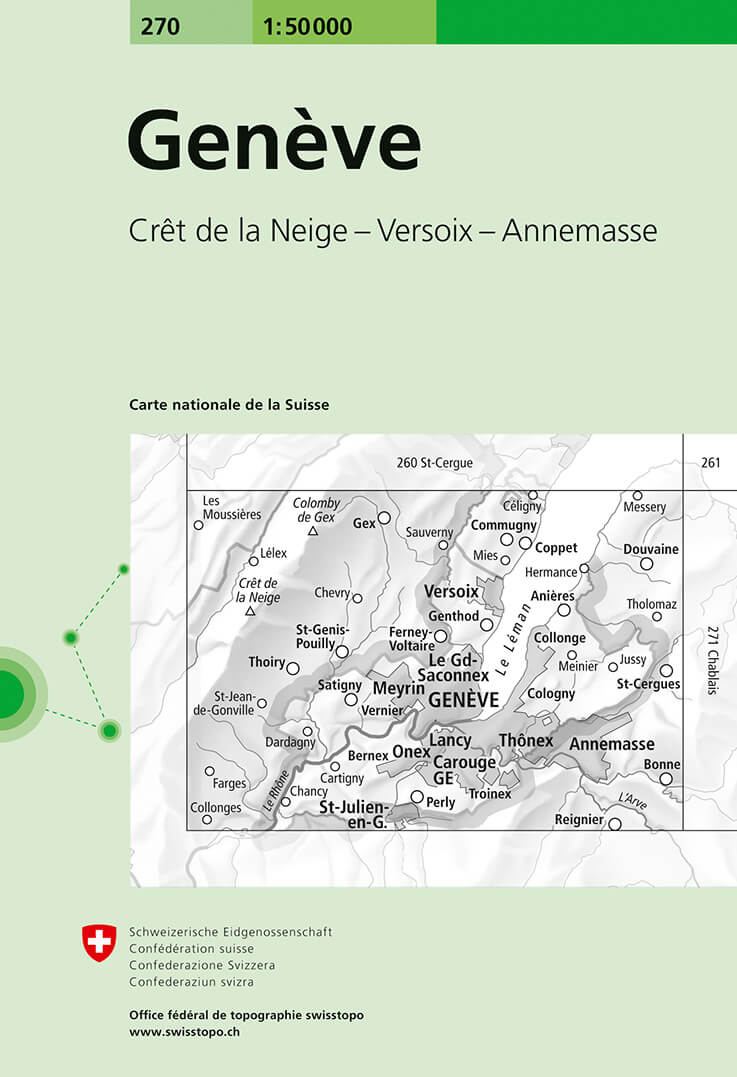
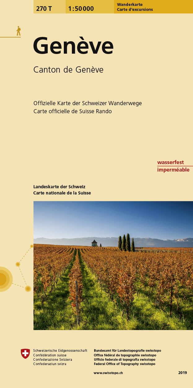
- Geneva Swisstopo 270
- Geneva, map No. 270, in the standard topographic survey of Switzerland at 1:50,000 from Swisstopo, i.e. without the special overprint highlighting walking trails, local bus stops, etc, presented in Swisstopo’s hiking editions of the 50K survey. The map covers the south-western tip of Lake Geneva and includes the French territory with Gex and... Leer más
- Also available from:
- De Zwerver, Netherlands
De Zwerver
Netherlands
Netherlands
- Wandelkaart - Topografische kaart 270 Genève | Swisstopo
- Geneva, map No. 270, in the standard topographic survey of Switzerland at 1:50,000 from Swisstopo, i.e. without the special overprint highlighting walking trails, local bus stops, etc, presented in Swisstopo Leer más

Stanfords
United Kingdom
United Kingdom
- Geneva Swisstopo Hiking 270T
- Geneva area, map No. 270T, at 1:50,000 in a special hiking edition of the country’s topographic survey, published by Swisstopo in cooperation with the Swiss Hiking Federation. The map covers the south-western tip of Lake Geneva and includes the French territory with Gex and Crête de la Neige, the highest peak in the Jura mountains.Cartography,... Leer más
- Also available from:
- De Zwerver, Netherlands
De Zwerver
Netherlands
Netherlands
- Wandelkaart 270T Genève | Swisstopo
- Geneva area, map No. 270T, at 1:50,000 in a special hiking edition of the country Leer más

Stanfords
United Kingdom
United Kingdom
- Val d`Arbia, Ombrone and Orcia
- The valleys of Arbia, Ombrone and Orcia in Tuscany directly south of Siena on a detailed contoured map at 1:50,000 from Litografia Artistica Cartografica highlighting the course of La Via Francigena and other waymarked local trails.The map covers an area from Siena southwards to Castel del Piano including several nature reserves. Topography is... Leer más

Stanfords
United Kingdom
United Kingdom
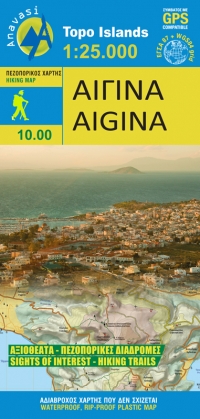
- Aigina / Aegina Anavasi 10.00
- Aegina at 1:25,000 on light, waterproof and tear-resistant, GPS compatible and contoured map from Anavasi, with on the reverse a simplified map of the island for sightseeing and recommended hiking trails.On one side is a contoured map of the island (interval 20m), with additional altitude colouring and shading. All place names are in both Greek... Leer más
- Also available from:
- De Zwerver, Netherlands
De Zwerver
Netherlands
Netherlands
- Wandelkaart 10.00 Aigina | Anavasi
- Aegina at 1:25,000 on light, waterproof and tear-resistant, GPS compatible and contoured map from Anavasi, with on the reverse a simplified map of the island for sightseeing and recommended hiking trails.On one side is a contoured map of the island (interval 20m), with additional altitude colouring and shading. All place names are in both Greek... Leer más

Stanfords
United Kingdom
United Kingdom
- Frangokastelo - Plakias Anavasi 11.17
- The Frangokastelo – Plakias area on the southern coast of Crete at 1:25,000 in a series of contoured, GPS compatible hiking maps of Crete from Anavasi, printed waterproof and tear-resistant paper. Annotations provide useful hints for walkers. Coverage extends from Imbros Gorge in the west to Plakias in the east.Topography is shown by contour... Leer más
- Also available from:
- The Book Depository, United Kingdom
- De Zwerver, Netherlands

The Book Depository
United Kingdom
United Kingdom
- Fragokastelo - Plakias 2016
- Uitstekende topografische kaarten van een deel van Griekenland: zonder meer hele goede kaarten voor wandeltochten in een onbekend stuk Griekenland! Ze zijn gedrukt op scheurvast en watervast papier op een schaal van 1:25.000 met een UTM grid voor GPS gebruikers. Op de meeste kaarten is geven de hoogtelijnen een interval van 20m. aan. Met... Leer más

De Zwerver
Netherlands
Netherlands
- Wandelkaart 11.17 Frangokastelo - Plakias - Kreta | Anavasi
- Uitstekende topografische kaarten van een deel van Griekenland: zonder meer hele goede kaarten voor wandeltochten in een onbekend stuk Griekenland! Ze zijn gedrukt op scheurvast en watervast papier op een schaal van 1:25.000 met een UTM grid voor GPS gebruikers. Op de meeste kaarten is geven de hoogtelijnen een interval van 20m. aan. Met... Leer más

Stanfords
United Kingdom
United Kingdom
- Samaria - Sougia - Paliochora Anavasi 11.13
- Samaria – Sougia area of the White Mountains on Crete on a waterproof and tear-resistant, GPS compatible and contoured hiking map at 1:25,000 from Anavasi, extending from the famous Gorge of Samaria westwards to Azogyres and Plemeniana, and north past Omalos and the peaks of Troili and Kaimeni Kafala.Topography is shown by contour lines at 20m... Leer más
- Also available from:
- The Book Depository, United Kingdom
- De Zwerver, Netherlands

The Book Depository
United Kingdom
United Kingdom
- Samaria - Sougia
- Uitstekende topografische kaarten van een deel van Griekenland: zonder meer hele goede kaarten voor wandeltochten in een onbekend stuk Griekenland! Ze zijn gedrukt op scheurvast en watervast papier op een schaal van 1:25.000 met een UTM grid voor GPS gebruikers. Op de meeste kaarten is geven de hoogtelijnen een interval van 20m. aan. Met... Leer más

De Zwerver
Netherlands
Netherlands
- Wandelkaart 11.13 Samaria - Soughia - Kreta | Anavasi
- Uitstekende topografische kaarten van een deel van Griekenland: zonder meer hele goede kaarten voor wandeltochten in een onbekend stuk Griekenland! Ze zijn gedrukt op scheurvast en watervast papier op een schaal van 1:25.000 met een UTM grid voor GPS gebruikers. Op de meeste kaarten is geven de hoogtelijnen een interval van 20m. aan. Met... Leer más