Stanfords
United Kingdom
United Kingdom
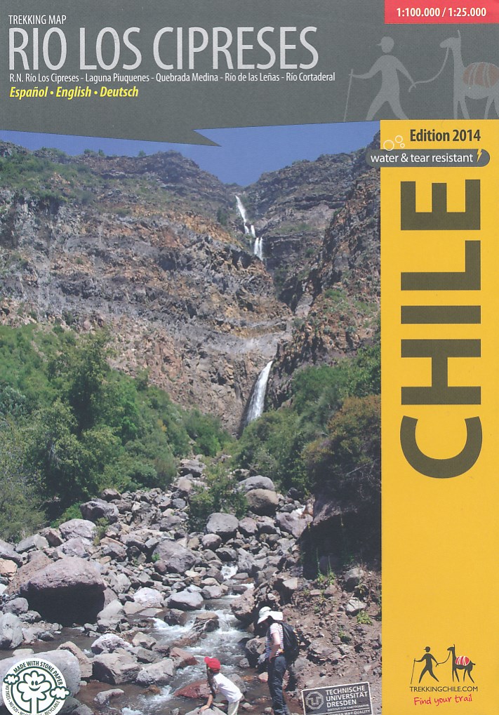
- Río Los Cipreses National Reserve
- Río Los Cipreses National Reserve on a waterproof and tear-resistant map from Trekkingchile presenting the whole Reserve at 1:100,000, plus its northern part in more detail on an enlargement at 1:25,000. Coverage of the main 100K map extends from El Manzanal southwards to the glaciers around the Cerro Alto de los Arrieros. Contours are at 100m... Leer más
- Also available from:
- De Zwerver, Netherlands
De Zwerver
Netherlands
Netherlands
- Wandelkaart Rio los Cipreses - Chili | Viachile Editores
- Hiking map of the National Preserve Rio Los Cipreses east of Rancagua, developed by the Institute for Cartography at the Dresden Technical University. Overview map1:100,000 showing the whole preserve with the Laguna Piuquenes and several 4,000 meter summits, being El Palomo volcano the highest with 4860 m. Detail map 1:25,000 of the preserve’s... Leer más

.jpg)

.jpg)