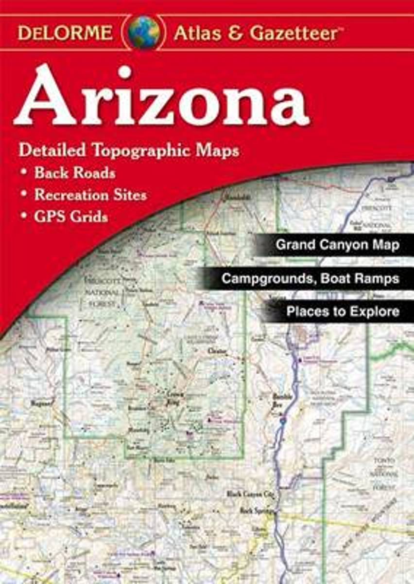
Arizona Recreational Atlas & Gazetteer at 1:245,000 approx., with the Grand Canyon area at 1:100,000, in a series of large format paperback state atlases from DeLorme, with detailed, contoured, GPS compatible topographic mapping. Recreational information includes lists of campgrounds, wildlife viewing sites (listing both species and...Leer más
Very clear, indexed tourist street plan of the city on durable, laminated paper, with additional maps of the surrounding area and the Grand Canyon. The main map includes the Strip, Interstate 15 to the west, Downtown, the international airport, and much of the Winchester district east of the Strip. Detail includes one-way streets, casinos,...Leer más
Verdon and its Grand Canyon - Lac de Sainte Croix - Plateau de Valensole region in a series of GPS compatible, contoured TOP 75 maps at 1:75,000 from the IGN, highlighting local and long-distance hiking paths, cycling routes and sites for other recreational activities. The map includes five large panels showing the areas around les Mées, Gorges...Leer más
Arizona at 1:400,000 in a series of excellent, detailed, GPS compatible state atlases from Benchmark Maps with extensive information on diverse recreational opportunities and facilities, covering The Rockies and the western states of the United States. Each atlas consists of three main sections:*Landscape:* with detailed mapping at scales...Leer más
American Southwest 1 : 3 000 000. Road Map + City Maps ab 9.9 EURO American Southwest, Grand Canyon National Park, Las Vegas - The Strip, Greater Los Angeles, L. A. Downtown, San Francisco, San Francisco Bay Area, Phoenix, San Diego, San Diego Downtown Borch Maps. 18. AuflageLeer más
A uniquely useful resource, the Atlas & Gazetteer* Series is great for information on camping, hiking, fishing, hunting, bike and motorcycle touring, birdwatching, back road exploration, and more. A guide is available for all 50 American states.Leer más
Waterproof Tear-Resistant Topographic MapExplore the uniquely inspiring and wondrous landscape of the Grand Canyon with National Geographic's Trails Illustrated map of Grand Canyon National Park, North and South Rims. Expertly researched and created in partnership with local land management agencies, this map is designed to meet the needs...Leer más
Prachtige geplastificeerde kaart van het bekende nationaal park. Met alle recreatieve voorzieningen als campsites, maar ook met topografische details en wandelroutes ed. Door uitgekiend kleurgebruik zeer prettig in gebruik. Scheur en watervast! Grand Canyon, Bright Angel Canyon/North & South Rims (#261) replaces the previous Grand Canyon...Leer más
Waterproof Tear-Resistant Topographic MapGrand Canyon East (#262) and Grand Canyon West (#263) combine to cover the entire Grand Canyon National Park and its bordering public lands. Both maps contain detailed and easy-to-read trail and road networks, locations of facilities, points of interest, and highly accurate terrain with thousands...Leer más
Prachtige geplastificeerde kaart van het nationaal park. Met alle recreatieve voorzieningen als campsites, maar ook met topografische details en wandelroutes ed. Door uitgekiend kleurgebruik zeer prettig in gebruik. Scheur en watervast! Grand Canyon East (#262) and Grand Canyon West (#263) combine to cover the entire Grand Canyon National Park...Leer más
Waterproof Tear-Resistant Topographic MapGrand Canyon West (#263) and Grand Canyon East (#262) combine to cover the entire Grand Canyon National Park and its bordering public lands. Both maps contain detailed and easy-to-read trail and road networks, locations of facilities, points of interest, and highly accurate terrain with thousands...Leer más
Prachtige geplastificeerde kaart van het nationaal park. Met alle recreatieve voorzieningen als campsites, maar ook met topografische details en wandelroutes ed. Door uitgekiend kleurgebruik zeer prettig in gebruik. Scheur en watervast! These Trail maps give outdoor enthusiasts & explorers the kind of details, accuracy, functionality, ease of...Leer más