
Stanfords
United Kingdom
- Mataro CNIG Topo 393
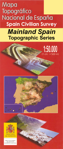
- Topographic coverage of mainland Spain at 1:50,000 in the MTN50 (Mapa Topográfico Nacional) series from the Centro Nacional de Información Geografica, the country’s civilian survey organization. The maps have contours at 20m intervals, enhanced by relief shading, plus colouring and/or graphics to show different types of terrain, vegetation or... Leer más

Stanfords
United Kingdom
- Los Corrales de Buelna CNIG Topo 58
- Topographic coverage of mainland Spain at 1:50,000 in the MTN50 (Mapa Topográfico Nacional) series from the Centro Nacional de Información Geografica, the country’s civilian survey organization. The maps have contours at 20m intervals, enhanced by relief shading, plus colouring and/or graphics to show different types of terrain, vegetation or... Leer más

Stanfords
United Kingdom
- Sabadell CNIG Topo 392
- Topographic coverage of mainland Spain at 1:50,000 in the MTN50 (Mapa Topográfico Nacional) series from the Centro Nacional de Información Geografica, the country’s civilian survey organization. The maps have contours at 20m intervals, enhanced by relief shading, plus colouring and/or graphics to show different types of terrain, vegetation or... Leer más

Stanfords
United Kingdom
- Mondonedo CNIG Topo 24
- Topographic coverage of mainland Spain at 1:50,000 in the MTN50 (Mapa Topográfico Nacional) series from the Centro Nacional de Información Geografica, the country’s civilian survey organization. The maps have contours at 20m intervals, enhanced by relief shading, plus colouring and/or graphics to show different types of terrain, vegetation or... Leer más

Stanfords
United Kingdom
- Aldeire CNIG Topo 1028
- Topographic coverage of mainland Spain at 1:50,000 in the MTN50 (Mapa Topográfico Nacional) series from the Centro Nacional de Información Geografica, the country’s civilian survey organization. The maps have contours at 20m intervals, enhanced by relief shading, plus colouring and/or graphics to show different types of terrain, vegetation or... Leer más

Stanfords
United Kingdom
- Montilla CNIG Topo 966
- Topographic coverage of mainland Spain at 1:50,000 in the MTN50 (Mapa Topográfico Nacional) series from the Centro Nacional de Información Geografica, the country’s civilian survey organization. The maps have contours at 20m intervals, enhanced by relief shading, plus colouring and/or graphics to show different types of terrain, vegetation or... Leer más

Stanfords
United Kingdom
- Alcuesar CNIG Topo 729
- Topographic coverage of mainland Spain at 1:50,000 in the MTN50 (Mapa Topográfico Nacional) series from the Centro Nacional de Información Geografica, the country’s civilian survey organization. The maps have contours at 20m intervals, enhanced by relief shading, plus colouring and/or graphics to show different types of terrain, vegetation or... Leer más

Stanfords
United Kingdom
- Banyoles CNIG Topo 295
- Topographic coverage of mainland Spain at 1:50,000 in the MTN50 (Mapa Topográfico Nacional) series from the Centro Nacional de Información Geografica, the country’s civilian survey organization. The maps have contours at 20m intervals, enhanced by relief shading, plus colouring and/or graphics to show different types of terrain, vegetation or... Leer más

Stanfords
United Kingdom
- L`Hospitalet de L`Infant CNIG Topo 498
- Topographic coverage of mainland Spain at 1:50,000 in the MTN50 (Mapa Topográfico Nacional) series from the Centro Nacional de Información Geografica, the country’s civilian survey organization. The maps have contours at 20m intervals, enhanced by relief shading, plus colouring and/or graphics to show different types of terrain, vegetation or... Leer más
Stanfords
United Kingdom
- Potes CNIG Topo 81
- Topographic coverage of mainland Spain at 1:50,000 in the MTN50 (Mapa Topográfico Nacional) series from the Centro Nacional de Información Geografica, the country’s civilian survey organization. The maps have contours at 20m intervals, enhanced by relief shading, plus colouring and/or graphics to show different types of terrain, vegetation or... Leer más

Stanfords
United Kingdom
- Mora
- Topographic survey of Portugal at 1:50,000 from the Instituto Geográfico Português, the country’s civilian survey organisation. The maps have contours at 25m intervals and in addition to the standard features shown on topographic mapping at this scale also indicate various types of vegetation (vineyards, olive groves, etc). Each sheet covers an... Leer más

Stanfords
United Kingdom
- Mora
- Topographic survey of Portugal at 1:50,000 from the Instituto Geográfico do Exército, the country’s military survey organisation. The maps have contours at 20m intervals and in addition to the standard features shown on topographic mapping at this scale also indicate various types of terrain or vegetation (sand, terraces, rocks, woodlands,... Leer más

Stanfords
United Kingdom
- Asturias Province 200K CNIG Map No. 5
- Contoured, GPS-compatible, indexed road map at 1:200,000 from CNIG - Spain’s civilian survey organization, with exceptionally informative presentation of the landscape and highlighting for facilities and places of interest including campsites and paradors.Maps in CNIG’s 200K Provincial Series provide an excellent picture the topography through... Leer más

Stanfords
United Kingdom
- San Salvador de Serantes CNIG Topo 6
- Topographic coverage of mainland Spain at 1:50,000 in the MTN50 (Mapa Topográfico Nacional) series from the Centro Nacional de Información Geografica, the country’s civilian survey organization. The maps have contours at 20m intervals, enhanced by relief shading, plus colouring and/or graphics to show different types of terrain, vegetation or... Leer más

Stanfords
United Kingdom
- Alpera CNIG Topo 792
- Topographic coverage of mainland Spain at 1:50,000 in the MTN50 (Mapa Topográfico Nacional) series from the Centro Nacional de Información Geografica, the country’s civilian survey organization. The maps have contours at 20m intervals, enhanced by relief shading, plus colouring and/or graphics to show different types of terrain, vegetation or... Leer más

Stanfords
United Kingdom
- Alcobendas CNIG Topo 534
- Topographic coverage of mainland Spain at 1:50,000 in the MTN50 (Mapa Topográfico Nacional) series from the Centro Nacional de Información Geografica, the country’s civilian survey organization. The maps have contours at 20m intervals, enhanced by relief shading, plus colouring and/or graphics to show different types of terrain, vegetation or... Leer más