Stanfords
United Kingdom
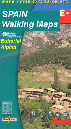
- Bachimala - Valles de Chistau y Bielsa Editorial Alpina
- Bachimala area of the High Pyrenees in Spain on a contoured and GPS compatible map at 1:25,000 from Editorial Alpina, with a booklet including English language descriptions of recommended walks, extensive accommodation list, etc. With the peak of Gran Bachimala towards the north-eastern corner of the map, coverage extends west to Bielsa and... Leer más

Stanfords
United Kingdom
- Ordesa - Monte Perdido National Park Editorial Alpina 2-Map Set
- Ordesa and Monte Perdido National Park at 1:25,000 in a set of two GPS compatible recreational maps in an extensive and very popular series from Editorial Alpina, providing more detailed coverage of this popular hiking area.Contours are at 10m intervals, with relief shading and vegetation colouring. An overprint highlights waymarked PR hiking... Leer más

Stanfords
United Kingdom
- Serra de Montsant Editorial Piolet Hiking Map
- Serra de Montsant area at 1:20,000 in a series of GPS compatible maps from Editorial Piolet with cartography based on Spain’s civilian topographic survey overprinted with hiking routes and other tourist information. The overprint includes 11 recommended itinerates in the park, plus eight special walks exploring local flora.Hiking maps in the... Leer más

Stanfords
United Kingdom
- Baix Empordà ICGC 10
- Topographic survey of Catalonia at 1:50,000 from the Institut Cartogràfic de Catalunya, with vivid presentation of the terrain and an overprint for long-distance GR hiking trails. The series provides an excellent alternative to the much smaller sheets in the civilian or military surveys produced for the whole of Spain. The Catalan 50K series... Leer más

Stanfords
United Kingdom
- Sort - PN de l`Alt Pirineu Sud
- Topographic survey of Catalonia at 1:25,000 from the Institut Cartogràfic i Geològic de Catalunya, an attractive alternative to Spain’s national topographic survey at this scale, offering a much larger area per sheet with extensive tourist information and vivid presentation of vegetation and land use.These large, detailed maps have contours at... Leer más

Stanfords
United Kingdom
- Serra de Pàndols and Serra de Cavalls
- Sierras de Pàndols and Sierra de Cavalls near Gandesa in southern Catalonia on a contoured and GPS compatible map at 1:25,000 from Editorial Piolet, highlighting recommended hiking routes and climbing sites, as well as locations connected with the Battle of Ebro, the longest and the bloodiest battle of the Spanish Civil War. On the reverse... Leer más

Stanfords
United Kingdom
- Muntanyes de Prades
- Topographic survey of Catalonia at 1:25,000 from the Institut Cartogràfic i Geològic de Catalunya, an attractive alternative to Spain’s national topographic survey at this scale, offering a much larger area per sheet with extensive tourist information and vivid presentation of vegetation and land use.These large, detailed maps have contours at... Leer más

Stanfords
United Kingdom
- Massif de la Vanoise IGN Wall Map
- Massif de la Vanoise presented on an encapsulated waterproof wall map, size 100 x 132cm (39.5” x 52” approx), with cartography of IGN’s excellent TOP25 series reduced slightly to 1:28,000. The map combines sections of TOP25 maps 3532ET, 3532OT, 3534OT, 3633ET and 3634OT to extend from Mâcot-la-Plagne and Aiguille Rouge in the north to Lac du... Leer más

Stanfords
United Kingdom
- Osona ICGC 24
- Topographic survey of Catalonia at 1:50,000 from the Institut Cartogràfic de Catalunya, with vivid presentation of the terrain and an overprint for long-distance GR hiking trails. The series provides an excellent alternative to the much smaller sheets in the civilian or military surveys produced for the whole of Spain. The Catalan 50K series... Leer más

Stanfords
United Kingdom
- Catalonia IGN 86221
- Certain regions of the world present an extraordinary tourist and cultural wealth and remain mythical destinations. To accompany you on your journey to these extraordinary regions, the IGN offers maps, at scales ranging from 1:50,000 to 1:800,000. Leer más

Stanfords
United Kingdom
- Lugo and Environs CNIG Map
- Lugo and its environs on a double-sided map combining a street plan with topographic mapping at 1:50,000 from the Instituto Geográfico Nacional – Centro Nacional de Información Geograficá, the country’s civilian survey organization.On one side is a street plan of the city showing the course along its streets of the Camino de Santiago – the Way... Leer más

Stanfords
United Kingdom
- Comarques Centrales
- Comarques Centrales, the foothills of the Catalan Pyrenees including Ripoll, Olot, Berga, Vic, Solsona, etc, at 1:100,000 in the topographic survey of Catalonia published by the Institut Cartogràfic de Catalunya, with very detailed coverage of a large area and an excellent representation of the region’s topography.Maps in this series have... Leer más

Stanfords
United Kingdom
- Barcelona and Environs ICGC 13
- Topographic survey of Catalonia at 1:50,000 from the Institut Cartogràfic de Catalunya, with vivid presentation of the terrain and an overprint for long-distance GR hiking trails. The series provides an excellent alternative to the much smaller sheets in the civilian or military surveys produced for the whole of Spain. The Catalan 50K series... Leer más
Stanfords
United Kingdom
- Tremp - la Pobla de Segur - Serra de Boumort - Isona
- Topographic survey of Catalonia at 1:25,000 from the Institut Cartogràfic i Geològic de Catalunya, an attractive alternative to Spain’s national topographic survey at this scale, offering a much larger area per sheet with extensive tourist information and vivid presentation of vegetation and land use.These large, detailed maps have contours at... Leer más

Stanfords
United Kingdom
- Terra Alta
- Topographic survey of Catalonia at 1:50,000 from the Institut Cartogràfic de Catalunya, with vivid presentation of the terrain and an overprint for long-distance GR hiking trails. The series provides an excellent alternative to the much smaller sheets in the civilian or military surveys produced for the whole of Spain. The Catalan 50K series... Leer más