
Stanfords
United Kingdom
- Eupen Mini-Ardenne
- Ardennes Recreational Maps at a scale of 1:25,000 enable you to discover the Ardennes from junction to junction, each associated with a locality, through a network of hiking, cycling or riding paths. The network of mini walks consists of suggested routes with kilometre distance marked showing field boundaries and urbanised built up areas.... Leer más

Stanfords
United Kingdom
- Limerle - Lengeler
- Topographical survey of Belgium at 1:20,000 from Nationaal Geografisch Instituut / Institut Géographique National, the country’s national survey organization. Each 20K map covers one quarter of the corresponding 1:50,000 map (with adjustments in the border and coastal areas). The maps provide all the information expected of topographic mapping... Leer más

Stanfords
United Kingdom
- Vilvoorde NGI Topo 23/7-8
- Topographical survey of Belgium at 1:20,000 from Nationaal Geografisch Instituut / Institut Géographique National, the country’s national survey organization. Each 20K map covers one quarter of the corresponding 1:50,000 map (with adjustments in the border and coastal areas). The maps provide all the information expected of topographic mapping... Leer más

Stanfords
United Kingdom
- Wavre NGI Topo 40
- Topographical survey of Belgium at 1:50,000 from the country’s national survey organization, Nationaal Geografisch Instituut / Institut Géographique National. Contour interval varies according to the terrain, from 2.5 metres in the coastal areas to 10 metres in the Ardennes. The maps provide all the information expected of topographic mapping... Leer más
Stanfords
United Kingdom
- Dalhem - Herve
- Topographical survey of Belgium at 1:20,000 from Nationaal Geografisch Instituut / Institut Géographique National, the country’s national survey organization. Each 20K map covers one quarter of the corresponding 1:50,000 map (with adjustments in the border and coastal areas). The maps provide all the information expected of topographic mapping... Leer más

Stanfords
United Kingdom
- Tongres NGI Topographic Map 34
- Topographical survey of Belgium at 1:50,000 from the country’s national survey organization, Nationaal Geografisch Instituut / Institut Géographique National. Contour interval varies according to the terrain, from 2.5 metres in the coastal areas to 10 metres in the Ardennes. The maps provide all the information expected of topographic mapping... Leer más
Stanfords
United Kingdom
- Quievrain - Boussu
- Topographical survey of Belgium at 1:20,000 from Nationaal Geografisch Instituut / Institut Géographique National, the country’s national survey organization. Each 20K map covers one quarter of the corresponding 1:50,000 map (with adjustments in the border and coastal areas). The maps provide all the information expected of topographic mapping... Leer más

Stanfords
United Kingdom
- Lier NGI Topo 16
- Topographical survey of Belgium at 1:50,000 from the country’s national survey organization, Nationaal Geografisch Instituut / Institut Géographique National. Contour interval varies according to the terrain, from 2.5 metres in the coastal areas to 10 metres in the Ardennes. The maps provide all the information expected of topographic mapping... Leer más
Stanfords
United Kingdom
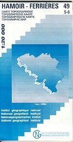
- Hamoir - Ferrieres
- Topographical survey of Belgium at 1:20,000 from Nationaal Geografisch Instituut / Institut Géographique National, the country’s national survey organization. Each 20K map covers one quarter of the corresponding 1:50,000 map (with adjustments in the border and coastal areas). The maps provide all the information expected of topographic mapping... Leer más
Stanfords
United Kingdom
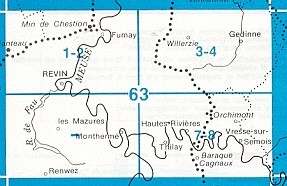
- Vresse-sur-Semois
- Topographical survey of Belgium at 1:20,000 from Nationaal Geografisch Instituut / Institut Géographique National, the country’s national survey organization. Each 20K map covers one quarter of the corresponding 1:50,000 map (with adjustments in the border and coastal areas). The maps provide all the information expected of topographic mapping... Leer más
Stanfords
United Kingdom
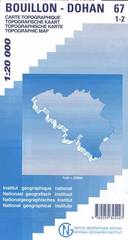
- Bouillon - Dohan
- Topographical survey of Belgium at 1:20,000 from Nationaal Geografisch Instituut / Institut Géographique National, the country’s national survey organization. Each 20K map covers one quarter of the corresponding 1:50,000 map (with adjustments in the border and coastal areas). The maps provide all the information expected of topographic mapping... Leer más

Stanfords
United Kingdom
- Nivelles NGI Topo 39 - Battle of Waterloo Area
- Nivelles, map No. 39 in the topographic survey of Belgium at 1:50, covering both the main area of the Battle of Waterloo on 18th June 1815 including the Mont St-Jean escarpment, the Lion’s Mound (Lion’s Hillock) and the museum, and the Les Quatre Bras crossroads - the site of French victory on 16th June.Although not specifically designed to... Leer más

Stanfords
United Kingdom
- Seraing - Chaudfontaine
- Topographical survey of Belgium at 1:20,000 from Nationaal Geografisch Instituut / Institut Géographique National, the country’s national survey organization. Each 20K map covers one quarter of the corresponding 1:50,000 map (with adjustments in the border and coastal areas). The maps provide all the information expected of topographic mapping... Leer más
Stanfords
United Kingdom
- Mons NGI Topo 45 - WWI Battlefields
- Mons, map No. 45 in the topographic survey of Belgium at 1:50,000 covering the area of the Battle of Mons, British Army’s first major engagement in World War I in August 1914. The Mons - Condé Canal runs across the middle of the map and coverage includes Obourg where Private John Parr became the first British soldier to be killed in the war.... Leer más

Stanfords
United Kingdom
- Mons - Givry
- Topographical survey of Belgium at 1:20,000 from Nationaal Geografisch Instituut / Institut Géographique National, the country’s national survey organization. Each 20K map covers one quarter of the corresponding 1:50,000 map (with adjustments in the border and coastal areas). The maps provide all the information expected of topographic mapping... Leer más