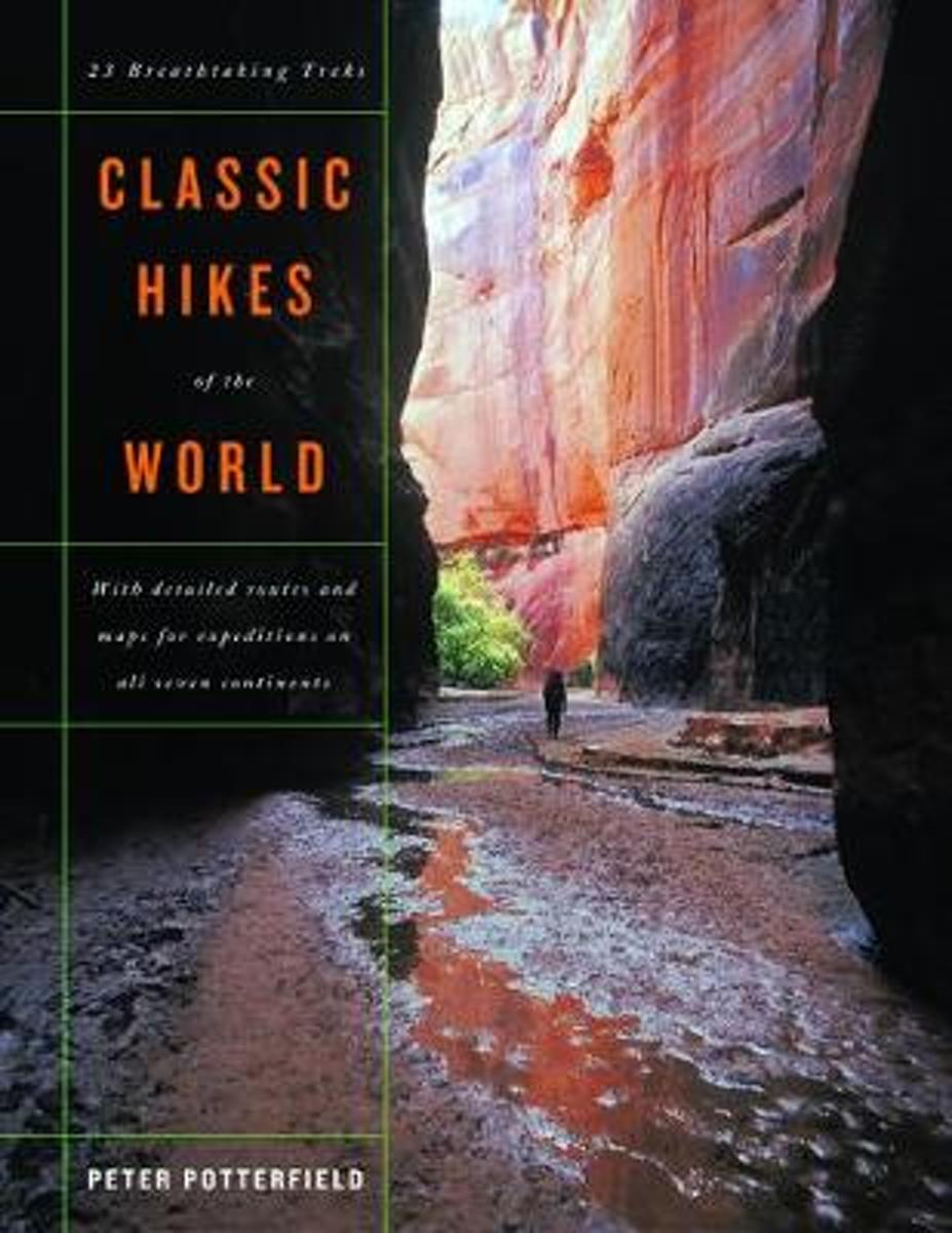
This book will help you realize your dreams of hiking among the world's highest peaks and most scenic canyons, discovering wilderness far from the clamor of civilization, encountering rare birds and animals, glorying in sunsets over glacier-clad ranges, and feeling the joy and achievement of hiking some of the world's most spectacular trails....Leer más
This book will help you realize your dreams of hiking among the world's highest peaks and most scenic canyons, discovering wilderness far from the clamor of civilization, encountering rare birds and animals, glorying in sunsets over glacier-clad ranges, and feeling the joy and achievement of hiking some of the world's most spectacular trails....Leer más
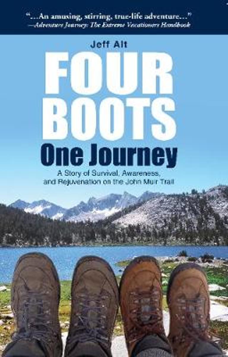
Originally published as an award-winning paperback: A Hike for Mike. Jeff Alt takes you vicariously along the John Muir Trail, on an entertaining adventure, with his new wife, Beth. Jeff convinces Beth, a woman who prefers hotels, hot showers and warm beds to chuck her domesticated ways and hike over 218-miles which leads to lots of humorous...Leer más
Originally published as an award-winning paperback: A Hike for Mike. Jeff Alt takes you vicariously along the John Muir Trail, on an entertaining adventure, with his new wife, Beth. Jeff convinces Beth, a woman who prefers hotels, hot showers and warm beds to chuck her domesticated ways and hike over 218-miles which leads to lots of humorous...Leer más
Long-distance walking is good for you and good for the earth... But most of all, walking is a joyful celebration of life and the diverse, beautiful, and curious world in which we live. -from the Introduction Walking is simple, but it can also be profound. In an increasingly complex and frantic world, walking can simplify our lives. It...Leer más
Long-distance walking is good for you and good for the earth... But most of all, walking is a joyful celebration of life and the diverse, beautiful, and curious world in which we live. -from the Introduction Walking is simple, but it can also be profound. In an increasingly complex and frantic world, walking can simplify our lives. It...Leer más
After landing the perfect job, Wellman drives to Maine where she spends five months living off grid, teaching Leave No Trace and confronting both men and moose in hilarious, behind the scene stories of what being a Ridgerunner on the Appalachian Trail really means. Known to the hiking community by her trail name 'Brawny', she has thru hiked the...Leer más
After landing the perfect job, Wellman drives to Maine where she spends five months living off grid, teaching Leave No Trace and confronting both men and moose in hilarious, behind the scene stories of what being a Ridgerunner on the Appalachian Trail really means. Known to the hiking community by her trail name 'Brawny', she has thru hiked the...Leer más
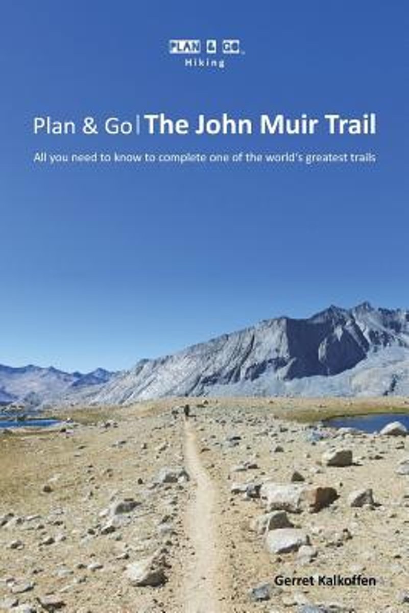
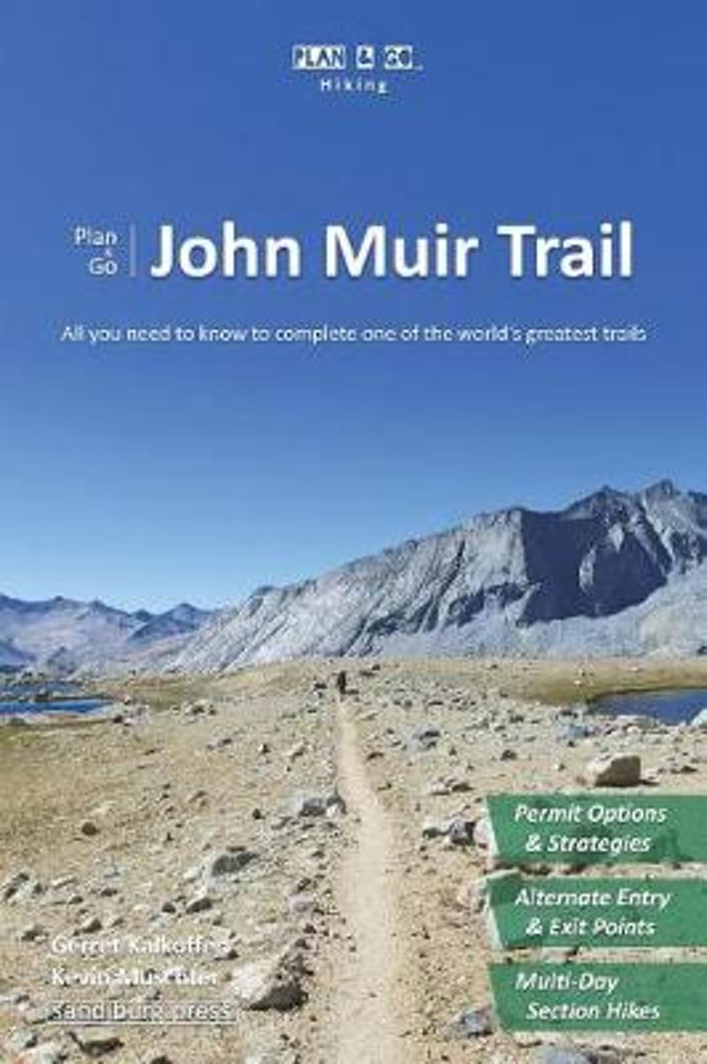
Plan & Go The John Muir Trail is the ultimate guide on how to prepare for and hike one of the greatest trails in the world. Its main goal is to save you time, money, and make you feel confident about completing this awesome adventure. One after another, the book covers each topic you need to organize in advance: How do I get a permit? What...Leer más
Plan & Go The John Muir Trail is the ultimate guide on how to prepare for and hike one of the greatest trails in the world. Its main goal is to save you time, money, and make you feel confident about completing this awesome adventure. One after another, the book covers each topic you need to organize in advance: How do I get a permit? What...Leer más
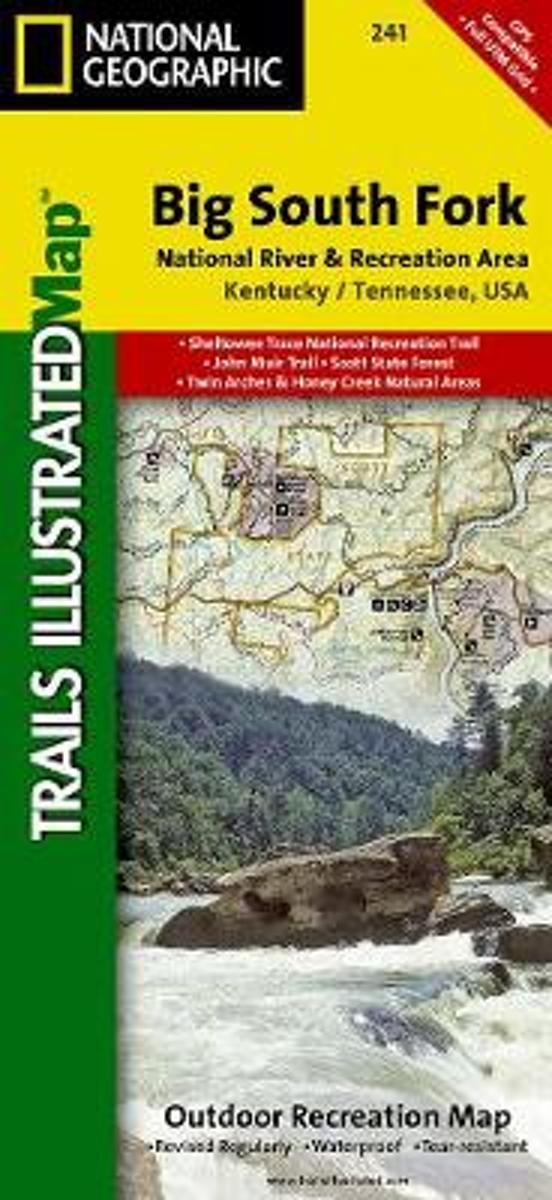
Map No. 241, Big South Fork National Recreation Area, KY/TN, in an extensive series of GPS compatible, contoured hiking maps of USA’s national and state parks or forests and other popular recreational areas. Cartography based on the national topographic survey, with additional tourist information.The maps, with most titles now printed on light,...Leer más
Waterproof Tear-Resistant Topographic MapThis Trails Illustrated topographic map for Big South Fork National River and Recreation Area in southern Kentucky and northern Tennessee is the perfect map for hiking, biking, exploring, climbing, camping, and sightseeing in this stunning area.The map includes Daniel Boone National Forest, Big...Leer más
Waterproof Tear-Resistant Topographic MapThis Trails Illustrated topographic map for Big South Fork National River and Recreation Area in southern Kentucky and northern Tennessee is the perfect map for hiking, biking, exploring, climbing, camping, and sightseeing in this stunning area.The map includes Daniel Boone National Forest, Big...Leer más
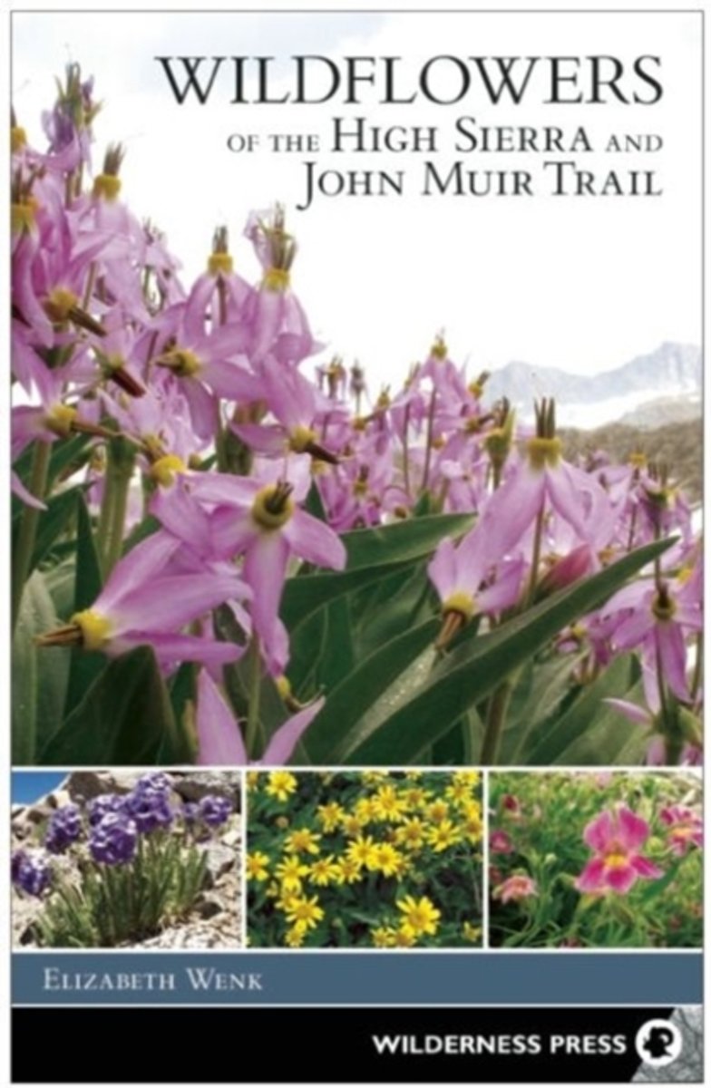
This new book by Sierra expert Elizabeth Wenk includes photos and descriptions of approximately 300 species of wildflowers and flowering shrubs in the High Sierra. Focused on areas above 8,000 feet in elevation from Yosemite south through the Whitney Region, by restricting the collection of species to higher elevations, the book can include all...Leer más
This new book by Sierra expert Elizabeth Wenk includes photos and descriptions of approximately 300 species of wildflowers and flowering shrubs in the High Sierra. Focused on areas above 8,000 feet in elevation from Yosemite south through the Whitney Region, by restricting the collection of species to higher elevations, the book can include all...Leer más
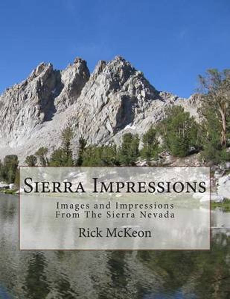
The first time I went backpacking in the Sierra Nevada Mountains of California I fell in love! That was back in 1987. Almost every year since then I have been back including a through hike of the John Muir Trail in 2004.Over the past 27 years of hiking in the Sierras I have collected hundreds of beautiful photographs and wonderful memories....Leer más
The first time I went backpacking in the Sierra Nevada Mountains of California I fell in love! That was back in 1987. Almost every year since then I have been back including a through hike of the John Muir Trail in 2004.Over the past 27 years of hiking in the Sierras I have collected hundreds of beautiful photographs and wonderful memories....Leer más
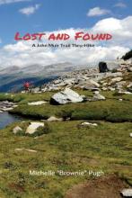
When she found herself craving a new challenge, Michelle “Brownie” Pugh set her eyes on the John Muir Trail—a hiking trail traversing 211 miles from Yosemite Valley to Mount Whitney in California. Heralded by Backpacker Magazine as the best long-distance trail in the country, the John Muir Trail boasts scenic and demanding...Leer más
When she found herself craving a new challenge, Michelle “Brownie” Pugh set her eyes on the John Muir Trail—a hiking trail traversing 211 miles from Yosemite Valley to Mount Whitney in California. Heralded by Backpacker Magazine as the best long-distance trail in the country, the John Muir Trail boasts scenic and demanding...Leer más
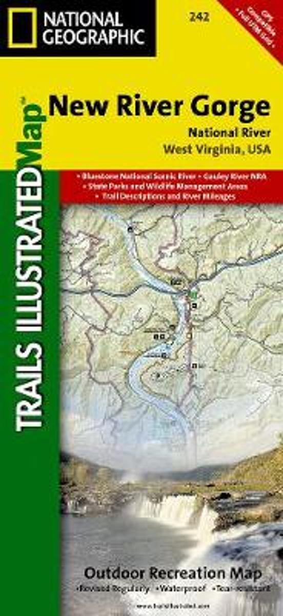
Map No. 242, New River Gorge National River, WV, in an extensive series of GPS compatible, contoured hiking maps of USA’s national and state parks or forests and other popular recreational areas. Cartography based on the national topographic survey, with additional tourist information.The maps, with most titles now printed on light, waterproof...Leer más
Waterproof Tear-Resistant Topographic MapThis Trails Illustrated topographic map for Big South Fork National River and Recreation Area in southern Kentucky and northern Tennessee is the perfect map for hiking, biking, exploring, climbing, camping, and sightseeing in this stunning area.The map includes Daniel Boone National Forest, Big...Leer más
Waterproof Tear-Resistant Topographic MapThis Trails Illustrated topographic map for Big South Fork National River and Recreation Area in southern Kentucky and northern Tennessee is the perfect map for hiking, biking, exploring, climbing, camping, and sightseeing in this stunning area.The map includes Daniel Boone National Forest, Big...Leer más
This book is powered by sweat and joy; steep hills and exhilarating telemark skiing descents into silent stands of snowy trees. The land and its smells and tastes are embedded in the memory of those lucky enough to have immersed themselves in it. My goal is to transport you: to the soft meadows, the smooth, hard granite, and the dancing trees...Leer más
This book is powered by sweat and joy; steep hills and exhilarating telemark skiing descents into silent stands of snowy trees. The land and its smells and tastes are embedded in the memory of those lucky enough to have immersed themselves in it. My goal is to transport you: to the soft meadows, the smooth, hard granite, and the dancing trees...Leer más