Côte d'Azur
Descripción
Enlaces
Datos
Informes
Guías y mapas
Hospedaje
Organizaciones
Operadores turísticos
GPS
Otro
Libros

Stanfords
United Kingdom
2015
United Kingdom
2015
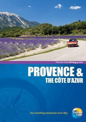
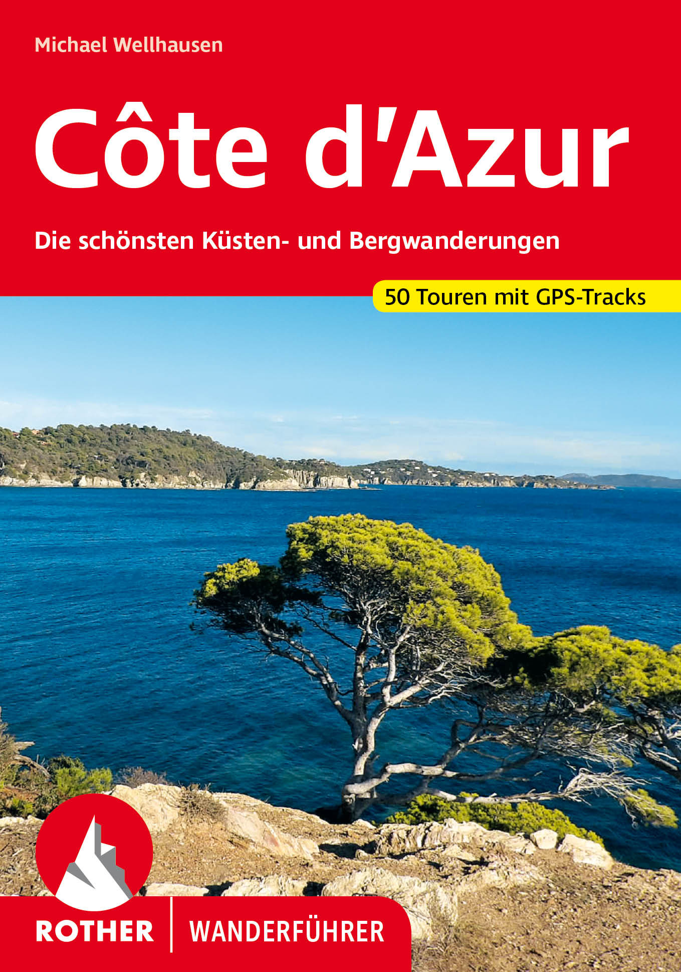
- Eastern Provence: Côte d’Azur to the Alps Sunflower Landscape Guide
- This guide, half of a two-volume set, is intended for motorists who want to tour eastern Provence and the Cote d`Azur by car and enjoy some superb walks en route. The drives have been described in such detail that there is no need to make constant reference to a map. The walks selected - all set in areas of great natural beauty and historical... Leer más

Stanfords
United Kingdom
United Kingdom
- Le Lavandou - Parc National de Port Cros - Corniche des Maures IGN 3446ET
- Topographic survey of France at 1:25,000 in IGN`s excellent TOP25 / Série Bleue series. All the maps are GPS compatible, with a 1km UTM grid plus latitude and longitude lines at 5’ intervals. Contours are at 5m intervals except for mountainous areas where the maps have contours at 10m intervals, vividly enhanced by hill shading and graphics for... Leer más

The Book Depository
United Kingdom
United Kingdom
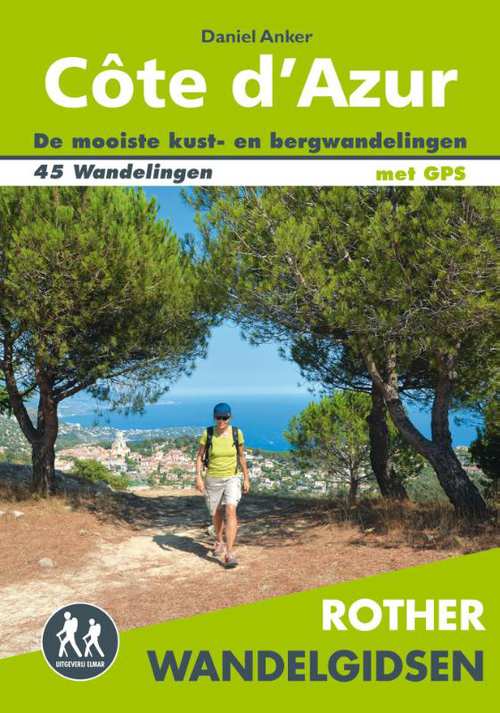
- Cote d'Azur walking guide
- The Finest Valley and Mountain Walks - ROTH.E4817 Leer más
Bol.com
Netherlands
Netherlands
- Provence and the Cote D'Azur
- <DIV><DIV><P style="MARGIN: 0in 0in 0pt">No touring holiday is complete without one of these essential guides. The driving guides series holds a range of 23 titles offering an extensive list of destinations for you to choose from.</P><P class=MsoBodyText3 style="MARGIN: 0in 0in 0pt">They contain everything the... Leer más
- Also available from:
- Bol.com, Belgium
Bol.com
Belgium
Belgium
- Provence and the Cote D'Azur
- <DIV><DIV><P style="MARGIN: 0in 0in 0pt">No touring holiday is complete without one of these essential guides. The driving guides series holds a range of 23 titles offering an extensive list of destinations for you to choose from.</P><P class=MsoBodyText3 style="MARGIN: 0in 0in 0pt">They contain everything the... Leer más

Stanfords
United Kingdom
2022
United Kingdom
2022
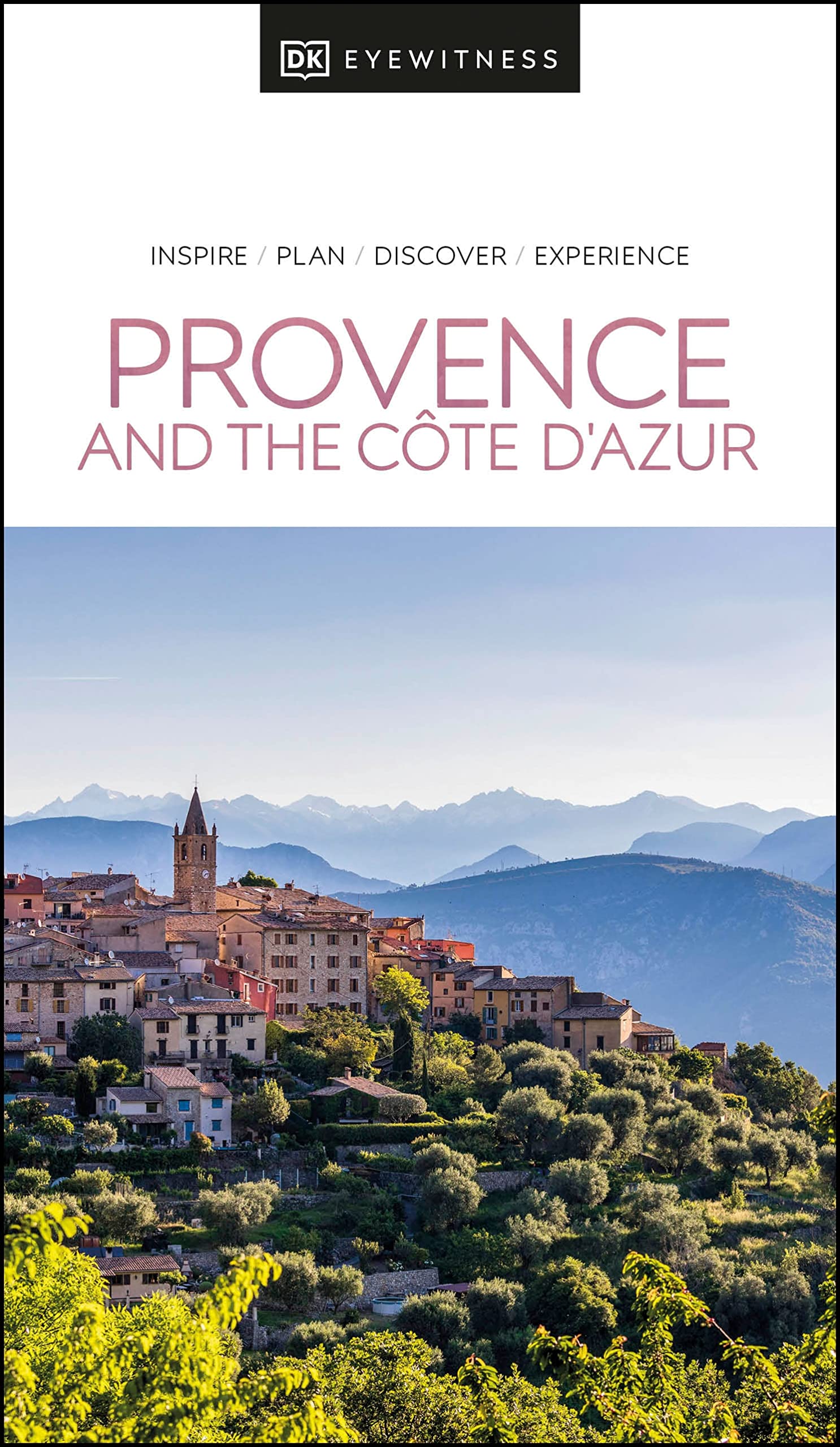
- DK Eyewitness Provence and the Cote d`Azur
- France`s most alluring region promises fragrant fields of lavender, incredible ancient relics and celebrated art collections.Whether you want to watch flocks of flamingos strutting across the wild wetlands of the Camargue, visit lush vineyards in the Rhone valley or simply soak up the sun in St-Tropez, your DK Eyewitness travel guide makes sure... Leer más
- Also available from:
- De Zwerver, Netherlands
De Zwerver
Netherlands
2022
Netherlands
2022
- Reisgids Eyewitness Travel Provence and the Cote d'Azur | Dorling Kindersley
- France`s most alluring region promises fragrant fields of lavender, incredible ancient relics and celebrated art collections.Whether you want to watch flocks of flamingos strutting across the wild wetlands of the Camargue, visit lush vineyards in the Rhone valley or simply soak up the sun in St-Tropez, your DK Eyewitness travel guide makes sure... Leer más
De Zwerver
Netherlands
2017
Netherlands
2017
- Wandelgids Côte d'Azur | Uitgeverij Elmar
- de mooiste kust- en bergwandelingen Leer más
Bol.com
Netherlands
Netherlands
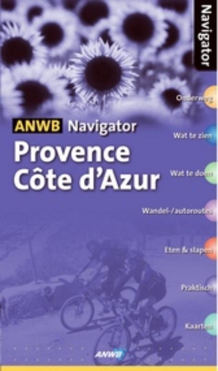
- Provence Cote d'Azur
- De Navigator reisgidsen zijn luxe uitgevoerde gidsen, boordevol informatie.ANWB Navigator combineert een glossy uitstraling met een grote toegankelijkheid. Naast traditionele onderwerpen als geschiedenis en bezienswaardigheden biedt ANWB Navigator u nog veel meer.Bijvoorbeeld informatie over shoppen, hoe het openbaar vervoer werkt, foto s van... Leer más
- Also available from:
- Bol.com, Belgium
Bol.com
Belgium
Belgium
- Provence Cote d'Azur
- De Navigator reisgidsen zijn luxe uitgevoerde gidsen, boordevol informatie.ANWB Navigator combineert een glossy uitstraling met een grote toegankelijkheid. Naast traditionele onderwerpen als geschiedenis en bezienswaardigheden biedt ANWB Navigator u nog veel meer.Bijvoorbeeld informatie over shoppen, hoe het openbaar vervoer werkt, foto s van... Leer más
Bol.com
Netherlands
Netherlands
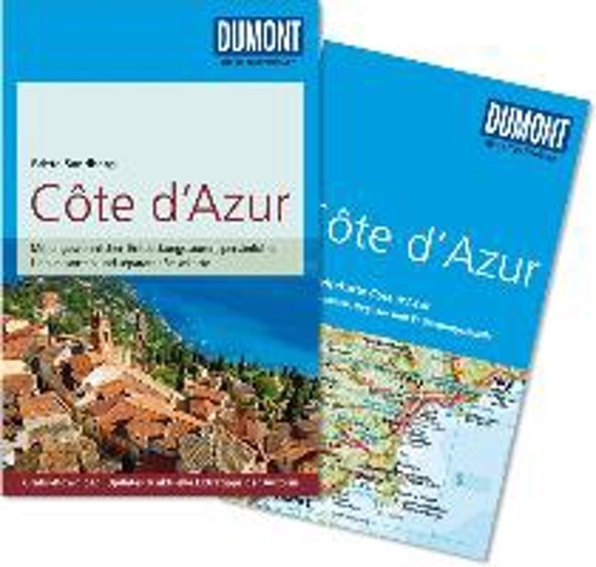
- DuMont Reise-Taschenbuch Reisef hrer Cote d'Azur
- Die C te d'Azur hat atemberaubende K stenstra en, tiefblaues Wasser und wundersch ne Altst dte. Mit ihrem Zauber lockte die legend re K ste schon in der Vergangenheit zahlreiche K nstler nach S dfrankreich. Doch in welchen Museen findet man heute die Werke von Picasso und Matisse? Warum sollte die Reise gerade in Nizza beginnen? Lohnt ein... Leer más
- Also available from:
- Bol.com, Belgium
Bol.com
Belgium
Belgium
- DuMont Reise-Taschenbuch Reisef hrer Cote d'Azur
- Die C te d'Azur hat atemberaubende K stenstra en, tiefblaues Wasser und wundersch ne Altst dte. Mit ihrem Zauber lockte die legend re K ste schon in der Vergangenheit zahlreiche K nstler nach S dfrankreich. Doch in welchen Museen findet man heute die Werke von Picasso und Matisse? Warum sollte die Reise gerade in Nizza beginnen? Lohnt ein... Leer más
De Zwerver
Netherlands
2017
Netherlands
2017
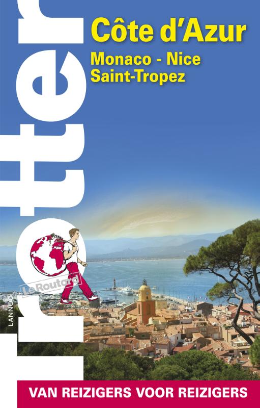
- Reisgids Trotter Cote d'Azur | Lannoo
- Beroemd om zijn betrouwbare keuze van hotel- en restaurantadressen in alle prijsklassen. Berucht voor zijn kritische noten en persoonlijke visie; Overvloedige achtergrondinformatie over het land en over de bezienswaardigheden; Speciale aandacht voor extra tips die een reis net iets meer pit geven. De onmisbare gids voor echte trotters... Leer más
Más libros…
Mapas

Stanfords
United Kingdom
United Kingdom
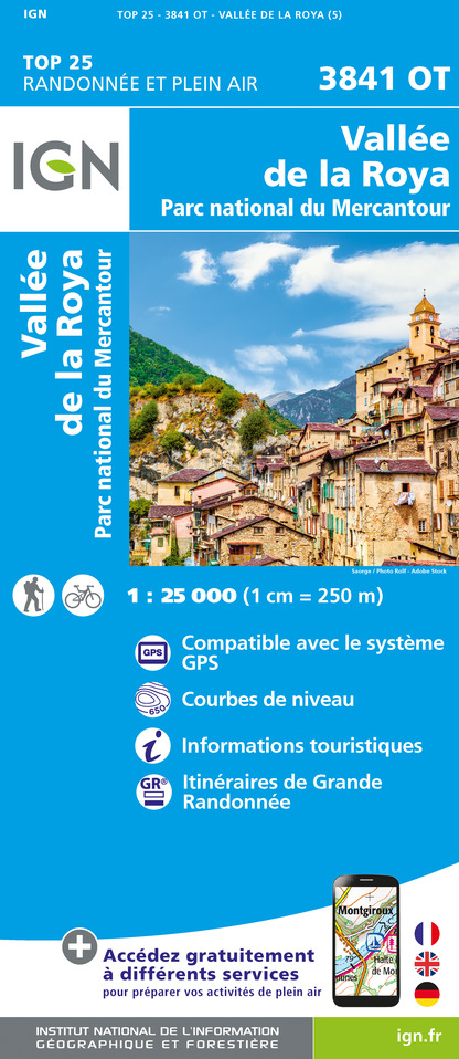
- Vallee de la Roya - PN du Mercantour IGN 3841OT
- Topographic survey of France at 1:25,000 in IGN`s excellent TOP25 / Série Bleue series. All the maps are GPS compatible, with a 1km UTM grid plus latitude and longitude lines at 5’ intervals. Contours are at 5m intervals except for mountainous areas where the maps have contours at 10m intervals, vividly enhanced by hill shading and graphics for... Leer más

Stanfords
United Kingdom
United Kingdom
- Saint-Maximin-la-Sainte-Baume - Barjols - Trets - Mont Aurelien IGN 3344OT
- Topographic survey of France at 1:25,000 in IGN`s excellent TOP25 / Série Bleue series. All the maps are GPS compatible, with a 1km UTM grid plus latitude and longitude lines at 5’ intervals. Contours are at 5m intervals except for mountainous areas where the maps have contours at 10m intervals, vividly enhanced by hill shading and graphics for... Leer más

Stanfords
United Kingdom
United Kingdom
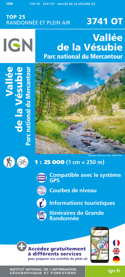
- Vallée de la Vésubie - PN du Mercantour IGN 3741OT
- Topographic survey of France at 1:25,000 in IGN`s excellent TOP25 / Série Bleue series. All the maps are GPS compatible, with a 1km UTM grid plus latitude and longitude lines at 5’ intervals. Contours are at 5m intervals except for mountainous areas where the maps have contours at 10m intervals, vividly enhanced by hill shading and graphics for... Leer más

Stanfords
United Kingdom
United Kingdom
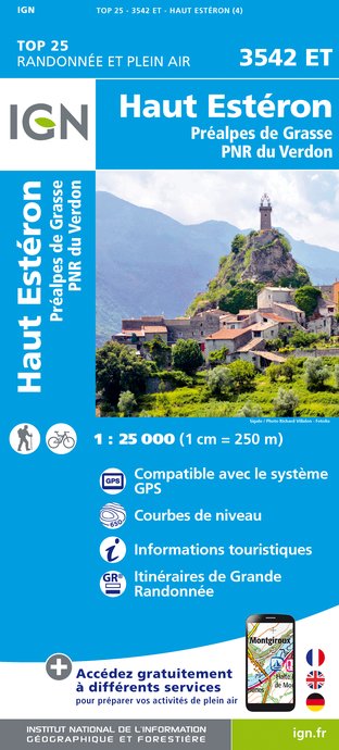
- Haut-Esteron - Prealpes de Grasse - PNR du Verdon IGN 3542ET
- Topographic survey of France at 1:25,000 in IGN`s excellent TOP25 / Série Bleue series. All the maps are GPS compatible, with a 1km UTM grid plus latitude and longitude lines at 5’ intervals. Contours are at 5m intervals except for mountainous areas where the maps have contours at 10m intervals, vividly enhanced by hill shading and graphics for... Leer más
- Also available from:
- The Book Depository, United Kingdom
- De Zwerver, Netherlands

The Book Depository
United Kingdom
United Kingdom
- Haute Esteron / Prealpes de Grasse / PNR Verdon
- Topographic survey of France at 1:25,000 in IGN`s excellent TOP25 / Série Bleue series. All the maps are GPS compatible, with a 1km UTM grid plus latitude and longitude lines at 5’ intervals. Contours are at 5m intervals except for mountainous areas where the maps have contours at 10m intervals, vividly enhanced by hill shading and graphics for... Leer más
De Zwerver
Netherlands
Netherlands
- Wandelkaart - Topografische kaart 3542ET Haute Estéron | IGN - Institut Géographique National
- Topographic survey of France at 1:25,000 in IGN`s excellent TOP25 / Série Bleue series. All the maps are GPS compatible, with a 1km UTM grid plus latitude and longitude lines at 5’ intervals. Contours are at 5m intervals except for mountainous areas where the maps have contours at 10m intervals, vividly enhanced by hill shading and graphics for... Leer más

Stanfords
United Kingdom
United Kingdom
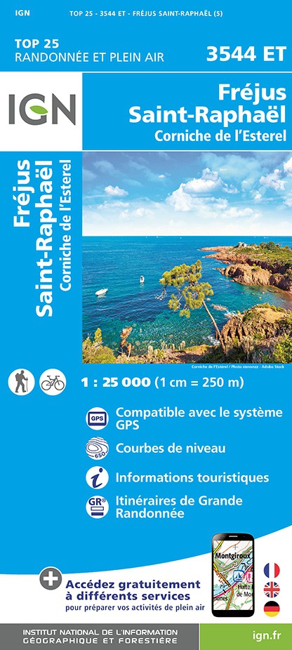
- Frejus - Saint-Raphael - Corniche de l`Esterel IGN 3544ET
- Topographic survey of France at 1:25,000 in IGN`s excellent TOP25 / Série Bleue series. All the maps are GPS compatible, with a 1km UTM grid plus latitude and longitude lines at 5’ intervals. Contours are at 5m intervals except for mountainous areas where the maps have contours at 10m intervals, vividly enhanced by hill shading and graphics for... Leer más
- Also available from:
- The Book Depository, United Kingdom
- De Zwerver, Netherlands

De Zwerver
Netherlands
Netherlands

- Also available from:
- The Book Depository, United Kingdom
- De Zwerver, Netherlands

De Zwerver
Netherlands
Netherlands

Stanfords
United Kingdom
United Kingdom
- Vallees de la Bevera - Vallees des Paillons - Parc National du Mercantour IGN 3741ET
- Topographic survey of France at 1:25,000 in IGN`s excellent TOP25 / Série Bleue series. All the maps are GPS compatible, with a 1km UTM grid plus latitude and longitude lines at 5’ intervals. Contours are at 5m intervals except for mountainous areas where the maps have contours at 10m intervals, vividly enhanced by hill shading and graphics for... Leer más
- Also available from:
- The Book Depository, United Kingdom

The Book Depository
United Kingdom
United Kingdom
- Vallees de la Bevera / Vallees Paillons / PNR Mercantour
- De wandelkaart die de perfectie benadert! Werkelijk alle topografische details zijn er op te vinden; van hoogtelijnen tot aan bruggetjes en allerlei wandelpaden. Daarnaast hebben de makers een flinke dosis toeristische informatie op de kaart verwerkt: campings, gites d étape; restaurants en ingetekende doorgaande wandelpaden, de grandes... Leer más

Stanfords
United Kingdom
United Kingdom
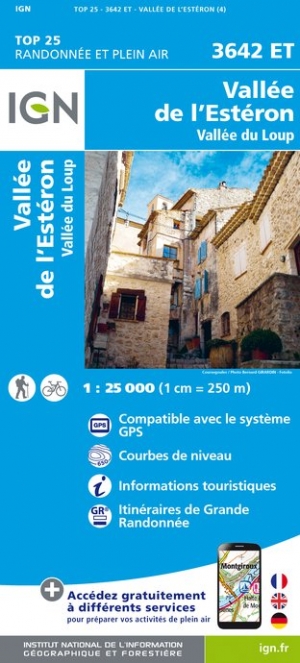
- Vallee de l`Esteron - Vallee du Loup IGN 3642ET
- Topographic survey of France at 1:25,000 in IGN`s excellent TOP25 / Série Bleue series. All the maps are GPS compatible, with a 1km UTM grid plus latitude and longitude lines at 5’ intervals. Contours are at 5m intervals except for mountainous areas where the maps have contours at 10m intervals, vividly enhanced by hill shading and graphics for... Leer más
- Also available from:
- The Book Depository, United Kingdom
- De Zwerver, Netherlands

The Book Depository
United Kingdom
United Kingdom
- Vallee de l'Esteron / Vallee du Loup 2018
- De wandelkaart die de perfectie benadert! Werkelijk alle topografische details zijn er op te vinden; van hoogtelijnen tot aan bruggetjes en allerlei wandelpaden. Daarnaast hebben de makers een flinke dosis toeristische informatie op de kaart verwerkt: campings, gites d étape; restaurants en ingetekende doorgaande wandelpaden, de grandes... Leer más
De Zwerver
Netherlands
Netherlands
- Wandelkaart - Topografische kaart 3642ET Vallée de l'Esteron | IGN - Institut Géographique National
- De wandelkaart die de perfectie benadert! Werkelijk alle topografische details zijn er op te vinden; van hoogtelijnen tot aan bruggetjes en allerlei wandelpaden. Daarnaast hebben de makers een flinke dosis toeristische informatie op de kaart verwerkt: campings, gites d étape; restaurants en ingetekende doorgaande wandelpaden, de grandes... Leer más

Stanfords
United Kingdom
United Kingdom
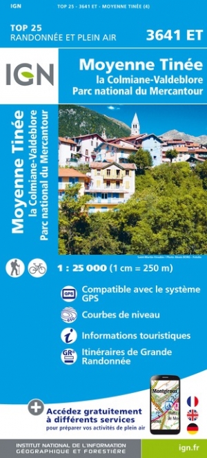
- Moyenne Tinee - la Colmiane-Valdeblore - PN du Mercantour IGN 3641ET
- Topographic survey of France at 1:25,000 in IGN`s excellent TOP25 / Série Bleue series. All the maps are GPS compatible, with a 1km UTM grid plus latitude and longitude lines at 5’ intervals. Contours are at 5m intervals except for mountainous areas where the maps have contours at 10m intervals, vividly enhanced by hill shading and graphics for... Leer más
- Also available from:
- The Book Depository, United Kingdom
- De Zwerver, Netherlands

De Zwerver
Netherlands
Netherlands

Stanfords
United Kingdom
United Kingdom
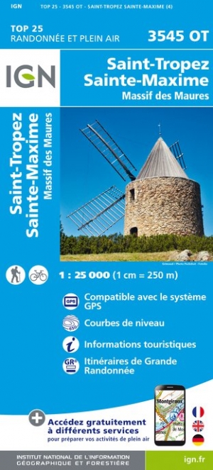
- Saint-Tropez - Sainte-Maxime - Massif des Maures IGN 3545OT
- Topographic survey of France at 1:25,000 in IGN`s excellent TOP25 / Série Bleue series. All the maps are GPS compatible, with a 1km UTM grid plus latitude and longitude lines at 5’ intervals. Contours are at 5m intervals except for mountainous areas where the maps have contours at 10m intervals, vividly enhanced by hill shading and graphics for... Leer más
- Also available from:
- The Book Depository, United Kingdom
- De Zwerver, Netherlands

The Book Depository
United Kingdom
United Kingdom
- St-Tropez / Ste-Maxime / Massif des Maures
- Topographic survey of France at 1:25,000 in IGN`s excellent TOP25 / S�rie Bleue series. All the maps are GPS compatible, with a 1km UTM grid plus latitude and longitude lines at 5� intervals. Contours are at 5m intervals except for mountainous areas where the maps have contours at 10m intervals, vividly enhanced by hill shading and graphics for ... Leer más
De Zwerver
Netherlands
Netherlands
- Wandelkaart - Topografische kaart 3545OT Saint-Tropez - Sainte-Maxime | IGN - Institut Géographique National
- Topographic survey of France at 1:25,000 in IGN`s excellent TOP25 / S�rie Bleue series. All the maps are GPS compatible, with a 1km UTM grid plus latitude and longitude lines at 5� intervals. Contours are at 5m intervals except for mountainous areas where the maps have contours at 10m intervals, vividly enhanced by hill shading and graphics for ... Leer más

Stanfords
United Kingdom
United Kingdom
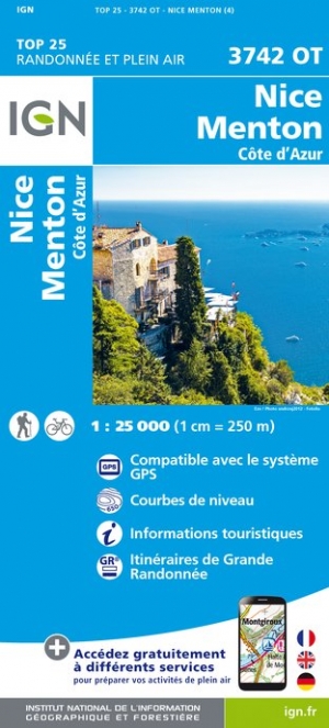
- Nice - Menton - Cote d`Azur IGN 3742OT
- Topographic survey of France at 1:25,000 in IGN`s excellent TOP25 / Série Bleue series. All the maps are GPS compatible, with a 1km UTM grid plus latitude and longitude lines at 5’ intervals. Contours are at 5m intervals except for mountainous areas where the maps have contours at 10m intervals, vividly enhanced by hill shading and graphics for... Leer más
- Also available from:
- De Zwerver, Netherlands
De Zwerver
Netherlands
Netherlands
- Wandelkaart - Topografische kaart 3742OT Nice - Menton | IGN - Institut Géographique National
- Wandelkaart - Topografische kaart 3742OT 3742 OT Nice, Menton, Côte d'Azur; Monaco, L'Escarène; La Turbie | IGN De wandelkaart die de perfectie benadert! Werkelijk alle topografische details zijn er op te vinden; van hoogtelijnen tot aan bruggetjes en allerlei wandelpaden. Daarnaast hebben de makers een flinke dosis toeristische informatie op... Leer más

Stanfords
United Kingdom
United Kingdom
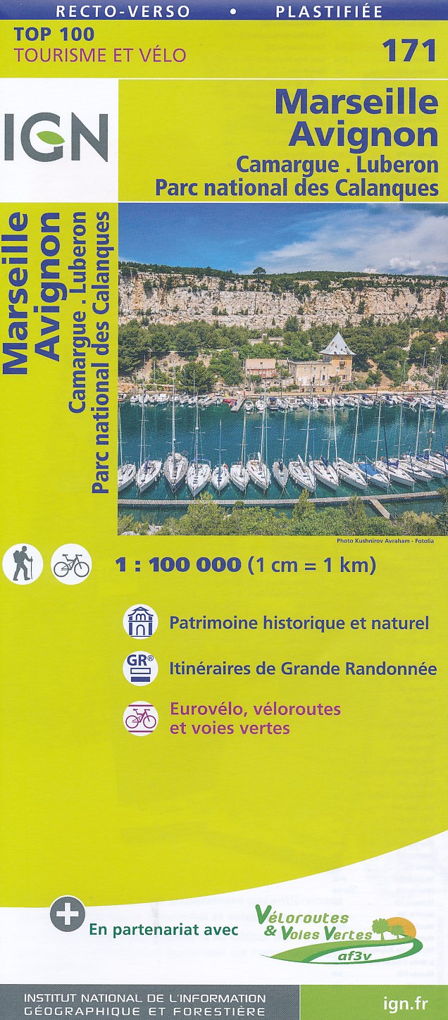
- Marseille - Avignon - Camargue - Luberon - PN des Calanques IGN TOP100 171
- Discover the new double-sided laminated edition of TOP100 road maps of France from the Institut Géographique National (IGN); exceptionally detailed, contoured road maps which include the cycle paths and greenways of the AF3V (French Association for the Development of Cycle Paths and Greenways), ideal for exploring the French countryside by car,... Leer más
- Also available from:
- De Zwerver, Netherlands
De Zwerver
Netherlands
Netherlands
- Fietskaart - Wegenkaart - landkaart 171 Marseille - Avignon | IGN - Institut Géographique National
- Map No.171, Marseille - Avignon, at 1:100,000, part of the TOP100 series from the Institut Géographique National (IGN). These exceptionally detailed, contoured and GPS compatible road maps which include English language map legend are ideal for exploring the French countryside by car, by bike, or even on foot. Used by millions of locals and... Leer más
- Also available from:
- De Zwerver, Netherlands

Más mapas…