
Great Eastern Trail
Descripción
- Name Great Eastern Trail (GET)
- Distancia de sendero 2,575 km, 1,600 millas
- Duración en días 170 días
- Clasificación Traildino SW, Caminata extenuante, sendero de montaña
- Clasificación Travesía de refugios T2, Caminata de montaña
 GET, 1600 miles (2575 km)
Hiking trail from Alabama to New York, in the eastern States, along the Appalachian Mountains. The proposed length is 1600 miles (2575 km) or even 2000 miles. The GET should get the pressure off the AT. Currently, many local organisations are working together to get a deffinite route proposal. Under construction.
Mapa


Enlaces
Datos
Informes
Guías y mapas
Hospedaje
Organizaciones
Operadores turísticos
GPS
Otro
Libros

Stanfords
United Kingdom
United Kingdom
- DK Eyewitness Travel Guide Venice & the Veneto
- Your journey starts here. Featuring DK`s much-loved maps and illustrations, walks and information, plus all new, full-colour photography, this 100% updated guide to Venice and the Veneto brings you the best of this Italian hot spot in a brand-new, lightweight format.What`s inside?- full-colour photography, hand-drawnillustrations, and maps... Leer más

Stanfords
United Kingdom
United Kingdom
- Rick Steves Pocket Amsterdam (Third Edition)
- Make the most of every day and every dollar with Rick Steves! This colourful, compact guidebook is perfect for spending a week or less in Amsterdam:City walks and tours: Six detailed tours and walks showcase Amsterdam`s essential sights, including the Rijksmuseum, Van Gogh Museum, and the Anne Frank House, plus neighbourhood walks through the... Leer más

Stanfords
United Kingdom
United Kingdom
- The Brooklyn Nobody Knows: An Urban Walking Guide
- Bill Helmreich walked every block of New York City--6,000 miles in all--to write the award-winning `The New York Nobody Knows`. Now he has re-walked Brooklyn--some 816 miles--to write this one-of-a-kind walking guide to the city`s hottest borough. Drawing on hundreds of conversations he had with residents during his block-by-block journeys,... Leer más

Stanfords
United Kingdom
2015
United Kingdom
2015
- Azores: Car Tours and Walks
- The Azores in the Sunflower Landscapes guide series; exploring the best walking and touring possibilities in the region or area. Detailed information about touring by hired car or public transport, as well as on foot, is provided, helping walkers to navigate and plan day-trips. Shorter strolls are also included as an alternative for each main... Leer más

Stanfords
United Kingdom
United Kingdom
- DK Eyewitness Europe
- Your journey starts here. Featuring DK`s much-loved maps and illustrations, walks and information, plus all new, full-colour photography, this 100% updated guide to Europe brings you the best of this diverse continent in a brand-new, lightweight format.- full-colour photography, hand-drawn illustrations, and maps throughout - easy-to-follow... Leer más

Stanfords
United Kingdom
2012
United Kingdom
2012
- Algarve Car Tours and Walks - 6th ed.
- Algarve in the Sunflower Landscapes guide series; exploring the best walking and touring possibilities in the region or area. Detailed information about touring by hired car or public transport, as well as on foot is provided, helping walkers to navigate and plan day-trips. Shorter strolls are also included as an alternative for each main route... Leer más

Stanfords
United Kingdom
2015
United Kingdom
2015
- Paxos: Car Tours and Walks
- Paxos is the Sunflower Landscapes guide to exploring the best walking and touring possibilities on the island. The guide covers a range of routes including walks in Gaios, Bogdanatika, Loggos, Lakka and Antixpaxos. A double-sided, fold-out touring map at the back of the book gives an overview of the island and the location of each walk.... Leer más

Stanfords
United Kingdom
United Kingdom
- Insight Guides Explore New York
- From making sure you don`t miss out on must-see attractions like Times Square, Brooklyn Bridge, Empire State Building, Central Park and Statue of Liberty, to discovering hidden gems, including Greenwich Village, the easy-to-follow, ready-made walking routes will save you time, help you plan and enhance your visit to New York.Practical,... Leer más

Stanfords
United Kingdom
United Kingdom
- DK Eyewitness Great Britain
- Three unique nations interwoven into a rich cultural tapestry, this small island has huge character.Whether you want to tour elegant stately homes, marvel at prehistoric wonders or take a windswept walk along cliff-top paths, your DK Eyewitness travel guide makes sure you experience all that Great Britain has to offer.From the jagged peaks of... Leer más

Stanfords
United Kingdom
United Kingdom
- Rick Steves Best of Germany (Third Edition): With Salzburg
- Hit Germany`s can`t-miss art, sights, and bites in two weeks or less with Rick Steves Best of Germany! Inside you`ll find:*Strategic advice from Rick Steves on what`s worth your time and money*Short itineraries covering Munich, Bavaria, Rothenburg and the Romantic Road, the Rhine Valley, and Berlin, plus Salzburg, Austria*Rick`s tips for... Leer más
Stanfords
United Kingdom
United Kingdom
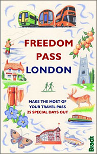
- Freedom Pass London
- Since its creation over 40 years ago, London`s Freedom Pass concessionary travel scheme has continued to grow in popularity and there are now over 1 million registered holders. Whether a fruit picker or forager, a rambler or angler, or simply someone who enjoys the quirky charm of a local pub, Bradt`s new Freedom Pass is the perfect read to... Leer más

Stanfords
United Kingdom
United Kingdom
- DK Eyewitness Washington DC
- Discover Washington, DC - a compact city that makes an impact.Whether you want to stroll beneath the cherry blossoms, visit the iconic domed Capitol, or tour the magnificent White House, your DK Eyewitness travel guide makes sure you experience all that Washington, DC has to offer.Washington, DC delights at every turn. Wherever you go, there is... Leer más

Stanfords
United Kingdom
United Kingdom
- DK Eyewitness Travel Guide Cambodia and Laos
- Admire Siem Reap`s awe-inspiring Angkor Wat, sample French-Lao cuisine at Luang Prabang`s waterfront restaurants or take a boat down the Mekong and stop off at the stunning islands of Si Phan Don. This DK Eyewitness Guide covers the all the must-see sights and hidden backstreets, so you won`t miss a thing.- See Cambodia and Laos from a... Leer más

Stanfords
United Kingdom
2020
United Kingdom
2020
- DK Eyewitness Krakow 14/5/20
- Krakow/Cracow a regal city frozen in time.Whether you want to enjoy a coffee in the iconic market square, explore the cavernous Wieliczka salt mine or simply indulge on moreish Pierogi, your DK Eyewitness travel guide makes sure you experience all that Krakow has to offer.Winding medieval streets, monumental palaces, soaring gothic spires and... Leer más

Stanfords
United Kingdom
United Kingdom
- Costa Rica Eyewitness
- Welcome to Costa Rica - unmatched in beauty and biodiversityWhether you want to experience incredible wildlife, scuba dive in crystal-clear waters or savour a cup of world-famous coffee, your DK Eyewitness travel guide makes sure you experience all that Costa Rica has to offer. Inside you`ll find a detailed guide to the country`s animals,... Leer más
Mapas

Stanfords
United Kingdom
United Kingdom
- Rasuwagadhi
- Rasuwagadhi, sheet no. 2885-10, in the topographic survey of Nepal at 1:50,000 published by the Nepali Government in the late 1990s and early 2000s and produced from remote sensing data by Finnish cartographers as part of that country’s international aid program. The maps cover 15’ x 15’ quadrangles.IMPORTANT – PLEASE NOTE BEFORE ORDERING:... Leer más
Stanfords
United Kingdom
United Kingdom
- Talkot
- Talkot, sheet no. 2981-06, in the topographic survey of Nepal at 1:50,000 published by the Nepali Government in the late 1990s and early 2000s and produced from remote sensing data by Finnish cartographers as part of that country’s international aid program. The maps cover 15’ x 15’ quadrangles.IMPORTANT – PLEASE NOTE BEFORE ORDERING:... Leer más
Stanfords
United Kingdom
United Kingdom
- Mt. Cho Oyu - Pasan Lhamu Chuli
- Mt Cho Oyu - Pasan lhamu Chuli, sheet no. 2886-15, in the topographic survey of Nepal at 1:50,000 published by the Nepali Government in the late 1990s and early 2000s and produced from remote sensing data by Finnish cartographers as part of that country’s international aid program. The maps cover 15’ x 15’ quadrangles.IMPORTANT – PLEASE NOTE... Leer más
Stanfords
United Kingdom
United Kingdom
- Bagarchhap
- Bagarchhap, sheet no. 2884-06, in the topographic survey of Nepal at 1:50,000 published by the Nepali Government in the late 1990s and early 2000s and produced from remote sensing data by Finnish cartographers as part of that country’s international aid program. The maps cover 15’ x 15’ quadrangles.IMPORTANT – PLEASE NOTE BEFORE ORDERING:... Leer más
Stanfords
United Kingdom
United Kingdom
- Nepal Survey 1:25,000 Sheet 2883 11B (Tatopani)
- Koban, sheet no. 2883-07, in the topographic survey of Nepal at 1:50,000 published by the Nepali Government in the late 1990s and early 2000s and produced from remote sensing data by Finnish cartographers as part of that country’s international aid program. The maps cover 15’ x 15’ quadrangles.IMPORTANT – PLEASE NOTE BEFORE ORDERING:... Leer más
Stanfords
United Kingdom
United Kingdom
- Dattu
- Dattu, sheet no. 2980-02, in the topographic survey of Nepal at 1:50,000 published by the Nepali Government in the late 1990s and early 2000s and produced from remote sensing data by Finnish cartographers as part of that country’s international aid program. The maps cover 15’ x 15’ quadrangles.IMPORTANT – PLEASE NOTE BEFORE ORDERING:... Leer más
Stanfords
United Kingdom
United Kingdom
- Araniko Chuli
- Araniko Chuli, sheet no. 2983-11/15, in the topographic survey of Nepal at 1:50,000 published by the Nepali Government in the late 1990s and early 2000s and produced from remote sensing data by Finnish cartographers as part of that country’s international aid program. The maps cover 15’ x 15’ quadrangles.IMPORTANT – PLEASE NOTE BEFORE ORDERING:... Leer más
Stanfords
United Kingdom
United Kingdom
- Mount Makalu
- Mount Makalu, sheet no. 2787-01, in the topographic survey of Nepal at 1:50,000 published by the Nepali Government in the late 1990s and early 2000s and produced from remote sensing data by Finnish cartographers as part of that country’s international aid program. The maps cover 15’ x 15’ quadrangles.IMPORTANT – PLEASE NOTE BEFORE ORDERING:... Leer más

Stanfords
United Kingdom
United Kingdom
- London High 5 Edition Street Plan
- The first water-resistant “Comfort Map“ with direct access to useful additional information from the InternetLondon in a scale of 1:20,000 including tourist destinations (Hampstead Heath, Olympic Park and Greenwich) presented on a practical map; inclusive of the High 5 Edition app technology for calling up additional travel information and many... Leer más
Stanfords
United Kingdom
United Kingdom
- Chhedhul Gumba
- Chhedhul Gumba, sheet no. 2883-01, in the topographic survey of Nepal at 1:50,000 published by the Nepali Government in the late 1990s and early 2000s and produced from remote sensing data by Finnish cartographers as part of that country’s international aid program. The maps cover 15’ x 15’ quadrangles.IMPORTANT – PLEASE NOTE BEFORE ORDERING:... Leer más
Stanfords
United Kingdom
United Kingdom
- Gaurishankar Himal
- Gaurishankar Himal, sheet no. 2786-02, in the topographic survey of Nepal at 1:50,000 published by the Nepali Government in the late 1990s and early 2000s and produced from remote sensing data by Finnish cartographers as part of that country’s international aid program. The maps cover 15’ x 15’ quadrangles.IMPORTANT – PLEASE NOTE BEFORE... Leer más
Stanfords
United Kingdom
United Kingdom
- Kalanga Bajar (Jumla)
- Kalanga Bajar (Jumla), sheet no. 2982-09, in the topographic survey of Nepal at 1:50,000 published by the Nepali Government in the late 1990s and early 2000s and produced from remote sensing data by Finnish cartographers as part of that country’s international aid program. The maps cover 15’ x 15’ quadrangles.IMPORTANT – PLEASE NOTE BEFORE... Leer más
Stanfords
United Kingdom
United Kingdom
- Arughat
- Arughat, sheet no. 2884-16, in the topographic survey of Nepal at 1:50,000 published by the Nepali Government in the late 1990s and early 2000s and produced from remote sensing data by Finnish cartographers as part of that country’s international aid program. The maps cover 15’ x 15’ quadrangles.IMPORTANT – PLEASE NOTE BEFORE ORDERING:... Leer más

Stanfords
United Kingdom
2021
United Kingdom
2021
- Belgium NGI Long-Distance Trails Map
- Belgium: Long-distance Footpaths Map at 1:300,000 from Nationaal Geografisch Instituut/Institut Géographique National, the country’s national survey organization, showing the network of the waymarked long-distance GR routes.The map uses as its base a road map of the country, with an overprint highlighting the network of Belgium’s long-distance... Leer más
Stanfords
United Kingdom
United Kingdom
- Martadi
- Martadi, sheet no. 2981-10, in the topographic survey of Nepal at 1:50,000 published by the Nepali Government in the late 1990s and early 2000s and produced from remote sensing data by Finnish cartographers as part of that country’s international aid program. The maps cover 15’ x 15’ quadrangles.IMPORTANT – PLEASE NOTE BEFORE ORDERING:... Leer más