
Virginia
Descripción
Virginia, on the Atlantic Ocean, hosts a large part of the Appalachian Trail, some 550 miles.
Other lengthy long distance trails passing through Virginia are the East Coast Greenway, the Eastern Continental Trail and the Great Eastern Trail.
The Tuscarora Trail is 252 miles long, and besides Virginia, it runs across Maryland, Pennsylvania and West Virginia. Also with West Virginia, it shares the Allegheny Trail, 330 miles.
Parks of interest for hiking are the Shenandoah National Park and Jefferson National Forest, both in the Blue Ridge Mountains, and the Washington National Forest.
Mapa

Senderos en estado
Enlaces
Datos
Informes
Guías y mapas
Hospedaje
Organizaciones
Operadores turísticos
GPS
Otro
Libros

Stanfords
United Kingdom
2015
United Kingdom
2015
- Azores: Car Tours and Walks
- The Azores in the Sunflower Landscapes guide series; exploring the best walking and touring possibilities in the region or area. Detailed information about touring by hired car or public transport, as well as on foot, is provided, helping walkers to navigate and plan day-trips. Shorter strolls are also included as an alternative for each main... Leer más

Stanfords
United Kingdom
2021
United Kingdom
2021
- DK Eyewitness Top 10 Lake District
- England`s Lake District, with its unspoiled wilderness, pristine lakes, boulder-strewn fells and tiny villages, has inspired generations of poets, writers and hikers. Your DK Eyewitness Top 10 travel guide ensures you`ll find your way around the Lake District with absolute ease.Our updated Top 10 travel guide breaks down the best of the Lake... Leer más

Stanfords
United Kingdom
2015
United Kingdom
2015
- Paxos: Car Tours and Walks
- Paxos is the Sunflower Landscapes guide to exploring the best walking and touring possibilities on the island. The guide covers a range of routes including walks in Gaios, Bogdanatika, Loggos, Lakka and Antixpaxos. A double-sided, fold-out touring map at the back of the book gives an overview of the island and the location of each walk.... Leer más

Stanfords
United Kingdom
United Kingdom
- DK Eyewitness Travel Guide Rome
- Find your corner of Rome with this essential travel guide, designed to help you create your own unique trip and to transport you to this great city before you`ve even packed your case - step back in time at the Roman Forum and Colosseum, get a bird`s eye view of Rome from the top of the Victor Emmanuel Monument, or relax in Villa Borghese park.... Leer más
Stanfords
United Kingdom
United Kingdom
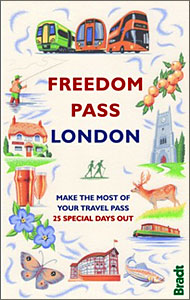
- Freedom Pass London
- Since its creation over 40 years ago, London`s Freedom Pass concessionary travel scheme has continued to grow in popularity and there are now over 1 million registered holders. Whether a fruit picker or forager, a rambler or angler, or simply someone who enjoys the quirky charm of a local pub, Bradt`s new Freedom Pass is the perfect read to... Leer más

Stanfords
United Kingdom
United Kingdom
- DK Eyewitness Travel Guide The Greek Islands
- Discover the Greek Islands with this essential travel guide, designed to help you create your own unique trip and to transport you to this beautiful region of Greece before you`ve even packed your case - explore Corfu`s atmospheric Old Town, admire Santorini`s brilliant white-and-blue-washed houses, explore archaeological sites on Delos, wander... Leer más

Stanfords
United Kingdom
United Kingdom
- DK Eyewitness Travel Guide Vietnam Angkor Wat
- Discover Vietnam with this essential travel guide, designed to help you create your own unique trip and to transport you to this beautiful country before you`ve even packed your case - step back in time in the imperial City of Hue, explore stunning islands, beaches and national parks, and take an excursion to the awe-inspiring Angkor Wat in... Leer más

Stanfords
United Kingdom
United Kingdom
- Rick Steves Pocket Prague (Second Edition)
- Make the most of every day and every dollar with Rick Steves! This colourful, compact guidebook is perfect for spending a week or less in Prague:City walks and tours: Five detailed self-guided walks, including a walk from the Old Town Square to the Charles Bridge and tours of The Jewish Quarter and Prague Castle- Rick`s strategic advice on... Leer más

Stanfords
United Kingdom
United Kingdom
- DK Eyewitness Madrid
- Traditional, vibrant and elegant, Madrid encompasses the best of Spain. Whether you want to visit royal palaces, indulge at atmospheric tapas bars or dance into the early morning, your DK Eyewitness travel guide makes sure you experience all that Madrid has to offer.With its historic plazas, glorious gardens and regal architecture, Madrid... Leer más

Stanfords
United Kingdom
United Kingdom
- DK Eyewitness Travel Guide Prague
- Your journey starts here. This new edition of our Prague guide, packed with colour photography, DK`s iconic illustrations and detailed maps, has been expertly updated so you won`t miss a thing.- Gorgeous, all-new colour photography so you can imagine yourself there- Reasons to love Prague: cosy pubs, beautifully preserved squares and Art... Leer más

Stanfords
United Kingdom
United Kingdom
- DK Eyewitness New England
- Discover New England - a region synonymous with fall foliage, seafood and historic sitesWhether you want to explore the rugged natural beauty of the Appalachian Mountains, follow the fascinating Freedom Trail through Boston, or indulge in fresh lobster from the coast of Cape Cod, your DK Eyewitness travel guide makes sure you experience all New... Leer más

Stanfords
United Kingdom
United Kingdom
- West Sussex - Year Round Walks
- These 20 circular walks vary in length from 41/2 to 71/2 miles and are enjoyable all year round. The author has divided the routes into seasons to show each at its very best. There are walks over Harting Downs, The Trundle and the South Downs Way, all with superb views; through the majestic woodland of Northpark Copse and Eartham Wood; and... Leer más

Stanfords
United Kingdom
United Kingdom
- DK Eyewitness Travel Guide Florida
- Discover Florida with this essential travel guide, designed to help you create your own unique trip and to transport you to the Sunshine State before you`ve even packed your case. Sample Miami`s vibrant nightlife, take a boat on the Everglades, visit Orlando`s theme parks or explore the remote Florida Keys - DK Eyewitness Travel Guide Florida... Leer más

Stanfords
United Kingdom
United Kingdom
- DK Eyewitness San Francisco and the Bay Area
- Discover San Francisco and the Bay Area - a region renowned for its culture, history, natural beauty, and incredible food.Whether you want to get inspired by contemporary art at SFMOMA, weekend in the Wine Country, or hike through Muir Woods National Monument, your DK Eyewitness travel guide makes sure you experience all that San Francisco and... Leer más

Stanfords
United Kingdom
United Kingdom
- Rick Steves Pocket Amsterdam (Third Edition)
- Make the most of every day and every dollar with Rick Steves! This colourful, compact guidebook is perfect for spending a week or less in Amsterdam:City walks and tours: Six detailed tours and walks showcase Amsterdam`s essential sights, including the Rijksmuseum, Van Gogh Museum, and the Anne Frank House, plus neighbourhood walks through the... Leer más
Mapas

Stanfords
United Kingdom
United Kingdom
- Araniko Chuli
- Araniko Chuli, sheet no. 2983-11/15, in the topographic survey of Nepal at 1:50,000 published by the Nepali Government in the late 1990s and early 2000s and produced from remote sensing data by Finnish cartographers as part of that country’s international aid program. The maps cover 15’ x 15’ quadrangles.IMPORTANT – PLEASE NOTE BEFORE ORDERING:... Leer más
Stanfords
United Kingdom
United Kingdom
- Mount Makalu
- Mount Makalu, sheet no. 2787-01, in the topographic survey of Nepal at 1:50,000 published by the Nepali Government in the late 1990s and early 2000s and produced from remote sensing data by Finnish cartographers as part of that country’s international aid program. The maps cover 15’ x 15’ quadrangles.IMPORTANT – PLEASE NOTE BEFORE ORDERING:... Leer más

Stanfords
United Kingdom
United Kingdom
- World Maps International Political Wall Map X-LARGE MAGNETIC-BOARD FRAMED
- Framed, 198 x 122cm (6ft 6’’ x 4ft approx.) version of the extra large political map of the world from Maps International mounted on *magnetic board* to which magnetic makers can be attached. Countries are shown in bright vivid colours against light blue oceans. Country names are in large, clearly legible print. English versions of all city... Leer más
Stanfords
United Kingdom
United Kingdom
- Chhedhul Gumba
- Chhedhul Gumba, sheet no. 2883-01, in the topographic survey of Nepal at 1:50,000 published by the Nepali Government in the late 1990s and early 2000s and produced from remote sensing data by Finnish cartographers as part of that country’s international aid program. The maps cover 15’ x 15’ quadrangles.IMPORTANT – PLEASE NOTE BEFORE ORDERING:... Leer más
Stanfords
United Kingdom
United Kingdom
- Gaurishankar Himal
- Gaurishankar Himal, sheet no. 2786-02, in the topographic survey of Nepal at 1:50,000 published by the Nepali Government in the late 1990s and early 2000s and produced from remote sensing data by Finnish cartographers as part of that country’s international aid program. The maps cover 15’ x 15’ quadrangles.IMPORTANT – PLEASE NOTE BEFORE... Leer más
Stanfords
United Kingdom
United Kingdom
- Kalanga Bajar (Jumla)
- Kalanga Bajar (Jumla), sheet no. 2982-09, in the topographic survey of Nepal at 1:50,000 published by the Nepali Government in the late 1990s and early 2000s and produced from remote sensing data by Finnish cartographers as part of that country’s international aid program. The maps cover 15’ x 15’ quadrangles.IMPORTANT – PLEASE NOTE BEFORE... Leer más
Stanfords
United Kingdom
United Kingdom
- Rasuwagadhi
- Rasuwagadhi, sheet no. 2885-10, in the topographic survey of Nepal at 1:50,000 published by the Nepali Government in the late 1990s and early 2000s and produced from remote sensing data by Finnish cartographers as part of that country’s international aid program. The maps cover 15’ x 15’ quadrangles.IMPORTANT – PLEASE NOTE BEFORE ORDERING:... Leer más
Stanfords
United Kingdom
United Kingdom
- Mt. Cho Oyu - Pasan Lhamu Chuli
- Mt Cho Oyu - Pasan lhamu Chuli, sheet no. 2886-15, in the topographic survey of Nepal at 1:50,000 published by the Nepali Government in the late 1990s and early 2000s and produced from remote sensing data by Finnish cartographers as part of that country’s international aid program. The maps cover 15’ x 15’ quadrangles.IMPORTANT – PLEASE NOTE... Leer más
Stanfords
United Kingdom
United Kingdom
- Bagarchhap
- Bagarchhap, sheet no. 2884-06, in the topographic survey of Nepal at 1:50,000 published by the Nepali Government in the late 1990s and early 2000s and produced from remote sensing data by Finnish cartographers as part of that country’s international aid program. The maps cover 15’ x 15’ quadrangles.IMPORTANT – PLEASE NOTE BEFORE ORDERING:... Leer más
Stanfords
United Kingdom
United Kingdom
- Nepal Survey 1:25,000 Sheet 2883 11B (Tatopani)
- Koban, sheet no. 2883-07, in the topographic survey of Nepal at 1:50,000 published by the Nepali Government in the late 1990s and early 2000s and produced from remote sensing data by Finnish cartographers as part of that country’s international aid program. The maps cover 15’ x 15’ quadrangles.IMPORTANT – PLEASE NOTE BEFORE ORDERING:... Leer más
Stanfords
United Kingdom
United Kingdom
- Olanchungola
- Olanchungola, sheet no. 2787-08, in the topographic survey of Nepal at 1:50,000 published by the Nepali Government in the late 1990s and early 2000s and produced from remote sensing data by Finnish cartographers as part of that country’s international aid program. The maps cover 15’ x 15’ quadrangles.IMPORTANT – PLEASE NOTE BEFORE ORDERING:... Leer más
Stanfords
United Kingdom
United Kingdom
- Jomson
- Jomson, sheet no. 2883-03, in the topographic survey of Nepal at 1:50,000 published by the Nepali Government in the late 1990s and early 2000s and produced from remote sensing data by Finnish cartographers as part of that country’s international aid program. The maps cover 15’ x 15’ quadrangles.IMPORTANT – PLEASE NOTE BEFORE ORDERING:... Leer más
Stanfords
United Kingdom
United Kingdom
- Salpa Bhanjyang - Baksila
- Salpa Bhanjyang - Baksila, sheet no. 2786-12, in the topographic survey of Nepal at 1:50,000 published by the Nepali Government in the late 1990s and early 2000s and produced from remote sensing data by Finnish cartographers as part of that country’s international aid program. The maps cover 15’ x 15’ quadrangles.IMPORTANT – PLEASE NOTE BEFORE... Leer más
Stanfords
United Kingdom
United Kingdom
- Gurjakhani
- Gurjakhani, sheet no. 2883-05, in the topographic survey of Nepal at 1:50,000 published by the Nepali Government in the late 1990s and early 2000s and produced from remote sensing data by Finnish cartographers as part of that country’s international aid program. The maps cover 15’ x 15’ quadrangles.IMPORTANT – PLEASE NOTE BEFORE ORDERING:... Leer más
Stanfords
United Kingdom
United Kingdom
- Lantan (2885 15)
- Upper Langtang Valley, sheet no. 2885-15, in the topographic survey of Nepal at 1:50,000 published by the Nepali Government in the late 1990s and early 2000s and produced from remote sensing data by Finnish cartographers as part of that country’s international aid program. The maps cover 15’ x 15’ quadrangles.IMPORTANT – PLEASE NOTE BEFORE... Leer más