Scotland
Descripción
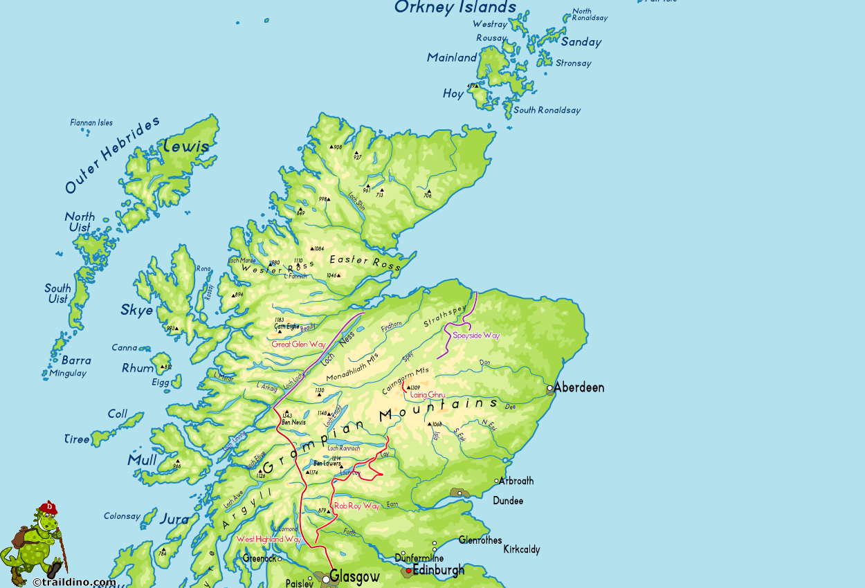
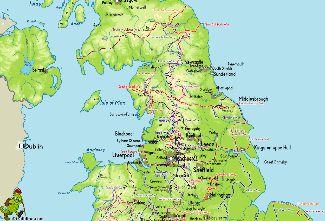
Mapa
Senderos en estado
- Annandale WayGPX
- Arran Coastal WayGPX
- Borders Abbeys WayGPX
- Cape Wrath TrailGPX
- Cateran TrailGPX
- Cowal WayGPX
- Dava WayGPX
- E2GPX
- Fife Coastal PathGPX
- Great Glen WayGPX
- Highland High Way
- John Muir WayGPX
- Kintyre WayGPX
- Lairig Ghru
- Lands End to John o'GroatsGPX
- Mary Queen of Scots WayGPX
- Moray Coast TrailGPX
- Moray Way
- North Sea TrailGPX
- River Ayr WayGPX
- Rob Roy WayGPX
- Saint Cuthbert's WayGPX
- Scottish Coast to Coast
- Sir Walter Scott Way
- Southern Upland WayGPX
- Speyside WayGPX
- West Highland WayGPX
- West Island WayGPX
Enlaces
Datos
Informes
Guías y mapas
Hospedaje
Organizaciones
Operadores turísticos
GPS
Otro
Libros

Stanfords
United Kingdom
2004
United Kingdom
2004
- Western Highlands
- This guide features 40 circular walks in the mountain country of the West Highlands. The routes in this volume take from the Rough Bounds of Knoydart and the silver sands of Morar to the ridges of Kintail and the ancient forests of Glen Affric, covering all of the Munros and many other great hills. Each walk section contains a detailed route... Leer más

Stanfords
United Kingdom
United Kingdom
- Nevermind the Quantocks
- `Every one of us knows the moment when the simple act of putting one foot in front of another stops being a method of propulsion and becomes an adventure.` In this hilarious and heart-warming collection of essays, writer and broadcaster Stuart Maconie reflects on a life spent exploring the British countryside on foot. From the splendour of the... Leer más

Stanfords
United Kingdom
United Kingdom
- Pilgrimage: The Great Pilgrim Routes of Britain and Europe
- Shortlisted for a 2018 Edward Stanford Travel Writing Award.Ten historic pilgrim routes of Western Europe, inspiration for today`s long distance walker. Pilgrimage in Europe is thriving on a massive scale. In 1990 the cathedral at Santiago de Compostela recorded less than 5000 pilgrims: today that figure is at least 200,000 a year. Author Derry... Leer más

Stanfords
United Kingdom
United Kingdom
- Walking Through Scotland`s History
- Today, walking is many things for many people - a leisure activity, a weekend pursuit, or even a chore - but rarely is it an integral part of everyday life. This book explores the world, and the way of life, that Scotland has left behind. From the Roman legions marching into Caledonia, to the 20th century`s travelling communities, Ian R.... Leer más

Stanfords
United Kingdom
2020
United Kingdom
2020
- Hadrian`s Wall Path
- Trailblazer British Walking Guide, two-way edition with routes re-walked from Bowness-on-Solway to Wallsend (Newcastle) and Wallsend (Newcastle) to Bowness-on-Solway. All-in-one guide to walking Hadrian`s Wall Path National Trail. Hadrian`s Wall Path, 84 miles from end to end, follows the course of northern Europe`s largest surviving Roman... Leer más

Stanfords
United Kingdom
United Kingdom
- Scotland The Best: New and Fully Updated 13th Edition
- The true Scot`s insider`s guide to the very best Scotland has to offer. Fully revised and updated in Pete Irvine`s own unique style, the 13th edition includes over 2000 recommendations for every type of adventure.Trusted for over 20 years, this fully comprehensive and independent guide to Scotland gives you only the very best recommendations,... Leer más

Stanfords
United Kingdom
United Kingdom
- Ireland The Best: The insider`s guide to Ireland
- The true Irish insider`s guide to the very best Ireland has to offer. This fully comprehensive and independent guide to Ireland gives you only the very best recommendations, whatever your budget. Brought to you by the McKennas, who have over 30 years` experience writing and talking about Ireland`s amazing food, drink and hospitality.... Leer más

Stanfords
United Kingdom
United Kingdom
- Explore Aviemore - Rothiemurchus - Glenmore - Boat of Garten - Inshriach Forest
- Aviemore and its environs, including Rothiemurchus, Glenmore, Boat of Garten and Inshriach Forest on a light, waterproof and tear-resistant, contoured and GPS compatible map at 1:35,000 from Footprint Walks, designed to highlight best local routes for walkers, trail runners and mountain bikers.On one side is a map of the whole area around... Leer más

Stanfords
United Kingdom
United Kingdom
- Windswept: Walking in the Footsteps of Remarkable Women
- The story of extraordinary women who lost their way - their sense of self, their identity, their freedom - and found it again through walking in the wild. A feminist exploration of the power of walking in nature, following in the footsteps of Gwen John, Georgia O`Keeffe, Frieda Lawrence, Clara Vyvyan, Simone de Beauvoir, Daphne Du Maurier and... Leer más

Stanfords
United Kingdom
2015
United Kingdom
2015
- Torridon Walking
- Walking in Torridon is a Cicerone guide to 52 day walks of differing grades in this area of the Scottish Highlands, including ascent routes for nine Munros, which will enable you to discover the best of remote Torridon and prepare you to range over heather, grass, rock and marsh, without paths or waymarks. Making Shieldaig its base, the book... Leer más

Stanfords
United Kingdom
United Kingdom
- Scotland Philip`s Navigator Road Atlas
- PHILIP`S NAVIGATOR SCOTLAND - THE BEST-SELLING ATLAS OF SCOTLAND`A map that beats all others` The Daily Telegraph`Scale, accuracy and clarity are without parallel` Driving Magazine`No.1 in the UK for clear maps` Independent research survey- Exceptional clarity at a scale of 1.5 miles to 1 inch = 1:100,000 (3 miles to 1 inch = 1:200,000 for... Leer más

Stanfords
United Kingdom
United Kingdom
- Isles at the Edge of the Sea
- Rising off the western seaboard of mainland Scotland are hundreds of islands; hidden worlds. Beginning on Arran, Jonny Muir sets out to explore these places with a single ambition: to reach the faraway St Kilda archipelago; the islands at the edge of the world. On the way he attempts to find his inner peace on Holy Island, takes part in a... Leer más

Stanfords
United Kingdom
United Kingdom
- Sherlock Holmes Walk
- Step back in time and explore the London of Sherlock Holmes and Dr Watson. It is 1895 — a time of Hansom cabs rattling along cobbled streets, foggy lanes and gas-lit alleys, a romantic yet sinister London at the height of her Imperial greatness. Each site that is visited on this Walk has a major literary connection with our two heroes and their... Leer más

Stanfords
United Kingdom
United Kingdom
- Scotland Traveler Guide
- The latest edition of National Geographic`s popular guidebook covers all the main cities, towns, and regions of Scotland, helping travelers negotiate one of Europe`s more remote yet enduringly popular destinations. The book providesdetailed city walks in Edinburgh and Glasgow and drives into the highlands, complete with maps and reservation... Leer más

Stanfords
United Kingdom
United Kingdom
- Walks The Trossachs
- Last rewalked and updated 2010, Walks The Trossachs & East Loch Lomond including Killin & Tyndrum covers one of the most popular walking districts in Scotland (much of it now a National Park). Its hills, lochs, glens and woodlands provide an enormous range of routes within a small area. The 40 walks featured range from 0.5 miles to 15 miles... Leer más
Mapas

Stanfords
United Kingdom
United Kingdom
- Luxembourg North
- One of two topographic survey maps of Luxembourg at 1:50,000, with contours at 10-metres intervals and additional relief shading. An overprint highlights long-distance footpaths, including the GR5 (E-2), cycle routes, and various places of interest, including campsites. The map covers an area of approximately 53 x 43 km / 33 x 27 miles. Map... Leer más

Stanfords
United Kingdom
United Kingdom
- Lyme Bay 25K AA/OS Walker`s Map No. 11
- Lyme Bay at 1:25,000 in a series of Walker’s Maps published by the AA with the cartography from the Ordnance Survey’s Explorer series. Coverage includes Lyme Regis, Axmouth, Seaton, Shute, Axminster, Yarcombe, Chard, Crewkerne, Mosterton, Beaminster, Bridport, West Bay, etc.Maps in the AA Walker’s series are identical to the OS Explorer maps... Leer más

Stanfords
United Kingdom
United Kingdom
- Edinburgh 1926-1928
- Edinburgh 1926-1928 map from Cassini reproducing old Ordnance Survey mapping of Scotland presented in a format designed to offer a convenient comparison with the present day coverage from the OS.Old maps have been combined so that the sheet lines correspond to the current Landranger series map No. 66 and are reproduced with the scale changed... Leer más

Stanfords
United Kingdom
United Kingdom
- Luxembourg South
- One of two topographic survey maps of Luxembourg at 1:50,000, with contours at 10-metres intervals and additional relief shading. An overprint highlights long-distance footpaths, including the GR5 (E-2), cycle routes, and various places of interest, including campsites. The map covers an area of approximately 53 x 43 km / 33 x 27 miles. Map... Leer más

Stanfords
United Kingdom
United Kingdom
- North Pembrokeshire OS Explorer Map OL35 (paper)
- The northern coast of Pembrokeshire between Cardigan and St Davids on a detailed topographic and GPS compatible map OL35, paper version, from the Ordnance Survey’s 1:25,000 Explorer series. Coverage includes Pembrokeshire Coast National Park, Goodwick, Fishguard, Llys-y-fran Reservoir, Ramsey Island, the Pembrokeshire Coast Path National Trail... Leer más
Stanfords
United Kingdom
United Kingdom
- Edinburgh 1857-1957 (5-map set)
- Edinburgh Historical Set of five maps from Cassini reproducing old Ordnance Survey mapping of Scotland. The set consists of four maps at 1:50,000 with coverage corresponding to the present day OS Landranger Map No. 66, reproducing mapping from the OS published between 1857 and 1957. The fifth map presents the coverage of the city itself at... Leer más

Stanfords
United Kingdom
United Kingdom
- North York Moors West AA Walker`s Map 19
- The western part of the North York Moors at 1:25,000 in a series of Walker’s Maps published by the AA with the cartography from the Ordnance Survey’s Explorer series. The map is double-sided and coverage includes North York Moors National Park, Middlesbrough, Salturn-by-the-Sea, Guisboroughm Stokesley, Castleton, Seave Green, Hutton-le-Hole,... Leer más
Stanfords
United Kingdom
United Kingdom
- Edinburgh 1956-1957
- Edinburgh 1956-1957 map from Cassini reproducing old Ordnance Survey mapping of Scotland presented in a format designed to offer a convenient comparison with the present day coverage from the OS.Old maps have been combined so that the sheet lines correspond to the current Landranger series map No. 66 and are reproduced with the scale changed... Leer más
Stanfords
United Kingdom
United Kingdom
- Edinburgh 1857-1928 (3-map set)
- Edinburgh Historical Set of three maps from Cassini reproducing old Ordnance Survey mapping of Scotland between 1857 and 1928 presented in a format designed to offer a convenient comparison with the present day coverage from the OS.Old maps have been combined so that the sheet lines correspond to the current Landranger series map No. 66 and are... Leer más

Stanfords
United Kingdom
United Kingdom
- Two Moors Way Harvey National Trail XT40
- Two Moors Way, a 150km / 93 mile long-distance trail between Lynmouth on the north coast of Devon and Ivybridge near Plymouth, crossing Exmoor and Dartmoor National Parks, presented at 1:40,000 on a light, waterproof and tear-resistant map from Harvey Map Services. The route is shown on six panels.Maps in the Harvey’s series covering Great... Leer más

Stanfords
United Kingdom
United Kingdom
- London
- London at 1:50,00 with mapping from the Ordnance Survey’s Landranger series published by Cassini to add to their extensive coverage of the city on historical maps reflecting different periods in its development. Unlike the Landranger series which splits the city east/west, the Cassini version is centred on Charing Cross and covers most of the... Leer más
Stanfords
United Kingdom
United Kingdom
- Edinburgh 1857-1869
- Edinburgh 1857-1869 map from Cassini reproducing old Ordnance Survey mapping of Scotland presented in a format designed to offer a convenient comparison with the present day coverage from the OS.Old maps have been combined so that the sheet lines correspond to the current Landranger series map No. 66 and are reproduced with the scale changed... Leer más

Stanfords
United Kingdom
United Kingdom
- Bob Graham Round in the Lakeland Fells
- Bob Graham Round, a historic 106km / 66 mile circuit across the fells of the Lake District, presented at 1:40,000 on a light, waterproof and tear-resistant map from Harvey Map Services. First completed by Bob Graham in 1932 and now a popular challenge, the route which takes in 42 Lakeland summits is presented on four overlapping panels.Maps in... Leer más

Stanfords
United Kingdom
United Kingdom
- Isle of Wight AA Walker`s Map 16
- Isle of Wight at 1:25,000 in a series of Walker’s Maps published by the AA with the cartography from the Ordnance Survey’s Explorer series. The map is double-sided and coverage includes The Solent and part of the mainland with ferry connections from Portsmouth and Lymington.Maps in the AA Walker’s series are identical to the OS Explorer maps... Leer más
Stanfords
United Kingdom
United Kingdom
- Edinburgh 1905-1907
- Edinburgh 1905-1907 map from Cassini reproducing old Ordnance Survey mapping of Scotland presented in a format designed to offer a convenient comparison with the present day coverage from the OS.Old maps have been combined so that the sheet lines correspond to the current Landranger series map No. 66 and are reproduced with the scale changed... Leer más


