
Yorkshire Dales
Descripción
The Yorkshire Dales National Park is a pretty area for walking. The upland parts consist of pastures separated by dry-stone walls and grazed by sheep and cattle. Elsewhere, you will find heather moorland. The Yorkshire Dales belong to the Pennines. A great number of Long Distance Trails traverse this area, including the Coast to Coast Walk, the Pennine Way and the Dales Way.
Senderos en región
Enlaces
Datos
Informes
Guías y mapas
Hospedaje
Organizaciones
Operadores turísticos
GPS
Otro
Libros

Stanfords
United Kingdom
United Kingdom
- Yorkshire Dales Short Walks
- Many characteristics of the Yorkshire Dales alter day by day, changing with the seasons, the weather and the hour-making the area an ideal destination for the walker. The unique limestone landscape encompasses vast expanses of high, lonely moor and respectable-sized hills, but it is the intricate web of valleys such as Wharfedale and Swaledale... Leer más

Stanfords
United Kingdom
2019
United Kingdom
2019
- Yorkshire Dales: AA 50 Walks
- Walking is one of Britain`s favourite leisure activities, and `AA 50 Walks in the Yorkshire Dales` features a variety of mapped walks of two to ten miles, to suit all abilities. The book features all the practical detail you need, accompanied by fascinating background reading on the history and wildlife of the Yorkshire Dales, and clear full... Leer más

Stanfords
United Kingdom
United Kingdom
- Railway Walks: LNER
- In ”Railway Walks: LNER”, Jeff Vinter, consultant to the BBC`s ”Railway Walks” series, provides an indispensable guide to ten carefully selected railway paths converted from lines once owned by the London and North Eastern Railway. From the quiet byways of East Anglia to the dramatic scenery of the North Yorkshire coast and the moorlands of... Leer más

Stanfords
United Kingdom
United Kingdom
- Wharfedale & Ilkley: Short Scenic Walks
- This colourful pocket-sized guide is your passport to 10 great walks in the countryside of the Yorkshire Dales, within the National Park and around Ilkley. The principal feature is that all walks are no more than five miles in length, offering a perfect half day`s stroll for families, casual walkers and all who want to enjoy a leisurely... Leer más

Stanfords
United Kingdom
2019
United Kingdom
2019
- Pennine Way: Edale to Kirk Yetholm
- Britain`s best-known National Trail winds for 256 miles through three National Parks - the Peak District, Yorkshire Dales and Northumberland. This is the 5th edition. This superb footpath showcases Britain`s finest upland scenery, while touching the literary landscape of the Bronte family and Roman history along Hadrian`s Wall. *138 large-scale... Leer más

Stanfords
United Kingdom
2014
United Kingdom
2014
- North Yorkshire: AA 50 Walks
- North Yorkshire in the AA 50 Walks series; comprising an extensive range of walking guides helping you to explore the best walking routes in Great Britain. Each guide covers a total of 50 walks, many of which are circular, between 2-10 miles and also that are suitable for a range of different walking standards.Every walk in the guides has an... Leer más

Stanfords
United Kingdom
United Kingdom
- West Yorkshire - Footpaths for Fitness
- Twenty circular walks graded by length and degree of engergy needed. They range from 2 to 8 miles and include Boston Spa, Badsworth, Denby Dale, Todmorden and Addingham. With maps and photographs. Leer más

Stanfords
United Kingdom
United Kingdom
- Camra`s Yorkshire Pub Walks
- This is a pocket-sized, traveller`s guide to some of the best walking and finest pubs in God`s own county. The walks are grouped geographically and explore some of the region`s fascinating historical and literary heritage as well as its thriving brewing scene. The book contains essential information about local transport and accommodation. The... Leer más

Stanfords
United Kingdom
United Kingdom
- Walker`s Britain in a Box: Third Expanded Edition
- WALKS FOR EVERYONEMost are easy half-day circular routes, but a few are more challenging. Some are two-day walks on folding four-page cards, ideal for a short walking break.TRANSPARENT SLEEVE PROVIDEDIf it rains, read the card through the transparent plastic sleeve.CHARMING PLACES TO STAYWalks near charming places to stay, some offering onward... Leer más


Stanfords
United Kingdom
United Kingdom
- Britain`s Best Coastal Walks
- Accompanied by beautiful colour photography, ”Britain`s Best Coastal Walks” celebrates the varied treasures to be found on the coastlines of England, Wales and Scotland. Andrew McCloy has devised 15 two- to three-day walks along sections of Britain`s most famous coastal paths, which are shown on clear and detailed maps. His commentaries focus... Leer más

Stanfords
United Kingdom
United Kingdom
- Yorkshire Coast Path: A guide to walking 120 miles of magnificent coastline from Redcar to the Humber
- The Yorkshire coastline is the second most visited tourist destination in England - so why no walking guide to its entire length? The Trail Guides published by, for example, Aurum, and other walking publishers like Cicerone, sell steady numbers of guides to the Northumberland Coast Path, let alone National Trails like the South-West Coast Path.... Leer más
Stanfords
United Kingdom
United Kingdom
- Yorkshire Dales and South Pennines Walks In a Box: The region`s best walks on pocketable cards, revised and updated
- The best Yorkshire Dales walks in one handy box. Immerse yourself in the Yorkshire Dales and South Pennines` wonderful landscape with this unique collection of walks on pocketable cards. In this boxed collection of walking cards you`ll find a happy mix of routes around the Yorkshire Dales and South Pennines. From child-friendly strolls to... Leer más

Stanfords
United Kingdom
United Kingdom
- Wild Pub Walks
- Join the author on 30 walks in beautiful remote or mountain landscapes, each with a great pub - often with historical significance - at journey`s end. The book is aimed at the large market of hill walkers who enjoy long days out followed by a great pint in a great pub.The areas covered are: Peak District; Lake District; Highlands/Islands;... Leer más

Stanfords
United Kingdom
United Kingdom
- Nidderdale and Ripon Walks
- This new title is in an improved series of Paul Hannon`s walking guides. A range of enhancements see two previous titles merge to cover a broader, logically grouped area - in this instance the neighbouring Nidderdale and Ripon areas, which are already strongly linked within the Nidderdale Area of Outstanding Natural Beauty. The new series is... Leer más
Mapas

Stanfords
United Kingdom
United Kingdom
- Appleby-in-Westmorland 1925
- Map No. 91, Appleby-in-Westmorland 1925, in the Cassini Historical Series of old Ordnance Survey mapping of England and Wales at 1:50,000 in a format designed to offer a convenient comparison with the present day coverage from the OS, and most locations in three different editions. Old historical maps have been combined so that the sheet lines... Leer más
Stanfords
United Kingdom
United Kingdom
- Scarborough 1903-1904
- Map No. 101, Scarborough 1903-1904, in the Cassini Historical Series of old Ordnance Survey mapping of England and Wales at 1:50,000 in a format designed to offer a convenient comparison with the present day coverage from the OS, and most locations in three different editions. Old historical maps have been combined so that the sheet lines... Leer más
Stanfords
United Kingdom
United Kingdom
- Hexham and Haltwhistle 1901-1904
- Map No. 87, Hexham and Haltwhistle 1901-1904, in the Cassini Historical Series of old Ordnance Survey mapping of England and Wales at 1:50,000 in a format designed to offer a convenient comparison with the present day coverage from the OS, and most locations in three different editions. Old historical maps have been combined so that the sheet... Leer más
Stanfords
United Kingdom
United Kingdom
- Scarborough 1856-1925 (3-map set)
- Map No. 101, Scarborough 1856-1925 (3-map set), in the Cassini Historical Series of old Ordnance Survey mapping of England and Wales at 1:50,000 in a format designed to offer a convenient comparison with the present day coverage from the OS, and most locations in three different editions. Old historical maps have been combined so that the sheet... Leer más
Stanfords
United Kingdom
United Kingdom
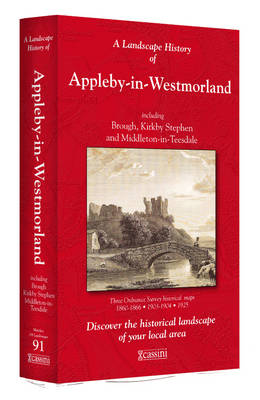
- Appleby-in-Westmorland 1860-1925 (3-map set)
- Map No. 91, Appleby-in-Westmorland 1860-1925 (3-map set), in the Cassini Historical Series of old Ordnance Survey mapping of England and Wales at 1:50,000 in a format designed to offer a convenient comparison with the present day coverage from the OS, and most locations in three different editions. Old historical maps have been combined so that... Leer más

Stanfords
United Kingdom
United Kingdom
- Peak District - Dark Peak A-Z Adventure Atlas
- Peak District: Dark Peak Adventure Atlas at 1:25,000 in a series of handy A5 size Adventure Atlases from Geographers` A-Z Map Company with cartography from the Ordnance Survey’s Explorer series. Coverage includes Glossop, Hadfield, Stocksbridge, Chapel-en-le-Frith, Hope, Bamford, New Mills, Castleton, Bradwell, Hayfield, Tintwistle, Greenfield,... Leer más
Stanfords
United Kingdom
United Kingdom
- Northallerton and Ripon 1858-1861
- Map No. 99, Northallerton and Ripon 1858-1861, in the Cassini Historical Series of old Ordnance Survey mapping of England and Wales at 1:50,000 in a format designed to offer a convenient comparison with the present day coverage from the OS, and most locations in three different editions. Old historical maps have been combined so that the sheet... Leer más

Stanfords
United Kingdom
United Kingdom
- Yorkshire Dales South Adventure Atlas
- The southern part of the Yorkshire Dales at 1:25,000 in a series of handy A5 size Adventure Atlases from Geographers` A-Z Map Company with cartography from the Ordnance Survey’s Explorer series. The atlas covers Wharfedale and Ribblesdale, including Skipton, Gargrave, Long Preston, Settle, Austwick, High Bentham, Ingleton, Dent, Buckden... Leer más
Stanfords
United Kingdom
United Kingdom
- Barnard Castle and Richmond 1860-1866
- Map No. 92, Barnard Castle and Richmond 1860-1866, in the Cassini Historical Series of old Ordnance Survey mapping of England and Wales at 1:50,000 in a format designed to offer a convenient comparison with the present day coverage from the OS, and most locations in three different editions. Old historical maps have been combined so that the... Leer más
Stanfords
United Kingdom
United Kingdom
- Malton & Pickering 1924-1925
- Map No. 100, Malton and Pickering 1924-1925, in the Cassini Historical Series of old Ordnance Survey mapping of England and Wales at 1:50,000 in a format designed to offer a convenient comparison with the present day coverage from the OS, and most locations in three different editions.Old historical maps have been combined so that the sheet... Leer más
Stanfords
United Kingdom
United Kingdom
- Barnard Castle & Richmond 1925 - 92
- Map No. 92, Barnard Castle and Richmond 1925, in the Cassini Historical Series of old Ordnance Survey mapping of England and Wales at 1:50,000 in a format designed to offer a convenient comparison with the present day coverage from the OS, and most locations in three different editions. Old historical maps have been combined so that the sheet... Leer más
Stanfords
United Kingdom
United Kingdom
- Blackburn and Burnley 1903-1904
- Map No. 103, Blackburn and Burnley 1903-1904, in the Cassini Historical Series of old Ordnance Survey mapping of England and Wales at 1:50,000 in a format designed to offer a convenient comparison with the present day coverage from the OS, and most locations in three different editions. Old historical maps have been combined so that the sheet... Leer más
Stanfords
United Kingdom
United Kingdom
- Appleby-in-Westmorland 1903-1904
- Map No. 91, Appleby-in-Westmorland 1903-1904, in the Cassini Historical Series of old Ordnance Survey mapping of England and Wales at 1:50,000 in a format designed to offer a convenient comparison with the present day coverage from the OS, and most locations in three different editions. Old historical maps have been combined so that the sheet... Leer más
Stanfords
United Kingdom
United Kingdom
- Blackburn and Burnley 1843-1925 (3-map set)
- Map No. 103, Blackburn and Burnley 1843-1925 (3-map set), in the Cassini Historical Series of old Ordnance Survey mapping of England and Wales at 1:50,000 in a format designed to offer a convenient comparison with the present day coverage from the OS, and most locations in three different editions. Old historical maps have been combined so that... Leer más
Stanfords
United Kingdom
United Kingdom
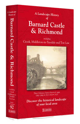
- Barnard Castle and Richmond 1860-1925 (3-map set)
- Map No. 92, Barnard Castle and Richmond 1860-1925 (3-map set), in the Cassini Historical Series of old Ordnance Survey mapping of England and Wales at 1:50,000 in a format designed to offer a convenient comparison with the present day coverage from the OS, and most locations in three different editions. Old historical maps have been combined so... Leer más