
All Wales Coast Path
Descripción
- Name All Wales Coast Path (WCP)
- Distancia de sendero 1,400 km, 870 millas
- Duración en días 70 días
- Inicio de sendero Chepstow
- Fin de sendero Queensferry
- Clasificación Traildino MW, Caminata moderada, sendero de mochileros
- Clasificación Travesía de refugios T1, Caminata
Chepstow - Queensferry, 870 miules, 1400 km, two months
Wales will not be the first country to have a dedicated footpath along its entire coastline, but some other records will undoubtedly be broken once this trail is complete. This is planned for the year 2012. The initiative is in the hands of the regional Ramblers organisations.
The All Wales Coast Path will include the Pembrokeshire Coast Path, a National Trail, and also the Anglesey Coastal Path and many other local trails.
About 20% will be on roads, but in the British context this usually means very small roads.
Once you finishes this trail, you could get back to the start of your walk via Offa's Dyke Path.
Select some tracks
Enlaces
Datos
Informes
Guías y mapas
Hospedaje
Organizaciones
Operadores turísticos
GPS
Otro
Libros

Stanfords
United Kingdom
United Kingdom
- Cadair Idris & Bala Lake OS Explorer Active Map OL23 (waterproof)
- Cadair Idris and Llyn Tegid area of the Snowdonia National Park on a detailed topographic and GPS compatible map OL23, waterproof version, from the Ordnance Survey’s 1:25,000 Explorer series. Coverage extends from Bala in the north-east to the coast between Barmouth and Ynyslas, and includes Dolgellau, Tywin, Machynlleth, the epaks of Moel... Leer más

Stanfords
United Kingdom
2018
United Kingdom
2018
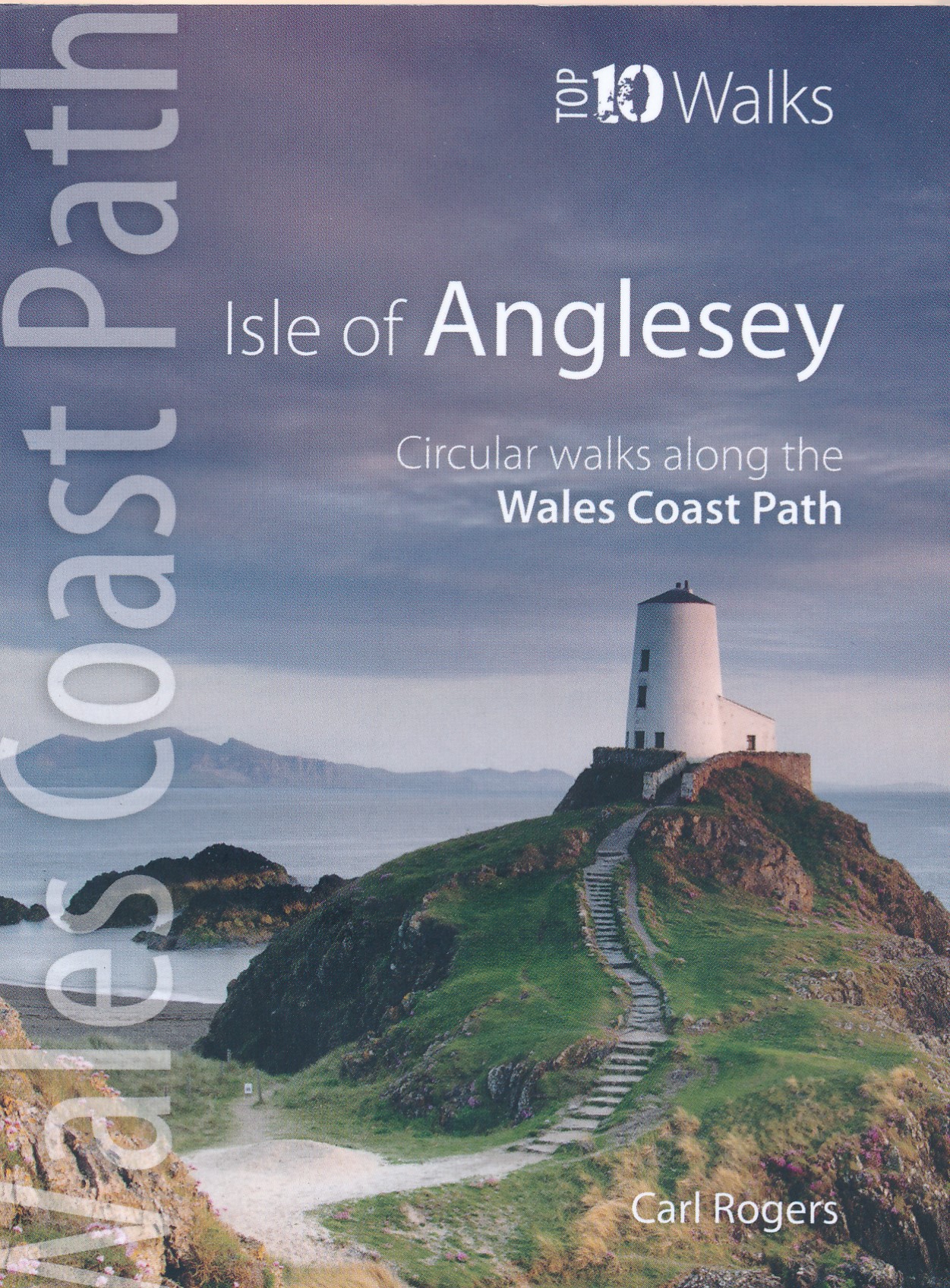
- Wales Coast Path: Isle of Anglesey - Circular walks along the Wales Coast Path
- These attractive and cleverley structured guidebooks give walkers the ten finest circualr routes on a section of the Wales Coast Path in a popular pocketable format. With clear information, an overview and introduction for each walk, expertly written numbered directions, enhanced OS mapping, eye-grabbing panoramic photopgraphs, and... Leer más
- Also available from:
- The Book Depository, United Kingdom
- De Zwerver, Netherlands

The Book Depository
United Kingdom
2018
United Kingdom
2018
- Isle of Anglesey - Top 10 Walks
- Circular walks along the Wales Coast Path Leer más

- Also available from:
- De Zwerver, Netherlands
De Zwerver
Netherlands
2021
Netherlands
2021
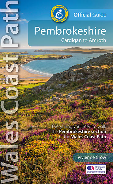
- Wandelgids Wales Coast Path: Pembrokeshire | Northern Eye Books
- Cardigan to Amroth Leer más

Stanfords
United Kingdom
United Kingdom
- Coastal Pub Walks: North Wales: Walks to amazing coastal pubs on the Wales Coast Path
- These attractive and cleverly structured guides will give walkers ten of the best short circular walks along the 870-mile long Wales Coast Path.With clear information, an overview and introduction for each walk, expertly written numbered directions, large scale Ordnance Survey maps, and interpretation of points of interest along the way, these... Leer más
- Also available from:
- The Book Depository, United Kingdom

The Book Depository
United Kingdom
United Kingdom
- Coastal Pub Walks: North Wales
- Walks to amazing coastal pubs on the Wales Coast Path Leer más

Stanfords
United Kingdom
United Kingdom
- Snowdonia Coast: Circular walks along the Wales Coast Path
- These attractive and cleverly structured guides give walkers ten of the finest walks along each of the main sections of the Wales Coast Path in a popular pocketable format.With clear information, an overview and introduction for each walk, expertly written numbered directions, large scale Ordnance Survey maps, superb eye-grabbing panoramic... Leer más
- Also available from:
- The Book Depository, United Kingdom

The Book Depository
United Kingdom
United Kingdom
- The Snowdonia Coast
- Circular walks along the Wales Coast Path Leer más

Stanfords
United Kingdom
United Kingdom
- Pembrokeshire - Walks to Coastal Viewpoints: Circular walks with the most stunning views in Pembrokeshire
- A new addition to the popular Top 10 Walks: Wales Coast Path series - handy, pocket-sized, full colour walking guides written by experts.This attractive and cleverly constructed guide will give walkers ten of the best short circular walks to stunning coastal viewpoints in Pembrokeshire. With clear information, an overview and introduction for... Leer más
- Also available from:
- The Book Depository, United Kingdom

The Book Depository
United Kingdom
United Kingdom
- Pembrokeshire - Walks to Coastal Viewpoints
- Circular walks with the most stunning views in Pembrokeshire Leer más

The Book Depository
United Kingdom
2019
United Kingdom
2019
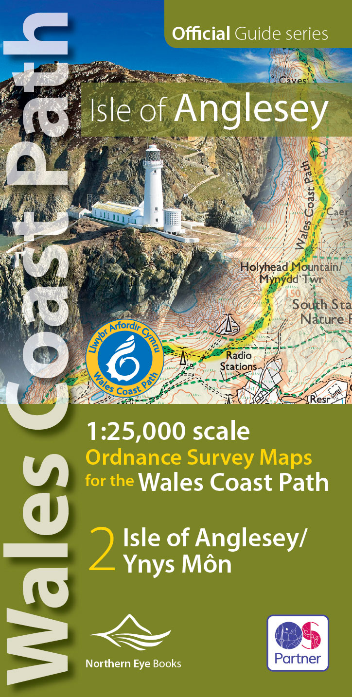
- Isle of Anglesey Coast Path Map
- 1:25,000 scale Ordnance Survey mapping for the entire Isle of Anglesey Coast Path Leer más
- Also available from:
- De Zwerver, Netherlands
De Zwerver
Netherlands
2019
Netherlands
2019
- Wandelkaart Wales Coast Path: Isle of Anglesey | Northern Eye Books
- 1:25,000 scale Ordnance Survey mapping for the entire Isle of Anglesey Coast Path Leer más

Stanfords
United Kingdom
United Kingdom
- Carmarthen Bay & Gower: Circular Walks Along the Wales Coast Path
- One of a series of ten books in the new Top 10 Walks: Wales Coast Path series. Handy, pocket-sized, full colour walking guides written by experts.. Each volume outlines the most popular circular walks along key sections of the coast path, with clear information, an overview and introduction for each walk, expertly written numbered directions,... Leer más
- Also available from:
- The Book Depository, United Kingdom

The Book Depository
United Kingdom
United Kingdom
- Carmarthen Bay & Gower
- Circular Walks Along the Wales Coast Path Leer más

The Book Depository
United Kingdom
2019
United Kingdom
2019
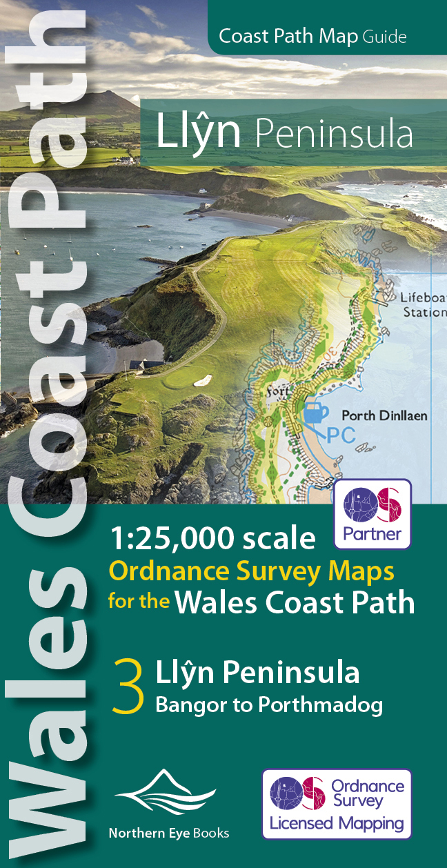
- Llyn Peninsula Coast Path Map
- 1:25,000 scale Ordnance Survey mapping for the Llyn Peninsula section of the Wales Coast Path Leer más
- Also available from:
- De Zwerver, Netherlands
De Zwerver
Netherlands
2019
Netherlands
2019
- Wandelkaart Wales Coast Path Llyn Peninsula Map | Northern Eye Books
- 1:25,000 scale Ordnance Survey mapping for the Llyn Peninsula section of the Wales Coast Path Leer más


Stanfords
United Kingdom
United Kingdom
- South Pembrokeshire OS Explorer Map OL36 (paper)
- The southern coast of Pembrokeshire on a detailed topographic and GPS compatible map OL36, paper version, from the Ordnance Survey’s 1:25,000 Explorer series. Coverage includes Pembrokeshire Coast National Park, Haverforwest, Milford haven, Arberth, Tenby, Pembroke, Skomer Island, Caldey Island, the Pembrokeshire Coast Path National Trail which... Leer más
- Also available from:
- The Book Depository, United Kingdom
- De Zwerver, Netherlands


De Zwerver
Netherlands
Netherlands

Stanfords
United Kingdom
United Kingdom
- The Wales Coast Path: A Practical Guide for Walkers
- The Wales Coast Path - A Practical Guide for Walkers, now in an updated and fully revised second edition, is the bestselling and essential companion to the whole 896 mile path for both the serious long-distance walker and for day-trippers who wish to tackle the path one stage at a time.The Wales Coast Path - A Practical Guide for Walkers:... Leer más
- Also available from:
- The Book Depository, United Kingdom


The Book Depository
United Kingdom
United Kingdom
- Wales Coast Path 3
- Cardigan to Llanelli including Pembrokeshire Coast Path Leer más


The Book Depository
United Kingdom
United Kingdom
- Wales Coast Path 2
- Caernarfon to Cardigan Including Llyn Peninsula Leer más
Mapas

Stanfords
United Kingdom
United Kingdom
- North Pembrokeshire OS Explorer Map OL35 (paper)
- The northern coast of Pembrokeshire between Cardigan and St Davids on a detailed topographic and GPS compatible map OL35, paper version, from the Ordnance Survey’s 1:25,000 Explorer series. Coverage includes Pembrokeshire Coast National Park, Goodwick, Fishguard, Llys-y-fran Reservoir, Ramsey Island, the Pembrokeshire Coast Path National Trail... Leer más

Stanfords
United Kingdom
2022
United Kingdom
2022
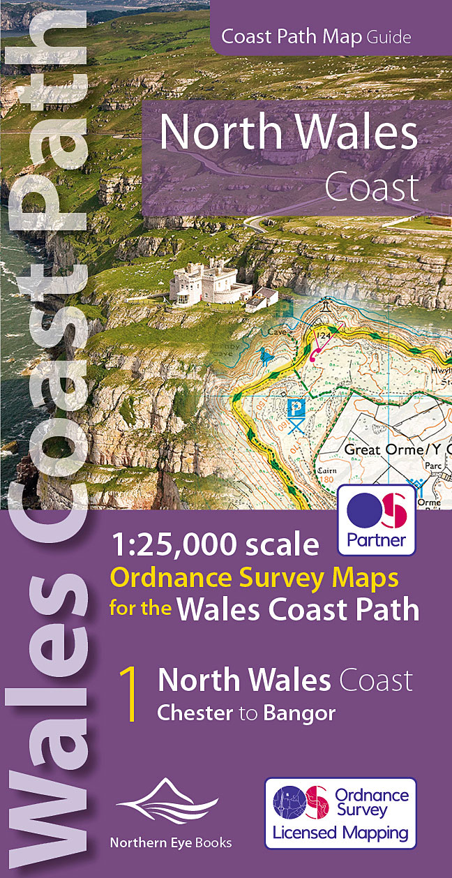
- North Wales Coast - Chester to Bangor - Wales Coast Path Map-Booklet
- One of seven handy, lightweight, pocket sized map bookscovering the whole of the 870 mile/1400 kilometre Wales Coast Path. This volume covers North Wales from Chester to Bangor and includes enhanced large scale (1:25,000) Ordnance Survey mapping in a handy atlas format, with extracts from large scale Explorer maps 266, 265, 264 and OL17.The... Leer más
- Also available from:
- The Book Depository, United Kingdom
- De Zwerver, Netherlands

The Book Depository
United Kingdom
2022
United Kingdom
2022
- North Wales Coast Path Map
- 1:25,000 scale Ordnance Survey mapping for the Wales Coast Path Leer más
De Zwerver
Netherlands
2022
Netherlands
2022
- Wandelkaart North Wales Coast Path Map | Northern Eye Books
- One of seven handy, lightweight, pocket sized map bookscovering the whole of the 870 mile/1400 kilometre Wales Coast Path. This volume covers North Wales from Chester to Bangor and includes enhanced large scale (1:25,000) Ordnance Survey mapping in a handy atlas format, with extracts from large scale Explorer maps 266, 265, 264 and OL17.The... Leer más

Stanfords
United Kingdom
United Kingdom
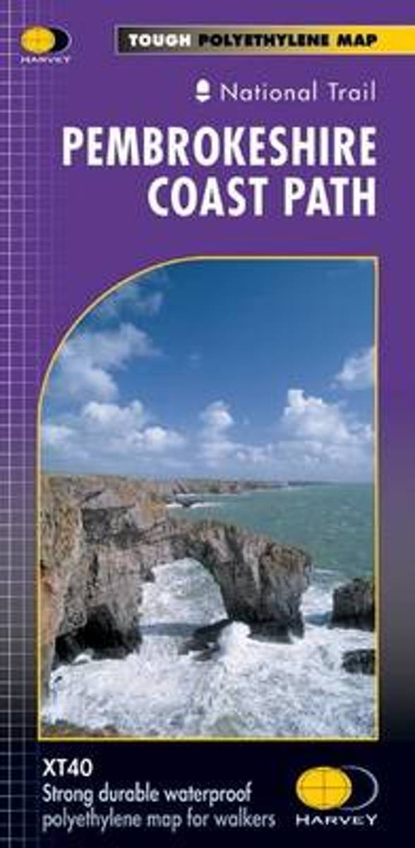
- Pembrokeshire Coast Path Harvey National Trail XT40
- Pembrokeshire Coast Path, a 265km / 165 mile section of the Wales Coast Path, presented at 1:40,000 on a light, waterproof and tear-resistant map from Harvey Map Services. The route is shown on nine panels.Maps in the Harvey’s series covering Great Britain’s national trails and other long-distance footpaths are printed on light, waterproof and... Leer más
- Also available from:
- Bol.com, Netherlands
- Bol.com, Belgium
Bol.com
Netherlands
Netherlands
- Pembroke Coast Path XT40
- Pembrokeshire Coast Path, a 265km / 165 mile section of the Wales Coast Path, presented at 1:40,000 on a light, waterproof and tear-resistant map from Harvey Map Services. The route is shown on nine panels.Maps in the Harvey Leer más
Bol.com
Belgium
Belgium
- Pembroke Coast Path XT40
- Pembrokeshire Coast Path, a 265km / 165 mile section of the Wales Coast Path, presented at 1:40,000 on a light, waterproof and tear-resistant map from Harvey Map Services. The route is shown on nine panels.Maps in the Harvey Leer más
Bol.com
Netherlands
2013
Netherlands
2013
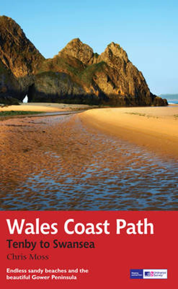
- Wales Coast Path
- 2012 saw the opening of the entire Welsh coastline as an official long-distance footpath. Now, to complement its existing National Trail Guide to the Pembrokeshire Coast Path, which makes up the section of the Path from Fishguard to just beyond Tenby, Aurum publishes a completely new guide to the other most scenic and popular stretch of the... Leer más
- Also available from:
- Bol.com, Belgium
- De Zwerver, Netherlands
Bol.com
Belgium
2013
Belgium
2013
- Wales Coast Path
- 2012 saw the opening of the entire Welsh coastline as an official long-distance footpath. Now, to complement its existing National Trail Guide to the Pembrokeshire Coast Path, which makes up the section of the Path from Fishguard to just beyond Tenby, Aurum publishes a completely new guide to the other most scenic and popular stretch of the... Leer más
De Zwerver
Netherlands
2013
Netherlands
2013
- Wandelgids Wales Coast Path: Tenby-Swansea | Aurum Press
- 2012 saw the opening of the entire Welsh coastline as an official long-distance footpath. Now, to complement its existing National Trail Guide to the Pembrokeshire Coast Path, which makes up the section of the Path from Fishguard to just beyond Tenby, Aurum publishes a completely new guide to the other most scenic and popular stretch of the... Leer más