
Forest of Bowland
Descripción
Hills, moorland, gritstone fells, in northern England, north of Manchester. The central area is an Area of Outstanding Natural Beauty. The word "Forest" does not so much denote a collection of trees, but rather a royal hunting ground. The area is barren. The hills rise to 500 - 600 m. The Forest of Bowland is a good destination for those hikers who enjoy the more desolate areas.
Senderos en región
Enlaces
Datos
Informes
Guías y mapas
Hospedaje
Organizaciones
Operadores turísticos
GPS
Otro
Libros

Stanfords
United Kingdom
2019
United Kingdom
2019
- Pennine Way: Edale to Kirk Yetholm
- Britain`s best-known National Trail winds for 256 miles through three National Parks - the Peak District, Yorkshire Dales and Northumberland. This is the 5th edition. This superb footpath showcases Britain`s finest upland scenery, while touching the literary landscape of the Bronte family and Roman history along Hadrian`s Wall. *138 large-scale... Leer más

Stanfords
United Kingdom
United Kingdom
- Oxford, Chipping Norton & Bicester OS Landranger Active Map 164 (waterproof)
- Oxford area, including sections of the Thames Path and the E2 European Long-distance Path, on a waterproof and tear-resistant OS Active version of map No. 164 from the Ordnance Survey’s Landranger series at 1:50,000, with contoured and GPS compatible topographic mapping plus tourist information.MOBILE DOWNLOADS: As well as the physical edition... Leer más

Stanfords
United Kingdom
United Kingdom
- Ely, Wisbech & Downham Market OS Landranger Active Map 143 (waterproof)
- Cambridgeshire around Ely, Wisbech and Downham Market, including part of the E2 European Long-distance Path, on a waterproof and tear-resistant OS Active version of map No. 143 from the Ordnance Survey’s Landranger series at 1:50,000, with contoured and GPS compatible topographic mapping plus tourist information.MOBILE DOWNLOADS: As well as the... Leer más

Stanfords
United Kingdom
United Kingdom
- Ipswich, The Naze & Clacton-on-Sea OS Landranger Active Map 169 (waterproof)
- Ipswich with Harwich and The Naze area, including part of the E2 European Long-distance Path, on a waterproof and tear-resistant OS Active version of map No. 169 from the Ordnance Survey’s Landranger series at 1:50,000, with contoured and GPS compatible topographic mapping plus tourist information.MOBILE DOWNLOADS: As well as the physical... Leer más

Stanfords
United Kingdom
United Kingdom
- Stratford-upon-Avon, Warwick & Banbury OS Landranger Active Map 151 (waterproof)
- The area between Stratford-upon-Avon, Warwick and Banbury, including the northern part of the Cotswold Hills and part of the Cotswold Way / E2 European Long-distance Path, on a waterproof and tear-resistant OS Active version of map No. 151 from the Ordnance Survey’s Landranger series at 1:50,000, with contoured and GPS compatible topographic... Leer más

Stanfords
United Kingdom
United Kingdom
- Cambridge, Newmarket & Saffron Walden OS Landranger Active Map 154 (waterproof)
- Parts of Cambridgeshire, Suffolk and Essex with Cambridge, Newmarket and Saffron Walden, including part of the E2 European Long-distance path, on a waterproof and tear-resistant OS Active version of map No. 154 from the Ordnance Survey’s Landranger series at 1:50,000, with contoured and GPS compatible topographic mapping plus tourist... Leer más

Stanfords
United Kingdom
United Kingdom
- Bury St Edmunds, Sudbury & Stowmarket OS Landranger Active Map 155 (waterproof)
- Suffolk around Bury St Edmunds, Sudbury and Stowmarket, including part of the E2 European Long-distance path, on a waterproof and tear-resistant OS Active version of map No. 155 from the Ordnance Survey’s Landranger series at 1:50,000, with contoured and GPS compatible topographic mapping plus tourist information.MOBILE DOWNLOADS: As well as... Leer más

Stanfords
United Kingdom
United Kingdom
- Maidstone, Royal Tunbridge Wells, Sevenoaks & Tonbridge OS Landranger Active Map 188 (waterproof)
- Maidstone, Tunbridge Wells and the High Weald area, including a section of the North Downs Way / E2 European Long-distance Path, on a waterproof and tear-resistant OS Active version of map No. 188 from the Ordnance Survey’s Landranger series at 1:50,000, with contoured and GPS compatible topographic mapping plus tourist information.MOBILE... Leer más

Stanfords
United Kingdom
United Kingdom
- North York Moors Western OS Explorer Active Map OL26 (waterproof)
- The western part of the North York Moors National Park on a detailed topographic and GPS compatible map OL26, waterproof version, from the Ordnance Survey’s 1:25,000 Explorer series. Coverage extends from Ampleforth in the south northwards to Saltburn-by-the-Sea, and from Ingleby Arncliffe to Danby, Castleton and Hutton-le-Hole, and includes... Leer más

Stanfords
United Kingdom
United Kingdom
- Cheltenham, Cirencester & Stow-on-the-Wold OS Landranger Active Map 163 (waterproof)
- Cheltenham and Cirencester area, including sections of the Thames Path, the Cotswold Way and the E2 European Long-distance Path, on a waterproof and tear-resistant OS Active version of map No. 163 from the Ordnance Survey’s Landranger series at 1:50,000, with contoured and GPS compatible topographic mapping plus tourist information.MOBILE... Leer más

Stanfords
United Kingdom
United Kingdom
- Colchester, Halstead & Maldon OS Landranger Map 168 (paper)
- Colchester, Halstead and Maldon area, including part of the E2 European Long-distance Path, on a paper version of map No. 168 from the Ordnance Survey’s Landranger series at 1:50,000, with contoured and GPS compatible topographic mapping plus tourist information.MOBILE DOWNLOADS: As well as the physical edition of the map, each Landranger title... Leer más
- Also available from:
- The Book Depository, United Kingdom
- De Zwerver, Netherlands


De Zwerver
Netherlands
Netherlands

Stanfords
United Kingdom
United Kingdom
- Peterborough, Market Deeping & Chatteris OS Landranger Map 142 (paper)
- The area around Peterborough, Market Deeping and Chatteris, including the Fens of the North and Middle Levels with part of the E2 European Long-distance Path, on a paper version of map No. 142 from the Ordnance Survey’s Landranger series at 1:50,000, with contoured and GPS compatible topographic mapping plus tourist information.MOBILE... Leer más
- Also available from:
- The Book Depository, United Kingdom
- De Zwerver, Netherlands


De Zwerver
Netherlands
Netherlands

Stanfords
United Kingdom
United Kingdom
- North York Moors Western OS Explorer Map OL26 (paper)
- The western part of the North York Moors National Park on a detailed topographic and GPS compatible map OL26, paper version, from the Ordnance Survey’s 1:25,000 Explorer series. Coverage extends from Ampleforth in the south northwards to Saltburn-by-the-Sea, and from Ingleby Arncliffe to Danby, Castleton and Hutton-le-Hole, and includes... Leer más
- Also available from:
- The Book Depository, United Kingdom
- De Zwerver, Netherlands


De Zwerver
Netherlands
Netherlands

Stanfords
United Kingdom
United Kingdom
- Birmingham, Wolverhampton & The Black Country OS Landranger Active Map 139 (waterproof)
- Birmingham with the surrounding area including the Black Country, Wolverhampton, Walsall, Solihull, Stourbridge, Bromsgrove and a section of the E2 European Long-distance Path on a waterproof and tear-resistant OS Active version of map No. 139 from the Ordnance Survey’s Landranger series at 1:50,000, with contoured and GPS compatible... Leer más
- Also available from:
- The Book Depository, United Kingdom


Stanfords
United Kingdom
United Kingdom
- Kielder Water & Forest - Bellingham & Simonside Hills OS Explorer Active Map OL42 (waterproof)
- Kielder Water and Kielder Forest on a detailed topographic and GPS compatible map OL42, waterproof version, from the Ordnance Survey’s 1:25,000 Explorer series. Coverage includes Simonside Hills, Kershope Forest, Liddesdale, Sweethope Loughs, the peaks of The Dodd, Muckle Knowe, Mid Fell, the lakeside circuit around the Kielder Water, a section... Leer más
- Also available from:
- The Book Depository, United Kingdom

Mapas

Stanfords
United Kingdom
United Kingdom
- Cheviot Hills and Kielder Water 1901
- Map No. 80, Cheviot Hills and Kielder Water 1901, in the Cassini Historical Series of old Ordnance Survey mapping of England and Wales at 1:50,000 in a format designed to offer a convenient comparison with the present day coverage from the OS, and most locations in three different editions. Old historical maps have been combined so that the... Leer más
Stanfords
United Kingdom
United Kingdom
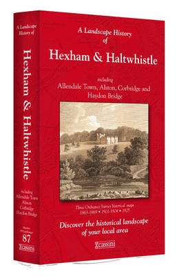
- Hexham and Haltwhistle 1863-1925 (3-map set)
- Map No. 87, Hexham and Haltwhistle 1983-1925 (3-map set), in the Cassini Historical Series of old Ordnance Survey mapping of England and Wales at 1:50,000 in a format designed to offer a convenient comparison with the present day coverage from the OS, and most locations in three different editions. Old historical maps have been combined so that... Leer más
Stanfords
United Kingdom
United Kingdom
- Hexham and Haltwhistle 1863-1869
- Map No. 87, Hexham and Haltwhistle 1863-1869, in the Cassini Historical Series of old Ordnance Survey mapping of England and Wales at 1:50,000 in a format designed to offer a convenient comparison with the present day coverage from the OS, and most locations in three different editions. Old historical maps have been combined so that the sheet... Leer más

Stanfords
United Kingdom
United Kingdom
- Yorkshire Dales Mountain Biking: Classic Pennine Trails
- Yorkshire Dales Mountain Biking features 26 rides between 10 and 43 kilometres in length in one of the UK`s most MTB-friendly national parks.The routes make the most of the Dales` superb network of stone-based trails, rideable in all seasons. Classic loops take in the best of Swaledale, a tour of Ingleborough, big days around Whernside and... Leer más
Stanfords
United Kingdom
United Kingdom
- Haltwhistle and Brampton 1925
- Map No. 86, Haltwhistle and Brampton 1925, in the Cassini Historical Series of old Ordnance Survey mapping of England and Wales at 1:50,000 in a format designed to offer a convenient comparison with the present day coverage from the OS, and most locations in three different editions. Old historical maps have been combined so that the sheet... Leer más
Stanfords
United Kingdom
United Kingdom
- Haltwhistle and Brampton 1901-1904
- Map No. 86, Haltwhistle and Brampton 1901-1904, in the Cassini Historical Series of old Ordnance Survey mapping of England and Wales at 1:50,000 in a format designed to offer a convenient comparison with the present day coverage from the OS, and most locations in three different editions. Old historical maps have been combined so that the sheet... Leer más
Stanfords
United Kingdom
United Kingdom
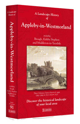
- Appleby-in-Westmorland 1860-1925 (3-map set)
- Map No. 91, Appleby-in-Westmorland 1860-1925 (3-map set), in the Cassini Historical Series of old Ordnance Survey mapping of England and Wales at 1:50,000 in a format designed to offer a convenient comparison with the present day coverage from the OS, and most locations in three different editions. Old historical maps have been combined so that... Leer más

Stanfords
United Kingdom
United Kingdom
- Peak District - Dark Peak A-Z Adventure Atlas
- Peak District: Dark Peak Adventure Atlas at 1:25,000 in a series of handy A5 size Adventure Atlases from Geographers` A-Z Map Company with cartography from the Ordnance Survey’s Explorer series. Coverage includes Glossop, Hadfield, Stocksbridge, Chapel-en-le-Frith, Hope, Bamford, New Mills, Castleton, Bradwell, Hayfield, Tintwistle, Greenfield,... Leer más
Stanfords
United Kingdom
United Kingdom
- Appleby-in-Westmorland 1860-1866
- Map No. 91, Appleby-in-Westmorland 1860-1866, in the Cassini Historical Series of old Ordnance Survey mapping of England and Wales at 1:50,000 in a format designed to offer a convenient comparison with the present day coverage from the OS, and most locations in three different editions. Old historical maps have been combined so that the sheet... Leer más

Stanfords
United Kingdom
United Kingdom
- Pennine Bridleway: From Derbyshire through the Yorkshire Dales to Cumbria
- Pennine Bridleway is a guidebook to this National Trail taking you from Derbyshire through the Yorkshire Dales to Cumbria, following the Pennine Hills.The route is split into four sections; each section includes detailed directions as well as information on points of interest along the route, bringing the history and landscape of the trail into... Leer más
Stanfords
United Kingdom
United Kingdom
- Hexham and Haltwhistle 1925
- Map No. 87, Hexham and Haltwhistle 1925, in the Cassini Historical Series of old Ordnance Survey mapping of England and Wales at 1:50,000 in a format designed to offer a convenient comparison with the present day coverage from the OS, and most locations in three different editions. Old historical maps have been combined so that the sheet lines... Leer más
Stanfords
United Kingdom
United Kingdom
- Hexham and Haltwhistle 1901-1904
- Map No. 87, Hexham and Haltwhistle 1901-1904, in the Cassini Historical Series of old Ordnance Survey mapping of England and Wales at 1:50,000 in a format designed to offer a convenient comparison with the present day coverage from the OS, and most locations in three different editions. Old historical maps have been combined so that the sheet... Leer más
Stanfords
United Kingdom
United Kingdom
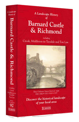
- Barnard Castle and Richmond 1860-1925 (3-map set)
- Map No. 92, Barnard Castle and Richmond 1860-1925 (3-map set), in the Cassini Historical Series of old Ordnance Survey mapping of England and Wales at 1:50,000 in a format designed to offer a convenient comparison with the present day coverage from the OS, and most locations in three different editions. Old historical maps have been combined so... Leer más
Stanfords
United Kingdom
United Kingdom
- Wensleydale and Upper Wharfedale 1852-1865
- Map No. 98, Wensleydale and Upper Wharfedale 1852-1865, in the Cassini Historical Series of old Ordnance Survey mapping of England and Wales at 1:50,000 in a format designed to offer a convenient comparison with the present day coverage from the OS, and most locations in three different editions. Old historical maps have been combined so that... Leer más

Stanfords
United Kingdom
United Kingdom
- England Coast Path Adventure Map - Minehead to Brean Down
- The A-Z Adventure Series of maps combines the best of OS and A-Z, creating the perfect companion for walkers, off-road cyclists, horse riders and anyone wishing to explore the great outdoors.This official Minehead to Brean Down Adventure Map covers a 58 mile (93km) section of the England Coast Path, a new National Trail around England`s coast.... Leer más