
GR1 - Tour de Paris
Descripción
- Name GR1 - Tour de Paris (GR1)
- Distancia de sendero 577 km, 359 millas
- Duración en días 29 días
- Inicio de sendero Porte Maillot, Paris
- Fin de sendero Feucherolles, Paris
- Clasificación Traildino EW, Paseo fácil, sendero en la naturaleza


1
 Tour de l'Ile de France
A good way to explore the city of cities: this trail starts and ends in Paris, and explores the city and its surroundings. Of course it is named the first long distance trail, GR1, allthough it is not the oldest one. You can easily make day hikes and return to your hotel at night.
Select some tracks
☐Accès GR 2, 2.9km
☐Liaison GR 1 - GR 11, 4.7km
☐GR 1 - Grande Rota do Litoral, 6.7km
☐GruBrìa Anello GR1 Seregno, 13km
☐Eijsden-Margraten Gr1 Historische Bronkroute, 11km
☐GR - Tour de Mayotte, 142km
☐Accès tour de Paris
☐Liaison GR 1 - GR 11, 30km
☐Grand Tour de Paris (01), Villiers-Saint-Frédéric - Mantes-la-Jolie, 40km
☐(no name), 30km
☐Grand Tour de Paris (03), Magny-en-Vexin - Montagny-Prouvaire, 48km
☐Grand Tour de Paris (04), Montagny-Prouvaire - La Ferté-Milon, 126km
☐Grand Tour de Paris (05), La Ferté-Milon - Lizy-sur-Ourcq, 32km
☐Grand Tour de Paris (06), Lizy-sur-Ourcq - La Ferté-sous-Jouarre, 35km
☐Grand Tour de Paris (07), La Ferté-sous-Jouarre - Coulommiers, 25km
☐Grand Tour de Paris (08), Coulommiers - Provins, 56km
☐Grand Tour de Paris (09), Provins - Montereau, 54km
☐Grand Tour de Paris (11), Fontainebleau - Franchard, 6.6km
☐Grand Tour de Paris (12), Franchard - Villiers-Saint-Frédéric, 159km
☐Grand Tour de Paris, variante par Bonnelles, 19km
☐Grand Tour de Paris, variante par Ballancourt, 22km
☐Grand Tour de Paris, liaison Pont d’Austerlitz, 68km
☐GR 1 Sendero Histórico: Asturias, 419km
☐GR 1 Sendero Histórico: Galicia, 93km
☐Grande Rota de Montanha do Alto Minho - Ponte da Barca, 23km
Mapa

Enlaces
Datos
Informes
Guías y mapas
Hospedaje
Organizaciones
Operadores turísticos
GPS
Otro
Libros
Stanfords
United Kingdom
United Kingdom
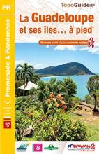
- La Guadeloupe et ses îles à pied
- La Guadeloupe et ses îles à pied, FFRP topo-guide Ref. No. D971, with 49 day walks of varying length and difficulty, plus coverage of the 65km-long GR1 across the mountains of the Basse Terre. The day walks include two on Marie-Galante, one on La Désirade, and two on Les Saintes islands. Each walk is presented on a separate colour extract from... Leer más
- Also available from:
- The Book Depository, United Kingdom

The Book Depository
United Kingdom
United Kingdom
- Guadeloupe & ses iles a pied
- La Guadeloupe et ses îles à pied, FFRP topo-guide Ref. No. D971, with 49 day walks of varying length and difficulty, plus coverage of the 65km-long GR1 across the mountains of the Basse Terre. The day walks include two on Marie-Galante, one on La Désirade, and two on Les Saintes islands. Each walk is presented on a separate colour extract from... Leer más
Mapas

Stanfords
United Kingdom
United Kingdom
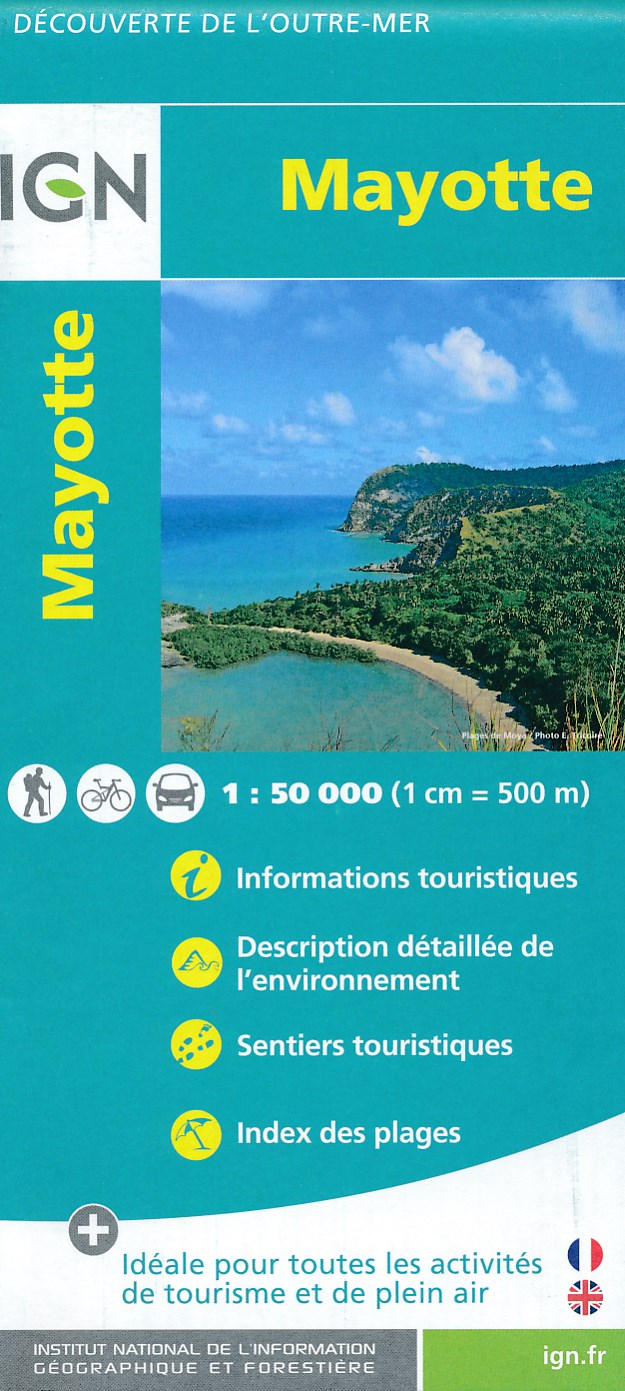
- Mayotte IGN Map 84976
- Mayotte at 1:50,000 on a contoured and GPS compatible map from the IGN, with plans of Mazoudzou and Dzaoudzi, plus an index of beaches. Topography is shown by contours at 20m intervals with relief shading and spot heights, plus colouring and/or graphics for different types of vegetation. In the surrounding waters coral reefs are prominently... Leer más
- Also available from:
- De Zwerver, Netherlands
De Zwerver
Netherlands
Netherlands
- Fietskaart - Wandelkaart Mayotte | IGN - Institut Géographique National
- MayotteLes cartes routières et touristiques de l?Outre-mer vous permettent de découvrir ces destinations exotiques. Leer más