
Stanfords
United Kingdom
- Wensleydale and Upper Wharfedale 1852-1865
- Map No. 98, Wensleydale and Upper Wharfedale 1852-1865, in the Cassini Historical Series of old Ordnance Survey mapping of England and Wales at 1:50,000 in a format designed to offer a convenient comparison with the present day coverage from the OS, and most locations in three different editions. Old historical maps have been combined so that... Leer más

Stanfords
United Kingdom
- England Coast Path Adventure Map - Minehead to Brean Down
- The A-Z Adventure Series of maps combines the best of OS and A-Z, creating the perfect companion for walkers, off-road cyclists, horse riders and anyone wishing to explore the great outdoors.This official Minehead to Brean Down Adventure Map covers a 58 mile (93km) section of the England Coast Path, a new National Trail around England`s coast.... Leer más
Stanfords
United Kingdom
- Wensleydale and Upper Wharfedale 1924-1925
- Map No. 98, Wensleydale and Upper Wharfedale 1924-1925, in the Cassini Historical Series of old Ordnance Survey mapping of England and Wales at 1:50,000 in a format designed to offer a convenient comparison with the present day coverage from the OS, and most locations in three different editions. Old historical maps have been combined so that... Leer más
Stanfords
United Kingdom
- Wensleydale and Upper Wharfedale 1903-1904
- Map No. 98, Wensleydale and Upper Wharfedale 1903-1904, in the Cassini Historical Series of old Ordnance Survey mapping of England and Wales at 1:50,000 in a format designed to offer a convenient comparison with the present day coverage from the OS, and most locations in three different editions. Old historical maps have been combined so that... Leer más
Stanfords
United Kingdom
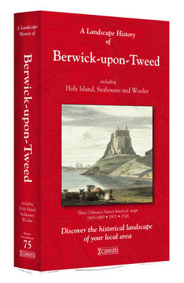
- Berwick-upon-Tweed 1865-1926 (3-map set)
- Map No. 75, Berwick-upon-Tweed 1865-1926 (3-map set), in the Cassini Historical Series of old Ordnance Survey mapping of England and Wales at 1:50,000 in a format designed to offer a convenient comparison with the present day coverage from the OS, and most locations in three different editions. Old historical maps have been combined so that the... Leer más

Stanfords
United Kingdom
- Yorkshire Dales West
- The western part of the Yorkshire Dales on a waterproof and tear-resistant, contoured and GPS compatible map at 1:40,000 from Harvey Map Services showing local right of way paths, long-distance hiking routes, off road cycling routes, etc.Topography is shown by contours at 15m intervals, with spot heights plus colouring and graphics to show... Leer más
Stanfords
United Kingdom
- Barnard Castle & Richmond 1925 - 92
- Map No. 92, Barnard Castle and Richmond 1925, in the Cassini Historical Series of old Ordnance Survey mapping of England and Wales at 1:50,000 in a format designed to offer a convenient comparison with the present day coverage from the OS, and most locations in three different editions. Old historical maps have been combined so that the sheet... Leer más
Stanfords
United Kingdom
- Blackburn and Burnley 1843-1859
- Map No. 103, Blackburn and Burnley 1843-1859, in the Cassini Historical Series of old Ordnance Survey mapping of England and Wales at 1:50,000 in a format designed to offer a convenient comparison with the present day coverage from the OS, and most locations in three different editions. Old historical maps have been combined so that the sheet... Leer más

Stanfords
United Kingdom
- Pennine Way North A-Z Adventure Atlas
- The Pennine Way North Adventure Atlas, presenting the northern section of the route between Kirk Yetholm in the Cheviot Hills and Bowes near Barnard Castle on mapping at 1:25,000 in a series of handy A5 size Adventure Atlases from Geographers` A-Z Map Company with cartography from the Ordnance Survey’s Explorer series. Coverage includes a large... Leer más
Stanfords
United Kingdom
- Blackburn and Burnley 1924-1925
- Map No. 103, Blackburn and Burnley 1924-1925, in the Cassini Historical Series of old Ordnance Survey mapping of England and Wales at 1:50,000 in a format designed to offer a convenient comparison with the present day coverage from the OS, and most locations in three different editions. Old historical maps have been combined so that the sheet... Leer más
Stanfords
United Kingdom
- Blackburn and Burnley 1903-1904
- Map No. 103, Blackburn and Burnley 1903-1904, in the Cassini Historical Series of old Ordnance Survey mapping of England and Wales at 1:50,000 in a format designed to offer a convenient comparison with the present day coverage from the OS, and most locations in three different editions. Old historical maps have been combined so that the sheet... Leer más
Stanfords
United Kingdom
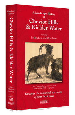
- Cheviot Hills and Kielder Water 1868-1926 (3-map set)
- Map No. 80, Cheviot Hills and Kielder Water 1868-1926 (3-map set), in the Cassini Historical Series of old Ordnance Survey mapping of England and Wales at 1:50,000 in a format designed to offer a convenient comparison with the present day coverage from the OS, and most locations in three different editions. Old historical maps have been... Leer más
Stanfords
United Kingdom
- Appleby-in-Westmorland 1903-1904
- Map No. 91, Appleby-in-Westmorland 1903-1904, in the Cassini Historical Series of old Ordnance Survey mapping of England and Wales at 1:50,000 in a format designed to offer a convenient comparison with the present day coverage from the OS, and most locations in three different editions. Old historical maps have been combined so that the sheet... Leer más
Stanfords
United Kingdom
- Barnard Castle and Richmond 1903-1904
- Map No. 92, Barnard Castle and Richmond 1903-1904, in the Cassini Historical Series of old Ordnance Survey mapping of England and Wales at 1:50,000 in a format designed to offer a convenient comparison with the present day coverage from the OS, and most locations in three different editions. Old historical maps have been combined so that the... Leer más
Stanfords
United Kingdom
- Manchester 1842-1844
- Map No. 109, Manchester 1842-1844, in the Cassini Historical Series of old Ordnance Survey mapping of England and Wales at 1:50,000 in a format designed to offer a convenient comparison with the present day coverage from the OS, and most locations in three different editions. Old historical maps have been combined so that the sheet lines... Leer más