
Stanfords
United Kingdom
- Afghanistan - Kabul & 5 Cities Street Plans Gizi Wall Map
- Afghanistan at 1:2,000,000 on a wall map, size 88 x 95cm (35” x 37” approx) – paper version, from Gizi Map, with on the reverse large street plans of Kabul with an enlargement showing its central are in greater detail, plus Kandahar, Herat, Jalalabad, Kunduz and Mazar-e Sharif.On one side is a map of Afghanistan and the whole of Pakistan at... Leer más

Stanfords
United Kingdom
- Durbuy - Erezee
- Topographical survey of Belgium at 1:20,000 from Nationaal Geografisch Instituut / Institut Géographique National, the country’s national survey organization. Each 20K map covers one quarter of the corresponding 1:50,000 map (with adjustments in the border and coastal areas). The maps provide all the information expected of topographic mapping... Leer más
Stanfords
United Kingdom
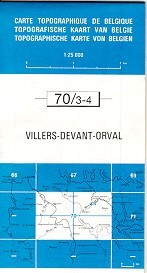
- Villers devant Orval
- Topographical survey of Belgium at 1:20,000 from Nationaal Geografisch Instituut / Institut Géographique National, the country’s national survey organization. Each 20K map covers one quarter of the corresponding 1:50,000 map (with adjustments in the border and coastal areas). The maps provide all the information expected of topographic mapping... Leer más

Stanfords
United Kingdom
- World Map Placemat
- This is a fantastic colourful and resistant placemat by Little Wigwam, featuring a political world map. Kids will love it and have fun locating remote places or guessing capitals of the world. The Mercator projection map shows the continents in different bright colours, all countries and seas and oceans are named, as well as most capitals,... Leer más

Stanfords
United Kingdom
- Burg-Reuland - Gross-Bohlscheid
- Topographical survey of Belgium at 1:20,000 from Nationaal Geografisch Instituut / Institut Géographique National, the country’s national survey organization. Each 20K map covers one quarter of the corresponding 1:50,000 map (with adjustments in the border and coastal areas). The maps provide all the information expected of topographic mapping... Leer más

Stanfords
United Kingdom
- Kieldrecht- Doel
- Topographical survey of Belgium at 1:20,000 from Nationaal Geografisch Instituut / Institut Géographique National, the country’s national survey organization. Each 20K map covers one quarter of the corresponding 1:50,000 map (with adjustments in the border and coastal areas). The maps provide all the information expected of topographic mapping... Leer más
Stanfords
United Kingdom
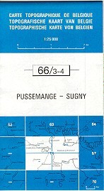
- Pussemange - Sugny
- Topographical survey of Belgium at 1:20,000 from Nationaal Geografisch Instituut / Institut Géographique National, the country’s national survey organization. Each 20K map covers one quarter of the corresponding 1:50,000 map (with adjustments in the border and coastal areas). The maps provide all the information expected of topographic mapping... Leer más

Stanfords
United Kingdom
- Seraing - Chaudfontaine
- Topographical survey of Belgium at 1:20,000 from Nationaal Geografisch Instituut / Institut Géographique National, the country’s national survey organization. Each 20K map covers one quarter of the corresponding 1:50,000 map (with adjustments in the border and coastal areas). The maps provide all the information expected of topographic mapping... Leer más

Stanfords
United Kingdom
- Monde Connu en 1688 par Jaugeon
- High quality reproduction from the IGN of a beautifully engraved map of the world prepared in 1688 by Jacques Jaugeon, French scholar and royal typographer during the reign of King Louis XIV. The map presents the world in two hemispheres, surrounded by allegorical figures representing the constellations and definitions of geographical terms... Leer más
Stanfords
United Kingdom
- Mons - Givry
- Topographical survey of Belgium at 1:20,000 from Nationaal Geografisch Instituut / Institut Géographique National, the country’s national survey organization. Each 20K map covers one quarter of the corresponding 1:50,000 map (with adjustments in the border and coastal areas). The maps provide all the information expected of topographic mapping... Leer más

Stanfords
United Kingdom
- Geological Map of the World Wall Map
- This new edition (August 2014) reconsiders the 3rd edition of the Geological Map of the Word, published initially in 2010 at the scales of 1:25 000 000 (3 sheets) and 1:50 000 000 (1 sheet Geology, structure), both presently out of print.The layout of this new version, centered on the Atlantic, was redesigned in order to fit a single sheet,... Leer más

Stanfords
United Kingdom
- Odeigne - Bihain
- Topographical survey of Belgium at 1:20,000 from Nationaal Geografisch Instituut / Institut Géographique National, the country’s national survey organization. Each 20K map covers one quarter of the corresponding 1:50,000 map (with adjustments in the border and coastal areas). The maps provide all the information expected of topographic mapping... Leer más

Stanfords
United Kingdom
- World Global Mapping Magnetic Fridge Map
- One of our best-selling maps of the world is now available to stick on your fridge, or any other magnetic surface.At a scale of 1:100,000,000 this wonderful fridge magnet measures 25.5x41.5cm and is flexibly made to simply peel on and peel off whenever you wish to display it.Bright, colourful and informative, this quirky magnetic World map... Leer más
Stanfords
United Kingdom
- Vielsalm - Recht
- Topographical survey of Belgium at 1:20,000 from Nationaal Geografisch Instituut / Institut Géographique National, the country’s national survey organization. Each 20K map covers one quarter of the corresponding 1:50,000 map (with adjustments in the border and coastal areas). The maps provide all the information expected of topographic mapping... Leer más
Stanfords
United Kingdom
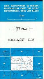
- Herbeumont - Suxy
- Topographical survey of Belgium at 1:20,000 from Nationaal Geografisch Instituut / Institut Géographique National, the country’s national survey organization. Each 20K map covers one quarter of the corresponding 1:50,000 map (with adjustments in the border and coastal areas). The maps provide all the information expected of topographic mapping... Leer más