
Stanfords
United Kingdom
- Taunton and Lyme Regis 1809-1811
- Map No. 193, Taunton and Lyme Regis 1809-1811, in the Cassini Historical Series of old Ordnance Survey mapping of England and Wales at 1:50,000 in a format designed to offer a convenient comparison with the present day coverage from the OS, and most locations in three different editions. Old historical maps have been combined so that the sheet... Leer más
Stanfords
United Kingdom
- Stafford and Telford 1833-1921 (3-map set)
- Map No. 127, Stafford and Telford 1833-1921 (3-map set), in the Cassini Historical Series of old Ordnance Survey mapping of England and Wales at 1:50,000 in a format designed to offer a convenient comparison with the present day coverage from the OS, and most locations in three different editions. Old historical maps have been combined so that... Leer más
Stanfords
United Kingdom
- Presteigne and Hay-on-Wye / Llanandras a’r Gelli Gandryll 1919-1920
- Map No. 148, Presteigne and Hay-on-Wye / Llanandras a’r Gelli Gandryll 1819-1920, in the Cassini Historical Series of old Ordnance Survey mapping of England and Wales at 1:50,000 in a format designed to offer a convenient comparison with the present day coverage from the OS, and most locations in three different editions. Old historical maps... Leer más

Stanfords
United Kingdom
- New Zealand Kiwimaps Travel & Touring Map
- New Zealand at 1:1,700,000 from Kiwimaps on a handy size, double-sided map with street plans of city centres in main towns. North and South Island are presented separately and accompanied by a distance table, a map showing driving times between various locations, plus the relevant street plans.The road network highlights state highways and... Leer más
Stanfords
United Kingdom
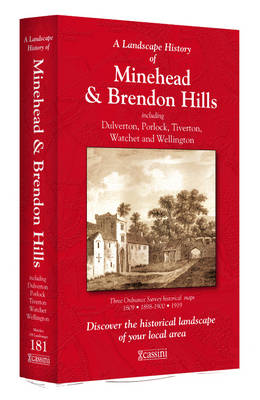
- Minehead and Brendon Hills 1809
- Map No. 181, Minehead and Brendon Hills 1809, in the Cassini Historical Series of old Ordnance Survey mapping of England and Wales at 1:50,000 in a format designed to offer a convenient comparison with the present day coverage from the OS, and most locations in three different editions. Old historical maps have been combined so that the sheet... Leer más
Stanfords
United Kingdom
- Minehead and Brendon Hills 1809- 1919 (3-map set)
- Map No. 181, Minehead and Brendon Hills 1919, in the Cassini Historical Series of old Ordnance Survey mapping of England and Wales at 1:50,000 in a format designed to offer a convenient comparison with the present day coverage from the OS, and most locations in three different editions. Old historical maps have been combined so that the sheet... Leer más
Stanfords
United Kingdom
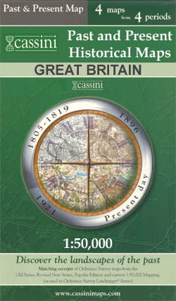
- Telford Past and Present
- Telford in the Cassini Past and Present map series which covers town and cities of England and Wales and offers a unique way of tracing their history and expansion by showing four different periods of their development using Ordnance Survey mapping from the mid-19th century, the late 19th century, the 1920s and the present day. Coverage... Leer más
Stanfords
United Kingdom
- Taunton and Lyme Regis 1919
- Map No. 193, Taunton and Lyme Regis 1919, in the Cassini Historical Series of old Ordnance Survey mapping of England and Wales at 1:50,000 in a format designed to offer a convenient comparison with the present day coverage from the OS, and most locations in three different editions. Old historical maps have been combined so that the sheet lines... Leer más
Stanfords
United Kingdom
- Taunton and Lyme Regis 1809-1919 (3-map set)
- Map No. 193, Taunton and Lyme Regis 1809-1919 (3-map set), in the Cassini Historical Series of old Ordnance Survey mapping of England and Wales at 1:50,000 in a format designed to offer a convenient comparison with the present day coverage from the OS, and most locations in three different editions. Old historical maps have been combined so... Leer más
Stanfords
United Kingdom
- Hereford and Leominster 1899-1901
- Map No. 149, Hereford and Leominster 1899-1901, in the Cassini Historical Series of old Ordnance Survey mapping of England and Wales at 1:50,000 in a format designed to offer a convenient comparison with the present day coverage from the OS, and most locations in three different editions. Old historical maps have been combined so that the sheet... Leer más
Stanfords
United Kingdom
- Minehead and Brendon Hills 1919
- Map No. 181, Minehead and Brendon Hills 1919, in the Cassini Historical Series of old Ordnance Survey mapping of England and Wales at 1:50,000 in a format designed to offer a convenient comparison with the present day coverage from the OS, and most locations in three different editions. Old historical maps have been combined so that the sheet... Leer más
Stanfords
United Kingdom
- Stafford and Telford 1833-1837
- Map No. 127, Stafford and Telford 1833-1837, in the Cassini Historical Series of old Ordnance Survey mapping of England and Wales at 1:50,000 in a format designed to offer a convenient comparison with the present day coverage from the OS, and most locations in three different editions. Old historical maps have been combined so that the sheet... Leer más
Stanfords
United Kingdom
- Presteigne and Hay-on-Wye / Llanandras a’r Gelli Gandryll 1900-1903
- Map No. 148, Presteigne and Hay-on-Wye / Llanandras a’r Gelli Gandryll 1900-1903, in the Cassini Historical Series of old Ordnance Survey mapping of England and Wales at 1:50,000 in a format designed to offer a convenient comparison with the present day coverage from the OS, and most locations in three different editions. Old historical maps... Leer más
Stanfords
United Kingdom
- Stafford and Telford 1921
- Map No. 127, Stafford and Telford 1921, in the Cassini Historical Series of old Ordnance Survey mapping of England and Wales at 1:50,000 in a format designed to offer a convenient comparison with the present day coverage from the OS, and most locations in three different editions. Old historical maps have been combined so that the sheet lines... Leer más

Stanfords
United Kingdom
- Wellington City and District Pathfinder
- Wellington city and district in a series of maps covering various districts of New Zealand, with each title combining a detailed road map with street plans of local towns, all with road and street indexes. The maps are published in two formats: handy Pocket Maps or Pathfinders with, as the publishers put it “Larger print so you don’t... Leer más