
Stanfords
United Kingdom
- Oxford 1898-1899
- Map No. 164, Oxford 1898-1899, in the Cassini Historical Series of old Ordnance Survey mapping of England and Wales at 1:50,000 in a format designed to offer a convenient comparison with the present day coverage from the OS, and most locations in three different editions. Old historical maps have been combined so that the sheet lines correspond... Leer más
Stanfords
United Kingdom
- Barrow-in-Furness and South Lakeland 1924-1925
- Map No. 96, Barrow-in-Furness and South Lakeland 1924-1925, in the Cassini Historical Series of old Ordnance Survey mapping of England and Wales at 1:50,000 in a format designed to offer a convenient comparison with the present day coverage from the OS, and most locations in three different editions. Old historical maps have been combined so... Leer más

Stanfords
United Kingdom
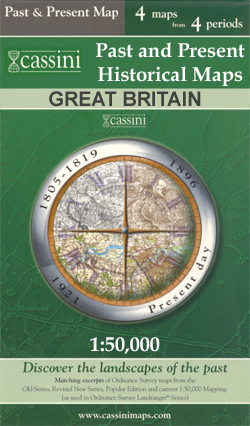
- Chatham, Gillingham and Rochester Past and Present
- Chatham, Gillingham and Rochester in the Cassini Past and Present map series which covers town and cities of England and Wales and offers a unique way of tracing their history and expansion by showing four different periods of their development using Ordnance Survey mapping from the mid-19th century, the late 19th century, the 1920s and the... Leer más
Stanfords
United Kingdom
- Sheffield and Doncaster 1824-1925 (3-map set)
- Map No. 111, Sheffield and Doncaster 1923-1925, in the Cassini Historical Series of old Ordnance Survey mapping of England and Wales at 1:50,000 in a format designed to offer a convenient comparison with the present day coverage from the OS, and most locations in three different editions. Old historical maps have been combined so that the sheet... Leer más

Stanfords
United Kingdom
- Kennet & Avon Canal - River Avon Heron Map SUPERCEDED
- A tourist map of the Kennet & Avon Canal and River Avon at 1:50,000, running from Bristol in the west to Reading and the junction with the River Thames in the east. There are detailed town plans at 1:12,500 for Bristol, Bath, Bradford-on-Avon, Devizes, Newbury, Hungerford and the centre of Reading. Suitable for both waterways and leisure... Leer más
Stanfords
United Kingdom
- Vale of Glamorgan / Bro Morgannwg 1899-1901
- Map No. 170, Vale of Glamorgan / Bro Morgannwg 1899-1901, in the Cassini Historical Series of old Ordnance Survey mapping of England and Wales at 1:50,000 in a format designed to offer a convenient comparison with the present day coverage from the OS, and most locations in three different editions. Old historical maps have been combined so that... Leer más
Stanfords
United Kingdom
- Dorchester and Weymouth 1899
- Map No. 194, Dorchester and Weymouth 1899, in the Cassini Historical Series of old Ordnance Survey mapping of England and Wales at 1:50,000 in a format designed to offer a convenient comparison with the present day coverage from the OS, and most locations in three different editions. Old historical maps have been combined so that the sheet... Leer más
Stanfords
United Kingdom
- Brecon Beacons / Bannau Brycheiniog 1919-1923
- Map No. 160, Brecon Beacons / Bannau Brycheiniog 1919-1923, in the Cassini Historical Series of old Ordnance Survey mapping of England and Wales at 1:50,000 in a format designed to offer a convenient comparison with the present day coverage from the OS, and most locations in three different editions. Old historical maps have been combined so... Leer más
Stanfords
United Kingdom
- Newbury and Thatcham Past and Present
- Newbury and Thatcham in the Cassini Past and Present map series which covers town and cities of England and Wales and offers a unique way of tracing their history and expansion by showing four different periods of their development using Ordnance Survey mapping from the mid-19th century, the late 19th century, the 1920s and the present day.... Leer más
Stanfords
United Kingdom
- Mansfield and Worksop 1824-1924 (3-map set)
- Map No. 120, Mansfield and Worksop 1824-1924 (3-map set), in the Cassini Historical Series of old Ordnance Survey mapping of England and Wales at 1:50,000 in a format designed to offer a convenient comparison with the present day coverage from the OS, and most locations in three different editions. Old historical maps have been combined so that... Leer más

Stanfords
United Kingdom
- Pennine Way South Harvey XT40 National Trail Map
- The southern section of the Pennine Way between Edale and Horton in Ribblesdale on a waterproof and tear-resistant map at 1:40,000 from Harvey Map Services presenting the route accompanied by extensive additional tourist information.Divided into six panels, the route is shown on mapping with contours at 15m intervals enhanced by additional... Leer más

De Zwerver
Netherlands
- Wandelkaart Pennine Way South | Harvey Maps
- The southern section of the Pennine Way between Edale and Horton in Ribblesdale on a waterproof and tear-resistant map at 1:40,000 from Harvey Map Services presenting the route accompanied by extensive additional tourist information.Divided into six panels, the route is shown on mapping with contours at 15m intervals enhanced by additional... Leer más
Stanfords
United Kingdom
- Newtown and Llanidloes / Y Drenewydd a Llanidloes 1901-1903
- Map No. 136, Newtown and Llanidloes / Y Drenewydd a Llanidloes 1901-1903, in the Cassini Historical Series of old Ordnance Survey mapping of England and Wales at 1:50,000 in a format designed to offer a convenient comparison with the present day coverage from the OS, and most locations in three different editions. Old historical maps have been... Leer más
Stanfords
United Kingdom
- Bala and Lake Vyrnwy / Y Bala a Llyn Efyrnwy 1921-1922
- Map No. 125, Bala and Lake Vyrnwy / Y Bala a Llyn Efyrnwy 1921-1922, in the Cassini Historical Series of old Ordnance Survey mapping of England and Wales at 1:50,000 in a format designed to offer a convenient comparison with the present day coverage from the OS, and most locations in three different editions. Old historical maps have been... Leer más

Stanfords
United Kingdom
- Bournemouth and Poole Past and Present
- Bournemouth and Poole in the Cassini Past and Present map series which covers town and cities of England and Wales and offers a unique way of tracing their history and expansion by showing four different periods of their development using Ordnance Survey mapping from the mid-19th century, the late 19th century, the 1920s and the present day.... Leer más
Stanfords
United Kingdom
- Leeds and Bradford 1925
- Map No. 104, Leeds and Bradford 1925, in the Cassini Historical Series of old Ordnance Survey mapping of England and Wales at 1:50,000 in a format designed to offer a convenient comparison with the present day coverage from the OS, and most locations in three different editions. Old historical maps have been combined so that the sheet lines... Leer más