
Great Eastern Trail
Descripción
- Name Great Eastern Trail (GET)
- Distancia de sendero 2,575 km, 1,600 millas
- Duración en días 170 días
- Clasificación Traildino SW, Caminata extenuante, sendero de montaña
- Clasificación Travesía de refugios T2, Caminata de montaña
 GET, 1600 miles (2575 km)
Hiking trail from Alabama to New York, in the eastern States, along the Appalachian Mountains. The proposed length is 1600 miles (2575 km) or even 2000 miles. The GET should get the pressure off the AT. Currently, many local organisations are working together to get a deffinite route proposal. Under construction.
Mapa


Enlaces
Datos
Informes
Guías y mapas
Hospedaje
Organizaciones
Operadores turísticos
GPS
Otro
Libros

Stanfords
United Kingdom
United Kingdom
- DK Eyewitness Southwest USA and National Parks
- The Southwest USA is a state of unmissable national parks, cities and sights.Whether you want to be awed by the spectacular sight of the Grand Canyon, learn about indigenous culture at Canyon de Chelly, or test your luck in glittering Las Vegas, your DK Eyewitness travel guide makes sure you experience all that Southwest USA has to... Leer más

Stanfords
United Kingdom
United Kingdom
- DK Eyewitness California
- Dreamin` of California?Whether you want to hike to the waterfalls in Yosemite National Park, tour a winery in Napa or ride a classic cable car in San Francisco, your DK Eyewitness travel guide makes sure you experience all that California has to offer.California`s dramatic landscape has inspired generations of artists and explorers - from... Leer más

Stanfords
United Kingdom
United Kingdom
- DK Eyewitness Travel Guide Ireland
- DK Eyewitness travel guides: award-winning guidebooksDiscover Ireland with this essential travel guide to this great island, designed to help you create your own unique trip and to transport you there before you`ve even packed your case - step back in time at Newgrange and other ancient sites across the country, explore the legendary Giant`s... Leer más

Stanfords
United Kingdom
United Kingdom
- DK Eyewitness Ireland
- Small but spectacular, the Emerald Isle dazzles from coast to coast.Whether you`re seeking the surreal beauty of the Giant`s Causeway, the historic halls of Trinity College or the perfect pub to enjoy a pint of Guinness, your DK Eyewitness travel guide makes sure you experience all that Ireland has to offer.Small but spectacular, the Emerald... Leer más

Stanfords
United Kingdom
United Kingdom
- DK Eyewitness Switzerland
- Discover Switzerland - a country small in size, but big on experience.Whether you want to hit the slopes, join the Swiss in their national pastime of hut-to-hut hiking, or take a scenic railway journey to remember, your DK Eyewitness travel guide makes sure you experience all that Switzerland has to offer.Full of magical sights and exhilarating... Leer más

Stanfords
United Kingdom
United Kingdom
- Azores Tour & Trail Super-Durable Map
- For the best adventures, use the best map. Azores Tour & Trail Super-Durable Map is the most detailed, accurate, toughest, large scale map of these 9 islands that you can buy. Super-Durable Maps now come with a 2 year adventurous use wear and tear guarantee, see Discovery Walking Guides website for details. 1:60,000 scale for each island, Sao... Leer más

Stanfords
United Kingdom
United Kingdom
- DK Eyewitness Germany
- Discover Germany - a haven for art aficionados and outdoor enthusiasts alike.Whether you want to hike the Bavarian Alps, discover health resorts and beautiful beaches on the Baltic coast, or seek out the coolest districts in Berlin, your DK Eyewitness travel guide makes sure you experience all that Germany has to offer.Synonymous with art and... Leer más

Stanfords
United Kingdom
United Kingdom
- DK Eyewitness USA 7/5/20
- Spectacular scenery, vibrant cities and captivating culture - welcome to the USA.Whether you want to hike in breathtaking Yosemite National Park, take a road trip from coast to coast or sample southern soul food in the Deep South, your DK Eyewitness travel guide makes sure you experience all that the USA has to offer. A nation of sublime... Leer más

Stanfords
United Kingdom
United Kingdom
- Tenerife 8/2012 – REMOVED FROM WEBSITE BECAUSE OF DISTRIBUTION PROBLEMS
- About this series:Landmark Visitors Guides present the reader with a detailed, wide-ranging, and easy-to-read overview of an area, making them not only useful guides while on a trip, but also an ideal way to get acquainted with an area before you go.Each guide offers a wide array of information on history & culture, local colour & character,... Leer más

Stanfords
United Kingdom
United Kingdom
- DK Eyewitness Travel Guide New Zealand
- Discover New Zealand with this essential travel guide, designed to help you create your own unique trip and to transport you to this beautiful country before you`ve even packed your case. Hike up mountains and glaciers, taste world-class wines, go whale-watching or enjoy spectacular coastal drives - DK Eyewitness Travel Guide New Zealand covers... Leer más

Stanfords
United Kingdom
2015
United Kingdom
2015
- Algarve Sunflower Landscape Guide
- Algarve in the Sunflower Landscapes guide series; exploring the best walking and touring possibilities in the region or area. Detailed information about touring by hired car or public transport, as well as on foot is provided, helping walkers to navigate and plan day-trips. Shorter strolls are also included as an alternative for each main route... Leer más

Stanfords
United Kingdom
United Kingdom
- The Wild Atlantic Way Route Atlas - Ireland West
- The Wild Atlantic Way is a 25,000 kilometre coastal route along Ireland’s Atlantic coast that stretches between the southerly point of Kinsale, County Cork up to Derry. This route is favoured by many in its entirety or broken down into more manageable, day trip sections. This Xploreit handy sized spiral bound route atlas contains 30 easy-to-use... Leer más
Stanfords
United Kingdom
United Kingdom
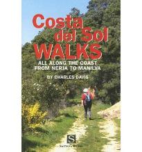
- Costa Del Sol Walks
- Full-color guide to thirty-four walks all within a short distance from the coast, from Nerja to Manilva. With easy-to-follow route notes, full-color maps and clear instructions on how to get to the start of each walk. Leer más

Stanfords
United Kingdom
United Kingdom
- New York Theatre Walks
- This outstanding volume provides readers with seven self-guided tours, not just of New York`s theatre district, but also the East and West Village, the Lower East Side, and the Upper West Side. ”New York Theatre Walks” abounds in amusing, and insightful Broadway anecdotes, as well as giving the reader a sense of the city`s own complex, rich... Leer más

Stanfords
United Kingdom
2020
United Kingdom
2020
- DK Eyewitness Chile and Easter Island
- Venture to Chile - a diverse landscape of vibrant towns and natural wondersWhether you want to hike the spectacular peaks of Torres del Paine, go stargazing in San Pedro de Atacama or relax with world-class wine in the Central Valley, your DK Eyewitness travel guide makes sure you experience all that Chile and Easter Island have to offer.... Leer más
Mapas

Stanfords
United Kingdom
United Kingdom
- Bahundada
- Bahundada, sheet no. 2884-10, in the topographic survey of Nepal at 1:50,000 published by the Nepali Government in the late 1990s and early 2000s and produced from remote sensing data by Finnish cartographers as part of that country’s international aid program. The maps cover 15’ x 15’ quadrangles.IMPORTANT – PLEASE NOTE BEFORE ORDERING:... Leer más
Stanfords
United Kingdom
United Kingdom
- Nepal Survey 1:25,000 Sheet 2883 11D (Patichaur)
- Koban, sheet no. 2883-07, in the topographic survey of Nepal at 1:50,000 published by the Nepali Government in the late 1990s and early 2000s and produced from remote sensing data by Finnish cartographers as part of that country’s international aid program. The maps cover 15’ x 15’ quadrangles.IMPORTANT – PLEASE NOTE BEFORE ORDERING:... Leer más
Stanfords
United Kingdom
United Kingdom
- Jomson
- Jomson, sheet no. 2883-03, in the topographic survey of Nepal at 1:50,000 published by the Nepali Government in the late 1990s and early 2000s and produced from remote sensing data by Finnish cartographers as part of that country’s international aid program. The maps cover 15’ x 15’ quadrangles.IMPORTANT – PLEASE NOTE BEFORE ORDERING:... Leer más
Stanfords
United Kingdom
United Kingdom
- Salpa Bhanjyang - Baksila
- Salpa Bhanjyang - Baksila, sheet no. 2786-12, in the topographic survey of Nepal at 1:50,000 published by the Nepali Government in the late 1990s and early 2000s and produced from remote sensing data by Finnish cartographers as part of that country’s international aid program. The maps cover 15’ x 15’ quadrangles.IMPORTANT – PLEASE NOTE BEFORE... Leer más
Stanfords
United Kingdom
United Kingdom
- Dattu
- Dattu, sheet no. 2980-02, in the topographic survey of Nepal at 1:50,000 published by the Nepali Government in the late 1990s and early 2000s and produced from remote sensing data by Finnish cartographers as part of that country’s international aid program. The maps cover 15’ x 15’ quadrangles.IMPORTANT – PLEASE NOTE BEFORE ORDERING:... Leer más
Stanfords
United Kingdom
United Kingdom
- Gurjakhani
- Gurjakhani, sheet no. 2883-05, in the topographic survey of Nepal at 1:50,000 published by the Nepali Government in the late 1990s and early 2000s and produced from remote sensing data by Finnish cartographers as part of that country’s international aid program. The maps cover 15’ x 15’ quadrangles.IMPORTANT – PLEASE NOTE BEFORE ORDERING:... Leer más
Stanfords
United Kingdom
United Kingdom
- Lantan (2885 15)
- Upper Langtang Valley, sheet no. 2885-15, in the topographic survey of Nepal at 1:50,000 published by the Nepali Government in the late 1990s and early 2000s and produced from remote sensing data by Finnish cartographers as part of that country’s international aid program. The maps cover 15’ x 15’ quadrangles.IMPORTANT – PLEASE NOTE BEFORE... Leer más

Stanfords
United Kingdom
United Kingdom
- London High 5 Edition Street Plan
- The first water-resistant “Comfort Map“ with direct access to useful additional information from the InternetLondon in a scale of 1:20,000 including tourist destinations (Hampstead Heath, Olympic Park and Greenwich) presented on a practical map; inclusive of the High 5 Edition app technology for calling up additional travel information and many... Leer más
Stanfords
United Kingdom
United Kingdom
- Dhime
- Dhime, sheet no. 2882-01, in the topographic survey of Nepal at 1:50,000 published by the Nepali Government in the late 1990s and early 2000s and produced from remote sensing data by Finnish cartographers as part of that country’s international aid program. The maps cover 15’ x 15’ quadrangles.IMPORTANT – PLEASE NOTE BEFORE ORDERING:... Leer más
Stanfords
United Kingdom
United Kingdom
- Arughat
- Arughat, sheet no. 2884-16, in the topographic survey of Nepal at 1:50,000 published by the Nepali Government in the late 1990s and early 2000s and produced from remote sensing data by Finnish cartographers as part of that country’s international aid program. The maps cover 15’ x 15’ quadrangles.IMPORTANT – PLEASE NOTE BEFORE ORDERING:... Leer más
Stanfords
United Kingdom
United Kingdom
- Martadi
- Martadi, sheet no. 2981-10, in the topographic survey of Nepal at 1:50,000 published by the Nepali Government in the late 1990s and early 2000s and produced from remote sensing data by Finnish cartographers as part of that country’s international aid program. The maps cover 15’ x 15’ quadrangles.IMPORTANT – PLEASE NOTE BEFORE ORDERING:... Leer más
Stanfords
United Kingdom
United Kingdom
- Lapchegau
- Lapchgau, sheet no. 2886-13, in the topographic survey of Nepal at 1:50,000 published by the Nepali Government in the late 1990s and early 2000s and produced from remote sensing data by Finnish cartographers as part of that country’s international aid program. The maps cover 15’ x 15’ quadrangles.IMPORTANT – PLEASE NOTE BEFORE ORDERING:... Leer más
Stanfords
United Kingdom
United Kingdom
- Gamaar
- Gamaar, sheet no. 2984-09, in the topographic survey of Nepal at 1:50,000 published by the Nepali Government in the late 1990s and early 2000s and produced from remote sensing data by Finnish cartographers as part of that country’s international aid program. The maps cover 15’ x 15’ quadrangles.IMPORTANT – PLEASE NOTE BEFORE ORDERING:... Leer más
Stanfords
United Kingdom
United Kingdom
- Dhunche (2885 14)
- Upper Langtang Valley, sheet no. 2885-15, in the topographic survey of Nepal at 1:50,000 published by the Nepali Government in the late 1990s and early 2000s and produced from remote sensing data by Finnish cartographers as part of that country’s international aid program. The maps cover 15’ x 15’ quadrangles.IMPORTANT – PLEASE NOTE BEFORE... Leer más
Stanfords
United Kingdom
United Kingdom
- Koban
- Koban, sheet no. 2883-07, in the topographic survey of Nepal at 1:50,000 published by the Nepali Government in the late 1990s and early 2000s and produced from remote sensing data by Finnish cartographers as part of that country’s international aid program. The maps cover 15’ x 15’ quadrangles.IMPORTANT – PLEASE NOTE BEFORE ORDERING:... Leer más