
Wildhorn
Descripción
- Altitud 3247.00 m
Enlaces
Datos
Informes
Guías y mapas
Hospedaje
Organizaciones
Operadores turísticos
GPS
Otro
Mapas

Stanfords
United Kingdom
United Kingdom
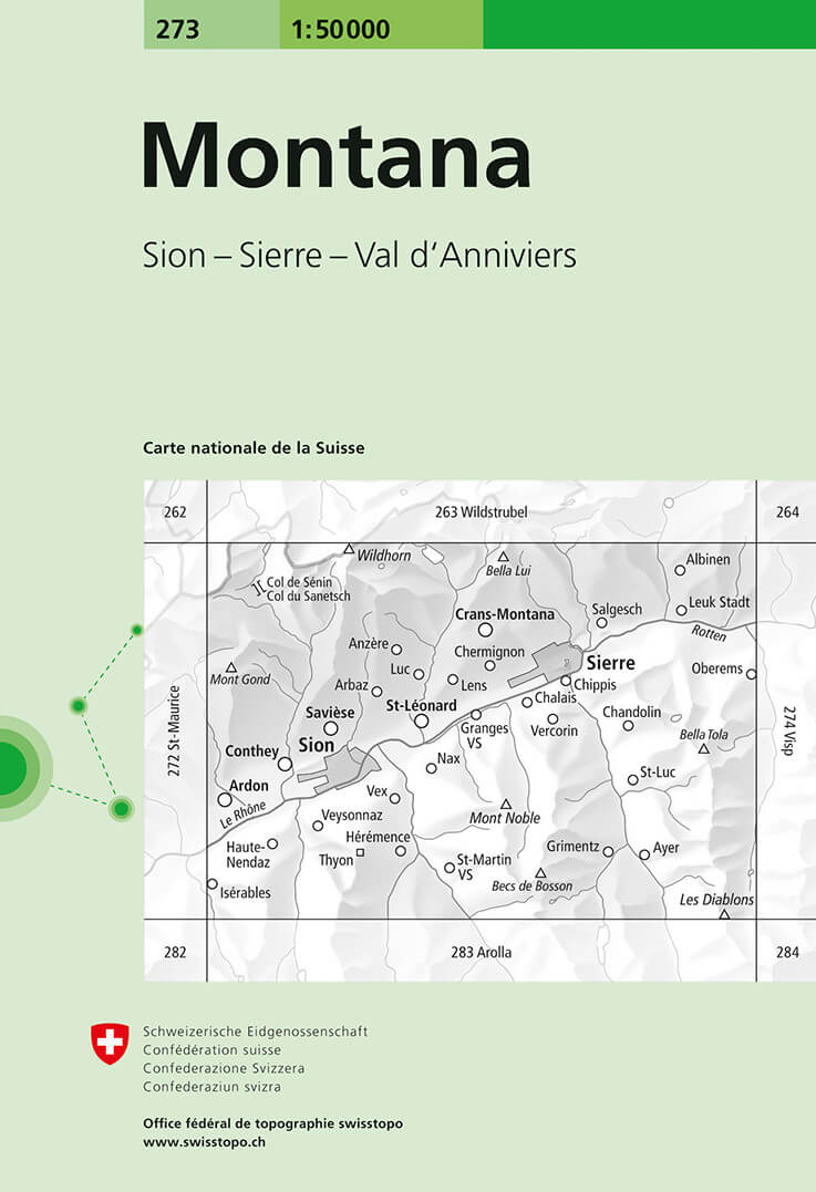
- Montana Swisstopo 273
- Montana, map No. 273, in the standard topographic survey of Switzerland at 1:50,000 from Swisstopo, i.e. without the special overprint highlighting walking trails, local bus stops, etc, presented in Swisstopo’s hiking editions of the 50K survey. The map is divided by the Rhone Valley with Sierre and Sion and covers north of it the resorts of... Leer más
- Also available from:
- De Zwerver, Netherlands
De Zwerver
Netherlands
Netherlands
- Wandelkaart - Topografische kaart 273 Montana | Swisstopo
- Montana, map No. 273, in the standard topographic survey of Switzerland at 1:50,000 from Swisstopo, i.e. without the special overprint highlighting walking trails, local bus stops, etc, presented in Swisstopo Leer más

Stanfords
United Kingdom
United Kingdom
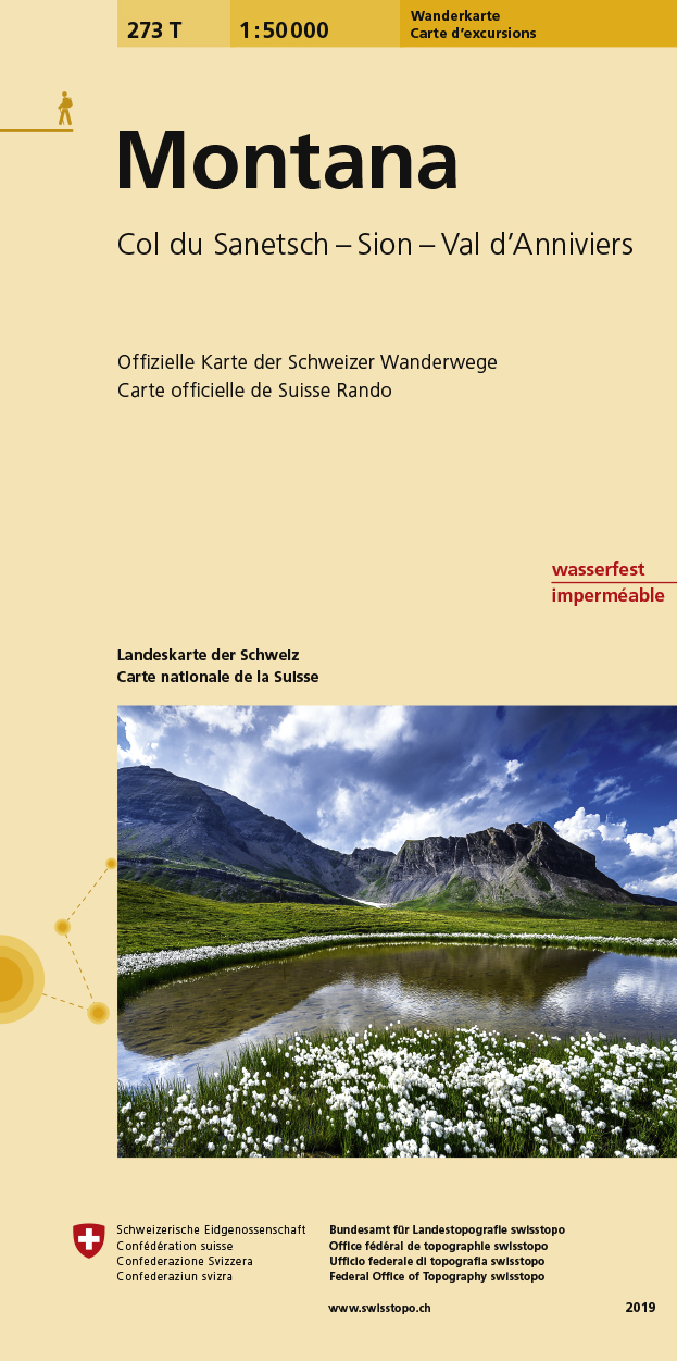
- Montana Swisstopo Hiking 273T
- Montana area, map No. 273T, at 1:50,000 in a special hiking edition of the country’s topographic survey, published by Swisstopo in cooperation with the Swiss Hiking Federation. The map is divided by the Rhone Valley with Sierre and Sion and covers north of it the resorts of Crans-Montana and Lens and the peak of Wildhorn, and to the south most... Leer más
- Also available from:
- De Zwerver, Netherlands
De Zwerver
Netherlands
Netherlands
- Wandelkaart 273T Montana | Swisstopo
- Montana area, map No. 273T, at 1:50,000 in a special hiking edition of the country Leer más