
Costa Brava
Descripción
The "Wild Coast", popular holiday destination, extending some 200 km South starting from the French border.
Senderos en región
Enlaces
Datos
Informes
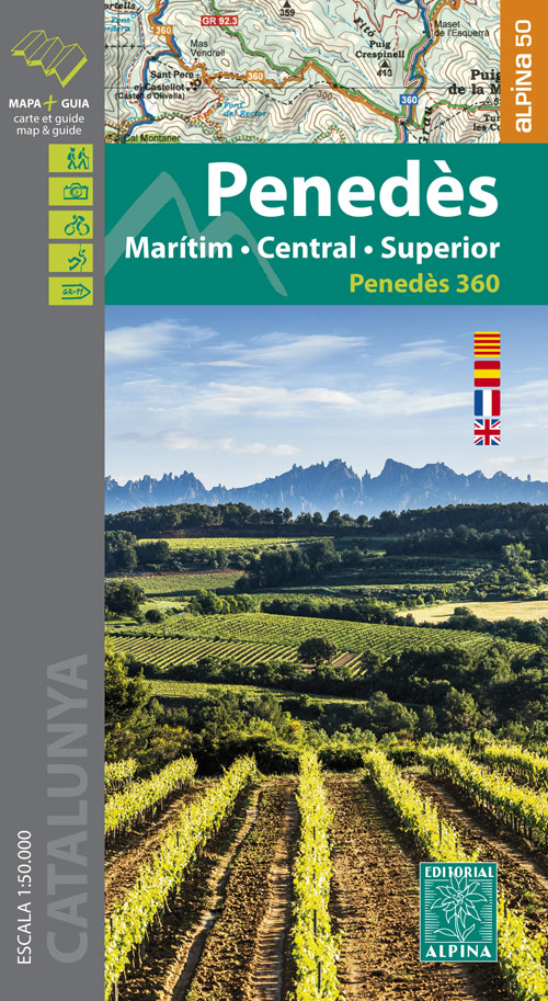
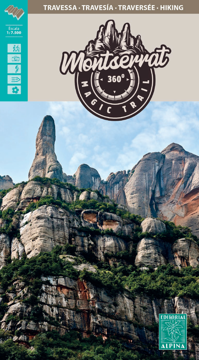
Guías y mapas
Hospedaje
Organizaciones
Operadores turísticos
GPS
Otro
Libros

- Also available from:
- De Zwerver, Netherlands


Stanfords
United Kingdom
United Kingdom
- Vignemale - Valle de Bujaruelo Editorial Alpina
- Cross-border area of the Pyrenees at 1:25,000 on a contoured and GPS compatible map covering on the Spanish side the valleys of Bujaruelo and Ara with the western section of the Ordesa National Park and the Ordesa Valley, and within France extending from the Vignemale Massif to Gavarnie, plus a Spanish/French booklet with recommendations for... Leer más
- Also available from:
- The Book Depository, United Kingdom
- De Zwerver, Netherlands

The Book Depository
United Kingdom
United Kingdom
- Vignemale - Valle de Bujaruelo
- Cross-border area of the Pyrenees at 1:25,000 on a contoured and GPS compatible map covering on the Spanish side the valleys of Bujaruelo and Ara with the western section of the Ordesa National Park and the Ordesa Valley, and within France extending from the Vignemale Massif to Gavarnie, plus a Spanish/French booklet with recommendations for... Leer más

De Zwerver
Netherlands
Netherlands
- Wandelkaart 06 Vignemale - Valle de Bujaruelo | Editorial Alpina
- Cross-border area of the Pyrenees at 1:25,000 on a contoured and GPS compatible map covering on the Spanish side the valleys of Bujaruelo and Ara with the western section of the Ordesa National Park and the Ordesa Valley, and within France extending from the Vignemale Massif to Gavarnie, plus a Spanish/French booklet with recommendations for... Leer más


- Also available from:
- De Zwerver, Netherlands

The Book Depository
United Kingdom
United Kingdom

Stanfords
United Kingdom
United Kingdom
- Macizo de Monte Perdido - Valle de Ordesa - Pineta Editorial Alpina
- Ordesa and Monte Perdido National Park at 1:25,000 in a set of two GPS compatible recreational maps in an extensive and very popular series from Editorial Alpina, providing more detailed coverage of this popular hiking area.Contours are at 10m intervals, with relief shading and vegetation colouring. An overprint highlights waymarked PR hiking... Leer más
- Also available from:
- The Book Depository, United Kingdom

The Book Depository
United Kingdom
United Kingdom
- Monte Perdido Macizo de / Valle de Ordesa / Pineta
- Ordesa and Monte Perdido National Park at 1:25,000 in a set of two GPS compatible recreational maps in an extensive and very popular series from Editorial Alpina, providing more detailed coverage of this popular hiking area.Contours are at 10m intervals, with relief shading and vegetation colouring. An overprint highlights waymarked PR hiking... Leer más

Stanfords
United Kingdom
2019
United Kingdom
2019
- The Pyrenean Haute Route
- There are three main trekking routes across the Pyrenees from coast to coast: of these, the Pyrenean Haute Route (or HRP for Haute Route Pyreneenne) is the most challenging - and arguably, the most spectacular. Unlike the GR10 and GR11, it is not waymarked and borders on mountaineering at times, sticking as closely as possible to the main... Leer más
- Also available from:
- The Book Depository, United Kingdom
- De Zwerver, Netherlands


De Zwerver
Netherlands
2022
Netherlands
2022
- Wandelgids Pyrenean Haute Route - a high level trail, Pyreneeën HRP | Cicerone
- Guidebook to trekking the Pyrenean Haute Route, which zigzags across the Franco-Spanish border, staying close to the main ridge in the highest and most spectacular central Pyrenees. It covers 750km with over 40km of ascent, so is suitable for experienced mountain walkers only. The largely unwaymarked route is presented in 45 stages. Leer más

- Also available from:
- De Zwerver, Netherlands


The Book Depository
United Kingdom
2019
United Kingdom
2019
- Shorter Treks in the Pyrenees
- 7 great one and two week circular treks Leer más
- Also available from:
- De Zwerver, Netherlands

De Zwerver
Netherlands
2019
Netherlands
2019
- Wandelgids Shorter Treks in the Pyrenees | Cicerone
- Guidebook detailing seven circular treks of 4-12 days in the beautiful Pyrenees. The varied routes cover both sides of the French-Spanish border and include both the High Pyrenees and the lower, more gentle mountains of the Basque Country and Catalonia. Variants are suggested for those wishing to shorten or extend the treks. Leer más


The Book Depository
United Kingdom
2017
United Kingdom
2017
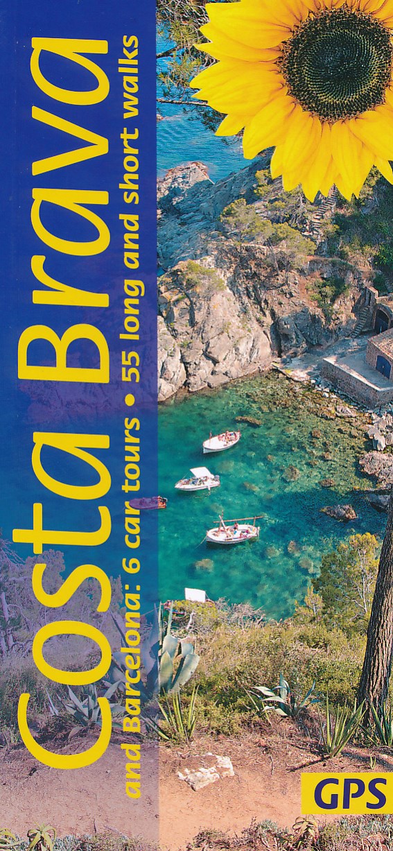
- Costa Brava and Barcelona
- 6 car tours, 55 long and short walks with GPS Leer más
- Also available from:
- De Zwerver, Netherlands
Bol.com
Netherlands
2011
Netherlands
2011
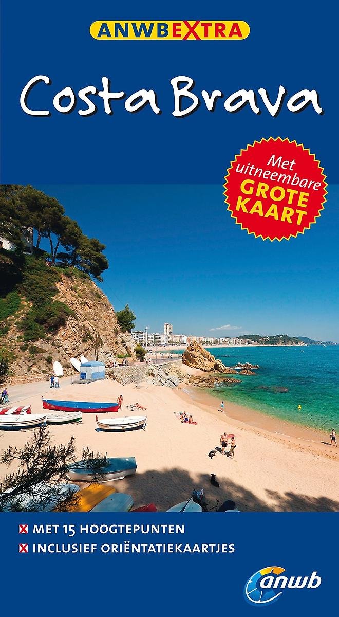
- Costa brava
- Met de ANWB Extra reisgids Costa Brava heeft u een handzame reisgezel. ¿Bezoek het Dali museum, wandel door de botanische tuin Jardi Botanic of geniet van de mooie kust van de Costa Brava.¿ In de reisgids Costa Brava staat actuele informatie over de bezienswaardigheden, café's, hotels, de lokale keuken, winkelen en uitgaan. De ANWB redactie... Leer más
- Also available from:
- Bol.com, Belgium
Bol.com
Belgium
2011
Belgium
2011
- Costa brava
- Met de ANWB Extra reisgids Costa Brava heeft u een handzame reisgezel. ¿Bezoek het Dali museum, wandel door de botanische tuin Jardi Botanic of geniet van de mooie kust van de Costa Brava.¿ In de reisgids Costa Brava staat actuele informatie over de bezienswaardigheden, café's, hotels, de lokale keuken, winkelen en uitgaan. De ANWB redactie... Leer más

Bol.com
Netherlands
Netherlands
- National Geographic Traveler
- Celebrating Barcelona's stronghold on architecture and art, this completely updated and revised guide to the city makes sure you don't miss a thing--from the intricately carved edifices of its Gothic quarter; Gaudi's moderniste structures; and the seminal surrealist works of Picasso and Miro. Special features include three-dimensional drawings... Leer más
- Also available from:
- Bol.com, Belgium
Bol.com
Belgium
Belgium
- National Geographic Traveler
- Celebrating Barcelona's stronghold on architecture and art, this completely updated and revised guide to the city makes sure you don't miss a thing--from the intricately carved edifices of its Gothic quarter; Gaudi's moderniste structures; and the seminal surrealist works of Picasso and Miro. Special features include three-dimensional drawings... Leer más
De Zwerver
Netherlands
2017
Netherlands
2017
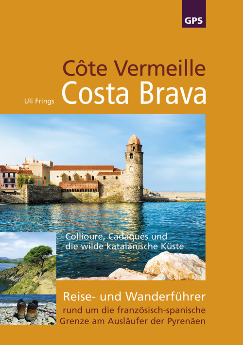
- Wandelgids Côte Vermeille, Costa Brava, Katalonien | Uli Frings Verlag
- Reise- und Wanderführer rund um die französisch-spanische Grenze am Ausläufer der Pyrenäen Leer más
Mapas

Stanfords
United Kingdom
United Kingdom
- Serra de Montsant Editorial Piolet Hiking Map
- Serra de Montsant area at 1:20,000 in a series of GPS compatible maps from Editorial Piolet with cartography based on Spain’s civilian topographic survey overprinted with hiking routes and other tourist information. The overprint includes 11 recommended itinerates in the park, plus eight special walks exploring local flora.Hiking maps in the... Leer más
Stanfords
United Kingdom
United Kingdom
- Ordesa - Monte Perdido National Park Editorial Alpina 2-Map Set
- Ordesa and Monte Perdido National Park at 1:25,000 in a set of two GPS compatible recreational maps in an extensive and very popular series from Editorial Alpina, providing more detailed coverage of this popular hiking area.Contours are at 10m intervals, with relief shading and vegetation colouring. An overprint highlights waymarked PR hiking... Leer más

Stanfords
United Kingdom
United Kingdom
- Cap de Creus Park Natural Editorial Alpina
- Cap de Creus Natural Park on the Costa Brava at 1:25,000 on a contoured and GPS compatible map from Editorial Alpina, plus a booklet which includes English language descriptions several recommended hiking trails, accommodation details, etc.Topography is presented by contours at10m intervals with relief shading and plenty of spot heights, plus... Leer más

Stanfords
United Kingdom
United Kingdom
- Pla de Lleida
- Pla de Lleida map at 1:100,000 in the topographic survey of Catalonia published by the Institut Cartogràfic de Catalunya, with very detailed coverage of a large area and an excellent representation of the region’s topography. Maps in this series have relief presented by contours at 40m intervals, enhanced by additional hill-shading and spot... Leer más

Stanfords
United Kingdom
United Kingdom
- 3220 Cabo de la Nao to the French border Chart Atlas - 2019 Edition
- A new chart atlas covering Mediterranean Spain from Cabo de la Nao to the French border. This appealing cruising area stretches from Jávea and Dénia in the south, past the low-lying Ebro delta to the charming towns along the rugged Costa Brava in the north. It includes the cities of Valencia, Tarragona and Barcelona. The 23 sheets in the atlas... Leer más
Stanfords
United Kingdom
United Kingdom
- Costa Brava - l’Emporda 1 - PN Aiguamolls - l`Escala Editorial Piolet
- Costa Brava: L’Empordà, map No.1 covering PN Aiguamolls - l`Escala area, at 1:25,000 in a series of GPS compatible maps from Editorial Piolet with cartography based on Spain’s civilian topographic survey overprinted with hiking routes and other tourist information. The map covers the southern part of the publishers’ coverage of the L’Empordà... Leer más
Stanfords
United Kingdom
United Kingdom
- Pirineu Occidental
- Pirineu Occidental, the western part of the Catalan Pyrenees, at 1:100,000 in the topographic survey of Catalonia published by the Institut Cartogràfic de Catalunya, with very detailed coverage of a large area and an excellent representation of the region’s topography.Maps in this series have relief presented by contours at 40m intervals,... Leer más
Stanfords
United Kingdom
United Kingdom
- Costa Brava - l’Emporda 2 - l`Escala - Pals Editorial Piolet
- Costa Brava: L’Empordà, map No.2 covering l`Escala – Pals area, at 1:25,000 in a series of GPS compatible maps from Editorial Piolet with cartography based on Spain’s civilian topographic survey overprinted with hiking routes and other tourist information. The map covers the central part of the publishers’ coverage of the L’Empordà area of... Leer más

Stanfords
United Kingdom
United Kingdom
- Pirineu Oriental - Girona - Costa Brava
- Pirineu Oriental - Girona - Costa Brava map, covering the eastern part of the Catalan Pyrenees and the coast southwards to Pineda de Mar at 1:100,000 in the topographic survey of Catalonia published by the Institut Cartogràfic de Catalunya, with very detailed coverage of a large area and an excellent representation of the region’s topography.... Leer más
Stanfords
United Kingdom
United Kingdom
- Camp de Tarragona
- Camp de Tarragona map at 1:100,000 in the topographic survey of Catalonia published by the Institut Cartogràfic de Catalunya, with very detailed coverage of a large area and an excellent representation of the region’s topography. Maps in this series have relief presented by contours at 40m intervals, enhanced by additional hill-shading and spot... Leer más
Stanfords
United Kingdom
United Kingdom
- Costa Brava - l’Emporda 3 - Begur - Palamos Editorial Piolet
- Costa Brava: L’Empordà, map No.3 covering Begur – Palamós area, at 1:25,000 in a series of GPS compatible maps from Editorial Piolet with cartography based on Spain’s civilian topographic survey overprinted with hiking routes and other tourist information. The map covers the southern part of the publishers’ coverage of the L’Empordà area of... Leer más

Stanfords
United Kingdom
United Kingdom
- Barcelona and Environs ICGC 100K 5
- Barcelona and Environs map at 1:100,000 in the topographic survey of Catalonia published by the Institut Cartogràfic de Catalunya, with very detailed coverage of a large area and an excellent representation of the region’s topography. Maps in this series have relief presented by contours at 40m intervals, enhanced by additional hill-shading and... Leer más
Stanfords
United Kingdom
United Kingdom
- Costa Brava - l’Emporda 3-Map Set Editorial Piolet
- Costa Brava: L’Empordà (3-map set) at 1:25,000 in a series of GPS compatible maps from Editorial Piolet with cartography based on Spain’s civilian topographic survey overprinted with hiking routes and other tourist information, including numerous campsites, beaches, surfing sites. Each of the three maps is also available separately.Hiking maps... Leer más
Stanfords
United Kingdom
United Kingdom
- Comarques Centrales
- Comarques Centrales, the foothills of the Catalan Pyrenees including Ripoll, Olot, Berga, Vic, Solsona, etc, at 1:100,000 in the topographic survey of Catalonia published by the Institut Cartogràfic de Catalunya, with very detailed coverage of a large area and an excellent representation of the region’s topography.Maps in this series have... Leer más
Stanfords
United Kingdom
United Kingdom
- L`Ardenya - Massis de Cadiretes Editorial Piolet Hiking Map
- L`Ardenya - Massis de Cadiretes area at 1:25,000 in a series of GPS compatible maps from Editorial Piolet with cartography based on Spain’s civilian topographic survey overprinted with hiking routes and other tourist information. The map covers the hinterland beyond the Costa Brava resorts of Platja d’Aro, Sant Feliu de Guíxols, Caynet de Mar,... Leer más