
Santa Maria, Azores
Descripción

One of the smallest and dryest islands of the Azores, Santa Maria is catering for both the hiker and the beach lover. Thanks to its old geological age and erosion, the island has real beaches and resorts. The western part is probably the driest spot you can find in the Azores. The eastern part of the island is made up of a patchwork of fields and forests.
The hills in the centre are humid and green. Highest point is 590 m, covered in forest. Even if this island has little traces of volcanism, it offers an interesting topography. And like on the other islands of the Azores, many trails have been marked and described.
Check the list of all nine Azores islands.
Enlaces
Datos
Informes
Guías y mapas
Hospedaje
Organizaciones
Operadores turísticos
GPS
Otro
Libros

Stanfords
United Kingdom
United Kingdom
- Azores Tour & Trail Super-Durable Map
- For the best adventures, use the best map. Azores Tour & Trail Super-Durable Map is the most detailed, accurate, toughest, large scale map of these 9 islands that you can buy. Super-Durable Maps now come with a 2 year adventurous use wear and tear guarantee, see Discovery Walking Guides website for details. 1:60,000 scale for each island, Sao... Leer más

Stanfords
United Kingdom
2015
United Kingdom
2015
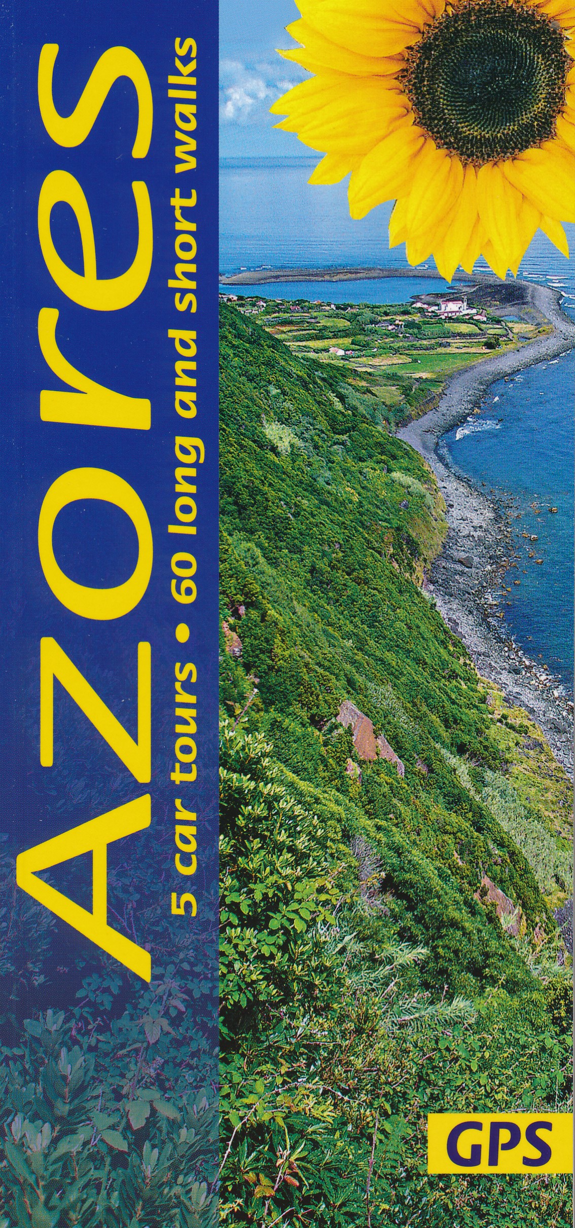
- Azores: Car Tours and Walks
- The Azores in the Sunflower Landscapes guide series; exploring the best walking and touring possibilities in the region or area. Detailed information about touring by hired car or public transport, as well as on foot, is provided, helping walkers to navigate and plan day-trips. Shorter strolls are also included as an alternative for each main... Leer más

Stanfords
United Kingdom
United Kingdom
- Insight Guides Explore Florence (Travel Guide with Free eBook)
- Travel made easy. Ask local experts.Focused travel guide featuring the very best routes and itineraries, now with free eBook.Discover the best of Florence with this unique travel guide, packed full of insider information and stunning images. From making sure you don`t miss out on must-see, top attractions like the Uffizi, Cathedral of Santa... Leer más

Stanfords
United Kingdom
United Kingdom
- Insight Guides Explore Rome (Travel Guide with Free eBook)
- Part of our UEFA Euro 2020 guidebook series. If you`re planning to visit Stadio Olimpico in Rome to watch Euro 2020 matches, then this pocket guidebook provides all the information you need to make the most of your trip, from ready-made itineraries to help you explore the city when you`re not at the game, to essential advice about getting... Leer más

Stanfords
United Kingdom
2014
United Kingdom
2014
- La Gomera and Southern Tenerife: Car Tours and Walks
- Southern Tenerife and La Gomera is the Sunflower Landscapes guide to exploring the best walking and touring possibilities in the region. The guide covers a range of routes including walks in Montana Guaza, Masca, Arure, Degollada de Peraza and Vallehermoso. A double-sided, fold-out touring map at the back of the book gives an overview of... Leer más

Stanfords
United Kingdom
2015
United Kingdom
2015
- Sorrento, Amalfi Coast and Capri: Car Tours and Walks
- Sorrento, Amalfi and Capri is the Sunflower Landscapes guide to exploring the best walking and touring possibilities in the region. The guide covers a range of routes including walks in Amalfi/Ravello, Positano/Praiano, Conca dei Marini, Maiori/Minori, Sorrento and Capri. A double-sided, fold-out touring map at the back of the book shows the... Leer más

Stanfords
United Kingdom
2021
United Kingdom
2021
- DK Eyewitness Portugal
- Welcome to Portugal, a sunseekers` paradise.Whether you`re looking for world-renowned beaches, serene hilltop villages, verdant islands, or captivating cities, your DK Eyewitness travel guide makes sure you experience all that Portugal has to offer.Small but immensely varied, Portugal offers countless opportunities for adventure. From the... Leer más

Stanfords
United Kingdom
United Kingdom
- Azores - 6th ed.
- The Azores in the Sunflower Landscapes guide series; exploring the best walking and touring possibilities in the region or area. Detailed information about touring by hired car or public transport, as well as on foot, is provided, helping walkers to navigate and plan day-trips. Shorter strolls are also included as an alternative for each main... Leer más

Stanfords
United Kingdom
2019
United Kingdom
2019
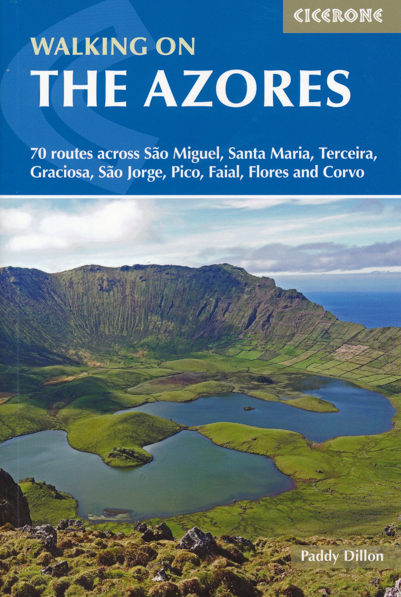
- Walking on the Azores: 70 routes across Sao Miguel, Santa Maria, Terceira, Graciosa, Sao Jorge, Pico, Faial, Flores and Corvo
- A comprehensive guide to walking in the Azores. The guidebook is divided into three island groups: Eastern Group (covering São Miguel and Santa Maria); Central Group (Terceira, Graciosa, São Jorge, Pico and Faial); and Western Group (Flores and Corvo). Most the 70 routes presented here use the Azores` official waymarked trail network and range... Leer más
- Also available from:
- The Book Depository, United Kingdom
- De Zwerver, Netherlands

The Book Depository
United Kingdom
2019
United Kingdom
2019
- Walking on the Azores
- 70 routes across Sao Miguel, Santa Maria, Terceira, Graciosa, Sao Jorge, Pico, Faial, Flores and Corvo Leer más
De Zwerver
Netherlands
2019
Netherlands
2019
- Wandelgids Walking on the Azores - Azoren | Cicerone
- Guidebook to 70 walks on the Azores, a remote archipelago in the North Atlantic Ocean. Most of the walks are easy or moderate, with a few graded difficult. The selection is spread across all nine islands, offering much variety, from easy village-to-village walks to remote and mountainous walks, including Portugal's highest mountain, Pico. Leer más

Stanfords
United Kingdom
2018
United Kingdom
2018
- Azores Sunflower Landscape Guide
- The Azores, nine islands in the Atlantic halfway between the Old World and the New, rise above sea level from a depth of several thousand metres. They are all volcanic in origin and all are covered in this guide.They are not the remains of the legendary continent of Atlantis, which is said to have sunk in the ocean once upon a time.... Leer más
- Also available from:
- The Book Depository, United Kingdom
- De Zwerver, Netherlands

The Book Depository
United Kingdom
2018
United Kingdom
2018
- Azores Sunflower Guide
- 60 long and short walks with detailed maps and GPS; 5 car tours with pull-out map Leer más
Bol.com
Netherlands
Netherlands
- Central Tuscany
- Central Tuscany: Best of CortonaNew and Expanded 2018 to 2019 EditionThe latest edition of the Cortona guidebook is the most comprehensive in English. It invites you to view its excellent churches and museums and to experience the culture. Founded by Noah after the ark sailed up the Tiber if you believe the legends it sits high on a steep... Leer más
- Also available from:
- Bol.com, Belgium
Bol.com
Belgium
Belgium
- Central Tuscany
- Central Tuscany: Best of CortonaNew and Expanded 2018 to 2019 EditionThe latest edition of the Cortona guidebook is the most comprehensive in English. It invites you to view its excellent churches and museums and to experience the culture. Founded by Noah after the ark sailed up the Tiber if you believe the legends it sits high on a steep... Leer más

Stanfords
United Kingdom
2019
United Kingdom
2019
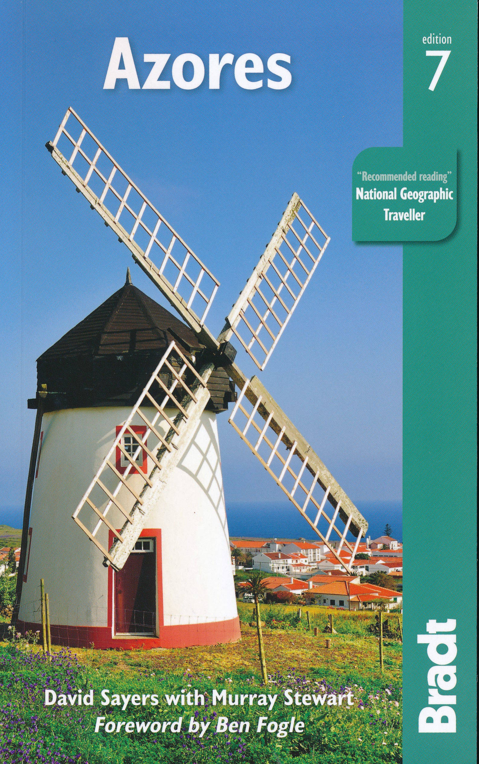
- Azores Bradt Guide
- Bradt`s Azores is the only comprehensive guidebook to the nine-island archipelago, a nature-lovers` wilderness perched at the western extremity of Europe in the mid-Atlantic, and one of the best places in the world for whale watching. Thanks to the experience of expert botanist and author David Sayers, and the ongoing involvement of author... Leer más
- Also available from:
- De Zwerver, Netherlands
De Zwerver
Netherlands
2019
Netherlands
2019
- Reisgids Azores - Azoren | Bradt Travel Guides
- Bradt`s Azores is the only comprehensive guidebook to the nine-island archipelago, a nature-lovers` wilderness perched at the western extremity of Europe in the mid-Atlantic, and one of the best places in the world for whale watching. Thanks to the experience of expert botanist and author David Sayers, and the ongoing involvement of author... Leer más

De Zwerver
Netherlands
2012
Netherlands
2012
- Reisgids Kunstreiseführer Florence | Dumont
- Von woher man sich auch Florenz nähert, das erste, was man von der Toskana-Metropole wahrnimmt, ist die aus dem Dunstschleier emportauchende Domkuppel. Und mit dem weiten Blick von dort oben beginnt Klaus Zimmermanns seine umfassende Kulturgeschichte der Stadt am Arno. Dabei bürgen Namen wie Giotto, Fra Angelico, Botticelli, Brunelleschi,... Leer más
Mapas
Stanfords
United Kingdom
United Kingdom
- S. Jorge - Farol de Rosais - Azores 14
- Topographic survey of Portugal at 1:25,000 from the Instituto Geográfico do Exército, the country’s military survey organisation.Map legend and a glossary of terms used on the maps include English.To see all the titles in this series please click on the series link. Leer más
Stanfords
United Kingdom
United Kingdom
- Terceira - Biscoitos - Azores 22
- Topographic survey of Portugal at 1:25,000 from the Instituto Geográfico do Exército, the country’s military survey organisation.Map legend and a glossary of terms used on the maps include English.To see all the titles in this series please click on the series link. Leer más
Stanfords
United Kingdom
United Kingdom
- S. Miguel - North East - Azores 30
- Topographic survey of Portugal at 1:25,000 from the Instituto Geográfico do Exército, the country’s military survey organisation.Map legend and a glossary of terms used on the maps include English.To see all the titles in this series please click on the series link. Leer más

Stanfords
United Kingdom
United Kingdom
- Cabo Froward
- Cabo Froward at 1:100,000 in a series of contoured, GPS compatible trekking and exploration maps at various scales form Trekkingchile. The map covers the south-eastern tip of the Brunswick Peninsula, from approx 45km south of Punta Arenas to Cape Froward. Contour interval is 50m, with colouring showing woodlands, shrubbery and pastures, swamps,... Leer más

Stanfords
United Kingdom
United Kingdom
- Santa Maria Navarrese to Quirra
- Santa Maria Navarrese to Quirra area in a series of contoured, GPS compatible maps at 1:60,000 from Ed. Abies, with extensive tourist information including special recreational routes plus additional coverage at more detailed scales of selected popular areas.*Main series at 1:60,000 (Nos. 1 to 12)*The maps have contours at 100m intervals and... Leer más
Stanfords
United Kingdom
United Kingdom
- Faial - Feteira - Azores 6
- Topographic survey of Portugal at 1:25,000 from the Instituto Geográfico do Exército, the country’s military survey organisation.Map legend and a glossary of terms used on the maps include English.To see all the titles in this series please click on the series link. Leer más
Stanfords
United Kingdom
United Kingdom
- S. Jorge - Velas - Azores 15
- Topographic survey of Portugal at 1:25,000 from the Instituto Geográfico do Exército, the country’s military survey organisation.Map legend and a glossary of terms used on the maps include English.To see all the titles in this series please click on the series link. Leer más
Stanfords
United Kingdom
United Kingdom
- Terceira - Praia da Vitoria - Azores 23
- Topographic survey of Portugal at 1:25,000 from the Instituto Geográfico do Exército, the country’s military survey organisation.Map legend and a glossary of terms used on the maps include English.To see all the titles in this series please click on the series link. Leer más
Stanfords
United Kingdom
United Kingdom
- S. Miguel - Arrifes - Azores 31
- Topographic survey of Portugal at 1:25,000 from the Instituto Geográfico do Exército, the country’s military survey organisation.Map legend and a glossary of terms used on the maps include English.To see all the titles in this series please click on the series link. Leer más

Stanfords
United Kingdom
United Kingdom
- El Puerto de Santa Maria CNIG Topo 1061-2
- Topographic coverage of mainland Spain at 1:25,000 published by the Centro Nacional de Información Geograficá, the country’s civilian survey organization. The maps have contours at 10m intervals and colouring and/or graphics to show different types of vegetation or land use. Boundaries of national parks and other protected areas are marked. In... Leer más
Stanfords
United Kingdom
United Kingdom
- Faial - Horta - Azores 7
- Topographic survey of Portugal at 1:25,000 from the Instituto Geográfico do Exército, the country’s military survey organisation.Map legend and a glossary of terms used on the maps include English.To see all the titles in this series please click on the series link. Leer más
Stanfords
United Kingdom
United Kingdom
- S. Jorge - Norte Grande - Azores 16
- Topographic survey of Portugal at 1:25,000 from the Instituto Geográfico do Exército, the country’s military survey organisation.Map legend and a glossary of terms used on the maps include English.To see all the titles in this series please click on the series link. Leer más
Stanfords
United Kingdom
United Kingdom
- Terceira - Angra do Heroismo - Azores 24
- Topographic survey of Portugal at 1:25,000 from the Instituto Geográfico do Exército, the country’s military survey organisation.Map legend and a glossary of terms used on the maps include English.To see all the titles in this series please click on the series link. Leer más
Stanfords
United Kingdom
United Kingdom
- S. Miguel - Ponta Delgada - Azores 32
- Topographic survey of Portugal at 1:25,000 from the Instituto Geográfico do Exército, the country’s military survey organisation.Map legend and a glossary of terms used on the maps include English.To see all the titles in this series please click on the series link. Leer más
Stanfords
United Kingdom
United Kingdom
- Santa Maria del Campo CNIG Topo 275
- Topographic coverage of mainland Spain at 1:50,000 in the MTN50 (Mapa Topográfico Nacional) series from the Centro Nacional de Información Geografica, the country’s civilian survey organization. The maps have contours at 20m intervals, enhanced by relief shading, plus colouring and/or graphics to show different types of terrain, vegetation or... Leer más