
Toscana
Descripción
Famous and picturesque region between Florence (Firenze) and Sienna.
Senderos en región
Enlaces
Datos
Informes
Guías y mapas
Hospedaje
Organizaciones
Operadores turísticos
GPS
Otro
Libros

Stanfords
United Kingdom
United Kingdom
- Tuscany Marco Polo Spiral Guide
- Tuscany in the Marco Polo Spiral Guides series is a practical guide presenting the most important things to see and do in the region in a nutshell, and aimed at travellers who don’t have a lot of time to prepare and research for a trip. The guide highlights the top 10 sights, suggests tours and great ideas for exciting days out, and features... Leer más

Stanfords
United Kingdom
United Kingdom
- Rick Steves Pocket Florence (fourth Edition)
- Make the most of every day and every dollar with Rick Steves! This colorful, compact guidebook is perfect for spending a week or less in Florence: City walks and tours: Five detailed tours and walks showcase Florence`s essential sights, including the Uffizi Gallery, the Duomo, and Michelangelo`s David at the Accademia, plus handy neighborhood... Leer más

Stanfords
United Kingdom
2021
United Kingdom
2021
- DK Eyewitness Florence and Tuscany
- Divine cuisine and spectacular art await in Florence and TuscanyWhether you want to sample delicious Tuscan food and wine, gaze at the iconic Leaning Tower of Pisa or browse eclectic markets in Florence, your DK Eyewitness travel guide makes sure you experience all that this region has to offer.The birthplace of the Renaissance, Florence is... Leer más

Stanfords
United Kingdom
2005
United Kingdom
2005
- Walking and Eating in Tuscany & Umbria
- In Walking and Eating in Tuscany and Umbria, James Lasdun and Pia Davis offer forty walks through the spectacular countryside of both regions. Arranged for the utmost flexibility the guide includes half-day outings easily accessible from a city base to day walks that can be linked together in a series. These itineraries are designed to combine... Leer más

Stanfords
United Kingdom
United Kingdom
- Sardinia North 4-Map Set Kompass 2497
- The northern part of Sardinia on a set of four double-sided, contoured and GPS compatible recreational maps at 1:50,000 from Kompass. Extensive overprint highlights hiking trails, cycle and selected mountain bike routes, and horse riding paths. Symbols indicate various types of accommodation including campsites, youth hostels, “Friends of... Leer más

Stanfords
United Kingdom
United Kingdom
- Parco Nazionale del Stelvio / NP Stilfser Joch Kompass 072
- Parco Nazionale del Stelvio (NP Stilfser Joch) on a GPS compatible hiking and recreational map at 1:50,000 from Kompass printed on durable, waterproof and tear-resistant synthetic paper.KOMPASS HIKING MAPS OF ITALY:This title is part of an extensive series of walking maps from Kompass covering selected areas of Italy at mainly 1:50,000, with a... Leer más

Stanfords
United Kingdom
United Kingdom
- Cortina d`Ampezzo Kompass 55
- Map No. 55, Cortina d`Ampezzo - with a panorama map on the reverse, from Kompass, printed on sturdy, waterproof and tear-resistant synthetic paper in their series of walking maps of selected areas of Italy at 1:50,000, with hiking routes on a topographic base, various types of accommodation, recreational facilities, places of interest, etc.... Leer más

Stanfords
United Kingdom
2021
United Kingdom
2021
- Lonely Planet Best Day Walks Italy
- Lonely Planet`s Best Day Walks Italy is your passport to 60 easy escapes into nature. Stretch your legs outside the city by picking a hike that works for you, from just a couple of hours to a full day, from easy to hard. Hike the Dolomites, explore the Italian Lakes, and stroll Sardinia`s coast. Get to the heart of Italy and begin your journey... Leer más
- Also available from:
- The Book Depository, United Kingdom
- De Zwerver, Netherlands


Stanfords
United Kingdom
2019
United Kingdom
2019
- Walking in Umbria: 40 walks in the `Green Heart` of Italy
- This guidebook by Italian walking expert Gillian Price describes 40 varied day walks in the region of Umbria, taking in the towns of Assisi, Perugia, Orvieto and Norcia. The walks range from 2.5km to 19km in length, the majority of the routes are circular, and several wonderful traverses have been included, with the return to the start point... Leer más
- Also available from:
- The Book Depository, United Kingdom
- De Zwerver, Netherlands

The Book Depository
United Kingdom
2019
United Kingdom
2019
- Walking in Umbria
- 40 walks in the 'Green Heart' of Italy Leer más

De Zwerver
Netherlands
2019
Netherlands
2019
- Wandelgids Walking in Umbria - Umbrië | Cicerone
- This guidebook describes 40 walks in Umbria, among the ancient towns of Assisi, Perugia, Orvieto and Norcia. Known as the 'green heart' of Italy, the region of Umbria is home to hills reaching up to the Apennines and Sibillini mountains, as well as ancient villages, Roman and Etruscan ruins, dense woodland and nature reserves. Leer más

Stanfords
United Kingdom
2018
United Kingdom
2018
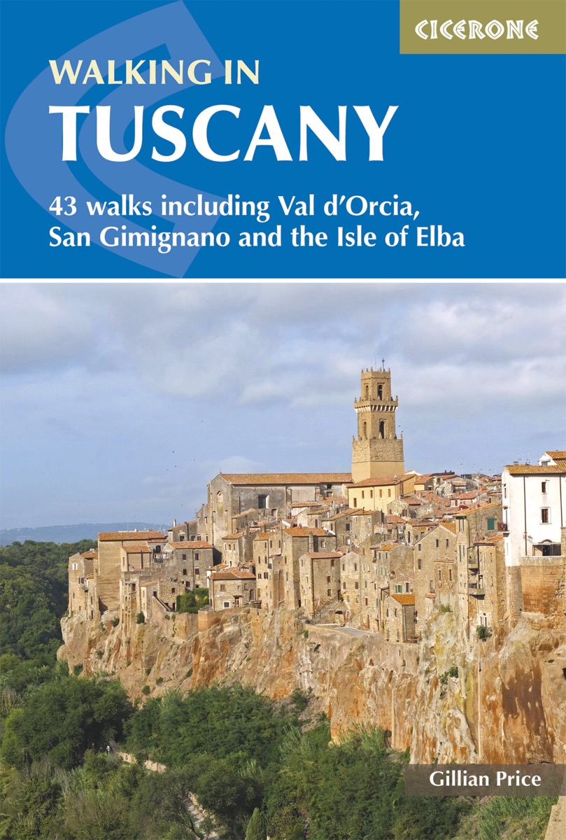
- Walking in Tuscany
- A guidebook to walks in the Italian region of Tuscany. 43 graded routes range from 2.5 to 18km, and take in the Renaissance splendour of Florence and Siena, the World Heritage scenery of Val d`Orcia and San Gimignano and the stunning island of Elba. Alongside detailed route descriptions and clear mapping there is essential practical information... Leer más
- Also available from:
- The Book Depository, United Kingdom
- De Zwerver, Netherlands

The Book Depository
United Kingdom
2018
United Kingdom
2018
- Walking in Tuscany
- 43 walks including Val d'Orcia, San Gimignano and the Isle of Elba Leer más
De Zwerver
Netherlands
2018
Netherlands
2018
- Wandelgids Walking in Tuscany - Toscane | Cicerone
- Guidebook to 43 graded, mostly easy walks in Tuscany. Taking in the Renaissance splendour of Florence and Siena, the World Heritage scenery of Val d'Orcia and San Gimignano and the stunning island of Elba, the routes use historical pathways used by traders, pilgrims and armies, and include some brief, trouble-free climbs/descents. Leer más

Stanfords
United Kingdom
2018
United Kingdom
2018
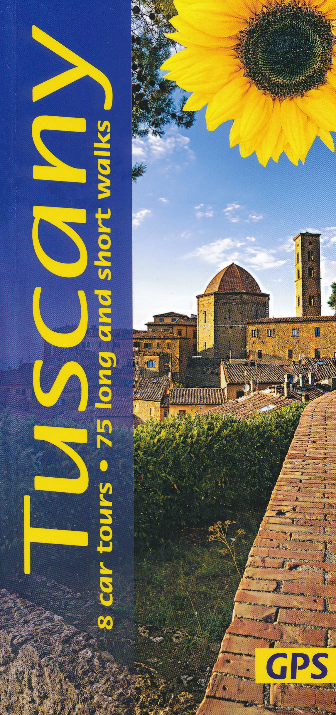
- Tuscany Sunflower Landscape Guide
- This book features walks and car tours from Carrara marble quarries in the northwest down to southern Tuscany, with particular emphasis on the countryside around Florence and in the Chianti. While the region`s historic towns and architectural highlights are often focal points for these excursions, the role of the Tuscan peasant in creating this... Leer más
- Also available from:
- The Book Depository, United Kingdom
- De Zwerver, Netherlands

Bol.com
Netherlands
Netherlands
- The Long Road Home- Living the Dream in Italy
- The Long Road Home - Living the dream in Italy Author A.J. ReissA full-length adventure. A.J. Reiss's journey in Italy, from tourist to resident. A journey that has her destiny hidden in it, she encounters her past when she discovers her father's stories from 1943 are still alive, in her meeting of an old-world war two girlfriend of his.... Leer más
- Also available from:
- Bol.com, Belgium
Bol.com
Belgium
Belgium
- The Long Road Home- Living the Dream in Italy
- The Long Road Home - Living the dream in Italy Author A.J. ReissA full-length adventure. A.J. Reiss's journey in Italy, from tourist to resident. A journey that has her destiny hidden in it, she encounters her past when she discovers her father's stories from 1943 are still alive, in her meeting of an old-world war two girlfriend of his.... Leer más
De Zwerver
Netherlands
2019
Netherlands
2019
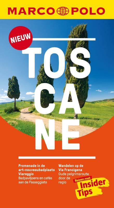
- Reisgids Marco Polo NL Toscane | 62Damrak
- Marco Polo reisgids voor Toscane. Handig pocketformaat, boordevol informatie, met uitneembare kaart achter in het boek en atlas-pagina's. Met Insider Tips om Toscane écht te ontdekken en de TOP 15 van bezienswaardigheden in één oogopslag. Veel up-to-date informatie in overzichtelijke hoofdstukken: sightseeing, eten & drinken, winkelen, uitgaan,... Leer más

De Zwerver
Netherlands
2017
Netherlands
2017
- Reisgids Capitool Top 10 Toscane en Florence | Unieboek
- Een compacte versie van de veel geprezen Capitool serie. Eigenlijk vergelijkbaar met veel illustraties, veel aandacht voor cultuur en bevolking en hier en daar praktische informatie. Kleine versie, handig in de binnenzak. Capitool Top 10 Toscane en Florence - Top 10 van onder andere de beste restaurants, de mooiste bezienswaardigheden en de... Leer más
Bol.com
Netherlands
Netherlands
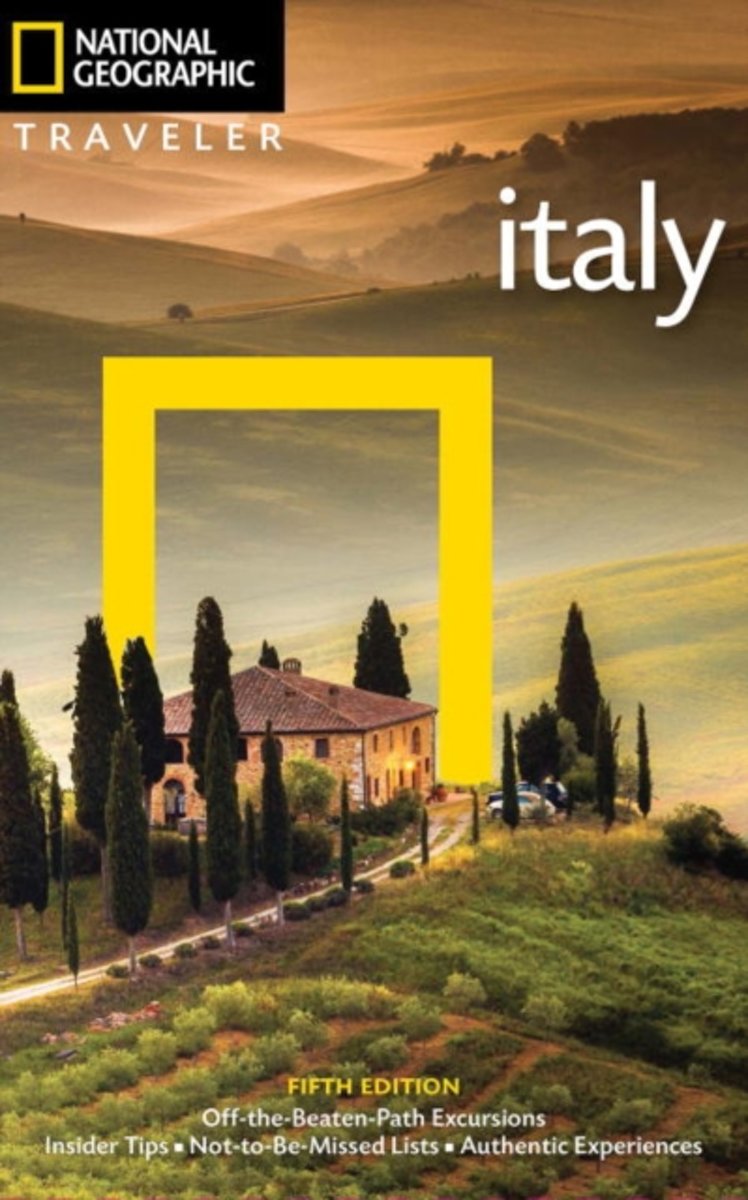
- NG Traveler
- Wherever you visitRome, Florence, Venice, Tuscany, Naples, Sicily, etc.you are in good hands with renowned Italy expert Tim Jepson. He ably guides readers through the storied capital of Rome, Northwest Italy, Lombardy & the Lakes, Venice, Northeast Italy, Emilia-Romagna & the Marche, Florence, Tuscany, Umbria, the South, and Sicily and... Leer más
- Also available from:
- Bol.com, Belgium
Bol.com
Belgium
Belgium
- NG Traveler
- Wherever you visitRome, Florence, Venice, Tuscany, Naples, Sicily, etc.you are in good hands with renowned Italy expert Tim Jepson. He ably guides readers through the storied capital of Rome, Northwest Italy, Lombardy & the Lakes, Venice, Northeast Italy, Emilia-Romagna & the Marche, Florence, Tuscany, Umbria, the South, and Sicily and... Leer más
Mapas

Stanfords
United Kingdom
United Kingdom
- Foreste Casentinesi NP Monti Editore 20
- Map No. 20, Foreste Casentinesi: Campigna, Camaldoli, Chiusi dell Verna, in series of contoured, GPS compatible hiking maps at 1:25,000 from the Istituto Geografico Adriatico, covering mainly the spine of the Apennines along the borders of Tuscany, Emilia-Romagna, Umbria and the Marches.Map in this series have contours at 25m intervals with... Leer más

Stanfords
United Kingdom
United Kingdom
- Monti Sibillini National Park Edizioni Multigraphic 60/61
- Monti Sibillini National Park at 1:25,000 on a double-sided contoured map from Edizioni Multigraphic highlighting local waymarked hiking routes including the GAS – Grand Anello dei Sibilini, the circular tour around the mountains.The map has contours at 25m intervals with colouring for woodlands. Waymarked routes are highlighted and annotated... Leer más

Stanfords
United Kingdom
United Kingdom
- S. Godenzo & the Surrounding Footpaths 25K Ed. Multigraphic Map No. 526
- S.Godenzo and the Surrounding Footpaths at 1:25,000 in a series of hiking maps from Edizioni Multigraphic covering Tuscany, parts of Umbria, and the adjoining areas. The cartography is rather old fashioned and sometimes not as clear as in the other map series but for many areas, especially for parts of Tuscany, these are the only hiking maps... Leer más

Stanfords
United Kingdom
United Kingdom
- Volterra and its Environs Edizioni Multigraphic 513
- Volterra and its environs at 1:25,000 in a series of hiking maps from Edizioni Multigraphic covering Tuscany, parts of Umbria, and the adjoining areas. The cartography is rather old fashioned and sometimes not as clear as in the other map series but for many areas, especially for parts of Tuscany, these are the only hiking maps available. Most... Leer más

Stanfords
United Kingdom
United Kingdom
- Alta Val Tiberina
- Map No. 125, Alta Val Tiberina, in a series of GPS compatible hiking maps at 1:50,000 from the Istituto Geografico Adriatico, covering parts of central Italy: eastern Tuscany, with northern Umbria and the Marches, plus the south-eastern of part of Emilia-Romagna.The maps have contours at 50m intervals with additional shading and numerous spot... Leer más

Stanfords
United Kingdom
United Kingdom
- Alpi di Ledro - Valli Giudicarie Kompass 071
- Map No. 071, Alpi di Ledro - Valli Giudicarie, from Kompass in a series of walking maps of selected areas of Italy at 1:50,000, with hiking routes on a topographic base, various types of accommodation, recreational facilities, places of interest, etc. Kompass are Europe’s largest publishers of walking maps, with extensive coverage of hiking... Leer más
Stanfords
United Kingdom
United Kingdom
- Colline di Rimini
- Map No. 124, Colline di Rimini, in a series of GPS compatible hiking maps at 1:50,000 from the Istituto Geografico Adriatico, covering parts of central Italy: eastern Tuscany, with northern Umbria and the Marches, plus the south-eastern of part of Emilia-Romagna. This title covers the holiday resorts on the Adriatic coast around Rimini,... Leer más

Stanfords
United Kingdom
United Kingdom
- Gran Sasso and Monti della Laga National Park Kompass 2476
- Gran Sasso and Monti della Laga National Park in Umbria, the Marches, Lazio and Abruzzo on a double-sided, GPS compatible hiking and recreational map at 1:50,000 from Kompass, printed on durable, waterproof and tear-resistant synthetic paper. Contours are at 40m intervals, with a 2-km UTM grid. In addition to the region’s numerous local hiking... Leer más

Stanfords
United Kingdom
United Kingdom
- Dolomiti di Sesto / Sextner Dolomiten Kompass 58
- Dolomiti di Sesto/Sextner Dolomiten area on a GPS compatible hiking and recreational map at 1:50,000 from Kompass, printed on durable, waterproof and tear-resistant synthetic paper, plus on the reverse a panorama map of the region. KOMPASS HIKING MAPS OF ITALY: this title is part of an extensive series of walking maps from Kompass covering... Leer más

Stanfords
United Kingdom
United Kingdom
- Monti Sibillini National Park Kompass 2474
- Monti Sibillini National Park in Umbria and the Marches on a GPS compatible hiking and recreational map at 1:50,000 from Kompass, printed on durable, waterproof and tear-resistant synthetic paper. Contours are at 40m intervals, with a 2-km UTM grid. In addition to the region’s numerous local hiking trails and several long-distance routes,... Leer más

Stanfords
United Kingdom
United Kingdom
- San Gimignano - Volterra
- Contoured, GPS compatible map of one of Tuscany’s most visited areas, with hiking and mountain bike routes, plus on the reverse street plans of San Gimignano and Volterra, recommendations for rural accommodation, etc.The main map covers the area at 1:25,000 and has contours at 25m intervals. An overprint highlights numerous waymarked hiking... Leer más

Stanfords
United Kingdom
United Kingdom
- Alpe di San Benedetto 21
- Map No. 21, Alpe di San Benedetto: Passo del Muraglione – San Godenzo – Dicomano, in series of contoured, GPS compatible hiking maps at 1:25,000 from the Istituto Geografico Adriatico, covering mainly the spine of the Apennines along the borders of Tuscany, Emilia-Romagna, Umbria and the Marches.Map in this series have contours at 25m intervals... Leer más

Stanfords
United Kingdom
United Kingdom
- Riviera di Ponente: Finale Ligure to Albenga 25K Ed. Multigraphic Map No. 104
- Map No. 104, covering at 1:25,000 the coast of the Italian Riviera from Finale Ligure to Albenga and inland beyond Monte Carmo. The map is part of a series of walking maps from Edizioni Multigraphic covering the Ligurian Alps and the coast, the crest of the Apennines along the border between Tuscany with the neighbouring regions, and parts of... Leer más

Stanfords
United Kingdom
United Kingdom
- Siena and Crete - Senesi West Edizioni Multigraphic 517
- Crete Senesi 1 - Val d`Arbia at 1:25,000 in a series of hiking maps from Edizioni Multigraphic covering Tuscany, parts of Umbria, and the adjoining areas. The cartography is rather old fashioned and sometimes not as clear as in the other map series but for many areas, especially for parts of Tuscany, these are the only hiking maps available.... Leer más
Stanfords
United Kingdom
United Kingdom
- Riviera Cesenate - San Marino
- Map No. 128, Riviera Cesenate - San Marino, in a series of GPS compatible hiking maps at 1:50,000 from the Istituto Geografico Adriatico, covering parts of central Italy: eastern Tuscany, with northern Umbria and the Marches, plus the south-eastern of part of Emilia-Romagna.The maps have contours at 50m intervals with additional shading and... Leer más