
Normandie
Descripción

Coastal region in the north of France, pituresque, traversed by many trails. In the south is a large Nature Park, Parc de Normandie Maine; the E5, GR22 and GR36 bring you into it.
Mapa

Senderos en región
Enlaces
Datos
Informes
Guías y mapas
Hospedaje
Organizaciones
Operadores turísticos
GPS
Otro
Libros

Stanfords
United Kingdom
2015
United Kingdom
2015
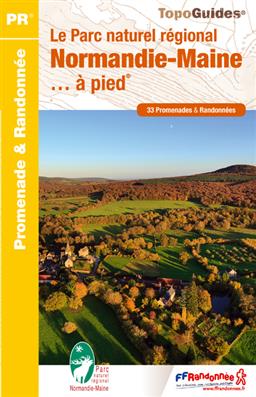
- Le parc naturel régional Normandie Maine à pied FFRP Topo-guide No. PN21
- Le parc naturel régional Normandie Maine à pied, FFRP topo-guide Ref. No. PN21, with 33 day walks of varying length and difficulty in the park. Each walk is presented on a separate colour extract from IGN’s topographic survey of France at 1:25,000, with its description cross-referenced to the map. Current edition of this title was published in... Leer más
- Also available from:
- De Zwerver, Netherlands
De Zwerver
Netherlands
2015
Netherlands
2015
- Wandelgids PN21 Le Parc naturel régional Normandie-Maine... à pied | FFRP
- Franstalige wandelgids met een beschrijving van een aantal dagtochten. Uitstekende beschrijvingen met duidelijk kaartmateriaal. Mislopen is nauwelijks mogelijk, maar ja .. de franse taal! Ook praktische informatie staat in deze gids. Alle gidsen bevatten een door ons toegevoegde uitgebreide frans - nederlandse wandelwoordenlijst. Aiguille de... Leer más

Stanfords
United Kingdom
2022
United Kingdom
2022
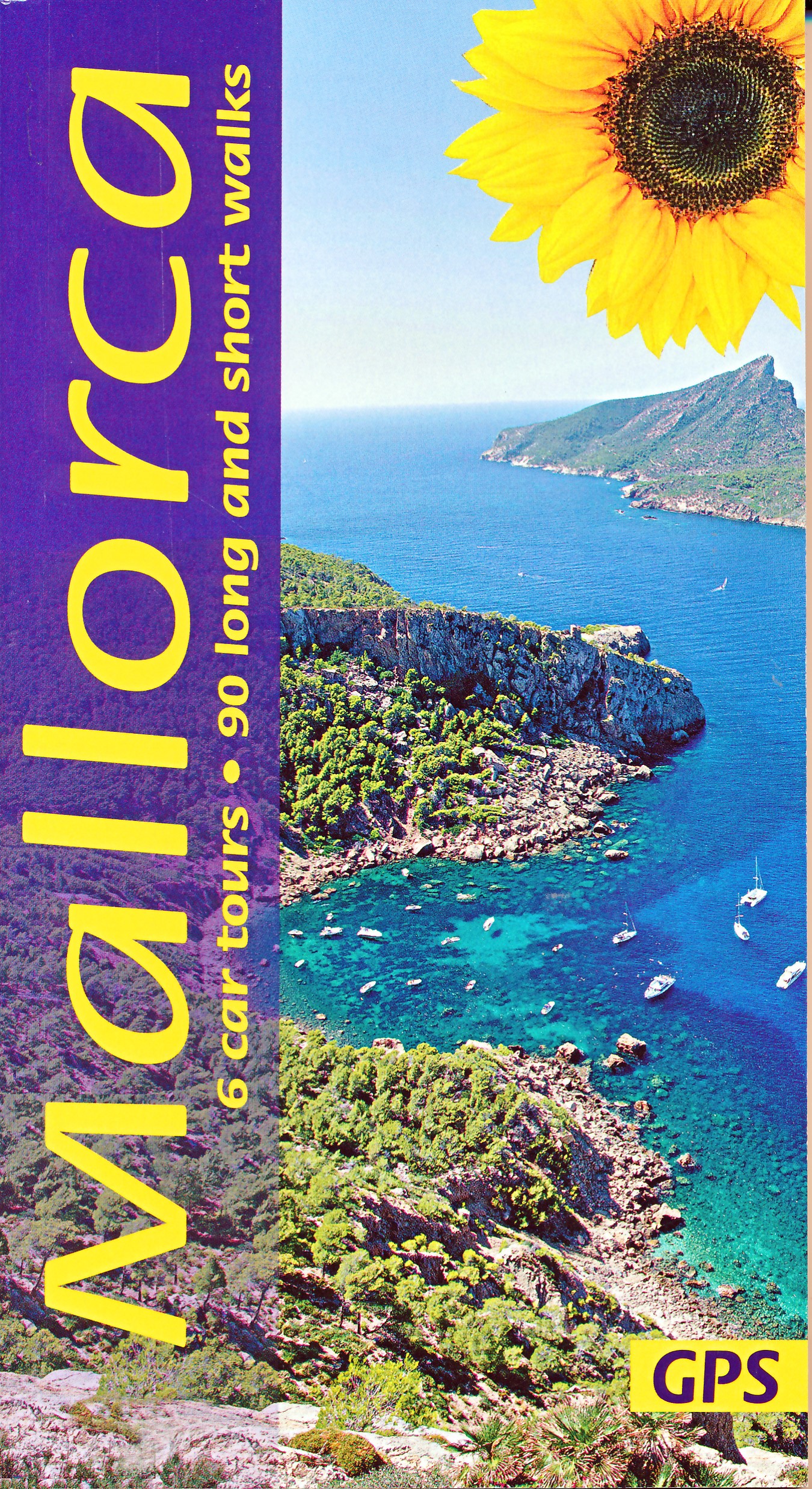
- Mallorca Guide: 90 long and short walks with detailed maps and GPS; 6 car tours with pull-out map
- The go-to Mallorca travel guide for over 30 years. Strap on your boots and discover Mallorca on foot with the Sunflower Mallorca travel guide. And on the days when your feet may have had enough, enjoy some spectacular scenery on one of our legendary car tours. The Sunflower Mallorca guide is indispensable for hiking in Mallorca or seeing... Leer más
- Also available from:
- De Zwerver, Netherlands
De Zwerver
Netherlands
2022
Netherlands
2022
- Wandelgids Mallorca | Sunflower books
- The go-to Mallorca travel guide for over 30 years. Strap on your boots and discover Mallorca on foot with the Sunflower Mallorca travel guide. And on the days when your feet may have had enough, enjoy some spectacular scenery on one of our legendary car tours. The Sunflower Mallorca guide is indispensable for hiking in Mallorca or seeing... Leer más

Stanfords
United Kingdom
2019
United Kingdom
2019
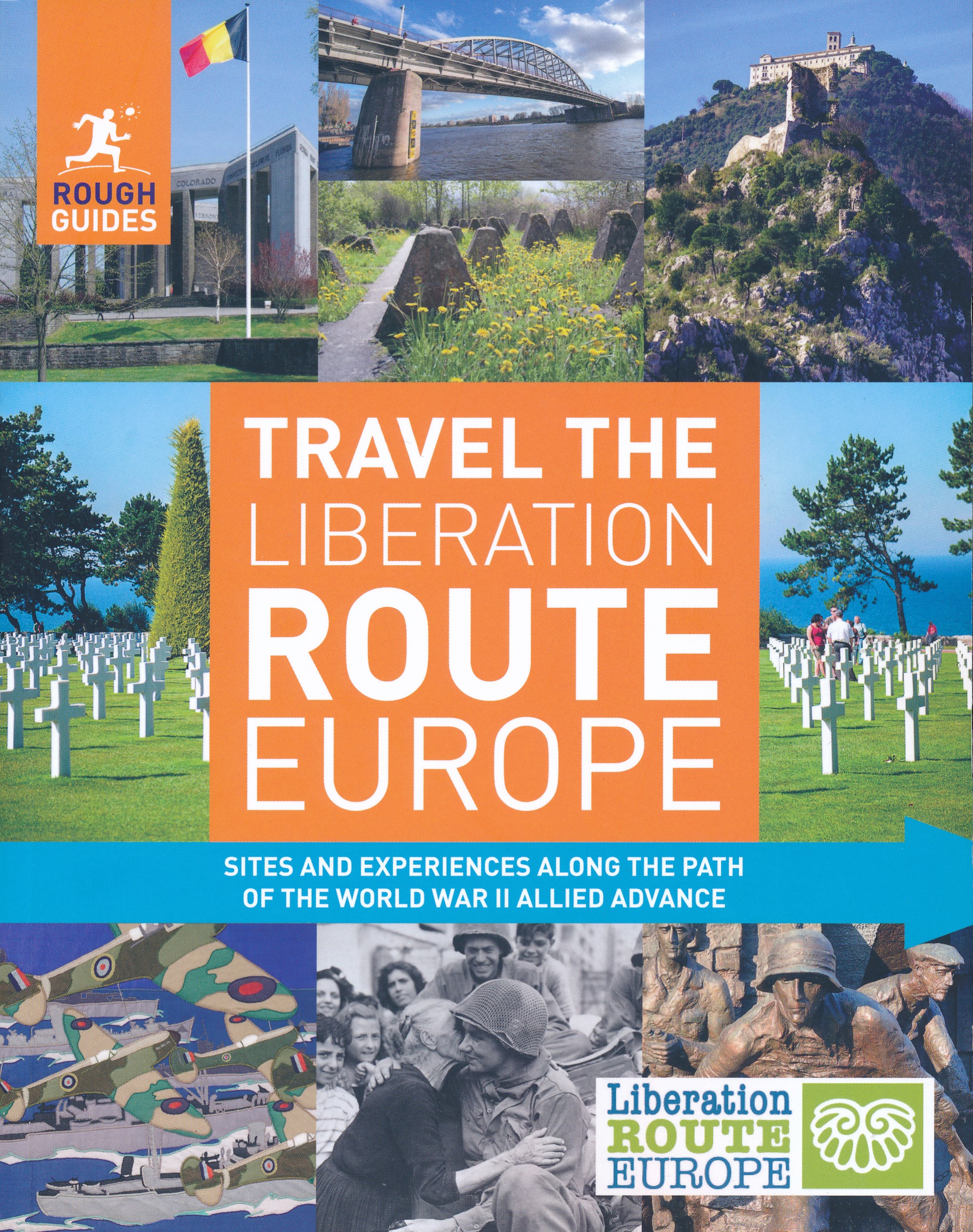
- Rough Guides Travel The Liberation Route Europe (Travel Guide with Free eBook)
- Discover the sights and experiences along the path of the Liberation Route in Europe with this inspirational, authoritative and beautifully illustrated Rough Guide, published to commemorate the 75th anniversary of the end of World War II.Following the Allied advance through Europe, Rough Guides Travel The Liberation Route Europe explores the... Leer más
- Also available from:
- De Zwerver, Netherlands

Stanfords
United Kingdom
2017
United Kingdom
2017
- Le Calvados à pied D014
- Le Calvados à pied, FFRP topo-guide Ref. No. D014, with 40 day walks of varying length and difficulty throughout the department of Calvados, including the birthplace of William the Conqueror in Falaise, D-Day beaches and the sites of the Normandy campaign of 1944. Each walk is presented on a separate colour extract from IGN’s topographic... Leer más

Stanfords
United Kingdom
2015
United Kingdom
2015
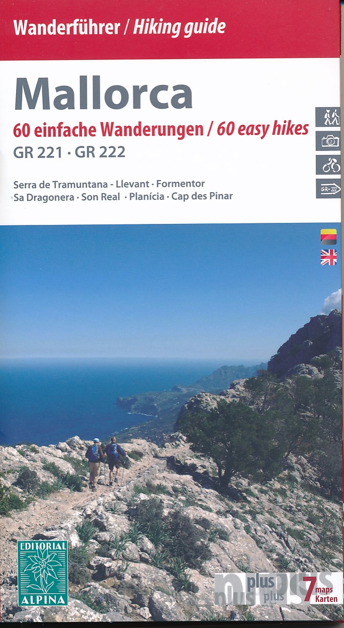
- Mallorca - 60 Easy Hikes Editorial Alpina GR211-GR222 ENGLISH/GERMAN
- Northern Mallorca 7-Map Walking Set – ENGLISH/German version - at 1:50,000 from the hiking map specialists Editorial Alpina, presenting the northern half of the island on seven handy-size maps. Accompanying booklet, in this version in English and German, includes descriptions of 60 day hikes from different locations, plus the GR221 across the... Leer más
- Also available from:
- De Zwerver, Netherlands
De Zwerver
Netherlands
2015
Netherlands
2015
- Wandelgids 73 Mallorca wandelkaarten met GR221 en GR222 | Editorial Alpina
- Wandelgids van Mallorca - gids met beschrijvingen van de routes en 7 gedetailleerde wandelkaarten. 60 wandelingen: wandelingen in natuurgebieden, cultuurwandelingen, GR 221 en GR222 Serra de Tramuntana, Llevant, Formentor, Sa Dragonera, Son Real, Planicia, Cap des Pinar. Taal: Engels / Duits kaart A: Andratx - Estellencs / GR 221 kaart B:... Leer más

Stanfords
United Kingdom
United Kingdom
- Rick Steves Best of France (Third Edition)
- Hit France`s can`t-miss art, sights, and bites in two weeks or less with Rick Steves Best of France! Inside you`ll find:Strategic advice from Rick Steves on what`s worth your time and moneyShort itineraries covering the best of Paris, Normandy, the Loire, Dordogne, Provence, the French Riviera, and Burgundy, including Versailles, Nice, the... Leer más

Stanfords
United Kingdom
2015
United Kingdom
2015
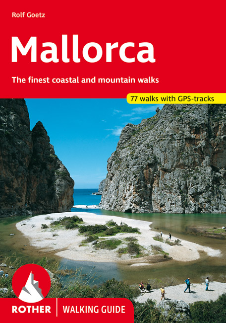
- Mallorca Rother Guide
- Rother’s handy little hiking book to Mallorca has 70 tour recommendations described in detail.Generously illustrated by photos and colour map excerpts (scale 1:50,000 and 1:75,000), there is also an overview map (at 1:500,000 scale) which is ideal for route planning. Thoroughly-researched introductory chapters with tips on interesting sights... Leer más
- Also available from:
- De Zwerver, Netherlands
De Zwerver
Netherlands
2021
Netherlands
2021
- Wandelgids Mallorca | Rother Bergverlag
- The finest coastal and montain walks. 70 walks. With GPS Data. Rother Wanderführer. 4., completely revised edition 2015. Leer más

Stanfords
United Kingdom
United Kingdom
- Pilgrimage: The Great Pilgrim Routes of Britain and Europe
- Shortlisted for a 2018 Edward Stanford Travel Writing Award.Ten historic pilgrim routes of Western Europe, inspiration for today`s long distance walker. Pilgrimage in Europe is thriving on a massive scale. In 1990 the cathedral at Santiago de Compostela recorded less than 5000 pilgrims: today that figure is at least 200,000 a year. Author Derry... Leer más

Stanfords
United Kingdom
2014
United Kingdom
2014
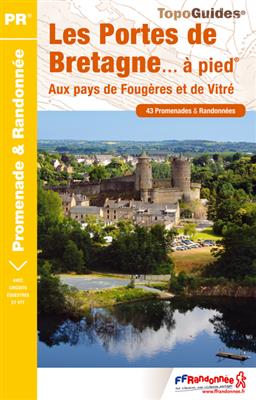
- Les Portes de Bretagne à pied FFRP Topo-guide No. 355
- Les Portes de Bretagne à pied, FFRP topo-guide Ref. No. P355, with 43 walks of varying length and difficulty in the department of ’Ille-et-Vilaine east of Rennes. Current edition of this title was published in August 2014.To see the list of other FFRP guides with day walks please click on the series link.ABOUT THE FFRP (Fédération française de... Leer más
- Also available from:
- De Zwerver, Netherlands
De Zwerver
Netherlands
2014
Netherlands
2014
- Wandelgids P355 Les Portes de Bretagne... à pied | FFRP
- Uitstekende wandelgids met gedetailleerde kaarten en een routebeschrijving. Fout lopen wordt op deze manier wel erg moeilijk. Met symbolen is weergegeven welke voorzieningen (openbaar vervoer / winkels / overnachtingen) er zijn langs of bij de route. Een nadeel is dat de daadwerkelijke adressen dan weer niet altijd genoemd worden. Alle gidsen... Leer más
Stanfords
United Kingdom
2020
United Kingdom
2020
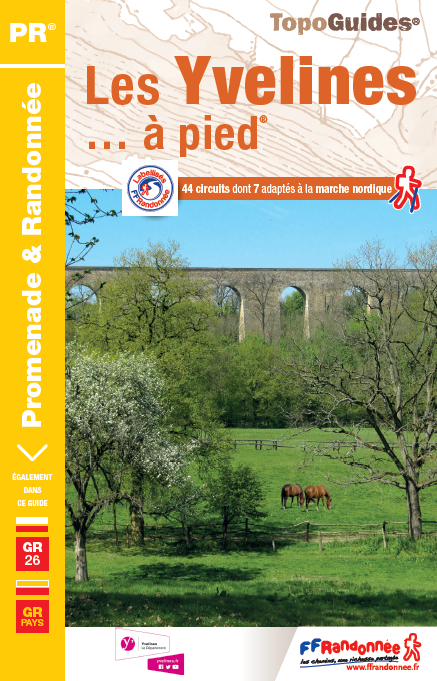
- Les Yvelines à pied D078
- Les Yvelines à pied, FFRP topo-guide Ref. No. D078, with 43 day walks of varying length and difficulty in the department of Les Yvelines. The guide, which also includes two GR de Pays routes totaling 150 kms, covers an area west and south-west of Paris with Versailles, Saint-Germain-en-Laye and the forest of Rambouillet. Each walk is presented... Leer más
- Also available from:
- De Zwerver, Netherlands

Stanfords
United Kingdom
2015
United Kingdom
2015
- Marais du Cotentin et du Bessin PNR à pied FFRP Topo-guide No. PN20
- Marais du Cotentin et du Bessin Parc Naturel Régional à pied, FFRP topo-guide Ref. No. PN20, with 33 day walks of varying length and difficulty in the southern part of the Cotentin Peninsula, including a walk along the Utah Beach of the 1944 D-Day Landings. Each day walk is presented on a separate colour extract from IGN’s topographic survey... Leer más

Stanfords
United Kingdom
United Kingdom
- Normandy: Juno Beach D-Day Landings
- By June 1944, Juno Beach was a key part of Hitler`s vaunted Atlantic Wall, with no less than four major strong points along its length. German pillboxes were sited to sweep the beaches with machine gun fire and were surrounded by belts of barbed wire and mines. Leading the attack were the 3rd Canadian Division, supported by the specialist... Leer más

Stanfords
United Kingdom
2015
United Kingdom
2015
- GR2: La Seine à pied en Ile de France FFRP Topo-guide No. 203
- More than 10 days of hiking following the course of the Seine between Montereau (77) and Vernon (27).La Seine à pied en Ile de France, FFRP topoguide Ref. no. 203, covering a 262kms route along the GR2 from Monterau-Fault-Yonne to Vernon following the Seine, including in the suburbs of Paris and across the capital, with variants on both sides... Leer más

Stanfords
United Kingdom
United Kingdom
- Falaise - Morteaux-Couliboeuf IGN 1614SB
- Topographic survey of France at 1:25,000 in IGN`s excellent TOP25 / Série Bleue series. All the maps are GPS compatible, with a 1km UTM grid plus latitude and longitude lines at 5’ intervals. Contours are at 5m intervals except for mountainous areas where the maps have contours at 10m intervals, vividly enhanced by hill shading and graphics for... Leer más

Stanfords
United Kingdom
United Kingdom
- Mallorca 4-Map Set Kompass 2230
- Mallorca on a set of four double-sided, contoured and GPS compatible maps at 1:35,000 from Kompass with exceptionally detailed presentation of the topography, extensive overprint for hiking trails and cycling routes, accommodation and places of interest, etc, plus street plans of central Palma de Mallorca, Platja de Palma, Sóller, Alcúdia/Port... Leer más
Mapas

Stanfords
United Kingdom
United Kingdom
- Le Perche Parc Naturel Régional à pied FFRP Topo-guide No. PN16
- Le Perche Parc Naturel Régional à pied, FFRP topo-guide Ref. No. PN16, with 20 day walks of varying length and difficulty in the park. Each walk is presented on a separate colour extract from IGN’s topographic survey of France at 1:25,000, with its description cross-referenced to the map. Current edition of this title was published in May... Leer más

Stanfords
United Kingdom
United Kingdom
- Ouistreham (Pegasus Bridge) 1944
- Ouistreham (Pegasus Bridge) in a series of reproductions of the Bigot Plans prepared by the GSGS (Geographic Section General Staff) for the D-Day landings in Normandy in June 1944, showing German defences and other obstacles facing the invading Allied troops. The map is centred on the bridge that is now known as Pegasus Bridge, near Bénouville... Leer más

Stanfords
United Kingdom
United Kingdom
- Pont-Audemer - Tancarville - PNR des Boucles de la Seine Normande IGN 1811OT
- Topographic survey of France at 1:25,000 in IGN`s excellent TOP25 / Série Bleue series. All the maps are GPS compatible, with a 1km UTM grid plus latitude and longitude lines at 5’ intervals. Contours are at 5m intervals except for mountainous areas where the maps have contours at 10m intervals, vividly enhanced by hill shading and graphics for... Leer más
Stanfords
United Kingdom
United Kingdom
- Serra de Tramuntana Editorial Alpina 4-Map Set
- Mallorca’s Serra de Tramuntana mountains presented by Editorial Alpina at 1:25,000 on a set of two light, waterproof and tear-resistant, contoured and GPS compatible, double-sided maps with an overprint for local hiking trails, GR221 long-distance route, sites for various outdoor activities, accommodation options, etc. Coverage extends from... Leer más

Stanfords
United Kingdom
United Kingdom
- St Aubin - Sword & Juno Beaches 1944 - 40/18 SW
- St Aubin (Sword and Juno Beaches) in a series of reproductions of the Bigot Plans prepared by the GSGS (Geographic Section General Staff) for the D-Day landings in Normandy in June 1944, showing German defences and other obstacles facing the invading Allied troops. The map covers the area north of the Ouistreham map with St Aubin,... Leer más

Stanfords
United Kingdom
United Kingdom
- FR1 Oostende à Cherbourg - 2018/19 Edition
- Passage ChartsC1 France · Atlantique 1: 1.750.000 C2 Normandie · Ouest 1: 350.000 C3 Barfleur au Tréport 1: 350.000 C4 Le Tréport à Oostende 1: 350.000 Coastal ChartsC5 Cherbourg à la Baie de Seine 1: 150.000 C6 Baie de Seine au Cap d‘Antifer 1: 150.000 C7 Cap d‘ Antifer à Dieppe 1: 150.000 C8 Dieppe à Vergoyer 1: 150.000 C9 Vergoyer à Calais... Leer más

Stanfords
United Kingdom
United Kingdom
- 2110 North France Chart Atlas - Nord-Pas-de-Calais, Picardy and Normandy Coasts - 2017 edition
- The atlas includes:2110.1 Eastern English Channel1: 600 000 WGS 842110.2 Dover Strait1: 200 000 WGS 842110.3 Cap Gris-Nez to Dieppe1: 200 000 WGS 842110.4 Nieuwpoort & Nord-Pas-de-Calais PlansScales: various WGS 84Plans included:Nieuwpoort (1:30 000)Rade de Dunkerque (1:125 000)Dunkerque (1:25 000)Calais (1:20 000)Boulogne-sur-Mer (1:25... Leer más

Stanfords
United Kingdom
United Kingdom
- Domfront - Lassay-les-Châteaux - Bagnoles-de-l`Orne IGN 1516SB
- Topographic survey of France at 1:25,000 in IGN`s excellent TOP25 / Série Bleue series. All the maps are GPS compatible, with a 1km UTM grid plus latitude and longitude lines at 5’ intervals. Contours are at 5m intervals except for mountainous areas where the maps have contours at 10m intervals, vividly enhanced by hill shading and graphics for... Leer más

Stanfords
United Kingdom
United Kingdom
- Tour de Manche Vol. 1: North-West Normandy - Channel Is. - South Dorset Cycle Route (505km)
- Tour de Manche Vol.1: North-Western Normandy - Channel Islands - Southern Dorset Cycle Route, an A5 spiral-bound cycling guide from Itinerance a Vélo showing the 505km-long cross-Channel route on 50 map panels, plus contact addresses for recommended accommodation, cycle shops, etc. Information provided for the Channel Islands and the Dorset... Leer más

Stanfords
United Kingdom
United Kingdom
- Menorca - Camí de Cavalls - GR223 Editorial Alpina CATALAN
- Menorca at 1:50,000 on a contoured, GPS compatible map from Editorial Alpina with a special overprint for the GR223 – Camí de Cavalls, a long-distance hiking path along the island’s coast, plus local trails, mountain bike routes, accommodation, sights, etc, plus a booklet in Catalan only.The map has contours at 20m intervals, with additional... Leer más

Stanfords
United Kingdom
United Kingdom
- Saint-Valery-en-Caux - Veules-les-Roses - Varengeville-sur-Mer IGN 1909OT
- Topographic survey of France at 1:25,000 in IGN`s excellent TOP25 / Série Bleue series. All the maps are GPS compatible, with a 1km UTM grid plus latitude and longitude lines at 5’ intervals. Contours are at 5m intervals except for mountainous areas where the maps have contours at 10m intervals, vividly enhanced by hill shading and graphics for... Leer más

Stanfords
United Kingdom
United Kingdom
- Alençon - Sees IGN 1716SB
- Topographic survey of France at 1:25,000 in IGN`s excellent TOP25 / Série Bleue series. All the maps are GPS compatible, with a 1km UTM grid plus latitude and longitude lines at 5’ intervals. Contours are at 5m intervals except for mountainous areas where the maps have contours at 10m intervals, vividly enhanced by hill shading and graphics for... Leer más

Stanfords
United Kingdom
United Kingdom
- France Chamina Edition Greenways and Cycle Routes Atlas
- Guarantee of quality and reliability, the Atlas France of greenways & cycle routes Chamina is enriched this year by more than 1,000 km of cycle route: 2 new cycle routes (The Flow Vélo and the EuroVelo 4 - Tour de Manche) , as well as the updating of the extensive routes such as the ViaRhôna, the Vélo Francette, the EuroVelo 6 and the... Leer más

Stanfords
United Kingdom
United Kingdom
- Fecamp - Saint-Valery-en-Caux - Cote d`Albatre IGN 1809OT
- Topographic survey of France at 1:25,000 in IGN`s excellent TOP25 / Série Bleue series. All the maps are GPS compatible, with a 1km UTM grid plus latitude and longitude lines at 5’ intervals. Contours are at 5m intervals except for mountainous areas where the maps have contours at 10m intervals, vividly enhanced by hill shading and graphics for... Leer más

Stanfords
United Kingdom
United Kingdom
- Mortagne-au-Perche - le Mele-Sur-Sarthe IGN 1816SB
- Topographic survey of France at 1:25,000 in IGN`s excellent TOP25 / Série Bleue series. All the maps are GPS compatible, with a 1km UTM grid plus latitude and longitude lines at 5’ intervals. Contours are at 5m intervals except for mountainous areas where the maps have contours at 10m intervals, vividly enhanced by hill shading and graphics for... Leer más